Ashling Wood

Wood, Forest in Sussex Chichester

England

Ashling Wood

Field edge in late sunlight above Funtington The distant water is Chichester Harbour, with the sea on the horizon.
Field edge in late sunlight above Funtington Credit: David Martin

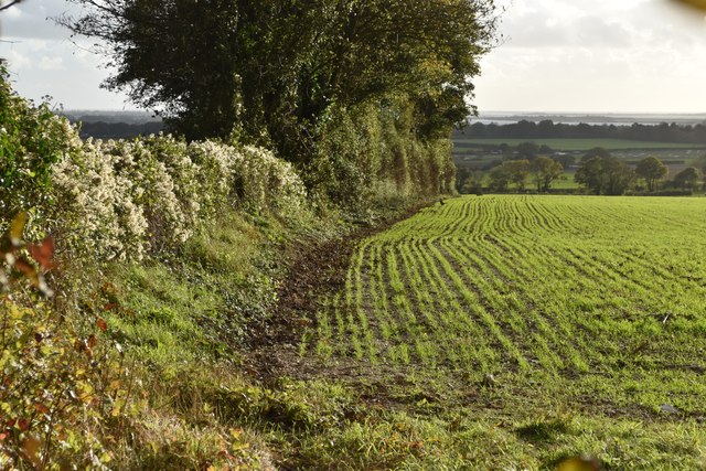
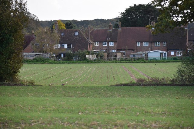
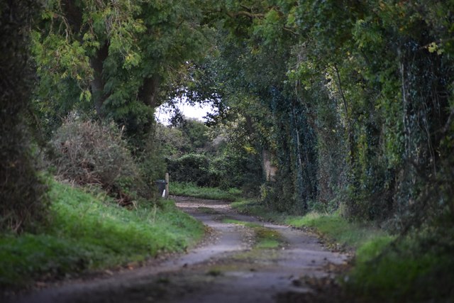
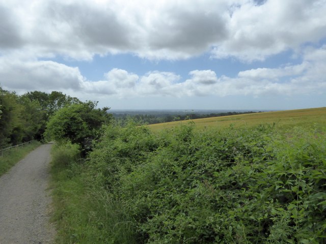
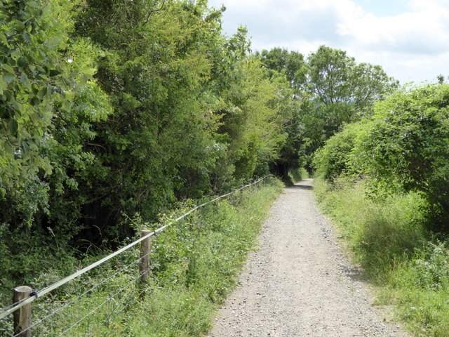
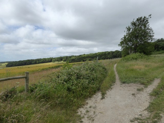
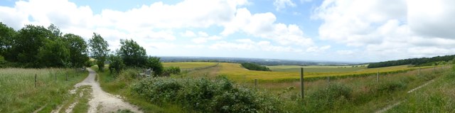
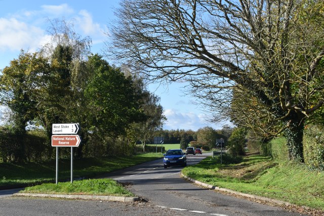
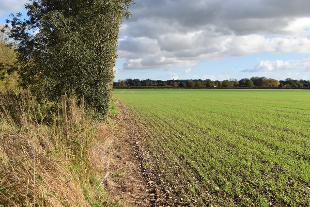
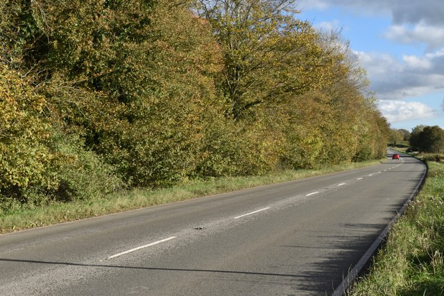
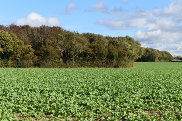
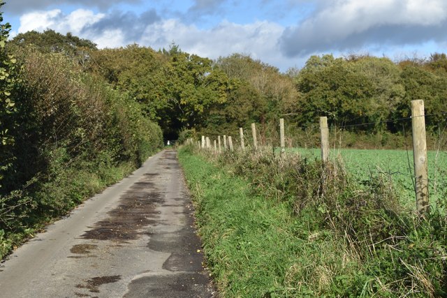
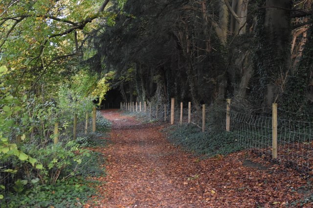
Ashling Wood, Sussex, is a picturesque forest located in the South Downs National Park in southern England. Covering an area of approximately 600 acres, this ancient woodland boasts an impressive array of flora and fauna, making it a popular destination for nature enthusiasts and hikers alike.

The woodland is predominantly composed of broadleaf trees, with oak, beech, and ash being the most common species. These tall, majestic trees create a dense canopy that allows only dappled sunlight to filter through, creating a serene and tranquil atmosphere within the woods.

The forest floor is a carpet of lush green moss, interspersed with wildflowers such as bluebells and primroses that bloom in abundance during the spring. This vibrant display of colors attracts a variety of insects, including butterflies and bees, which adds to the natural beauty of the surroundings.

Ashling Wood is also home to a diverse range of wildlife. Red squirrels can be spotted scurrying amongst the treetops, while deer and foxes roam the forest floor. Birdwatchers will be delighted by the presence of woodpeckers, owls, and various songbirds that inhabit the area.

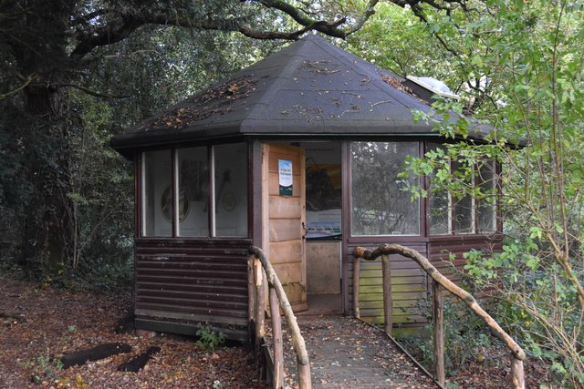
The woodland offers several well-marked walking trails, allowing visitors to explore its enchanting beauty at their own pace. Additionally, there are picnic areas and benches strategically placed throughout the forest, providing opportunities for visitors to relax and soak in the peaceful ambiance.

Overall, Ashling Wood, Sussex, is a captivating natural haven that offers a rich tapestry of biodiversity and scenic beauty, making it a must-visit destination for nature lovers and those seeking a tranquil escape from the hustle and bustle of everyday life.

If you have any feedback on the listing, please let us know in the comments section below.

Ashling Wood Images

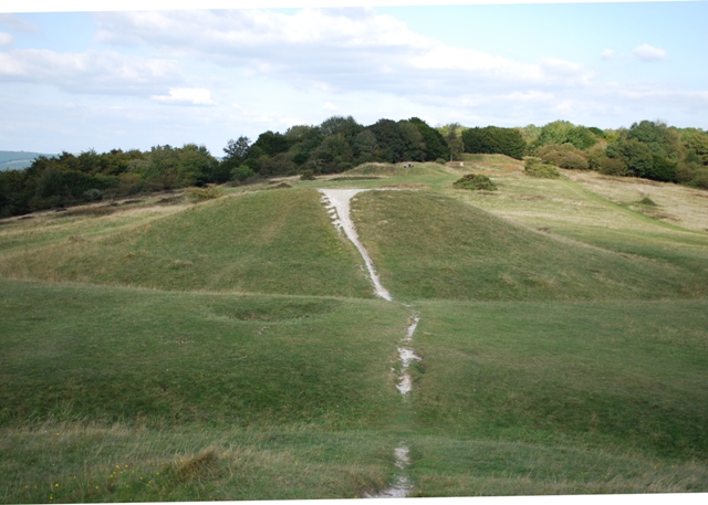
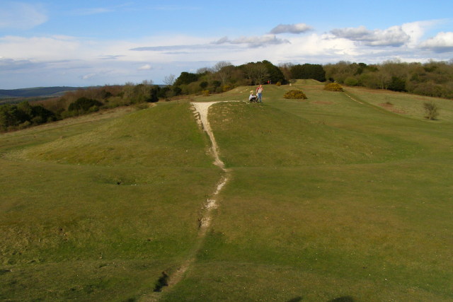
Images are sourced within 2km of 50.869261/-0.83970022 or Grid Reference SU8108. Thanks to Geograph Open Source API. All images are credited.

Field edge in late sunlight above Funtington The distant water is Chichester Harbour, with the sea on the horizon.
Field edge in late sunlight above Funtington
The distant water is Chichester Harbour, with the sea on the horizon.
Haresfoot Close, Funtington, seen across fields
Private drive to Funtington Down House
Looking down Stoke Down From the path outside the western edge of Kingley Vale
Looking down Stoke Down
From the path outside the western edge of Kingley Vale
Track on west side of Kingley Vale reserve A popular track for mountain biking, as this is not allowed in the reserve
Track on west side of Kingley Vale reserve
A popular track for mountain biking, as this is not allowed in the reserve
Fork in tracks on Stoke Down The track ahead is a bridleway; on the right is a footpath, also used by mountain bikers
Fork in tracks on Stoke Down
The track ahead is a bridleway; on the right is a footpath, also used by mountain bikers
Panorama looking down Stoke Down The view includes Kingley Vale on the left.  It looks across Chichester and Selsey
Panorama looking down Stoke Down
The view includes Kingley Vale on the left. It looks across Chichester and Selsey
Flooding on Stoke Road Despite Storm Ciaran passing through in the preceding week the surrounding countryside was merely muddy: it seems as if all the local water has drained into this dip in Stoke Road.  There was about 25cm of water, but it was very hard for drivers to assess the depth with some ploughing through and others turning back.
Flooding on Stoke Road
Despite Storm Ciaran passing through in the preceding week the surrounding countryside was merely muddy: it seems as if all the local water has drained into this dip in Stoke Road. There was about 25cm of water, but it was very hard for drivers to assess the depth with some ploughing through and others turning back.
Field east of the road junction at East Ashling
Road junction at East Ashling Looking west along the B2178
Road junction at East Ashling
Looking west along the B2178
Field edge beside the B2178
B2178 towards East Ashling
Southern edge of Ashling Wood
View along Woodend towards Ashling Wood
Woodland strip on the skyline On the OS map, the line of woodland is marked as an ancient earthwork.
Woodland strip on the skyline
On the OS map, the line of woodland is marked as an ancient earthwork.
Footpath to Kingley Vale This well-made path leads from the car park at West Stoke to the Kingley Vale National Nature Reserve.
Footpath to Kingley Vale
This well-made path leads from the car park at West Stoke to the Kingley Vale National Nature Reserve.
Kingley Vale Field Museum Visitor centre at the southern entrance to the National Nature Reserve.
Kingley Vale Field Museum
Visitor centre at the southern entrance to the National Nature Reserve.
Leafy bridleway climbing towards Funtington Down
Show me another place!

Ashling Wood is located at Grid Ref: SU8108 (Lat: 50.869261, Lng: -0.83970022)

Administrative County: West Sussex

District: Chichester

Police Authority: Sussex

What 3 Words

///presses.known.sapping. Near Bosham, West Sussex

Related Wikis

Funtington

Funtington is a village and civil parish in the Chichester district of West Sussex, England. It lies on the B2146 Road 4.5 miles (7.2 km) west of Chichester...

RAF Funtington

Royal Air Force Funtington or more simply RAF Funtington is a former Royal Air Force Advanced Landing Ground located in West Sussex, England. == History... ==

Sennicotts

Sennicotts is a small estate near Chichester, West Sussex, England, formed in 1809 by Charles Baker (1761–1839) having retired after serving in Madras...

Chichester West (electoral division)

Chichester West is an electoral division of West Sussex in the United Kingdom, and returns one member to sit on West Sussex County Council. The current...

Devil's Humps, Stoughton

The Devil's Humps (also known as the Kings' Graves) are four Bronze Age barrows situated on Bow Hill on the South Downs near Stoughton, West Sussex. They...

Kingley Vale National Nature Reserve

Kingley Vale is a 204.4-hectare (505-acre) biological Site of Special Scientific Interest north of Chichester in West Sussex. It is also a Special Area...

Bow Hill, Sussex

Bow Hill is an elongated hill ridge, 206 metres (676 ft) high, and running roughly from north to south in the South Downs, in the county of West Sussex...

Bosham railway station

Bosham railway station serves the small village of Bosham in West Sussex, England. It is located on the West Coastway Line that runs between Brighton and...

Nearby Amenities

Located within 500m of 50.869261,-0.83970022
Bus Stop
Chapel Corner
Naptan AtcoCode: 4400CH0417
Naptan Bearing: E
Naptan CommonName: Chapel Corner
Naptan Indicator: opp. B2146. Scout Hall
Naptan Landmark: B2146
Naptan NaptanCode: wsxajawm
Naptan Street: B2178
Naptan Verified: no
Source: naptan_import
Lat/Long: 50.8658147/-0.8441675
Barrier: stile
Lat/Long: 50.8709903/-0.8344
site of Woodend (house)
Addr City: Funtington
Addr Housename: site of Woodend
Building: yes
Wikidata: Q26277261
Lat/Long: 50.8731394/-0.8408687
Barrier: stile
Lat/Long: 50.8685839/-0.8424392
The data included in this document is from www.openstreetmap.org. The data is made available under ODbL.

Have you been to Ashling Wood?

Leave your review of Ashling Wood below (or comments, questions and feedback).