Ashridge Wood

Wood, Forest in Berkshire

England

Ashridge Wood

Farmland, St Nicholas Hurst Arable land with oaks to the east of Carters Hill.
Farmland, St Nicholas Hurst Credit: Andrew Smith

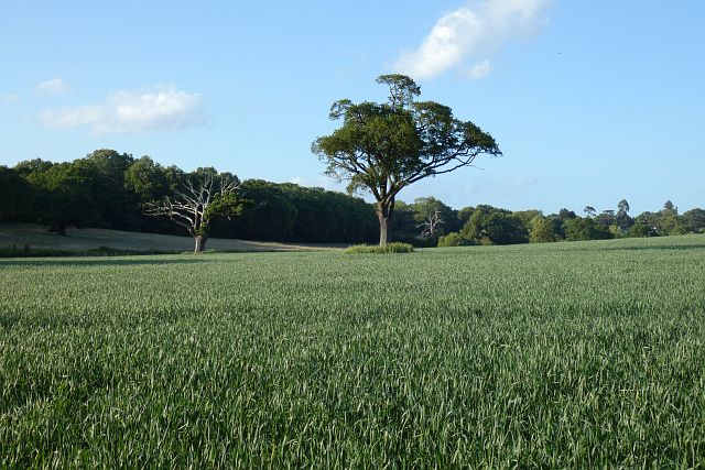
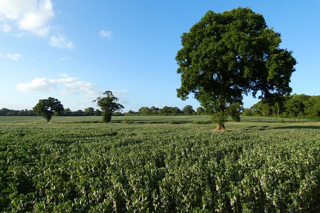
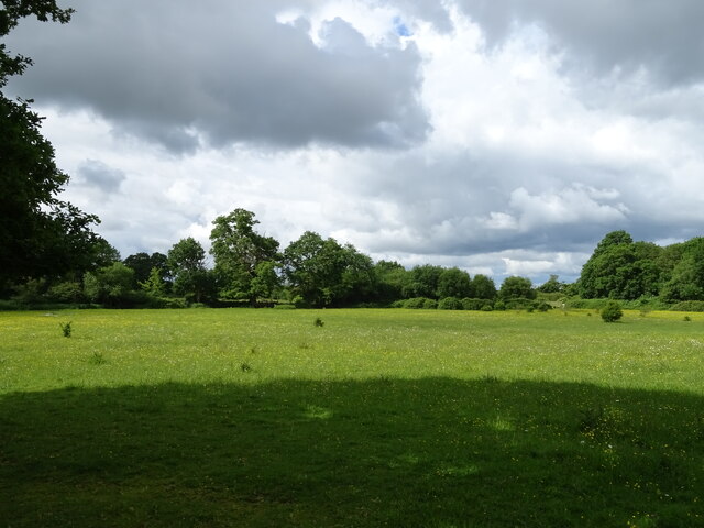
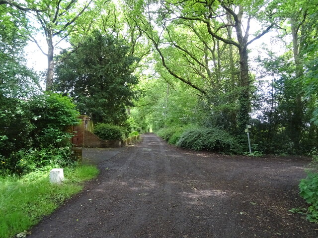
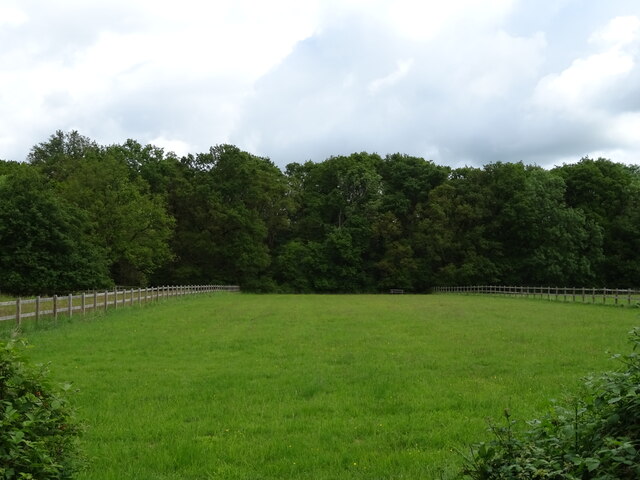
Ashridge Wood, located in Berkshire, is a picturesque woodland area that covers approximately 1,200 acres. It is renowned for its natural beauty, rich history, and diverse wildlife. The wood is part of the larger Ashridge Estate, which is managed by the National Trust.

The woodland is predominantly made up of native broadleaf trees, including oak, beech, and birch, creating a dense canopy that provides shelter and habitat for a variety of flora and fauna. The forest floor is adorned with a vibrant carpet of bluebells in spring, and ferns and mosses thrive in the shaded areas. Ashridge Wood is also home to a number of rare and protected species, such as the lesser spotted woodpecker and the dormouse.

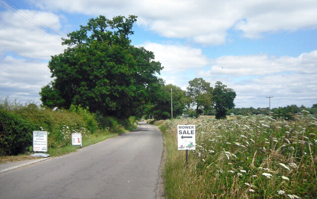
Visitors to Ashridge Wood can explore its numerous well-marked walking trails that wind through the forest, offering breathtaking views and opportunities to spot wildlife. The wood is particularly popular with hikers, dog walkers, and nature enthusiasts. There are also designated picnic areas and benches dotted throughout the wood, providing visitors with the perfect spot to relax and take in the peaceful surroundings.

In addition to its natural beauty, Ashridge Wood has a rich historical significance. The woodland was once part of a medieval hunting forest and has several ancient features, including earthworks and remnants of a former Iron Age hill fort. The wood also played a role in the timber industry during the Tudor period, supplying wood for shipbuilding.

Overall, Ashridge Wood is a stunning and historically significant woodland that offers visitors a tranquil escape into nature. Its diverse ecosystem and captivating scenery make it a cherished destination for both locals and tourists alike.

If you have any feedback on the listing, please let us know in the comments section below.

Ashridge Wood Images

Images are sourced within 2km of 51.43272/-0.8265642 or Grid Reference SU8171. Thanks to Geograph Open Source API. All images are credited.

Farmland, St Nicholas Hurst Arable land with oaks to the east of Carters Hill.
Farmland, St Nicholas Hurst
Arable land with oaks to the east of Carters Hill.
Farmland, St Nicholas Hurst Oaks stand in fields of beans currently occupying some of the small rural gap between Binfield and Wokingham.
Farmland, St Nicholas Hurst
Oaks stand in fields of beans currently occupying some of the small rural gap between Binfield and Wokingham.
Mower Sale, Binfield Road A mower business is based at Stokes Farm along this lane near Binfield.
Mower Sale, Binfield Road
A mower business is based at Stokes Farm along this lane near Binfield.
Wild Flowers by the Footpath A patch of daisies by the path towards Pebblestone Copse.
Wild Flowers by the Footpath
A patch of daisies by the path towards Pebblestone Copse.
Forest Road, B3034
Forest Road, B3034
Notices at the junction Pointing the way to firms at Warren Farm, a business park nearly 1 km north of here down a long service road.
Notices at the junction
Pointing the way to firms at Warren Farm, a business park nearly 1 km north of here down a long service road.
Keep Going for the Cafe Just over half way along the road to Warren Farm where a number of businesses are located. There is also a cafe serving workers and visitors.
Keep Going for the Cafe
Just over half way along the road to Warren Farm where a number of businesses are located. There is also a cafe serving workers and visitors.
Pond at Ashridge Manor Farm A secluded pond with landscaped surroundings. Probably a fish pond.
Pond at Ashridge Manor Farm
A secluded pond with landscaped surroundings. Probably a fish pond.
Another view of Ashridge Farm Pond Another view of a secluded fish pond in a woodland setting. Viewed from the nearby footpath.
Another view of Ashridge Farm Pond
Another view of a secluded fish pond in a woodland setting. Viewed from the nearby footpath.
Ashridge Manor A Victorian country house from the 1850s, now in business use.
Ashridge Manor
A Victorian country house from the 1850s, now in business use.
Grazing, Binfield Off the B3034.
Grazing, Binfield
Off the B3034.
Forest Road (B3034) leaving Binfield
Junction on Green Lane (Byway)
Houses on Forest Road
Forest Road (B3034) Towards the A321.
Forest Road (B3034)
Towards the A321.
Grazing towards Tippen's Wood
Forest Road (B3034) Towards the A321.
Forest Road (B3034)
Towards the A321.
Houses on Forest Road (B3034)
Show me another place!

Ashridge Wood is located at Grid Ref: SU8171 (Lat: 51.43272, Lng: -0.8265642)

Unitary Authority: Wokingham

Police Authority: Thames Valley

What 3 Words

///gravy.exists.itself. Near Wokingham, Berkshire

Nearby Locations

Ashridge Wood

Related Wikis

Billingbear

Billingbear is a hamlet in the civil parish of Binfield and a former country estate in the civil parish of Waltham St Lawrence, near Bracknell, in the...

Norreys Estate

The Norreys Estate is a housing estate, part of the Dowlesgreen area of Wokingham in the English county of Berkshire, situated just east of the town centre...

Billingbear House

Billingbear House was situated in the parish of Waltham St. Lawrence in Berkshire, England, about six miles from Windsor. Originally owned by the Bishop...

Holt Copse & Joel Park

Holt Copse & Joel Park is a 5.3-hectare (13-acre) Local Nature Reserve (LNR) in Wokingham in Berkshire. It is owned by Wokingham Town Council and managed...

The Emmbrook School

The Emmbrook School is a co-educational secondary school located in Emmbrook, Wokingham, Berkshire, England, for students between 11 and 18 years of age...

Emmbrook, Berkshire

Emmbrook is a suburb of the town of Wokingham in the county of Berkshire, England.The suburb takes its name from the Emm Brook, a small river that is...

The Holt School

The Holt School is a secondary school located on the outskirts of Wokingham, Berkshire, England, on Holt Lane. It is a girls' school and currently teaches...

Binfield

Binfield is a village and civil parish in Berkshire, England, which at the 2011 census had a population of 8,689. The village lies 2 miles (3.2 km) north...

Nearby Amenities

Located within 500m of 51.43272,-0.8265642
Source: #
Lat/Long: 51.4322213/-0.8222799
Source: #
Lat/Long: 51.4322879/-0.8221394
Source: #
Lat/Long: 51.4322919/-0.8223929
Source: #
Lat/Long: 51.43238/-0.8222537
Ashridgewood Place Home Farm
Landuse: farm
Note Retag: CS #48756035
Source: OS OpenData StreetView
Lat/Long: 51.4309622/-0.8292204
Ashridgewood Farm
Landuse: farm
Note Retag: CS #48756035
Source: OS OpenData StreetView
Lat/Long: 51.4296437/-0.824953
Direction: 180
Generator Method: photovoltaic
Generator Output Electricity: yes
Generator Solar Modules: 55
Generator Source: solar
Generator Type: solar_photovoltaic_panel
Location: roof
Power: generator
Lat/Long: 51.4326877/-0.8335387
Direction: 90
Generator Method: photovoltaic
Generator Output Electricity: yes
Generator Solar Modules: 66
Generator Source: solar
Generator Type: solar_photovoltaic_panel
Location: roof
Power: generator
Lat/Long: 51.4329131/-0.8335659
Direction: 165
Generator Method: photovoltaic
Generator Output Electricity: yes
Generator Solar Modules: 102
Generator Source: solar
Generator Type: solar_photovoltaic_panel
Location: roof
Power: generator
Tilt: 20
Lat/Long: 51.4296966/-0.825305
Post Box
Operator: Royal Mail
Post Box Type: wall
Ref: RG40 9
Royal Cypher: VR
Lat/Long: 51.4321474/-0.8221058
Shop: car_repair
Lat/Long: 51.4326433/-0.8213993
The data included in this document is from www.openstreetmap.org. The data is made available under ODbL.

Have you been to Ashridge Wood?

Leave your review of Ashridge Wood below (or comments, questions and feedback).