Ecton Field Plantation

Wood, Forest in Northamptonshire

England

Ecton Field Plantation

Rectory Farm Pocket Park Rectory Farm Pocket Park in Great Billing, Northampton, Northamptonshire, UK.
Rectory Farm Pocket Park Credit: Nathan Hadley

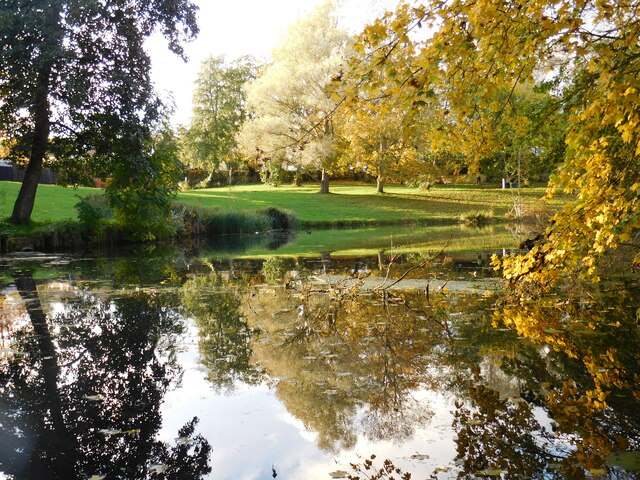
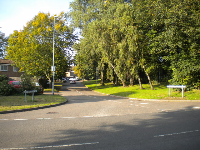
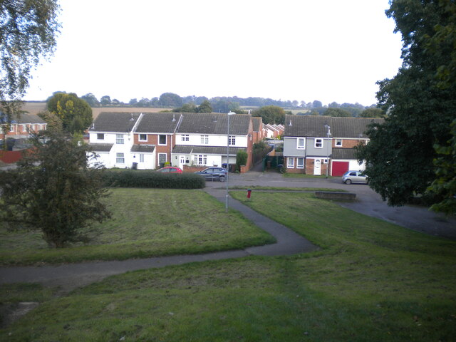
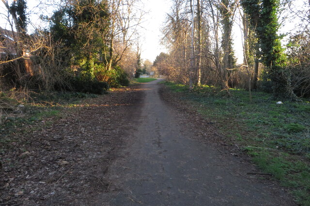
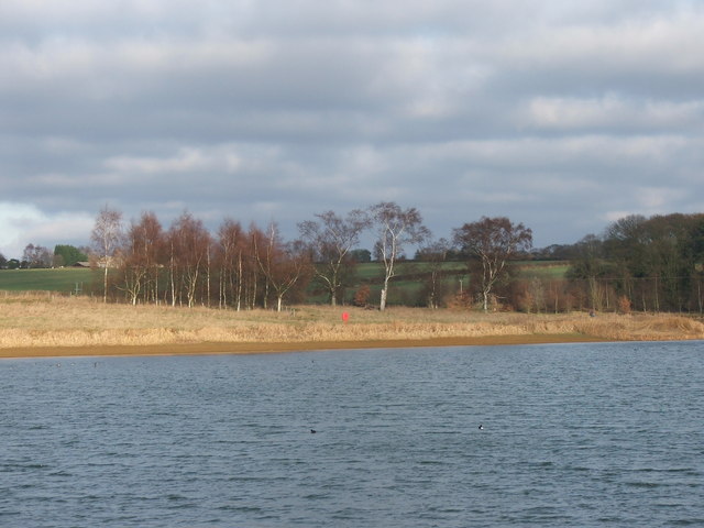
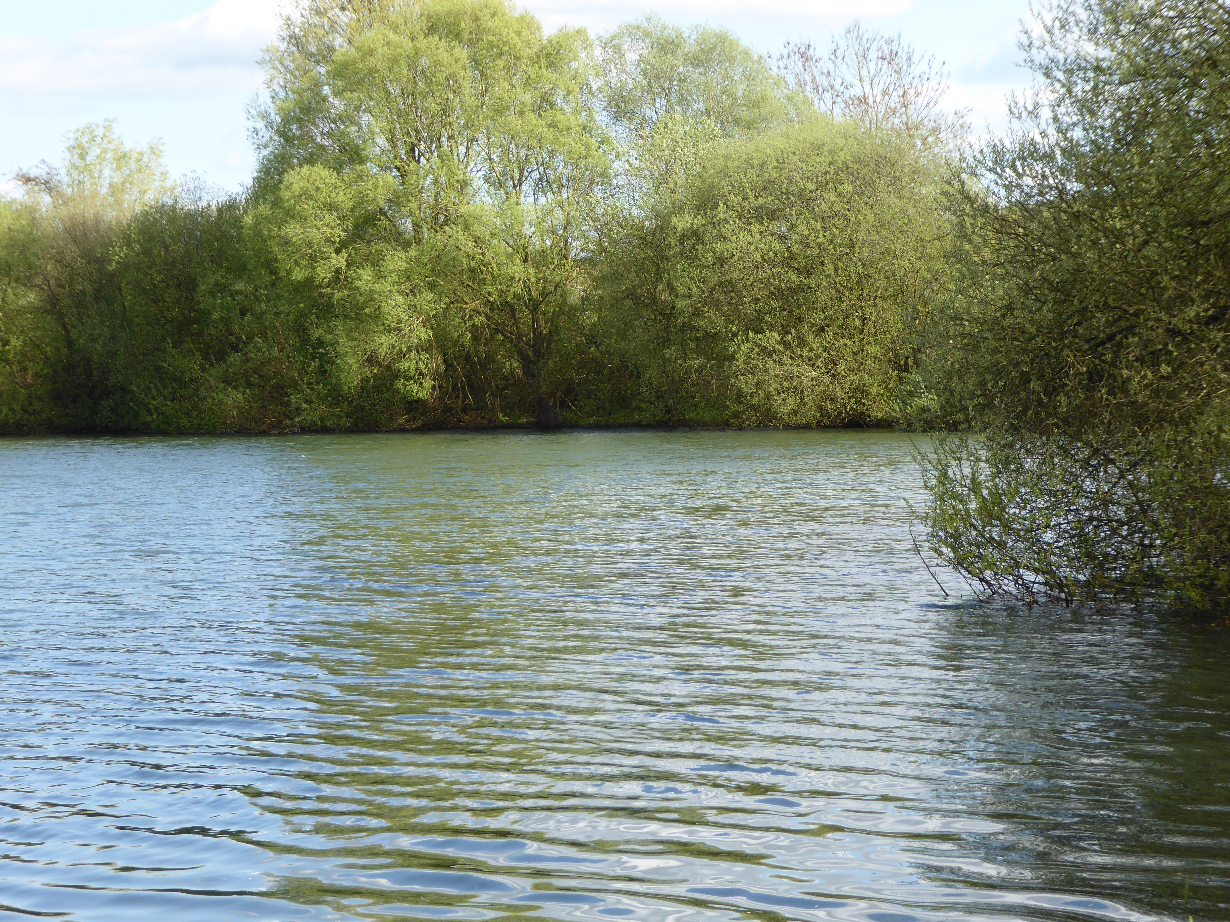
Ecton Field Plantation is a charming woodland located in Northamptonshire, England. Nestled within the picturesque countryside, this plantation covers an expansive area of approximately 150 hectares. The plantation is a mixture of woodlands and forests, offering a diverse range of flora and fauna for nature enthusiasts to explore.

The woodland at Ecton Field Plantation is primarily composed of native deciduous trees such as oak, beech, and ash. These majestic trees provide a lush canopy, creating a peaceful and serene atmosphere. Beneath the towering trees, the forest floor is adorned with a carpet of vibrant wildflowers, adding to the beauty of the landscape.

This plantation is not only a haven for nature lovers but also a valuable habitat for a variety of wildlife. It is home to numerous bird species, including woodpeckers, owls, and warblers. Additionally, the woodland provides shelter for mammals such as deer, foxes, and badgers. The diverse ecosystem of Ecton Field Plantation ensures that visitors can witness a wide array of wildlife in their natural habitat.

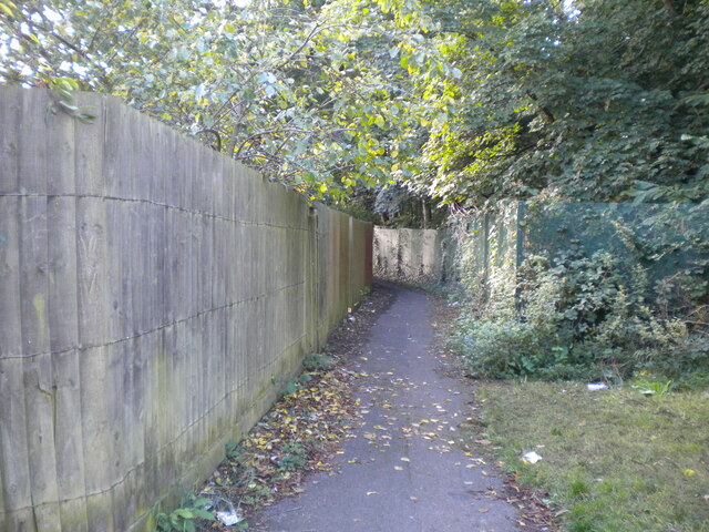
With its tranquil ambiance and scenic beauty, Ecton Field Plantation is a popular destination for outdoor activities. The woodland offers several walking trails, allowing visitors to explore its enchanting surroundings at their own pace. The plantation also provides opportunities for birdwatching, photography, and picnicking, making it an ideal spot for a day trip or a weekend getaway.

Overall, Ecton Field Plantation is a delightful woodland retreat that showcases the natural splendor of Northamptonshire. Its rich biodiversity, scenic landscapes, and recreational opportunities make it a cherished destination for nature enthusiasts and a valuable asset to the local community.

If you have any feedback on the listing, please let us know in the comments section below.

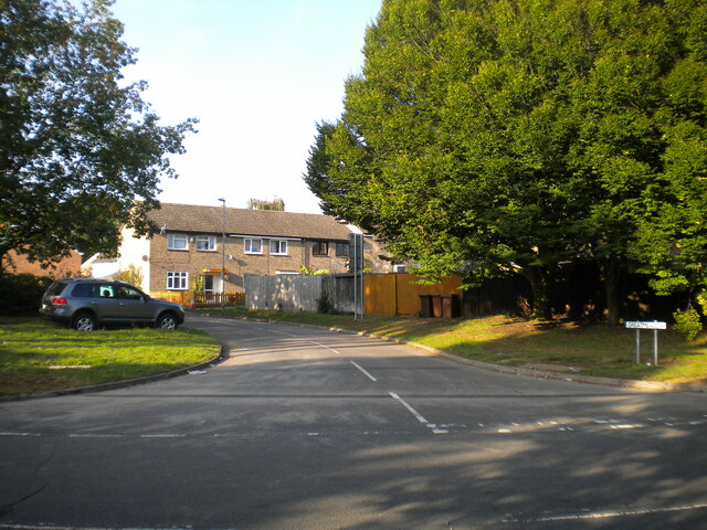
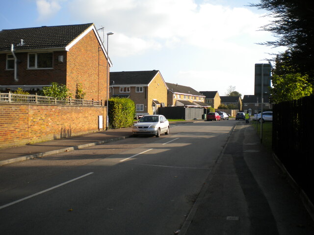
Ecton Field Plantation Images

Images are sourced within 2km of 52.27819/-0.80446894 or Grid Reference SP8165. Thanks to Geograph Open Source API. All images are credited.

Rectory Farm Pocket Park Rectory Farm Pocket Park in Great Billing, Northampton, Northamptonshire, UK.
Rectory Farm Pocket Park
Rectory Farm Pocket Park in Great Billing, Northampton, Northamptonshire, UK.
Blackthorn Bridge Court, Blackthorn Off Blackthorn Road, providing vehicular access to the local retail centre.
Blackthorn Bridge Court, Blackthorn
Off Blackthorn Road, providing vehicular access to the local retail centre.
Blackthorn Road, Blackthorn The main distributor road through the estate, approaching the junction with 
Cherry Lodge Road.
Blackthorn Road, Blackthorn
The main distributor road through the estate, approaching the junction with Cherry Lodge Road.
Collmead Court, Blackthorn A residential cul de sac off Blackthorn Road.
Collmead Court, Blackthorn
A residential cul de sac off Blackthorn Road.
Greatmeadow Road, Blackthorn Off Blackthorn Road.
Greatmeadow Road, Blackthorn
Off Blackthorn Road.
Greatmeadow, Blackthorn Off Blackthorn Road.
Greatmeadow, Blackthorn
Off Blackthorn Road.
Thornfield, Blackthorn Off Blackthorn Road.
Thornfield, Blackthorn
Off Blackthorn Road.
Footpath in Overstone Lodge (1) Part of a labyrinthine network of footpaths in this estate, this one leads eventually to Goldings Road.
Footpath in Overstone Lodge (1)
Part of a labyrinthine network of footpaths in this estate, this one leads eventually to Goldings Road.
Footpath in Overstone Lodge (2) Leading to a footbridge over Talavera Way; the path can be seen rising in the distance to gain the necessary height.
Footpath in Overstone Lodge (2)
Leading to a footbridge over Talavera Way; the path can be seen rising in the distance to gain the necessary height.
Footpath approaching footbridge, Overstone Lodge The footbridge takes the path across Shadowfax Drive and Great Billing Way to reach the north end of Rectory Farm.
Footpath approaching footbridge, Overstone Lodge
The footbridge takes the path across Shadowfax Drive and Great Billing Way to reach the north end of Rectory Farm.
North end of Great Billing Way, Overstone Lodge The main road continues left at the roundabout as Talavera Way.
North end of Great Billing Way, Overstone Lodge
The main road continues left at the roundabout as Talavera Way.
Footpath to Mortar Pit Road, Rectory Farm Zigzagging to lose height gently after crossing Great Billing Way on a footbridge (behind the photographer). Rectory Farm is on the eastern edge of Northampton, hence the countryside visible beyond the houses.
Footpath to Mortar Pit Road, Rectory Farm
Zigzagging to lose height gently after crossing Great Billing Way on a footbridge (behind the photographer). Rectory Farm is on the eastern edge of Northampton, hence the countryside visible beyond the houses.
Great Billing Way, Overstone Lodge Linking Northampton's easternmost housing estates with the A45, severing many said estates from one another in the process. At this point, the road firmly separates Overstone Lodge (right) from Rectory Farm (just out of frame to the left); they are linked by a footbridge immediately behind (and well above) the photographer.
Great Billing Way, Overstone Lodge
Linking Northampton's easternmost housing estates with the A45, severing many said estates from one another in the process. At this point, the road firmly separates Overstone Lodge (right) from Rectory Farm (just out of frame to the left); they are linked by a footbridge immediately behind (and well above) the photographer.
Pedestrian bridge over Wellingborough Road
Wellingborough Road Great Billing
Footpath / cycle track to Overstone
House on Ecton Road, Sywell
Ecton Road, Sywell
Ecton Road, Sywell
Show me another place!

Ecton Field Plantation is located at Grid Ref: SP8165 (Lat: 52.27819, Lng: -0.80446894)

Unitary Authority: North Northamptonshire

Police Authority: Northamptonshire

What 3 Words

///shades.united.rungs. Near Sywell, Northamptonshire

Related Wikis

Overstone Park School

Overstone Park School is a private co-educational day school near Northampton, England, for pupils aged 3 months to 18 years. == School == The school was...

Overstone Hall

Overstone Hall is a Grade II listed stately home in Northamptonshire, England. == History == The house was built in the early 1860s for Samuel Jones-Loyd...

Sywell Country Park

Sywell Country Park exists on the site of a former drinking water reservoir near the village of Sywell in East Northamptonshire, England.The reservoir...

Overstone, Northamptonshire

Overstone is a village and civil parish in West Northamptonshire, England. At the time of the 2001 census, the parish's population was 650 people, increasing...

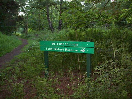
Lings Wood Nature Reserve

Lings Wood is a 20.1 hectare Local Nature Reserve in eastern Northampton. It is owned by Northampton Borough Council and managed by the Wildlife Trust...

Ecton, Northamptonshire

Ecton is a village and civil parish in North Northamptonshire, England. The village is just east of Northampton, just off the A4500 road. It was one of...

List of local nature reserves in Northamptonshire

Northamptonshire is a county in the East Midlands of England. It has an area of 236,700 hectares (914 sq mi) and a population estimated in mid-2015 at...

Northamptonshire

Northamptonshire (; abbreviated Northants.) is a ceremonial county in the East Midlands of England. It is bordered by Leicestershire, Rutland, and Lincolnshire...

Nearby Amenities

Located within 500m of 52.27819,-0.80446894
Building: yes
Lat/Long: 52.2784402/-0.8047552
Cafe
Acorn Cafe
Addr City: Northampton
Addr Country: GB
Addr Housename: Overstone Lakes Caravan Park
Addr Street: Ecton Lane
Addr Village: Sywell
Fhrs Authority: North Northamptonshire
Fhrs Id: 1005759
Fhrs Local Authority Id: 17/00080/COM
Lat/Long: 52.2815395/-0.8019269
Power: pole
Lat/Long: 52.2738778/-0.8028932
Power: pole
Lat/Long: 52.2743689/-0.80272
Power: pole
Lat/Long: 52.2750951/-0.8025186
Power: pole
Lat/Long: 52.2758512/-0.8022909
Power: pole
Lat/Long: 52.2766486/-0.8020186
The data included in this document is from www.openstreetmap.org. The data is made available under ODbL.

Have you been to Ecton Field Plantation?

Leave your review of Ecton Field Plantation below (or comments, questions and feedback).