East Hatley

Settlement in Cambridgeshire South Cambridgeshire

England

East Hatley

East Hatley, St Denys <span class="nowrap"><a title="http://www.druidic.org/camchurch/churches/easthatley.htm" rel="nofollow ugc noopener" href="http://www.druidic.org/camchurch/churches/easthatley.htm">Link</a><img style="margin-left:2px;" alt="External link" title="External link - shift click to open in new window" src="https://s1.geograph.org.uk/img/external.png" width="10" height="10"/></span>
East Hatley, St Denys Credit: mym

East Hatley is a small village located in the county of Cambridgeshire, England. Situated approximately 10 miles south of the city of Cambridge, it is part of the South Cambridgeshire district. East Hatley lies on the eastern bank of the River Cam, with picturesque views of the surrounding countryside.

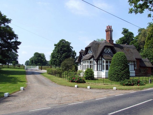
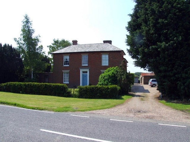
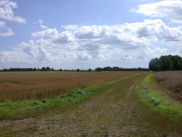
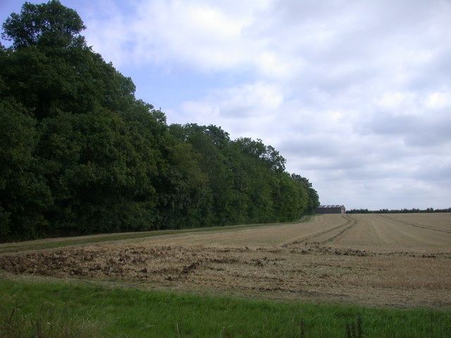
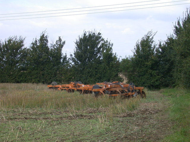
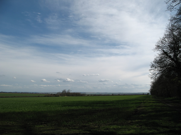
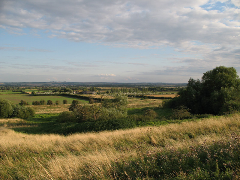
The village is known for its tranquil and rural setting, offering a peaceful retreat from the hustle and bustle of city life. It is characterized by its quaint thatched cottages and traditional English architecture, giving it a charming and timeless appeal. The village is surrounded by open fields and farmland, providing ample opportunities for outdoor activities such as walking, cycling, and horse riding.

Despite its small size, East Hatley boasts a strong sense of community. The village has a local pub, The Hatley Cock, which serves as a social hub for residents and visitors alike. Additionally, there is a village hall that hosts various events and activities throughout the year, fostering a sense of camaraderie among the villagers.

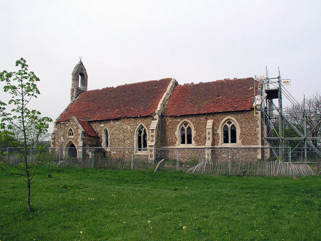
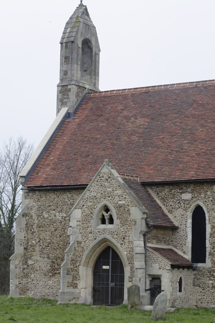
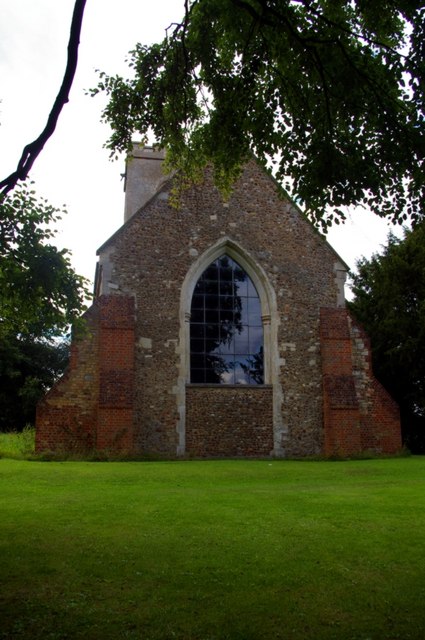
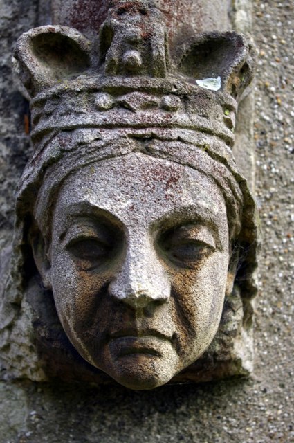
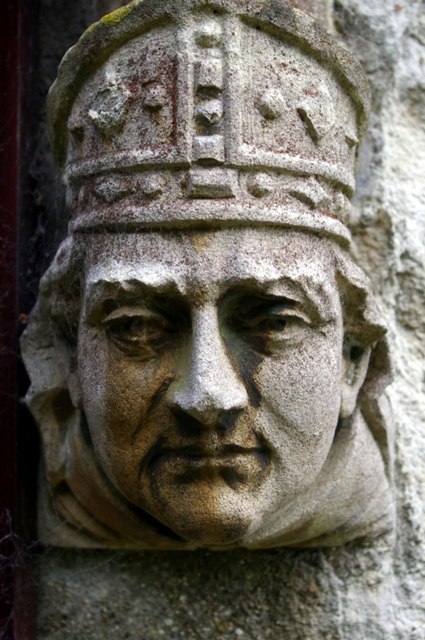
The history of East Hatley can be traced back to medieval times, and remnants of its past can still be seen today. The St. Denis Church, a Grade II listed building, stands as a testament to the village's historical significance. With its tranquil rural setting and strong community spirit, East Hatley offers a charming and idyllic place to reside or visit.

If you have any feedback on the listing, please let us know in the comments section below.

East Hatley Images

Images are sourced within 2km of 52.137461/-0.118109 or Grid Reference TL2850. Thanks to Geograph Open Source API. All images are credited.

East Hatley, St Denys <span class="nowrap"><a title="http://www.druidic.org/camchurch/churches/easthatley.htm" rel="nofollow ugc noopener" href="http://www.druidic.org/camchurch/churches/easthatley.htm">Link</a><img style="margin-left:2px;" alt="External link" title="External link - shift click to open in new window" src="https://s1.geograph.org.uk/img/external.png" width="10" height="10"/></span>
East Hatley, St Denys
Hatley St George, St George <span class="nowrap"><a title="http://www.druidic.org/camchurch/churches/hatleygeorge.htm" rel="nofollow ugc noopener" href="http://www.druidic.org/camchurch/churches/hatleygeorge.htm">Link</a><img style="margin-left:2px;" alt="External link" title="External link - shift click to open in new window" src="https://s1.geograph.org.uk/img/external.png" width="10" height="10"/></span>
Hatley St George, St George
Church Porch of St Denis, East Hatley <span class="nowrap"><a title="http://www.hatley.info/" rel="nofollow ugc noopener" href="http://www.hatley.info/">Link</a><img style="margin-left:2px;" alt="External link" title="External link - shift click to open in new window" src="https://s1.geograph.org.uk/img/external.png" width="10" height="10"/></span> :
"A feature of the Hatleys is that the more important buildings were once surrounded by moats. These can still be seen, especially in East Hatley. St. Denis church retains its moat and other moats can be seen from the road near Manor Barn and The Palace."
Church Porch of St Denis, East Hatley
LinkExternal link : "A feature of the Hatleys is that the more important buildings were once surrounded by moats. These can still be seen, especially in East Hatley. St. Denis church retains its moat and other moats can be seen from the road near Manor Barn and The Palace."
Buff Wood, East Hatley One of the earliest woodland nature reserves was Buff Wood (East Hatley), selected by the late Humphrey Gilbert-Carter in 1946 for purchase by Cambridge University.
Buff Wood, East Hatley
One of the earliest woodland nature reserves was Buff Wood (East Hatley), selected by the late Humphrey Gilbert-Carter in 1946 for purchase by Cambridge University.
Possibly a gate house to Hatley Park
Holbein's Farm
Holbein's Farm
Footpath to East Hatley
Buff Wood SSSI A long-standing woodland listed as a representative of wet ash-maple and pedunculate oak-hazel/ash woodland, with typical ancient woodland plants. <span class="nowrap"><a title="http://www.english-nature.org.uk/citation/citation_photo/1000205.pdf" rel="nofollow ugc noopener" href="http://www.english-nature.org.uk/citation/citation_photo/1000205.pdf">Link</a><img style="margin-left:2px;" alt="External link" title="External link - shift click to open in new window" src="https://s1.geograph.org.uk/img/external.png" width="10" height="10"/></span>
Buff Wood SSSI
A long-standing woodland listed as a representative of wet ash-maple and pedunculate oak-hazel/ash woodland, with typical ancient woodland plants. LinkExternal link
Disk harrow parked in field
Bar Lane Looking south-east across farmland from Bar Lane, Hatley St George.
Bar Lane
Looking south-east across farmland from Bar Lane, Hatley St George.
St George's Tower Converted water tower retained as a feature in the new business park to which it gives its name.
St George's Tower
Converted water tower retained as a feature in the new business park to which it gives its name.
St George's Church The body of the church is Perpendicular, but the chancel was rebuilt in 1875, when the whole church was restored.  The chancel, with its short transepts, was disused by 1970 and has since been demolished, the east end now being closed by this plain window and new wall within the original chancel arch of two chamfered orders.

<span class="nowrap"><a title="http://www.druidic.org/camchurch/churches/hatleygeorge.htm" rel="nofollow ugc noopener" href="http://www.druidic.org/camchurch/churches/hatleygeorge.htm">Link</a><img style="margin-left:2px;" alt="External link" title="External link - shift click to open in new window" src="https://s1.geograph.org.uk/img/external.png" width="10" height="10"/></span>
St George's Church
The body of the church is Perpendicular, but the chancel was rebuilt in 1875, when the whole church was restored. The chancel, with its short transepts, was disused by 1970 and has since been demolished, the east end now being closed by this plain window and new wall within the original chancel arch of two chamfered orders. LinkExternal link
We are not amused! Label stop by the north door of St George's Church.  Traditionally these stops are caricatures of the reigning monarch and current bishop (thanks to Richard Croft for pointing out this custom).  The church was restored in 1875, so this sour-faced queen must be Victoria.
We are not amused!
Label stop by the north door of St George's Church. Traditionally these stops are caricatures of the reigning monarch and current bishop (thanks to Richard Croft for pointing out this custom). The church was restored in 1875, so this sour-faced queen must be Victoria.
Bishop Woodford Label stop by the north door of St George's Church.  Traditionally these stops are caricatures of the reigning monarch and current bishop (thanks to Richard Croft for pointing out this custom).  The church was restored in 1875, so this must be Bishop James Russell Woodford of Ely.
Bishop Woodford
Label stop by the north door of St George's Church. Traditionally these stops are caricatures of the reigning monarch and current bishop (thanks to Richard Croft for pointing out this custom). The church was restored in 1875, so this must be Bishop James Russell Woodford of Ely.
Top Farm, Croydon, Cambs View of the square from the SE to the NW corners, from the B1042 road towards Top Farm; the ridge is the Lower Chalk escarpment capped by Chalky Boulder Clay.
Top Farm, Croydon, Cambs
View of the square from the SE to the NW corners, from the B1042 road towards Top Farm; the ridge is the Lower Chalk escarpment capped by Chalky Boulder Clay.
Field and track
Field and track
Open fields
Open fields
Field and Pincote Barn
Show me another place!

East Hatley is located at Grid Ref: TL2850 (Lat: 52.137461, Lng: -0.118109)

Administrative County: Cambridgeshire

District: South Cambridgeshire

Police Authority: Cambridgeshire

What 3 Words

///fields.instructs.scrapping. Near Gamlingay, Cambridgeshire

Related Wikis

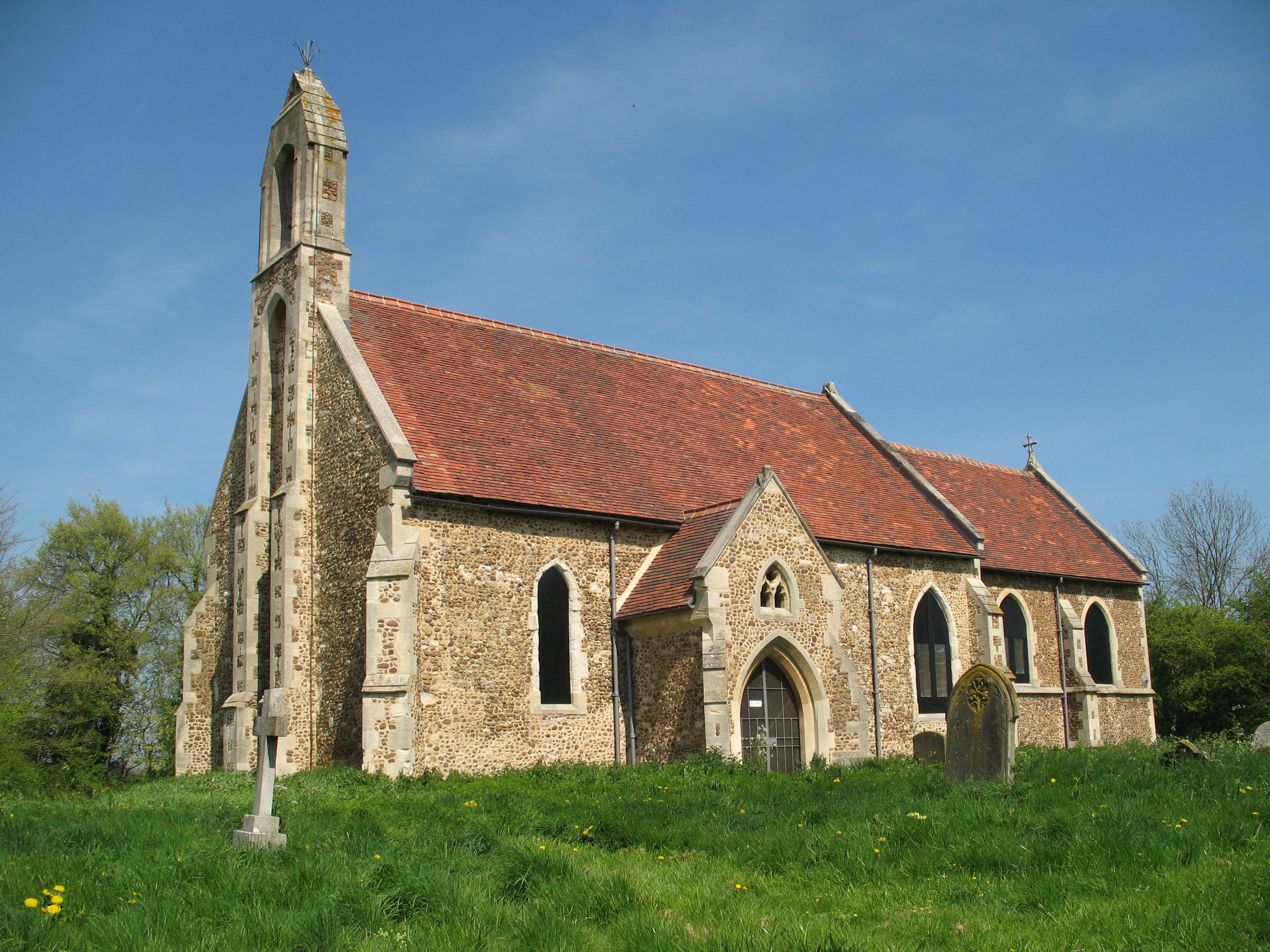
St Denis Church, East Hatley

St Denis' Church, East Hatley is a deconsecrated church in East Hatley in Cambridgeshire, England. It is a listed building, Grade 2*, and the building...
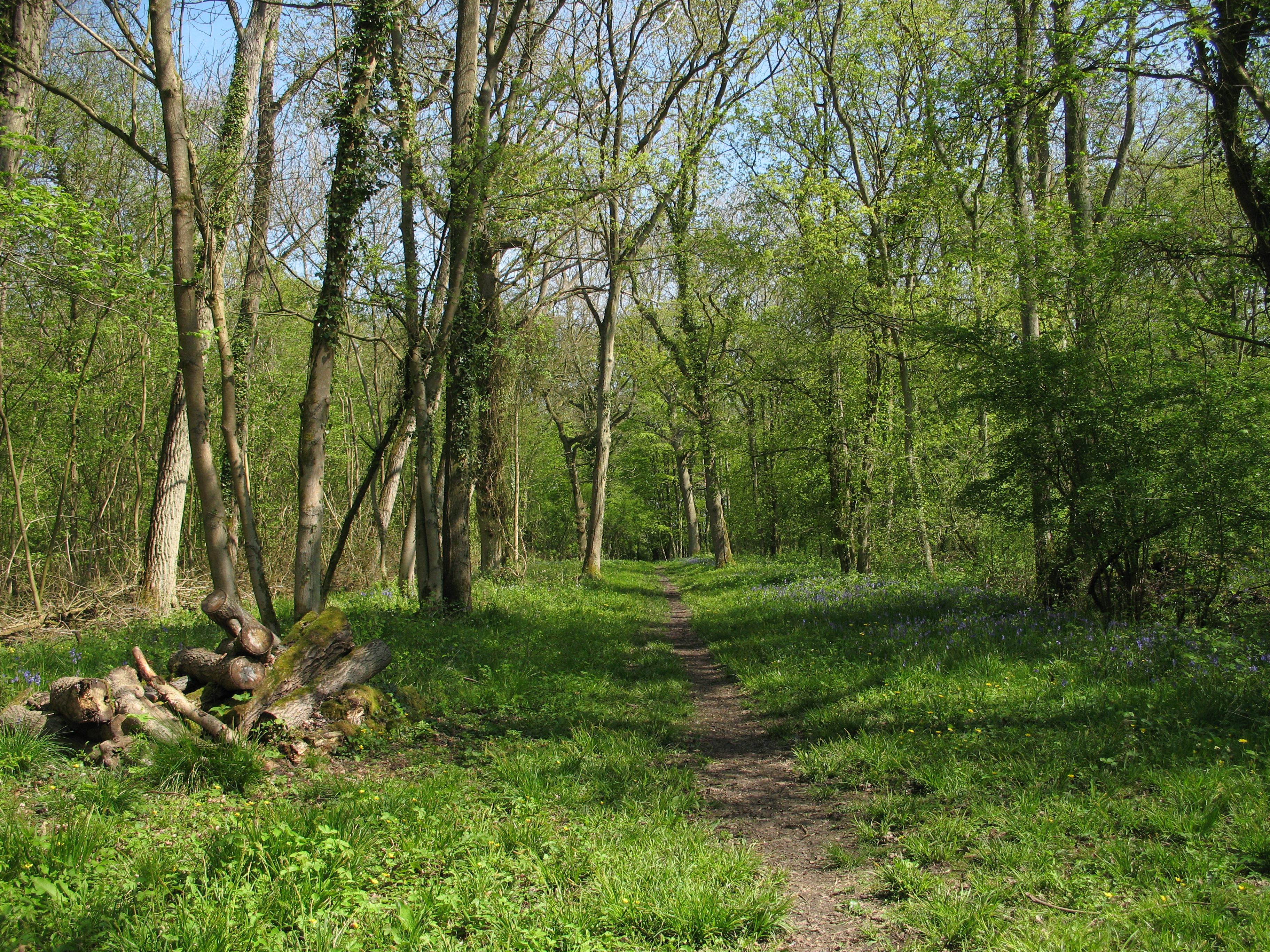
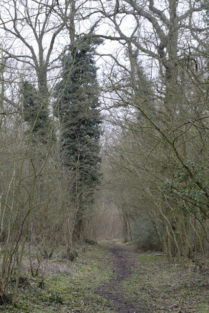
Buff Wood

Buff Wood is a 15.8-hectare (39-acre) biological Site of Special Scientific Interest in Hatley in Cambridgeshire. It is managed by the Wildlife Trust for...

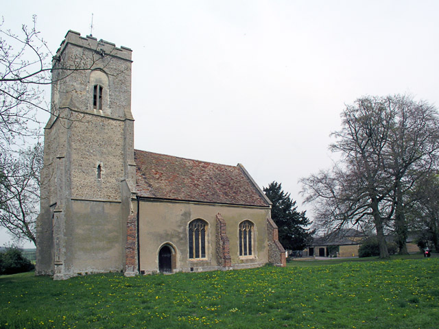
Hatley, Cambridgeshire

Hatley is a civil parish in South Cambridgeshire, England. It lies between the villages of Gamlingay and Croydon, 12 miles south-west of the city of Cambridge...

Clopton, Cambridgeshire

Clopton is a deserted medieval village (DMV), about 1 mile (1.6 km) south west of the village of Croydon, Cambridgeshire, that once stood on a prominent...

Nearby Amenities

Located within 500m of 52.137461,-0.118109
East Hatley
Created By: Potlatch 0.10b
Place: village
Wikidata: Q21693480
Lat/Long: 52.1372372/-0.1222529
Bus Stop
Moat Farm
Naptan AtcoCode: 0500SHATL003
Naptan Bearing: W
Naptan BusStopType: CUS
Naptan CommonName: Moat Farm
Naptan Indicator: near
Naptan Landmark: East Hatley
Naptan NaptanCode: cmbdwtdw
Naptan ShortCommonName: Moat Farm
Naptan Street: Main Street
Naptan Verified: no
Source: naptan_import
Lat/Long: 52.1397109/-0.1187336
Bus Stop
Moat Farm
Naptan AtcoCode: 0500SHATL004
Naptan Bearing: E
Naptan BusStopType: CUS
Naptan CommonName: Moat Farm
Naptan Indicator: opp
Naptan Landmark: East Hatley
Naptan NaptanCode: cmbdwtga
Naptan ShortCommonName: Moat Farm
Naptan Street: Main Street
Naptan Verified: no
Source: naptan_import
Lat/Long: 52.1397434/-0.118513
Barrier: kissing_gate
Lat/Long: 52.1367895/-0.1216749
Power: pole
Lat/Long: 52.140835/-0.1215057
Power: pole
Lat/Long: 52.140455/-0.1207209
Power: pole
Lat/Long: 52.1401653/-0.1194229
Power: pole
Lat/Long: 52.1403118/-0.1200691
Power: pole
Lat/Long: 52.1400269/-0.1188113
Power: pole
Lat/Long: 52.1387357/-0.1117382
Power: pole
Lat/Long: 52.1392387/-0.1149595
Power: pole
Lat/Long: 52.1393984/-0.1160351
Power: pole
Lat/Long: 52.1391128/-0.114153
Power: pole
Lat/Long: 52.1395498/-0.1170518
Post Box
Ref: SG19 227
Lat/Long: 52.1395844/-0.1188515
The data included in this document is from www.openstreetmap.org. The data is made available under ODbL.

Have you been to East Hatley?

Leave your review of East Hatley below (or comments, questions and feedback).