New Inn Spinney

Wood, Forest in Northamptonshire

England

New Inn Spinney

Sywell Aerodrome - Control Tower The control tower at Sywell Aerodrome, Northamptonshire.
Sywell Aerodrome - Control Tower Credit: Gary Sutherland

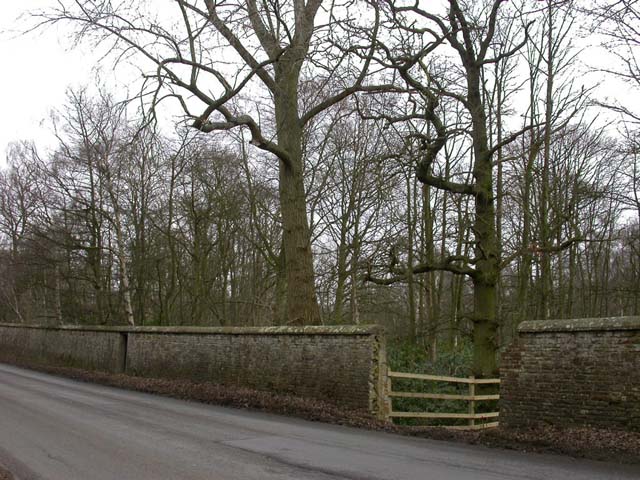
New Inn Spinney is a small woodland area located in Northamptonshire, England. Situated near the village of New Inn, the spinney covers an approximate area of 10 acres and is known for its diverse range of trees and wildlife.

The spinney is predominantly made up of deciduous trees, including oak, ash, and beech, which provide a beautiful canopy of greenery throughout the year. The forest floor is covered with an array of wildflowers, creating a vibrant and colorful landscape during the spring and summer seasons.

This woodland area is a popular destination for nature enthusiasts and walkers, offering a tranquil and peaceful environment away from the bustle of urban life. Several well-maintained footpaths traverse the spinney, allowing visitors to explore its various nooks and crannies.

Wildlife is plentiful in New Inn Spinney, with sightings of deer, foxes, and numerous bird species being common. The woodland provides a vital habitat for these creatures, offering a safe haven and a source of food and shelter.

The conservation of New Inn Spinney is of great importance to the local community, and efforts have been made to preserve its natural beauty. Regular maintenance and tree planting initiatives are undertaken to ensure the longevity and sustainability of the spinney.

Overall, New Inn Spinney is a picturesque woodland area in Northamptonshire, offering a peaceful retreat for nature lovers and a valuable ecosystem for local wildlife. Its beauty and serenity make it a cherished destination for both locals and visitors alike.

If you have any feedback on the listing, please let us know in the comments section below.

New Inn Spinney Images

Images are sourced within 2km of 52.309061/-0.81582675 or Grid Reference SP8068. Thanks to Geograph Open Source API. All images are credited.

Sywell Aerodrome - Control Tower The control tower at Sywell Aerodrome, Northamptonshire.
Sywell Aerodrome - Control Tower
The control tower at Sywell Aerodrome, Northamptonshire.
Ass Bank Beside Sywell Road in Overstone.
Ass Bank
Beside Sywell Road in Overstone.
Sywell Looking north-east along Overstone Road in Sywell.
Sywell
Looking north-east along Overstone Road in Sywell.
Sywell Aerodrome Looking north-west from the road that passes through the south-east corner of the square. Sorry it's such an uninspiring scene of what should be the whole square, but the view is almost completely obstructed by mud banks around the edge of the field and mounting one would constitute illicit entry and suspicious behaviour according to the signs. I'll need a light aircraft to improve on it, I'm afraid. At least there's a wind-sock visible.
Sywell Aerodrome
Looking north-west from the road that passes through the south-east corner of the square. Sorry it's such an uninspiring scene of what should be the whole square, but the view is almost completely obstructed by mud banks around the edge of the field and mounting one would constitute illicit entry and suspicious behaviour according to the signs. I'll need a light aircraft to improve on it, I'm afraid. At least there's a wind-sock visible.
Footpath North Taken from the edge of Cowpasture Spinney.
Footpath North
Taken from the edge of Cowpasture Spinney.
Farm Buildings and Pylons View North
Farm Buildings and Pylons
View North
Road Works on the A43 The road is reduced to one lane for a section and the temporary traffic light has turned red (seen in the distance). Traffic is beginning to emerge from the other direction.
Road Works on the A43
The road is reduced to one lane for a section and the temporary traffic light has turned red (seen in the distance). Traffic is beginning to emerge from the other direction.
A Bad Sign on the A43 View North. The road seems less busy than usual probably because people are avoiding roadworks further south which cause delays, but traffic is still very fast for a narrow road.
A Bad Sign on the A43
View North. The road seems less busy than usual probably because people are avoiding roadworks further south which cause delays, but traffic is still very fast for a narrow road.
Rectory Farm Seen from the A43
Rectory Farm
Seen from the A43
Sywell Lodge Farm Seen from Sywell Road. The view of the farmhouse is now obscured by development on the roadside.
Sywell Lodge Farm
Seen from Sywell Road. The view of the farmhouse is now obscured by development on the roadside.
Chartered Accountants Offices New development built on the roadside in front of a farmhouse. I have no knowledge of this case but I do know that some farmers are having to extend activities to raise enough money to stay in business.
Chartered Accountants Offices
New development built on the roadside in front of a farmhouse. I have no knowledge of this case but I do know that some farmers are having to extend activities to raise enough money to stay in business.
Stile on Footpath View east on a footpath leading out of the village of Holcot.
Stile on Footpath
View east on a footpath leading out of the village of Holcot.
Footbridge View east-north-east.  The bridge is on a footpath east of Holcot.
Footbridge
View east-north-east. The bridge is on a footpath east of Holcot.
Munching Horse There are fewer of this muscular breed of horse to be seen now.  I think they used to be called carthorses in the vernacular.  This one had the field to itself.
Munching Horse
There are fewer of this muscular breed of horse to be seen now. I think they used to be called carthorses in the vernacular. This one had the field to itself.
Largely disused Section of a Bridleway View north.  Bridleway should run south-east from here as far as the A43 but is blocked off at this point.  Rectory Farm, over in the next square, can be seen in the distance.
Largely disused Section of a Bridleway
View north. Bridleway should run south-east from here as far as the A43 but is blocked off at this point. Rectory Farm, over in the next square, can be seen in the distance.
Distant Farm The house can be seen on the left near the fir trees.  View south-west from a bridleway at a point where further progress towards the subject is blocked by a makeshift fence.
Distant Farm
The house can be seen on the left near the fir trees. View south-west from a bridleway at a point where further progress towards the subject is blocked by a makeshift fence.
Rectory Farm From a footpath which skirts the farm buildings.
Rectory Farm
From a footpath which skirts the farm buildings.
Aircraft at Sywell, July 1975 This is a civilian Chipmunk, being serviced outside the Sloane Helicopters hangar at Sywell in 1975. The building in the background is the airport hotel.
Aircraft at Sywell, July 1975
This is a civilian Chipmunk, being serviced outside the Sloane Helicopters hangar at Sywell in 1975. The building in the background is the airport hotel.
Show me another place!

New Inn Spinney is located at Grid Ref: SP8068 (Lat: 52.309061, Lng: -0.81582675)

Unitary Authority: North Northamptonshire

Police Authority: Northamptonshire

What 3 Words

///radiated.direct.wake. Near Sywell, Northamptonshire

Nearby Locations

New Inn Spinney

Related Wikis

A43 road

The A43 is a primary route in the English Midlands and northern South East England, that runs from the M40 motorway near Ardley in Oxfordshire to Stamford...

Holcot

Holcot is a village and civil parish in the West Northamptonshire in England. At the time of the 2001 census, the parish's population was 399 people. At...

Sywell Aerodrome

Sywell Aerodrome (IATA: ORM, ICAO: EGBK) is the local aerodrome serving the towns of Northampton, Wellingborough, Kettering and Rushden, as well as wider...

St Mary & All Saints' Church, Holcot

St Mary & All Saints' Church is an Anglican Church and the parish church of Holcot. It is a Grade II listed building and stands on the west side of Main...

Nearby Amenities

Located within 500m of 52.309061,-0.81582675
Parking
Lat/Long: 52.3086574/-0.8166709
Power: tower
Lat/Long: 52.308456/-0.8113901
Parking
Lat/Long: 52.3109796/-0.8150407
Power: tower
Lat/Long: 52.3095918/-0.8098493
Power: tower
Lat/Long: 52.3068538/-0.8128165
Power: tower
Lat/Long: 52.3051511/-0.8143409
Generator Source: wind
Power: generator
Lat/Long: 52.3073139/-0.8139252
Man Made: mast
Lat/Long: 52.3100585/-0.816176
Power: pole
Lat/Long: 52.3058595/-0.8119276
Power: pole
Lat/Long: 52.3063446/-0.8128304
Power: pole
Lat/Long: 52.3069967/-0.8140428
Power: pole
Lat/Long: 52.307654/-0.815238
Power: pole
Lat/Long: 52.3082821/-0.8163874
Power: pole
Lat/Long: 52.3086882/-0.8171469
Power: pole
Lat/Long: 52.3090105/-0.8184081
Power: pole
Lat/Long: 52.3102417/-0.8222001
Power: pole
Lat/Long: 52.3092805/-0.8195403
Power: pole
Lat/Long: 52.3097701/-0.8209899
The data included in this document is from www.openstreetmap.org. The data is made available under ODbL.

Have you been to New Inn Spinney?

Leave your review of New Inn Spinney below (or comments, questions and feedback).