East Ham

Settlement in Essex

England

East Ham

Green St This picture shows Green Street Upton Park. The covered market can be seen to the right. It was taken at the junction of King’s Rd on the left and Queens Rd on the right looking southbound.
Green St Credit: Glyn Baker

East Ham is a district located in the London Borough of Newham, in the county of Essex, England. Situated in the eastern part of London, it is approximately eight miles northeast of Charing Cross. East Ham is a vibrant and diverse area known for its rich cultural heritage and strong sense of community.

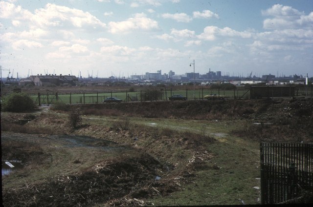
Historically, East Ham was a rural village until the late 19th century when it experienced rapid urbanization due to industrialization and the expansion of London. Today, it is a densely populated residential area with a mix of Victorian terraced houses, post-war council estates, and modern developments.

The district offers a range of amenities and facilities to cater to its diverse population. High Street North is the main shopping area, lined with a variety of shops, supermarkets, and local businesses. East Ham Market Hall is a popular destination for fresh produce, clothing, and household goods.

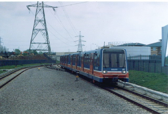
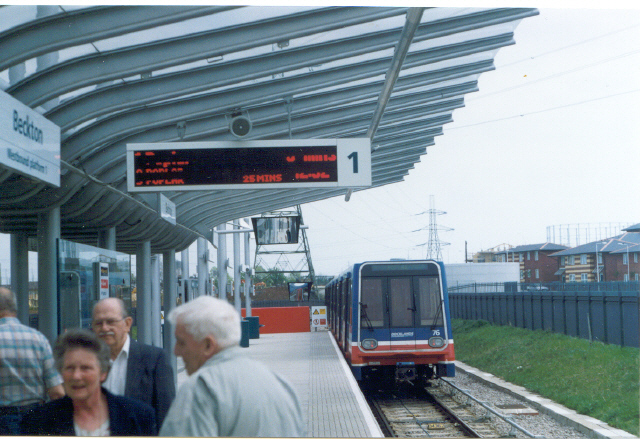
East Ham is also home to several parks and green spaces, including Central Park and Plashet Park, providing residents with recreational areas for outdoor activities and leisure. The area is well-connected via public transportation, with East Ham station providing access to the District and Hammersmith & City lines, connecting commuters to central London and beyond.

The multicultural nature of East Ham is reflected in its vibrant food scene, with a wide range of cuisines available, including Indian, Pakistani, Bangladeshi, and Caribbean. The area also hosts numerous cultural events and festivals throughout the year, celebrating the diversity and heritage of its residents.

Overall, East Ham offers a bustling and diverse community, with a mix of residential, commercial, and recreational opportunities, making it a lively and popular place to live.

If you have any feedback on the listing, please let us know in the comments section below.

East Ham Images

Images are sourced within 2km of 51.530105/0.054404 or Grid Reference TQ4283. Thanks to Geograph Open Source API. All images are credited.

Green St This picture shows Green Street Upton Park. The covered market can be seen to the right. It was taken at the junction of King’s Rd on the left and Queens Rd on the right looking southbound.
Green St
This picture shows Green Street Upton Park. The covered market can be seen to the right. It was taken at the junction of King’s Rd on the left and Queens Rd on the right looking southbound.
East Ham High St This is a photo of High St North East Ham, taken looking south towards the station. Sibley Grove is on the left. The pub on the corner is amusingly named the Overdraft Tavern
East Ham High St
This is a photo of High St North East Ham, taken looking south towards the station. Sibley Grove is on the left. The pub on the corner is amusingly named the Overdraft Tavern
Beckton. D.L.R. unit approaching Station.
Beckton.
D.L.R. unit approaching Station.
Beckton. The D.L.R. Station.
Beckton.
The D.L.R. Station.
Greenway and Newham General The Greenway (see <a href="https://www.geograph.org.uk/gridref/TQ4082">TQ4082</a>) where it passes behind Newham General hospital
Greenway and Newham General
The Greenway (see TQ4082) where it passes behind Newham General hospital
Greenway and Becton Alps The Greenway (see <a href="https://www.geograph.org.uk/gridref/TQ4082">TQ4082</a>) with the Becton Alps on the right. These were constructed from a derelict waste heap to become a short-lived artificial ski slope.
Greenway and Becton Alps
The Greenway (see TQ4082) with the Becton Alps on the right. These were constructed from a derelict waste heap to become a short-lived artificial ski slope.
No litter or graffiti in East Ham Landscaped planting, textured paving on the footpath and coloured asphalt on the cycle track all help humanise the otherwise brutal concrete wilderness of the A13 flyover at East Ham.  And there's no litter or graffiti.
No litter or graffiti in East Ham
Landscaped planting, textured paving on the footpath and coloured asphalt on the cycle track all help humanise the otherwise brutal concrete wilderness of the A13 flyover at East Ham. And there's no litter or graffiti.
Sarees and Spices in East Ham The saree and spice shops of East Ham provide a colourful display. This is Green Street, E7.
Sarees and Spices in East Ham
The saree and spice shops of East Ham provide a colourful display. This is Green Street, E7.
Up Barking Creek Footbridge over the River Roding near where it becomes known as Barking Creek.
Up Barking Creek
Footbridge over the River Roding near where it becomes known as Barking Creek.
Shree Kutch Satsang Swaminarayan Temple Shaftesbury Road, Forest Gate, London E7
Shree Kutch Satsang Swaminarayan Temple
Shaftesbury Road, Forest Gate, London E7
A sweet place to live The former Trebor sweets factory in East Ham, E7, has been converted to modern apartments.
A sweet place to live
The former Trebor sweets factory in East Ham, E7, has been converted to modern apartments.
Beckton Alps, 1973 The north end of the great spoil heaps of Beckton Gas works, looking east from the A13 Newham Way. Part later became an artificial ski slope, but the nickname pre-dates this.
Beckton Alps, 1973
The north end of the great spoil heaps of Beckton Gas works, looking east from the A13 Newham Way. Part later became an artificial ski slope, but the nickname pre-dates this.
Beckton Alps and Gas Works, 1973 Looking south east from A13 Newham Way to the southern part of the great spoil heaps of Beckton Gas Works, once the largest such plant in the world. Part of the works can be seen beyond. See also <a href="https://www.geograph.org.uk/gridref/TQ4382">TQ4382</a>
Beckton Alps and Gas Works, 1973
Looking south east from A13 Newham Way to the southern part of the great spoil heaps of Beckton Gas Works, once the largest such plant in the world. Part of the works can be seen beyond. See also TQ4382
Royal Docks Skyline, 1973 A view from the NW perimeter of Beckton Alps SW past East Ham Manor Way (A117). The cranes of the Royal Docks span the horizon, with the Albert Dock to the left and Victoria to the right. In the centre are the flour mills south of Victoria Dock and beyond is the old chimney at Tate & Lyle.
Royal Docks Skyline, 1973
A view from the NW perimeter of Beckton Alps SW past East Ham Manor Way (A117). The cranes of the Royal Docks span the horizon, with the Albert Dock to the left and Victoria to the right. In the centre are the flour mills south of Victoria Dock and beyond is the old chimney at Tate & Lyle.
Keppel and Kempton Rds East Ham This is the Junction of Keppel and Kempton Roads in East Ham. The terraced houses are typical of the area.
Keppel and Kempton Rds East Ham
This is the Junction of Keppel and Kempton Roads in East Ham. The terraced houses are typical of the area.
River Roding This is the River Roding before it becomes Barking Creek. Effectively the River is the boundary between East Ham & Barking.
River Roding
This is the River Roding before it becomes Barking Creek. Effectively the River is the boundary between East Ham & Barking.
Gallions Reach Entertainment Centre This is the Gallions Reach entertainment complex, it actually stands on Barking Creek which runs into the Thames at Gallions Reach.
Gallions Reach Entertainment Centre
This is the Gallions Reach entertainment complex, it actually stands on Barking Creek which runs into the Thames at Gallions Reach.
Upton Park, West Ham United FC. This is the West Stand, the Dr Martens Stand, taken on the afternoon of the FA Trophy Final between Grays and Woking (2-0).
Upton Park, West Ham United FC.
This is the West Stand, the Dr Martens Stand, taken on the afternoon of the FA Trophy Final between Grays and Woking (2-0).
Show me another place!

East Ham is located at Grid Ref: TQ4283 (Lat: 51.530105, Lng: 0.054404)

Unitary Authority: Newham

Police Authority: Metropolitan

What 3 Words

///leap.caked.placed. Near East Ham, London

Nearby Locations

Ham, East East Ham

Related Wikis

Newham College of Further Education

Newham College is a large general further education college in the London Borough of Newham, England, established in 1985. The college's main site is in...

East Ham

East Ham is a district of the London Borough of Newham, England, 8 miles (12.8 km) east of Charing Cross. Within the boundaries of the historic county...

County Borough of East Ham

East Ham was a local government district in the far south west of Essex from 1878 to 1965. It extended from Wanstead Flats in the north to the River Thames...
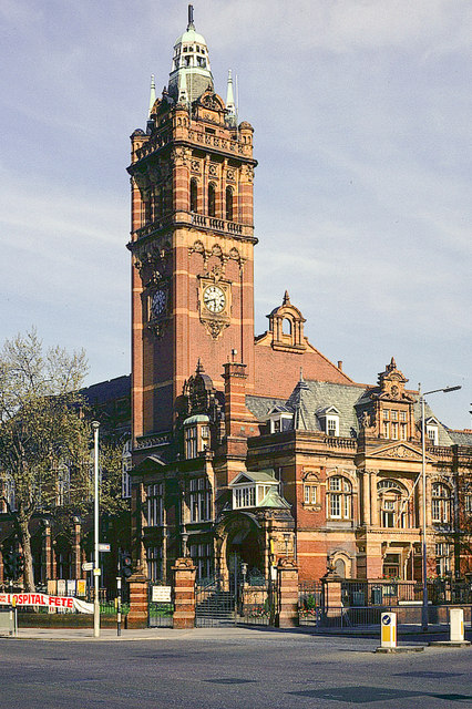
Newham Town Hall

Newham Town Hall, formerly East Ham Town Hall, is a municipal building in Barking Road, East Ham, London. The town hall, which is the headquarters of Newham...

Nearby Amenities

Located within 500m of 51.530105,0.054404
East Ham
Place: town
Wikidata: Q1025593
Wikipedia: en:East Ham
Lat/Long: 51.5329628/0.0553201
Ref GB Tflcid: RWG168748
Traffic Calming: hump
Lat/Long: 51.5282639/0.0512663
Ref GB Tflcid: RWG168745
Traffic Calming: hump
Lat/Long: 51.5282238/0.0521611
Ref GB Tflcid: RWG168720
Traffic Calming: hump
Lat/Long: 51.5272554/0.0543635
Ref GB Tflcid: RWG168754
Traffic Calming: hump
Lat/Long: 51.5274425/0.0497137
Mini Roundabout
Direction: clockwise
Lat/Long: 51.5295358/0.0478803
Ref GB Tflcid: RWG168845
Traffic Calming: hump
Lat/Long: 51.5297/0.0477804
Ref GB Tflcid: RWG168834
Traffic Calming: hump
Lat/Long: 51.5304648/0.0520327
Ref GB Tflcid: RWG181540
Traffic Calming: hump
Lat/Long: 51.5272306/0.0585917
Ref GB Tflcid: RWG169199
Traffic Calming: hump
Lat/Long: 51.5296671/0.0571472
Ref GB Tflcid: RWG169266
Traffic Calming: hump
Lat/Long: 51.5323452/0.0592353
Noexit: yes
Lat/Long: 51.5305326/0.0608552
Ref GB Tflcid: RWG168959
Traffic Calming: hump
Lat/Long: 51.5345359/0.0556198
Post Box
Brand: Royal Mail
Brand Wikidata: Q638098
Operator: Royal Mail
Operator Wikidata: Q638098
Post Box Design: type_b
Post Box Type: pillar
Ref: E6 21
Royal Cypher: EVIIR
Royal Cypher Wikidata: Q33102324
Lat/Long: 51.5259141/0.0566316
Post Office
High Street South Post Office
Addr City: London
Addr Country: GB
Addr Housenumber: 144
Addr Postcode: E6 3RW
Addr Street: High Street South
Addr Suburb: East Ham
Brand: Post Office
Brand Wikidata: Q1783168
Contact Website: https://www.postoffice.co.uk/branch-finder/0760021/high-street-south
Level: 0
Ref Pol Id: 18326
Lat/Long: 51.5258873/0.0565316
Doctors
45 White Horse Road Clinic
Lat/Long: 51.5272753/0.0584113
Yes
Barrier: bollard
Emergency: yes
Lat/Long: 51.5278147/0.0564694
Post Box
Brand: Royal Mail
Brand Wikidata: Q638098
Collection Times: Mo-Fr 17:30; Sa 11:30
Mapillary: 1136439277067971
Operator: Royal Mail
Operator Wikidata: Q638098
Post Box Design: type_b
Post Box Type: pillar
Ref: E6 11
Royal Cypher: GR
Royal Cypher Wikidata: Q33102273
Lat/Long: 51.5296025/0.0477662
Amy News
Addr City: London
Addr Housenumber: 165
Addr Postcode: E6 3DJ
Addr Street: Central Park Road
Fhrs Id: 640876
Shop: newsagent
Source Addr: FHRS Open Data
Lat/Long: 51.5296273/0.0476918
Pub
The Miller's Well
Addr City: London
Addr Country: GB
Addr Housenumber: 419-423
Addr Postcode: E6 2JX
Addr Street: Barking Road
Brand: Wetherspoon
Brand Wikidata: Q6109362
Brand Wikipedia: en:Wetherspoons
Contact Website: https://www.jdwetherspoon.com/pubs/all-pubs/england/london/the-millers-well-east-ham
Fhrs Id: 640847
Internet Access: wlan
Outdoor Seating: yes
Real Ale: yes
Source Addr: FHRS Open Data
Toilets: yes
Toilets Access: customers
Wheelchair: yes
Wikidata: Q88916734
Lat/Long: 51.5334728/0.0563692
Fast Food
Morley's
Addr City: London
Addr Housenumber: 401
Addr Postcode: E6 2JT
Addr Street: Barking Road
Brand: Morley's
Brand Wikidata: Q21008528
Cuisine: chicken
Diet Halal: yes
Fhrs Id: 1245718
Takeaway: yes
Lat/Long: 51.5333442/0.0553971
Fast Food
Sam's Chicken
Addr City: London
Addr Country: GB
Addr Housenumber: 389
Addr Postcode: E6 2JT
Addr Street: Barking Road
Brand: Sam's Chicken
Brand Wikidata: Q24439129
Cuisine: chicken
Fhrs Id: 852746
Takeaway: yes
Lat/Long: 51.5332781/0.0549058
Cafe
Costa
Addr City: London
Addr Housenumber: 50
Addr Postcode: E6 2HJ
Addr Street: High Street North
Addr Suburb: East Ham
Brand: Costa
Brand Wikidata: Q608845
Brand Wikipedia: en:Costa Coffee
Cuisine: coffee_shop
Fhrs Id: 845313
Opening Hours: Mo-Sa 06:00-20:00; Su 07:00-20:00
Takeaway: yes
Lat/Long: 51.5345549/0.0534637
Ref GB Tflcid: RWG168568
Traffic Calming: cushion
Lat/Long: 51.5291289/0.0484399
Bus Stop
Altmore Avenue
Local Ref: X
Naptan AtcoCode: 490003280X
Naptan Bearing: E
Naptan CommonName: Altmore Avenue
Naptan Indicator: Stop X
Naptan Street: BARKING ROAD
Naptan Verified: no
Public Transport: platform
Ref: 53028
Shelter: yes
Lat/Long: 51.5336564/0.0585242
Bus Stop
Aintree Avenue
Naptan AtcoCode: 490003126W
Naptan Bearing: W
Naptan CommonName: Aintree Avenue
Naptan Street: BARKING ROAD
Naptan Verified: no
Public Transport: platform
Lat/Long: 51.5319987/0.0486333
Bus Stop
Bartle Avenue
Local Ref: P
Naptan AtcoCode: 490003659P
Naptan Bearing: N
Naptan CommonName: Bartle Avenue
Naptan Indicator: P
Naptan Street: BARKING ROAD
Public Transport: platform
Shelter: yes
Lat/Long: 51.5324587/0.0505712
Bus Stop
Bartle Avenue
Local Ref: Q
Naptan AtcoCode: 490003659Q
Naptan Bearing: N
Naptan CommonName: Bartle Avenue
Naptan Indicator: Q
Naptan Street: BARKING ROAD
Network: London Buses
Operator: Transport for London
Public Transport: platform
Shelter: yes
Lat/Long: 51.5324289/0.0511574
Bus Stop
East Ham / Central Park
Local Ref: G
Naptan AtcoCode: 490006358N
Naptan Bearing: N
Naptan CommonName: East Ham White Horse
Naptan Indicator: Stop G
Naptan Street: HIGH STREET SOUTH
Naptan Verified: no
Network: London Buses
Operator: Transport for London
Public Transport: platform
Lat/Long: 51.5285807/0.0561731
Bus Stop
East Ham / Central Park
Local Ref: L
Naptan AtcoCode: 490006358S1
Naptan Bearing: S
Naptan CommonName: East Ham White Horse
Naptan Indicator: Stop L
Naptan Verified: no
Public Transport: platform
Lat/Long: 51.5273708/0.0563957
Bus Stop
East Ham / Central Park
Bench: yes
Bus: yes
Local Ref: M
Naptan AtcoCode: 490006358S2
Naptan Bearing: S
Naptan CommonName: East Ham White Horse
Naptan Indicator: Stop M
Naptan Street: HIGH STREET SOUTH
Naptan Verified: no
Note: Alighting point only.
Public Transport: platform
Ref: 52132
Shelter: yes
Source Ref: naptan
Lat/Long: 51.5286653/0.0563249
Bus Stop
High Street North
Bench: yes
Bin: yes
Lit: yes
Local Ref: R
Naptan AtcoCode: 490006360R
Naptan Bearing: N
Naptan CommonName: East Ham High Street
Naptan Indicator: Stop R
Naptan Street: BARKING ROAD
Naptan Verified: no
Public Transport: platform
Ref: 74458
Shelter: yes
Tactile Paving: no
Lat/Long: 51.532964/0.053496
Bus Stop
High Street North
Bench: yes
Bin: yes
Lit: yes
Local Ref: S
Naptan AtcoCode: 490006360S
Naptan Bearing: N
Naptan CommonName: East Ham High Street
Naptan Indicator: S
Naptan Street: BARKING ROAD
Naptan Verified: no
Public Transport: platform
Ref: 57723
Shelter: yes
Tactile Paving: no
Lat/Long: 51.5330107/0.0535584
Bus Stop
Market Street
Local Ref: N
Naptan AtcoCode: 490009662S
Naptan Bearing: S
Naptan CommonName: Market Street High St South
Naptan Indicator: Stop N
Naptan Street: HIGH STREET SOUTH
Naptan Verified: no
Public Transport: platform
Lat/Long: 51.5305629/0.0559149
Bus Stop
Marlow Road
Local Ref: H
Naptan AtcoCode: 490009682N
Naptan Bearing: N
Naptan CommonName: Marlow Road High St South
Naptan Indicator: Stop H
Naptan Street: HIGH STREET SOUTH
Naptan Verified: no
Public Transport: platform
Lat/Long: 51.5263419/0.0564541
Bus Stop
Newham Town Hall
Bench: yes
Bin: yes
Bus: yes
Lit: yes
Local Ref: O
Naptan AtcoCode: 490010218O
Naptan Bearing: N
Naptan CommonName: East Ham Newham Town Hall
Naptan Indicator: O
Naptan Street: BARKING ROAD
Naptan Verified: no
Public Transport: platform
Ref: 49570
Shelter: yes
Tactile Paving: no
Lat/Long: 51.5332765/0.0555311
Bus Stop
Newham Town Hall
Local Ref: T
Naptan AtcoCode: 490010218T
Naptan Bearing: N
Naptan CommonName: East Ham Newham Town Hall
Naptan Indicator: Stop T
Naptan Street: HIGH STREET SOUTH
Naptan Verified: no
Network: London Buses
Operator: Transport for London
Public Transport: platform
Lat/Long: 51.5325182/0.054752
Bus Stop
Newham Town Hall
Bus: yes
Local Ref: U
Naptan AtcoCode: 490010218U
Naptan Bearing: N
Naptan CommonName: East Ham Newham Town Hall
Naptan Indicator: Stop U
Naptan Street: HIGH STREET SOUTH
Naptan Verified: no
Public Transport: platform
Ref: 55226
Source Ref: naptan
Lat/Long: 51.5321544/0.0549883
Bus Stop
Newham Town Hall
Local Ref: V
Naptan AtcoCode: 490010218V
Naptan Bearing: N
Naptan CommonName: East Ham Newham Town Hall
Naptan Indicator: Stop V
Naptan Street: HIGH STREET SOUTH
Naptan Verified: no
Public Transport: platform
Ref: 76711
Lat/Long: 51.5318877/0.055312
Bus Stop
Newham Town Hall
Bench: yes
Bus: yes
Local Ref: W
Naptan AtcoCode: 490010218W
Naptan Bearing: N
Naptan CommonName: East Ham Newham Town Hall
Naptan Indicator: W
Naptan Street: BARKING ROAD
Naptan Verified: no
Public Transport: platform
Ref: 71435
Shelter: yes
Lat/Long: 51.5332342/0.0562478
Bus Stop
Tilbury Road
Local Ref: F
Naptan AtcoCode: 490013665N
Naptan Bearing: N
Naptan CommonName: Tilbury Road
Naptan Indicator: Stop F
Naptan Verified: no
Network: London Buses
Operator: Transport for London
Public Transport: platform
Lat/Long: 51.5299606/0.0557956
Post Box
Brand: Royal Mail
Brand Wikidata: Q638098
Mapillary: 3356897264574378
Operator: Royal Mail
Operator Wikidata: Q638098
Post Box Type: pillar
Ref: E6 13
Survey Date: 2023-02-26
Lat/Long: 51.5321713/0.0488376
Post Box
Brand: Royal Mail
Brand Wikidata: Q638098
Operator: Royal Mail
Operator Wikidata: Q638098
Post Box Design: type_b
Post Box Type: pillar
Ref: E6 17
Lat/Long: 51.5310296/0.0586747
Post Box
Brand: Royal Mail
Brand Wikidata: Q638098
Operator: Royal Mail
Operator Wikidata: Q638098
Post Box Design: type_a
Post Box Type: pillar
Ref: E6 5
Royal Cypher: EIIR
Royal Cypher Wikidata: Q33102113
Lat/Long: 51.5283584/0.0566249
Post Box
Brand: Royal Mail
Brand Wikidata: Q638098
Drive Through: no
Operator: Royal Mail
Operator Wikidata: Q638098
Post Box Design: type_b
Post Box Type: pillar
Ref: E6 22
Royal Cypher: GR
Royal Cypher Wikidata: Q33102273
Lat/Long: 51.5266209/0.0525759
Bicycle Parking
Capacity: 16
Lat/Long: 51.532552/0.0562111
Bicycle Parking
Capacity: 10
Lat/Long: 51.5330058/0.0548754
Bicycle Parking
Bicycle Parking: stands
Capacity: 2
Check Date: 2017-10-17
Ref GB Tflcid: RWG156697
Lat/Long: 51.5333979/0.0565504
Bicycle Parking
Bicycle Parking: stands
Capacity: 2
Check Date: 2017-10-17
Covered: no
Ref GB Tflcid: RWG156696
Lat/Long: 51.5333174/0.0558994
Bicycle Parking
Bicycle Parking: stands
Capacity: 2
Check Date: 2017-10-17
Ref GB Tflcid: RWG156698
Lat/Long: 51.5333838/0.0564424
Bicycle Parking
Bicycle Parking: stands
Capacity: 2
Check Date: 2017-10-17
Ref GB Tflcid: RWG156699
Lat/Long: 51.5334282/0.056812
Bicycle Parking
Bicycle Parking: stands
Capacity: 2
Check Date: 2017-10-17
Ref GB Tflcid: RWG156698
Lat/Long: 51.5333779/0.0563884
Bicycle Parking
Bicycle Parking: stands
Capacity: 4
Check Date: 2017-10-17
Ref GB Tflcid: RWG156708
Lat/Long: 51.5336455/0.0586696
Bicycle Parking
Bicycle Parking: stands
Capacity: 4
Check Date: 2017-10-17
Ref GB Tflcid: RWG156707
Lat/Long: 51.5335959/0.0582086
Bicycle Parking
Bicycle Parking: stands
Capacity: 2
Check Date: 2017-10-17
Ref GB Tflcid: RWG156856
Lat/Long: 51.5327813/0.0530672
Bicycle Parking
Bicycle Parking: stands
Capacity: 2
Check Date: 2017-10-17
Ref GB Tflcid: RWG156693
Lat/Long: 51.5329478/0.0532284
Bicycle Parking
Bicycle Parking: stands
Capacity: 2
Check Date: 2017-10-17
Ref GB Tflcid: RWG156718
Lat/Long: 51.5328396/0.0533848
Bicycle Parking
Capacity: 2
Lat/Long: 51.5295698/0.0477633
Bicycle Parking
Capacity: 2
Lat/Long: 51.53221/0.049102
Bicycle Parking
Bicycle Parking: stands
Capacity: 2
Check Date: 2017-10-17
Ref GB Tflcid: RWG156690
Lat/Long: 51.532532/0.0510139
Bicycle Parking
Capacity: 2
Lat/Long: 51.5321616/0.048788
Bicycle Parking
Bicycle Parking: stands
Capacity: 2
Check Date: 2017-10-17
Ref GB Tflcid: RWG156692
Lat/Long: 51.5325789/0.0512171
Bicycle Parking
Bicycle Parking: stands
Capacity: 2
Check Date: 2017-10-17
Ref GB Tflcid: RWG156719
Lat/Long: 51.5325442/0.0517272
Bicycle Parking
Capacity: 2
Lat/Long: 51.5272604/0.0561467
Bicycle Parking
Capacity: 1
Note: Sheffield stand but too close to fence, so only 1 space.
Lat/Long: 51.5275812/0.056376
Bicycle Parking
Bicycle Parking: stands
Capacity: 2
Mapillary: 307940584106344
Survey Date: 2019-06-09
Lat/Long: 51.5263751/0.0564411
Bicycle Parking
Bicycle Parking: stands
Capacity: 2
Covered: no
Mapillary: 2840394056223957
Survey Date: 2019-06-09
Lat/Long: 51.5258893/0.0566405
Crossing
Crossing: uncontrolled
Crossing Island: yes
Crossing Ref: zebra
Kerb: lowered
Tactile Paving: yes
Lat/Long: 51.5283687/0.0562959
Crossing
Crossing: uncontrolled
Crossing Island: yes
Crossing Ref: zebra
Kerb: lowered
Tactile Paving: yes
Lat/Long: 51.5276574/0.0563205
Crossing
Crossing: unmarked
Crossing Island: yes
Kerb: lowered
Tactile Paving: yes
Lat/Long: 51.5278163/0.0561437
Crossing
Crossing: uncontrolled
Crossing Island: yes
Crossing Ref: zebra
Kerb: lowered
Tactile Paving: yes
Lat/Long: 51.5313671/0.0555726
Bicycle Parking
Capacity: 2
Lat/Long: 51.5316255/0.0555036
Bicycle Parking
Capacity: 2
Lat/Long: 51.5277114/0.0561641
Bicycle Parking
Bicycle Parking: stands
Capacity: 2
Mapillary: 652588552807054
Survey Date: 2019-06-09
Lat/Long: 51.5271056/0.0562043
Bicycle Parking
Bicycle Parking: stands
Capacity: 2
Covered: no
Lat/Long: 51.5265066/0.0526236
Atm
Fee: no
Operator: Post Office
Lat/Long: 51.5258879/0.0565741
Give Way
Direction: forward
Traffic Sign: GB:1003A
Lat/Long: 51.5281438/0.0562345
Atm
Brand: Lloyds Bank
Brand Wikidata: Q1152847
Brand Wikipedia: en:Lloyds Bank
Operator: Lloyds Bank
Operator Wikidata: Q1152847
Lat/Long: 51.5334195/0.0541811
Entrance: main
Lat/Long: 51.5261293/0.0568244
Entrance: main
Lat/Long: 51.5342585/0.05274
Noexit: yes
Lat/Long: 51.5331847/0.0574002
Addr City: London
Addr Housenumber: 92-94
Addr Postcode: E6 3RL
Addr Street: High Street South
Addr Suburb: East Ham
Disused Shop: convenience
Fhrs Id: 996125
Level: 0
Note: closed as of survey 2022-12-21
Old Name: McColl's
Lat/Long: 51.5272581/0.0560729
Tradewell
Addr City: London
Addr Street: High Street South
Addr Suburb: East Ham
Level: 0
Shop: car_parts
Lat/Long: 51.5269897/0.0561499
East Ham Foot Clinic
Addr City: London
Addr Street: High Street South
Addr Suburb: East Ham
Healthcare: podiatrist
Level: 0
Lat/Long: 51.5270251/0.0561395
Pharmacy
Addr City: London
Addr Housenumber: 96
Addr Postcode: E6 3RL
Addr Street: High Street South
Addr Suburb: East Ham
Fhrs Id: 805366
Fhrs Local Authority Id: 69060/0096/0/000
Healthcare: pharmacy
Level: 0
Operator: Blakeberry Ltd
Lat/Long: 51.5270604/0.0561292
Fast Food
White Horse Fisheries
Addr City: London
Addr Housenumber: 106
Addr Postcode: E6 3RL
Addr Street: High Street South
Addr Suburb: East Ham
Cuisine: fish_and_chips;chicken
Fhrs Id: 1568327
Fhrs Local Authority Id: 17/00334/FOOD
Level: 0
Lat/Long: 51.5269275/0.056168
Central Park Estates
Addr City: London
Addr Housenumber: 108
Addr Street: High Street South
Addr Suburb: East Ham
Level: 0
Office: estate_agent
Lat/Long: 51.5268776/0.0561826
Atm
Lat/Long: 51.5268084/0.0562365
Central Park Food & Wine
Addr City: London
Addr Housenumber: 110
Addr Postcode: E6 3RL
Addr Street: High Street South
Addr Suburb: East Ham
Fhrs Id: 1081959
Fhrs Local Authority Id: 18/00340/FOOD
Level: 0
Not Brand Wikidata: Q97104475
Shop: convenience
Lat/Long: 51.526829/0.0561968
The Laundry Bag
Addr City: London
Addr Housenumber: 112
Addr Street: High Street South
Addr Suburb: East Ham
Level: 0
Shop: dry_cleaning
Lat/Long: 51.526779/0.0562113
Betfred
Addr City: London
Addr Street: High Street South
Addr Suburb: East Ham
Brand: Betfred
Brand Wikidata: Q4897425
Brand Wikipedia: en:Betfred
Gambling: betting
Level: 0
Shop: bookmaker
Lat/Long: 51.5267229/0.0562277
Ranic Motors
Addr City: London
Addr Street: High Street South
Addr Suburb: East Ham
Level: 0
Shop: car_parts
Lat/Long: 51.526649/0.0562493
Give Way
Direction: forward
Traffic Sign: GB:1003A
Lat/Long: 51.526584/0.056398
Tehzeeb Aysha Cash And Carry
Addr City: London
Addr Housenumber: 140
Addr Postcode: E6 3RW
Addr Street: High Street South
Addr Suburb: East Ham
Contact Facebook: https://www.facebook.com/people/Tehzeeb-Aysha-Cash-Carry/100068891874722/
Fhrs Id: 1286580
Level: 0
Shop: wholesale
Lat/Long: 51.5260888/0.0564424
Give Way
Direction: backward
Traffic Sign: GB:1003A
Lat/Long: 51.5260202/0.0565864
Restaurant
Ashes
Addr City: London
Addr Housenumber: 146
Addr Postcode: E6 3RW
Addr Street: High Street South
Addr Suburb: East Ham
Fhrs Id: 1241917
Level: 0
Lat/Long: 51.5258429/0.0565463
VSJ Food & Wine
Addr City: London
Addr Housenumber: 142
Addr Postcode: E6 3RW
Addr Street: High Street South
Addr Suburb: East Ham
Fhrs Id: 1098866
Fhrs Local Authority Id: 18/00913/FOOD
Level: 0
Shop: convenience
Lat/Long: 51.5259323/0.0565168
Give Way
Direction: forward
Traffic Sign: GB:1003A
Lat/Long: 51.5282597/0.0564006
Waste Basket
Lat/Long: 51.5277408/0.0564055
Give Way
Direction: forward
Traffic Sign: GB:1003A
Lat/Long: 51.5278018/0.0562319
JenningsBet
Addr City: London
Addr Street: High Street South
Addr Suburb: East Ham
Brand: JenningsBet
Brand Wikidata: Q112925339
Gambling: betting
Level: 0
Shop: bookmaker
Lat/Long: 51.5274934/0.0565206
Kabul Bazaar
Addr City: London
Addr Housenumber: 137
Addr Postcode: E6 3PA
Addr Street: High Street South
Addr Suburb: East Ham
Diet Halal: yes
Fhrs Id: 1076909
Fhrs Local Authority Id: 18/00382/FOOD
Level: 0
Shop: convenience
Lat/Long: 51.5274162/0.0565188
Waste Basket
Lat/Long: 51.5274751/0.0563901
Mini Market Lazgarici
Addr City: London
Addr Housenumber: 131
Addr Postcode: E6 3PA
Addr Street: High Street South
Addr Suburb: East Ham
Cuisine: romanian
Level: 0
Shop: convenience
Lat/Long: 51.5275615/0.0565293
Cataleya Cakes
Addr City: London
Addr Housenumber: 129
Addr Postcode: E6 3PA
Addr Street: High Street South
Addr Suburb: East Ham
Level: 0
Shop: pastry
Source: survey
Lat/Long: 51.5276136/0.0565305
Cafe
Parkside Cafe
Addr City: London
Addr Housenumber: 127
Addr Postcode: E6 3PA
Addr Street: High Street South
Addr Suburb: East Ham
Fhrs Id: 771903
Fhrs Local Authority Id: 14/00571/FOOD
Level: 0
Lat/Long: 51.5276736/0.0565249
Internet Cafe
Globe Internet
Addr City: London
Addr Street: High Street South
Addr Suburb: East Ham
Brand: Lycamobile
Level: 0
Lat/Long: 51.5273845/0.0560796
Fast Food
Spice Hut
Addr City: London
Addr Housenumber: 90
Addr Postcode: E6 3RL
Addr Street: High Street South
Addr Suburb: East Ham
Diet Halal: yes
Fhrs Id: 1050063
Fhrs Local Authority Id: 18/00173/FOOD
Level: 0
Lat/Long: 51.5273566/0.0560781
Entrance: yes
Lat/Long: 51.527231/0.0561214
Crossing
Crossing: unmarked
Kerb: flush
Tactile Paving: yes
Traffic Calming: table
Lat/Long: 51.5271602/0.0562054
Give Way
Direction: backward
Traffic Sign: GB:1003B
Lat/Long: 51.5271662/0.0562433
Shajalal Grocery
Addr City: London
Addr Housenumber: 120
Addr Postcode: E6 3RW
Addr Street: High Street South
Addr Suburb: East Ham
Fhrs Id: 746073
Fhrs Local Authority Id: 15/00160/FOOD
Level: 0
Operator: Shajalal Grocery Ltd
Shop: convenience
Lat/Long: 51.5264984/0.0563103
Diamond Furniture
Addr City: London
Addr Housenumber: 122
Addr Street: High Street South
Addr Suburb: East Ham
Level: 0
Shop: furniture
Lat/Long: 51.5264585/0.0563248
Brown Stores
Addr City: London
Addr Housenumber: 124
Addr Postcode: E6 3RW
Addr Street: High Street South
Addr Suburb: East Ham
Fhrs Id: 640981
Fhrs Local Authority Id: 69060/0124/0/000
Level: 0
Shop: convenience
Lat/Long: 51.5264186/0.0563394
SK's
Addr City: London
Addr Street: High Street South
Addr Suburb: East Ham
Level: 0
Shop: laundry
Lat/Long: 51.5263787/0.0563539
Waste Basket
Lat/Long: 51.5263904/0.0564364
Waste Basket
Lat/Long: 51.5262727/0.0564867
Fire Hydrant
Emergency: fire_hydrant
Fire Hydrant Position: sidewalk
Fire Hydrant Type: underground
Lat/Long: 51.5261121/0.0565349
A.M Barbers
Addr City: London
Addr Housenumber: 177
Addr Street: High Street South
Addr Suburb: East Ham
Level: 0
Shop: hairdresser
Lat/Long: 51.5262886/0.0567918
Crossing
Crossing: unmarked
Kerb: flush
Tactile Paving: yes
Traffic Calming: table
Lat/Long: 51.5260152/0.0565481
Waste Basket
Lat/Long: 51.5259013/0.0566362
Waste Basket
Lat/Long: 51.525896/0.0568588
Jessop Bathrooms Kitchens
Addr City: London
Addr Street: High Street South
Addr Suburb: East Ham
Level: 0
Shop: bathroom_furnishing;kitchen
Lat/Long: 51.5298326/0.056188
Crossing
Crossing: unmarked
Crossing Island: yes
Kerb: lowered
Tactile Paving: yes
Lat/Long: 51.5295934/0.0559932
Give Way
Direction: backward
Traffic Sign: GB:1003A
Lat/Long: 51.5295211/0.0560837
Addr City: London
Addr Housenumber: 2
Addr Street: High Street South
Level: 0
Old Name: Wiseman Lee
Was Lawyer: solicitor
Was Office: lawyer
Lat/Long: 51.5329093/0.0543107
Bench
Backrest: yes
Colour: black
Lat/Long: 51.5322829/0.0548625
Bench
Backrest: yes
Colour: black
Lat/Long: 51.5323256/0.0548339
Waste Basket
Lat/Long: 51.5319048/0.0551652
Crossing
Crossing: unmarked
Kerb: flush
Traffic Calming: table
Lat/Long: 51.5318286/0.0554622
Direction: backward
Traffic Sign: GB:616
Lat/Long: 51.5312315/0.0557197
Give Way
Direction: forward
Traffic Sign: GB:1003A
Lat/Long: 51.5312295/0.0557054
Double Blessing
Addr City: London
Addr Housenumber: 13
Addr Street: High Street South
Addr Suburb: East Ham
Contact Phone: +44 20 8471 3100
Level: 0
Shop: hairdresser
Lat/Long: 51.531503/0.0557058
Fast Food
Gah Shing
Addr City: London
Addr Housenumber: 5
Addr Postcode: E6 6EN
Addr Street: High Street South
Addr Suburb: East Ham
Fhrs Id: 1107748
Fhrs Local Authority Id: 19/00222/FOOD
Level: 0
Lat/Long: 51.5316775/0.0556093
Addr City: London
Addr Housenumber: 7
Addr Street: High Street South
Addr Suburb: East Ham
Level: 0
Was Amenity: fast_food
Lat/Long: 51.5316356/0.0556337
Pharmacy
Blakeberry Pharmacy
Addr City: London
Addr Housenumber: 9-11
Addr Postcode: E6 6EN
Addr Street: High Street South
Addr Suburb: East Ham
Alt Name: Blakeberry Chemists
Fhrs Id: 846588
Fhrs Local Authority Id: 11/00539/FOOD
Healthcare: pharmacy
Level: 0
Lat/Long: 51.5315756/0.0556707
Money Transfer
Jn Money Transfer
Addr City: London
Addr Housenumber: 13
Addr Street: High Street South
Addr Suburb: East Ham
Level: 0
Lat/Long: 51.5315139/0.0556989
Bavish Food & Wine
Addr City: London
Addr Housenumber: 15
Addr Postcode: E6 6EN
Addr Street: High Street South
Addr Suburb: East Ham
Brand: Lycamobile
Fhrs Id: 640331
Fhrs Local Authority Id: 10/00038/FOOD
Level: 0
Not Addr Postcode: E6 4EN
Shop: convenience
Source Addr Postcode: code-point_open
Lat/Long: 51.5314681/0.0557306
Fast Food
East Ham Grill Chicken
Addr City: London
Addr Housenumber: 17
Addr Postcode: E6 6EN
Addr Street: High Street South
Addr Suburb: East Ham
Alt Name: East Ham Fried Chicken
Cuisine: chicken
Fhrs Id: 962553
Fhrs Local Authority Id: 17/00226/FOOD
Level: 0
Lat/Long: 51.531426/0.0557479
Sickle Cell and Thalassaemia Centre
Addr City: London
Addr Housenumber: 19-21
Addr Street: High Street South
Addr Suburb: East Ham
Healthcare: clinic
Level: 0
Lat/Long: 51.5313455/0.055794
Waste Basket
Lat/Long: 51.5314556/0.0554131
Crossing
Crossing: unmarked
Kerb: flush
Tactile Paving: yes
Traffic Calming: table
Lat/Long: 51.5312386/0.055495
European Food & Wine
Addr City: London
Addr Housenumber: 40
Addr Postcode: E6 6ET
Addr Street: High Street South
Addr Suburb: East Ham
Fhrs Id: 852727
Fhrs Local Authority Id: 06/00199/FOOD
Level: 0
Not Addr Postcode: E6 4ET
Shop: convenience
Source Addr Postcode: code-point_open
Lat/Long: 51.5311227/0.0554506
Traffic Signals
Crossing: no
Traffic Signals: traffic_lights
Traffic Signals Direction: forward
Lat/Long: 51.5330951/0.0547485
Crossing
Button Operated: yes
Crossing: traffic_signals
Crossing Island: yes
Crossing Ref: pelican
Kerb: lowered
Tactile Paving: yes
Traffic Signals Sound: yes
Traffic Signals Vibration: yes
Lat/Long: 51.533008/0.0541582
Traffic Signals
Crossing: no
Traffic Signals: traffic_lights
Traffic Signals Direction: forward
Lat/Long: 51.5330549/0.0540565
Traffic Signals
Crossing: no
Traffic Signals: traffic_lights
Traffic Signals Direction: forward
Lat/Long: 51.5329293/0.0545164
Crossing
Crossing: traffic_signals
Crossing Ref: pelican
Kerb: flush
Tactile Paving: yes
Lat/Long: 51.5331685/0.054304
Crossing
Crossing: traffic_signals
Crossing Island: no
Crossing Ref: pelican
Kerb: lowered
Tactile Paving: yes
Lat/Long: 51.5329672/0.0544914
Crossing
Button Operated: yes
Crossing: traffic_signals
Crossing Island: no
Crossing Ref: pelican
Kerb: lowered
Tactile Paving: yes
Traffic Signals Sound: yes
Traffic Signals Vibration: yes
Lat/Long: 51.5330786/0.0546547
Give Way
Direction: forward
Traffic Sign: GB:1003A
Lat/Long: 51.5329512/0.054674
Crossing
Crossing: traffic_signals
Crossing Ref: pelican
Kerb: lowered
Lat/Long: 51.5329986/0.0547167
Traffic Signals
Traffic Signals Direction: forward
Lat/Long: 51.5330392/0.0547552
Waste Basket
Lat/Long: 51.5333373/0.0541853
Pound City
Level: 0
Shop: variety_store
Lat/Long: 51.5332412/0.0546072
Cost Saver
Addr City: London
Addr Housenumber: 2-4
Addr Postcode: E6 2HJ
Addr Street: High Street North
Fhrs Id: 640578
Level: 0
Shop: convenience
Lat/Long: 51.5332438/0.0544408
Waste Basket
Lat/Long: 51.5328305/0.0533334
Fast Food
Best Turkish Kebab
Addr City: London
Addr Housenumber: 302
Addr Postcode: E6 3BA
Addr Street: Barking Road
Addr Suburb: East Ham
Cuisine: kebab
Fhrs Id: 765300
Fhrs Local Authority Id: 15/00109/FOOD
Level: 0
Lat/Long: 51.5327653/0.0534413
Well Cutt
Addr City: London
Addr Housenumber: 300
Addr Postcode: E6 3BA
Addr Street: Barking Road
Addr Suburb: East Ham
Level: 0
Shop: hairdresser
Lat/Long: 51.5327524/0.0533682
Fast Food
Zeera Kebabish
Addr City: London
Addr Housenumber: 298
Addr Postcode: E6 3BA
Addr Street: Barking Road
Addr Suburb: East Ham
Cuisine: kebab
Fhrs Id: 1080824
Fhrs Local Authority Id: 18/00430/FOOD
Level: 0
Lat/Long: 51.5327399/0.0532967
Direction: forward
Maxgcweightrating Hgv: 7.5
Maxweightrating Hgv: 7.5
Traffic Sign: GB:622.1A[7.5]
Lat/Long: 51.53272/0.0528999
Crossing
Crossing: unmarked
Kerb: lowered
Tactile Paving: yes
Lat/Long: 51.5327312/0.0528938
Doctors
St Bartholomew's Surgery
Addr City: London
Addr Housenumber: 292a
Addr Postcode: E6 3BA
Addr Street: Barking Road
Addr Suburb: East Ham
Healthcare: doctor
Level: 0
Website: https://stbartholomewssurgery.gpsurgery.net
Lat/Long: 51.5326423/0.0527014
J&S Locksmiths
Addr City: London
Addr Housenumber: 278
Addr Postcode: E6 3BA
Addr Street: Barking Road
Addr Suburb: East Ham
Level: 0
Shop: locksmith
Lat/Long: 51.5324094/0.0513255
Tuition
Daffodil Tuition Centre
Addr City: London
Addr Housenumber: 280
Addr Postcode: E6 3BA
Addr Street: Barking Road
Addr Suburb: East Ham
Level: 1
Lat/Long: 51.5324062/0.0514247
Atlantis
Addr City: London
Addr Housenumber: 276
Addr Postcode: E6 3BA
Addr Street: Barking Road
Addr Suburb: East Ham
Lat/Long: 51.5323995/0.0512679
Restaurant
Sindhu Mahal
Addr City: London
Addr Housenumber: 274
Addr Postcode: E6 3BA
Addr Street: Barking Road
Addr Suburb: East Ham
Fhrs Id: 726671
Fhrs Local Authority Id: 14/00182/FOOD
Lat/Long: 51.5323866/0.0511924
Restaurant
Squires African Restaurant
Addr City: London
Addr Housenumber: 272
Addr Postcode: E6 3BA
Addr Street: Barking Road
Addr Suburb: East Ham
Fhrs Id: 1275966
Lat/Long: 51.5323737/0.0511169
Muhammad Hairdresser
Addr City: London
Addr Housenumber: 278
Addr Postcode: E6 3BA
Addr Street: Barking Road
Addr Suburb: East Ham
Level: 0
Shop: hairdresser
Lat/Long: 51.5324135/0.0513496
Cafe
Cafe Star
Addr City: London
Addr Housenumber: 280
Addr Postcode: E6 3BA
Addr Street: Barking Road
Addr Suburb: East Ham
Fhrs Id: 1178834
Fhrs Local Authority Id: 19/00837/FOOD
Level: 0
Lat/Long: 51.5324254/0.0514188
Fast Food
Dixy Chicken
Addr City: London
Addr Housenumber: 282
Addr Postcode: E6 3BA
Addr Street: Barking Road
Addr Suburb: East Ham
Brand: Dixy Chicken
Brand Wikidata: Q5285003
Brand Wikipedia: en:Dixy Chicken
Cuisine: chicken
Diet Halal: yes
Fhrs Id: 640218
Fhrs Local Authority Id: 07/00127/FOOD
Level: 0
Takeaway: yes
Lat/Long: 51.5324383/0.0514943
Day & Night Grocery Store
Addr City: London
Addr Housenumber: 284
Addr Postcode: E6 3BA
Addr Street: Barking Road
Addr Suburb: East Ham
Level: 0
Shop: convenience
Lat/Long: 51.5324512/0.0515698
Armin Supermarket
Addr City: London
Addr Housenumber: 286
Addr Postcode: E6 3BA
Addr Street: Barking Road
Addr Suburb: East Ham
Fhrs Id: 765273
Fhrs Local Authority Id: 14/01043/FOOD
Level: 0
Shop: convenience
Lat/Long: 51.5324641/0.0516453
Direction: backward
Traffic Sign: GB:616
Lat/Long: 51.5325365/0.0518654
Crossing
Crossing: unmarked
Kerb: lowered
Tactile Paving: yes
Lat/Long: 51.5325427/0.0518623
Waste Basket
Lat/Long: 51.5324154/0.0510069
Maxgcweightrating Hgv: 7.5
Maxweightrating Hgv: 7.5
Traffic Sign: GB:622.1A[7.5]
Lat/Long: 51.53237/0.0509638
Crossing
Crossing: unmarked
Kerb: lowered
Tactile Paving: yes
Lat/Long: 51.5323886/0.0509538
Give Way
Direction: forward
Traffic Sign: GB:1003A
Lat/Long: 51.5324065/0.0509442
Addr City: London
Addr Street: Barking Road
Addr Suburb: East Ham
Level: 0
Shop: yes
Lat/Long: 51.5322765/0.0505704
Addr City: London
Addr Street: Barking Road
Addr Suburb: East Ham
Level: 0
Shop: bed
Lat/Long: 51.5322895/0.050643
Cathy's
Addr City: London
Addr Street: Barking Road
Addr Suburb: East Ham
Level: 0
Lat/Long: 51.5323026/0.0507155
Amaana Tours
Addr City: London
Addr Street: Barking Road
Addr Suburb: East Ham
Level: 0
Shop: travel_agency
Lat/Long: 51.5323156/0.0507881
Dentist
Smile Dental Care
Addr City: London
Addr Street: Barking Road
Addr Suburb: East Ham
Healthcare: dentist
Level: 0
Lat/Long: 51.5323286/0.0508607
SJV Cash & Carry
Addr City: London
Addr Housenumber: 254
Addr Postcode: E6 3BB
Addr Street: Barking Road
Addr Suburb: East Ham
Fhrs Id: 864080
Fhrs Local Authority Id: 13/00112/FOOD
Shop: supermarket
Lat/Long: 51.5322093/0.0502505
Direction: forward
Maxgcweightrating Hgv: 7.5
Maxweightrating Hgv: 7.5
Traffic Sign: GB:622.1A[7.5]
Lat/Long: 51.5319262/0.0484011
Crossing
Crossing: unmarked
Crossing Island: no
Lat/Long: 51.5319457/0.0483904
Citylink Property
Addr City: London
Addr Housenumber: 225
Addr Postcode: E6 1LB
Addr Street: Barking Road
Addr Suburb: East Ham
Level: 0
Office: estate_agent
Lat/Long: 51.5320938/0.0479505
Crossing
Crossing: traffic_signals
Crossing Island: yes
Kerb: lowered
Tactile Paving: yes
Lat/Long: 51.5319388/0.0479521
Fast Food
Rustix Gourmet
Addr City: London
Addr Housenumber: 252
Addr Postcode: E6 3BB
Addr Street: Barking Road
Addr Suburb: East Ham
Fhrs Id: 946033
Fhrs Local Authority Id: 16/00730/FOOD
Level: 0
Lat/Long: 51.5321622/0.0500152
Crossing
Crossing: unmarked
Kerb: lowered
Tactile Paving: yes
Lat/Long: 51.5322268/0.0501076
Restaurant
F Osto
Addr City: London
Addr Housenumber: 250
Addr Postcode: E6 3BB
Addr Street: Barking Road
Addr Suburb: East Ham
Cuisine: african
Fhrs Id: 1002180
Fhrs Local Authority Id: 17/00399/FOOD
Level: 0
Lat/Long: 51.5321534/0.0499346
Aman Domestics Appliances
Addr City: London
Addr Housenumber: 248
Addr Postcode: E6 3BB
Addr Street: Barking Road
Addr Suburb: East Ham
Level: 0
Shop: appliance
Lat/Long: 51.5321397/0.0498609
Crossing
Button Operated: yes
Crossing: traffic_signals
Crossing Ref: pelican
Kerb: lowered
Tactile Paving: yes
Lat/Long: 51.5322813/0.0498789
Cafe
Aroma Espresso
Addr City: London
Addr Housenumber: 234
Addr Postcode: E6 3BB
Addr Street: Barking Road
Addr Suburb: East Ham
Fhrs Id: 1532209
Level: 0
Lat/Long: 51.5320107/0.0491607
Give Way
Direction: forward
Traffic Sign: GB:1003A
Lat/Long: 51.5321032/0.0492356
Hair & Beauty Salon
Addr City: London
Addr Street: Barking Road
Addr Suburb: East Ham
Level: 0
Shop: hairdresser
Lat/Long: 51.5319406/0.0487462
Motorcare Centre
Addr City: London
Addr Street: Barking Road
Addr Suburb: East Ham
Level: 0
Shop: car_repair
Lat/Long: 51.5319159/0.0486006
Traffic Signals
Crossing: no
Traffic Signals: traffic_lights
Traffic Signals Direction: backward
Lat/Long: 51.5326711/0.0518544
Crossing
Crossing: traffic_signals
Crossing Island: no
Kerb: lowered
Tactile Paving: yes
Lat/Long: 51.5326152/0.0519406
Give Way
Direction: forward
Traffic Sign: GB:1003A
Lat/Long: 51.532572/0.0518476
Pharmacy
Kingsway Pharmacy
Addr City: London
Addr Housenumber: 288
Addr Postcode: E6 3BA
Addr Street: Barking Road
Addr Suburb: East Ham
Healthcare: pharmacy
Level: 0
Lat/Long: 51.5324826/0.0517532
Crossing
Button Operated: yes
Crossing: traffic_signals
Crossing Island: no
Kerb: lowered
Tactile Paving: yes
Traffic Signals Sound: yes
Lat/Long: 51.5327198/0.0524881
Traffic Signals
Crossing: no
Traffic Signals: traffic_lights
Traffic Signals Direction: forward
Lat/Long: 51.5328839/0.0521241
Traffic Signals
Crossing: no
Traffic Signals: traffic_lights
Traffic Signals Direction: forward
Lat/Long: 51.5327449/0.0526443
Cycleway: asl
Direction: forward
Ref GB Tflcid: RWG154300
Lat/Long: 51.5327329/0.0525626
Traffic Signals
Crossing: no
Traffic Signals: pedestrian_crossing
Traffic Signals Direction: forward
Lat/Long: 51.5322909/0.049933
Traffic Signals
Crossing: no
Traffic Signals: pedestrian_crossing
Traffic Signals Direction: backward
Lat/Long: 51.5322708/0.0498199
Tactile Paving: yes
Lat/Long: 51.5330401/0.0546636
Tactile Paving: yes
Lat/Long: 51.5330062/0.0546251
Turning Circle
Lat/Long: 51.5263971/0.0582259
Communication Mobile Phone: yes
Man Made: mast
Source: survey
Tower Type: communication
Lat/Long: 51.5281921/0.0565001
Noexit: yes
Lat/Long: 51.5329724/0.0550687
Tactile Paving: yes
Lat/Long: 51.532848/0.052183
Tactile Paving: yes
Lat/Long: 51.5328343/0.0520983
Tactile Paving: yes
Lat/Long: 51.5328303/0.0520732
Tactile Paving: yes
Lat/Long: 51.532818/0.051997
Bicycle Parking
Bicycle Parking: stands
Capacity: 4
Check Date: 2017-10-18
Ref GB Tflcid: RWG156763
Lat/Long: 51.5335214/0.0540019
Ref GB Tflcid: RWG168894
Traffic Calming: hump
Lat/Long: 51.5324682/0.0519182
Tactile Paving: yes
Lat/Long: 51.5325895/0.0519517
Tactile Paving: yes
Lat/Long: 51.5326389/0.0519304
Tactile Paving: yes
Lat/Long: 51.5326495/0.0519259
Tactile Paving: yes
Lat/Long: 51.5327066/0.0519013
Tactile Paving: yes
Lat/Long: 51.5326871/0.0525023
Tactile Paving: yes
Lat/Long: 51.532749/0.0524754
Tactile Paving: yes
Lat/Long: 51.5327598/0.0524708
Tactile Paving: yes
Lat/Long: 51.5328086/0.0524496
Tactile Paving: yes
Lat/Long: 51.5329823/0.05417
Tactile Paving: yes
Lat/Long: 51.5330289/0.0541485
Tactile Paving: yes
Lat/Long: 51.5330436/0.0541417
Tactile Paving: yes
Lat/Long: 51.5330963/0.0541175
Crossing
Button Operated: yes
Crossing: traffic_signals
Crossing Island: yes
Crossing Ref: pelican
Kerb: lowered
Tactile Paving: yes
Traffic Signals Sound: yes
Traffic Signals Vibration: yes
Lat/Long: 51.5330671/0.0541309
Tactile Paving: yes
Lat/Long: 51.5329859/0.0545553
Tactile Paving: yes
Lat/Long: 51.5329788/0.054531
Crossing
Crossing: traffic_signals
Crossing Island: no
Crossing Ref: pelican
Kerb: lowered
Tactile Paving: yes
Lat/Long: 51.5329984/0.0545945
Tactile Paving: yes
Lat/Long: 51.5329531/0.0544433
Tactile Paving: yes
Lat/Long: 51.5330919/0.0546503
Tactile Paving: yes
Lat/Long: 51.5331085/0.054646
Tactile Paving: yes
Lat/Long: 51.5331686/0.0546306
Crossing
Button Operated: yes
Crossing: traffic_signals
Crossing Island: no
Crossing Ref: pelican
Kerb: lowered
Tactile Paving: yes
Traffic Signals Sound: yes
Traffic Signals Vibration: yes
Lat/Long: 51.5331334/0.0546396
Crossing
Crossing: traffic_signals
Crossing Island: no
Tactile Paving: yes
Lat/Long: 51.5326806/0.0519125
Crossing
Crossing: traffic_signals
Crossing Island: no
Tactile Paving: yes
Lat/Long: 51.532824/0.0520341
Crossing
Crossing: traffic_signals
Crossing Island: no
Tactile Paving: yes
Lat/Long: 51.5328411/0.0521405
Crossing
Crossing: traffic_signals
Crossing Island: no
Tactile Paving: yes
Lat/Long: 51.5333203/0.05189
Crossing
Crossing: traffic_signals
Crossing Island: no
Tactile Paving: yes
Lat/Long: 51.5334747/0.0520381
Crossing
Crossing: traffic_signals
Crossing Island: no
Tactile Paving: yes
Lat/Long: 51.533585/0.051749
Traffic Signals
Crossing: no
Traffic Signals: traffic_lights
Traffic Signals Direction: forward
Lat/Long: 51.5336207/0.0517299
Traffic Signals
Crossing: no
Traffic Signals: traffic_lights
Traffic Signals Direction: backward
Lat/Long: 51.5332806/0.0519111
Traffic Signals
Crossing: no
Traffic Signals: traffic_lights
Traffic Signals Direction: backward
Lat/Long: 51.5334824/0.0520887
Crossing
Button Operated: yes
Crossing: traffic_signals
Crossing Island: no
Kerb: lowered
Tactile Paving: yes
Traffic Signals Sound: yes
Lat/Long: 51.5327799/0.052462
Traffic Calming: hump
Lat/Long: 51.5326506/0.0529358
Traffic Calming: hump
Lat/Long: 51.532318/0.0509917
Noexit: yes
Lat/Long: 51.533463/0.0545491
Give Way
Direction: forward
Lat/Long: 51.5335985/0.0539005
Ref GB Tflcid: RWG168950
Traffic Calming: cushion
Lat/Long: 51.5336959/0.0546152
Ref GB Tflcid: RWG168954
Traffic Calming: cushion
Lat/Long: 51.5338241/0.0555969
Ref GB Tflcid: RWG168942
Traffic Calming: cushion
Lat/Long: 51.5343535/0.0554152
Give Way
Direction: forward
Traffic Sign: GB:1003A
Lat/Long: 51.5343808/0.0556375
Ref GB Tflcid: RWG168940
Traffic Calming: cushion
Lat/Long: 51.5340652/0.0558044
Ref GB Tflcid: RWG168937
Traffic Calming: hump
Lat/Long: 51.5336917/0.0559294
Ref GB Tflcid: RWG168936
Traffic Calming: hump
Lat/Long: 51.5338376/0.0568625
Ref GB Tflcid: RWG168945
Traffic Calming: cushion
Lat/Long: 51.5342325/0.0544323
Bicycle Parking
Bicycle Parking: stands
Capacity: 4
Check Date: 2017-10-18
Ref GB Tflcid: RWG156755
Lat/Long: 51.5343054/0.0534459
Ref GB Tflcid: RWG168928
Traffic Calming: hump
Lat/Long: 51.5340203/0.057797
Barrier: kerb
Kerb: flush
Tactile Paving: yes
Lat/Long: 51.5336027/0.0579992
Barrier: kerb
Kerb: flush
Tactile Paving: yes
Lat/Long: 51.5335905/0.0578942
Barrier: kerb
Kerb: flush
Tactile Paving: yes
Lat/Long: 51.5334811/0.0570474
Barrier: kerb
Kerb: flush
Tactile Paving: yes
Lat/Long: 51.5334682/0.056939
Barrier: kerb
Kerb: flush
Tactile Paving: yes
Lat/Long: 51.5333645/0.056095
Barrier: kerb
Kerb: flush
Tactile Paving: yes
Lat/Long: 51.533353/0.0559869
Crossing
Crossing: traffic_signals
Crossing Island: no
Lat/Long: 51.5334224/0.0573919
Crossing
Crossing: traffic_signals
Crossing Island: no
Lat/Long: 51.5334794/0.0573745
Traffic Signals
Crossing: no
Traffic Signals: pedestrian_crossing
Traffic Signals Direction: forward
Lat/Long: 51.5334308/0.0574635
Traffic Signals
Crossing: no
Traffic Signals: pedestrian_crossing
Traffic Signals Direction: forward
Lat/Long: 51.5334709/0.0573021
Crossing
Crossing: unmarked
Crossing Island: no
Kerb: flush
Ref GB Tflcid: RWG167176
Tactile Paving: yes
Traffic Calming: table
Lat/Long: 51.5335966/0.0579454
Crossing
Crossing: unmarked
Crossing Island: no
Kerb: flush
Ref GB Tflcid: RWG167091
Tactile Paving: yes
Traffic Calming: table
Lat/Long: 51.5334738/0.0569924
Crossing
Crossing: unmarked
Crossing Island: no
Kerb: flush
Ref GB Tflcid: RWG167067
Tactile Paving: yes
Traffic Calming: table
Lat/Long: 51.5333581/0.0560341
Give Way
Direction: forward
Traffic Sign: GB:1003A
Lat/Long: 51.5335578/0.0587929
Give Way
Direction: backward
Traffic Sign: GB:1003A
Lat/Long: 51.5335639/0.0579576
Give Way
Direction: forward
Traffic Sign: GB:1003A
Lat/Long: 51.5334298/0.0577093
Bus: yes
Direction: forward
Public Transport: stop_position
Lat/Long: 51.5332228/0.0556181
Give Way
Direction: backward
Traffic Sign: GB:1003A
Lat/Long: 51.5334486/0.0570015
Give Way
Direction: backward
Traffic Sign: GB:1003A
Lat/Long: 51.5333271/0.0560438
Traffic Signals
Crossing: no
Traffic Signals: traffic_lights
Traffic Signals Direction: forward
Lat/Long: 51.5319723/0.048141
Crossing
Crossing: unmarked
Crossing Island: no
Lat/Long: 51.5337613/0.0569634
Noexit: yes
Lat/Long: 51.5338434/0.0573081
Noexit: yes
Lat/Long: 51.5337223/0.0573205
Noexit: yes
Lat/Long: 51.5338113/0.0573292
Give Way
Direction: backward
Lat/Long: 51.5311416/0.0596707
Give Way
Direction: forward
Lat/Long: 51.5310721/0.0596931
Give Way
Direction: forward
Lat/Long: 51.5311948/0.0606291
Give Way
Direction: backward
Lat/Long: 51.5312621/0.0606124
Check Date: 2017-10-23
Ref GB Tflcid: RWG169193
Traffic Calming: hump
Lat/Long: 51.5312825/0.061026
Check Date: 2017-10-23
Ref GB Tflcid: RWG169287
Traffic Calming: hump
Lat/Long: 51.5314197/0.0605734
Barrier: bollard
Lat/Long: 51.532226/0.0602533
Bus: yes
Direction: backward
Public Transport: stop_position
Lat/Long: 51.5335883/0.0586223
Tactile Paving: yes
Lat/Long: 51.5333986/0.0573995
Kerb: flush
Tactile Paving: yes
Lat/Long: 51.5335473/0.0588595
Kerb: flush
Tactile Paving: yes
Lat/Long: 51.5335332/0.0587365
Crossing
Crossing: unmarked
Crossing Island: no
Kerb: flush
Tactile Paving: yes
Traffic Calming: table
Lat/Long: 51.5335404/0.0587987
Crossing
Crossing: unmarked
Crossing Island: no
Lat/Long: 51.5334129/0.0577158
Give Way
Direction: forward
Lat/Long: 51.5321333/0.0487511
Give Way
Direction: forward
Lat/Long: 51.5260804/0.0528798
Crossing
Crossing: unmarked
Lat/Long: 51.5261015/0.052871
Give Way
Direction: backward
Lat/Long: 51.5260108/0.0529076
Crossing
Crossing: unmarked
Lat/Long: 51.5259797/0.0529192
Ref GB Tflcid: RWG181423
Traffic Calming: hump
Lat/Long: 51.5262606/0.0528092
Ref GB Tflcid: RWG181419
Traffic Calming: hump
Lat/Long: 51.5258808/0.0557459
Ref GB Tflcid: RWG181421
Traffic Calming: hump
Lat/Long: 51.525631/0.0540113
Fade Cave
Male: yes
Shop: hairdresser
Lat/Long: 51.5276036/0.0560813
Central Park
Not Brand Wikidata: Q97104475
Shop: convenience
Lat/Long: 51.5276394/0.0560653
Fast Food
7 Mamas
Addr City: London
Addr Housenumber: 2
Addr Postcode: E6 3HN
Addr Street: Rancliffe Road
Cuisine: kebab
Fhrs Id: 1389145
Website: https://www.7mamas.com
Lat/Long: 51.5277217/0.0559885
Elite
Addr City: London
Addr Housenumber: 5
Addr Street: Rancliffe Road
Shop: beauty
Lat/Long: 51.5277748/0.0558243
Dana Favorit
Addr City: London
Addr Housenumber: 6
Addr Postcode: E6 3HN
Addr Street: Rancliffe Road
Fhrs Id: 1453336
Shop: convenience
Lat/Long: 51.5277954/0.0557187
Traffic Calming: hump
Lat/Long: 51.5279054/0.055697
Give Way
Direction: forward
Lat/Long: 51.5279613/0.0544029
Ref GB Tflcid: RWG168738
Traffic Calming: hump
Lat/Long: 51.5280529/0.0537046
Ref GB Tflcid: RWG168741
Traffic Calming: hump
Lat/Long: 51.5281301/0.052941
Give Way
Direction: forward
Lat/Long: 51.5282046/0.0508602
Give Way
Direction: forward
Lat/Long: 51.528234/0.0495584
Crossing
Crossing: unmarked
Crossing Island: yes
Lat/Long: 51.5282876/0.049508
Traffic Calming: hump
Lat/Long: 51.5264012/0.0513844
Give Way
Direction: forward
Lat/Long: 51.5266022/0.0527327
Ref GB Tflcid: RWG168727
Traffic Calming: hump
Lat/Long: 51.526754/0.0526128
Give Way
Direction: forward
Lat/Long: 51.5270241/0.052462
Give Way
Direction: backward
Lat/Long: 51.5274166/0.052582
Ref GB Tflcid: RWG181431
Traffic Calming: hump
Lat/Long: 51.5268314/0.0541696
Give Way
Direction: forward
Lat/Long: 51.526849/0.0545255
Give Way
Direction: backward
Lat/Long: 51.5269193/0.0544977
Give Way
Direction: backward
Lat/Long: 51.5273627/0.0542793
Give Way
Direction: backward
Lat/Long: 51.5275803/0.050792
Give Way
Direction: forward
Lat/Long: 51.5275096/0.0507817
Ref GB Tflcid: RWG168733
Traffic Calming: hump
Lat/Long: 51.527525/0.051232
Ref GB Tflcid: RWG168722
Traffic Calming: hump
Lat/Long: 51.5273891/0.053847
Ref GB Tflcid: RWG168750
Traffic Calming: hump
Lat/Long: 51.5278273/0.050819
Give Way
Direction: backward
Lat/Long: 51.5269346/0.0508195
Ref GB Tflcid: RWG168767
Traffic Calming: hump
Lat/Long: 51.5282358/0.0503819
Give Way
Direction: backward
Lat/Long: 51.5271469/0.0585834
Crossing
Crossing: unmarked
Ref GB Tflcid: RWG181539
Tactile Paving: yes
Traffic Calming: table;hump
Lat/Long: 51.5270495/0.058689
Give Way
Direction: forward
Lat/Long: 51.5285045/0.058276
Ref GB Tflcid: RWG181536
Traffic Calming: hump
Lat/Long: 51.5278425/0.0594823
Traffic Calming: hump
Lat/Long: 51.5284731/0.0592288
Give Way
Direction: backward
Lat/Long: 51.5286418/0.059161
Crossing
Crossing: unmarked
Crossing Island: yes
Tactile Paving: yes
Lat/Long: 51.5287022/0.0592677
Crossing
Crossing: unmarked
Crossing Island: yes
Tactile Paving: yes
Lat/Long: 51.5287368/0.0595115
Give Way
Direction: backward
Lat/Long: 51.5287638/0.0593831
Give Way
Direction: backward
Lat/Long: 51.5287633/0.0600916
Give Way
Direction: forward
Lat/Long: 51.5288424/0.0609436
Ref GB Tflcid: RWG181537
Traffic Calming: hump
Lat/Long: 51.527176/0.0597502
Ref GB Tflcid: RWG181532
Traffic Calming: hump
Lat/Long: 51.5279745/0.0604158
Ref GB Tflcid: RWG181534
Traffic Calming: hump
Lat/Long: 51.5285762/0.0601685
Ref GB Tflcid: RWG181514
Traffic Calming: hump
Lat/Long: 51.5287393/0.0609862
Give Way
Direction: backward
Lat/Long: 51.5289273/0.0562429
Ref GB Tflcid: RWG169216
Traffic Calming: hump
Lat/Long: 51.5289701/0.0565685
Ref GB Tflcid: RWG169198
Traffic Calming: hump
Lat/Long: 51.5295422/0.0562502
Give Way
Direction: backward
Lat/Long: 51.529702/0.0571351
Give Way
Direction: backward
Lat/Long: 51.5298224/0.0580108
Give Way
Direction: forward
Lat/Long: 51.5299089/0.0589137
Give Way
Direction: forward
Lat/Long: 51.5293191/0.0591272
Give Way
Direction: forward
Lat/Long: 51.53082/0.0576156
Ref GB Tflcid: RWG169200
Traffic Calming: hump
Lat/Long: 51.5298468/0.0570996
Ref GB Tflcid: RWG169195
Traffic Calming: hump
Lat/Long: 51.5309753/0.0583976
Give Way
Direction: forward
Lat/Long: 51.5309936/0.0585263
Ref GB Tflcid: RWG169256
Traffic Calming: hump
Lat/Long: 51.5306367/0.058705
Traffic Calming: hump
Lat/Long: 51.5297616/0.0590223
Shop: tyres
Lat/Long: 51.529454/0.0562592
Ref GB Tflcid: RWG169203
Traffic Calming: hump
Lat/Long: 51.5304091/0.0577622
Crossing
Crossing: unmarked
Lat/Long: 51.5297183/0.0571311
Addr City: London
Addr Housenumber: 27
Addr Street: Poulett Road
Lat/Long: 51.5315279/0.0571362
Give Way
Direction: forward
Lat/Long: 51.5321715/0.0581719
Give Way
Direction: backward
Lat/Long: 51.532243/0.0581467
Telephone
Booth: KX100
Covered: booth
Lat/Long: 51.5337085/0.058697
Jacobs & Co
Addr City: London
Addr Housenumber: 451
Addr Postcode: E6 2JX
Addr Street: Barking Road
Office: lawyer
Website: https://www.jacobsandcosolicitors.com/
Lat/Long: 51.5336149/0.0576165
The Learning Hub
Addr City: London
Addr Housenumber: 453a
Addr Postcode: E6 2JX
Addr Street: Barking Road
Office: educational_institution
Website: https://www.tlhtuition.com
Lat/Long: 51.5336271/0.0576941
Madina Halal Meat & Poultry
Addr City: London
Addr Housenumber: 446-449
Addr Postcode: E6 2JX
Addr Street: Barking Road
Fhrs Id: 1028277
Shop: butcher
Lat/Long: 51.5335997/0.0575088
SKT Super Food
Addr City: London
Addr Housenumber: 447-449
Addr Postcode: E6 2JX
Addr Street: Barking Road
Fhrs Id: 864068
Shop: convenience
Lat/Long: 51.5335868/0.0573884
Restaurant
New Feng Restaurant
Addr City: London
Addr Housenumber: 443-445
Addr Postcode: E6 2JX
Addr Street: Barking Road
Cuisine: chinese
Fhrs Id: 1279480
Lat/Long: 51.5335716/0.0572228
Osei Krom
Addr City: London
Addr Housenumber: 439
Addr Postcode: E6 2JX
Addr Street: Barking Road
Fhrs Id: 640850
Shop: convenience
Lat/Long: 51.5335558/0.0571082
Fast Food
Al Farooq Kebabish
Addr City: London
Addr Housenumber: 435
Addr Postcode: E6 2JX
Addr Street: Barking Road
Cuisine: kebab;burger
Diet Halal: yes
Fhrs Id: 965668
Lat/Long: 51.5335293/0.0568479
Fast Food
Yankees
Addr City: London
Addr Housenumber: 433
Addr Postcode: E6 2JX
Addr Street: Barking Road
Cuisine: pizza;burger
Diet Halal: yes
Fhrs Id: 987102
Lat/Long: 51.533521/0.0567673
Farah Dry Cleaners
Shop: dry_cleaning
Lat/Long: 51.5335078/0.0566866
Firat Food Centre
Addr City: London
Addr Housenumber: 427-429
Addr Postcode: E6 2JX
Addr Street: Barking Road
Fhrs Id: 640848
Shop: convenience
Lat/Long: 51.5335016/0.0566018
Lakabo
Addr City: London
Addr Housenumber: 425
Addr Postcode: E6 2JX
Addr Street: Barking Road
Shop: hairdresser
Lat/Long: 51.5334902/0.0565135
Cakes Choice
Addr City: London
Addr Housenumber: 417
Addr Postcode: E6 2JX
Addr Street: Barking Road
Fhrs Id: 640388
Shop: bakery
Source Name: survey
Lat/Long: 51.533457/0.0562217
Clippers & Curls
Addr City: London
Addr Housenumber: 415
Addr Postcode: E6 2JX
Addr Street: Barking Road
Shop: hairdresser
Lat/Long: 51.5334497/0.0561451
Shop: mobile_phone
Lat/Long: 51.5332502/0.0547205
Cafe
Steam & Bean
Addr City: London
Addr Housenumber: 387
Addr Postcode: E6 2JT
Addr Street: Barking Road
Fhrs Id: E6 2JT
Lat/Long: 51.5332642/0.0548172
Fast Food
Pizza Hut Delivery
Addr City: London
Addr Housenumber: 393
Addr Postcode: E6 2JT
Addr Street: Barking Road
Brand: Pizza Hut Delivery
Brand Wikidata: Q107293079
Cuisine: pizza
Delivery: yes
Fhrs Id: 1453341
Takeaway: only
Lat/Long: 51.533304/0.0550825
Barking Food & Wine
Addr City: London
Addr Housenumber: 391
Addr Postcode: E6 2JT
Addr Street: Barking Road
Fhrs Id: 770157
Shop: convenience
Lat/Long: 51.5332921/0.0549901
Fast Food
Frappe Shake & Grill
Addr City: London
Addr Housenumber: 395
Addr Postcode: E6 2JT
Addr Street: Barking Road
Fhrs Id: 1542679
Source Name: survey
Lat/Long: 51.5333152/0.0551705
Norman H. Barnett & Co
Addr City: London
Addr Housenumber: 397
Addr Postcode: E6 2JT
Addr Street: Barking Road
Office: lawyer
Lat/Long: 51.5333255/0.0552507
Fast Food
Chapandaz
Addr City: London
Addr Housenumber: 399
Addr Postcode: E6 2JT
Addr Street: Barking Road
Fhrs Id: 1424543
Lat/Long: 51.5333344/0.0553207
Restaurant
Speedy Noodle
Addr City: London
Addr Housenumber: 403
Addr Postcode: E6 2JT
Addr Street: Barking Road
Cuisine: noodle;chinese
Diet Halal: yes
Diet Meat: yes
Diet Vegetarian: yes
Fhrs Id: 939202
Payment Cash: only
Lat/Long: 51.5333598/0.0555189
Geetha Designer
Addr City: London
Addr Postcode: E6 2JT
Addr Street: Barking Road
Shop: hairdresser
Lat/Long: 51.5333721/0.0556148
Fast Food
Hyderabad Wala
Addr City: London
Addr Housenumber: 407
Addr Postcode: E6 2JT
Addr Street: Barking Road
Fhrs Id: 1286575
Lat/Long: 51.5333818/0.055691
Fast Food
Subway
Addr City: London
Addr Housenumber: 411
Addr Postcode: E6 2JT
Addr Street: Barking Road
Brand: Subway
Brand Wikidata: Q244457
Cuisine: sandwich
Fhrs Id: 1099838
Takeaway: yes
Lat/Long: 51.5334001/0.0558343
Ian Howard Schoolwear
Addr City: London
Addr Housenumber: 409
Addr Postcode: E6 2JT
Addr Street: Barking Road
Shop: clothes
Lat/Long: 51.5333914/0.0557657
homeview
Addr City: London
Addr Housenumber: 318
Addr Postcode: E6 3BA
Addr Street: Barking Road
Office: estate_agent
Lat/Long: 51.5328719/0.0540485
Fair Finance
Addr City: London
Addr Housenumber: 316
Addr Postcode: E6 3BA
Addr Street: Barking Road
Office: financial
Website: https://www.fairfinance.org.uk
Lat/Long: 51.5328598/0.0539796
Shumaila's
Addr City: London
Addr Housenumber: 314
Addr Postcode: E6 3BA
Addr Street: Barking Road
Shop: beauty
Lat/Long: 51.5328456/0.053899
Al-Rehman Halal Meat
Addr City: London
Addr Housenumber: 312
Addr Postcode: E6 3BA
Addr Street: Barking Road
Fhrs Id: 1170225
Shop: butcher
Lat/Long: 51.5328328/0.0538261
Addr City: London
Addr Housenumber: 310
Addr Postcode: E6 3BA
Addr Street: Barking Road
Shop: hairdresser
Lat/Long: 51.5328186/0.0537452
Restaurant
Kuramoh Lounge
Addr City: London
Addr Housenumber: 308
Addr Postcode: E6 3BA
Addr Street: Barking Road
Fhrs Id: 1018813
Website: https://www.kuramohlounge.com
Lat/Long: 51.5328064/0.0536755
Fast Food
KO Kebabish Original
Addr City: London
Addr Housenumber: 306
Addr Postcode: E6 3BA
Addr Street: Barking Road
Cuisine: kebab
Fhrs Id: 837076
Lat/Long: 51.5327929/0.0535986
Euro Asian Grocery
Addr City: London
Addr Housenumber: 304
Addr Postcode: E6 3BA
Addr Street: Barking Road
Fhrs Id: 640399
Fixme: check name
Shop: convenience
Lat/Long: 51.5327799/0.0535247
London Fish Net
Addr City: London
Addr Housenumber: 292-296
Addr Postcode: E6 3BA
Addr Street: Barking Road
Shop: seafood
Website: https://londonfishnet.com
Lat/Long: 51.5327121/0.0531388
Addr City: London
Addr Housenumber: 359
Addr Postcode: E6 1LA
Addr Street: Barking Road
Lat/Long: 51.5330386/0.0533041
ARQ
Addr City: London
Addr Housenumber: 355-357
Addr Postcode: E6 1LA
Addr Street: Barking Road
Office: estate_agent
Website: https://www.arqhomes.co.uk/
Lat/Long: 51.5330276/0.0532412
Tariq's Barbershop
Addr City: London
Addr Housenumber: 355
Addr Postcode: E6 1LA
Addr Street: Barking Road
Shop: hairdresser
Lat/Long: 51.5330155/0.0531723
Al-Haz Mini Market
Addr City: London
Addr Housenumber: 353
Addr Postcode: E6 1LA
Addr Street: Barking Road
Shop: convenience
Lat/Long: 51.5330049/0.0531117
Restaurant
Chico's
Addr City: London
Addr Housenumber: 349-351
Addr Postcode: E6 1LA
Addr Street: Barking Road
Cuisine: burger
Diet Halal: yes
Fhrs Id: 1204833
Lat/Long: 51.5329887/0.0530194
Roman Express
Addr City: London
Addr Housenumber: 347
Addr Postcode: E6 1LA
Addr Street: Barking Road
Fhrs Id: 1570913
Opening Hours: 24/7
Shop: convenience
Lat/Long: 51.5329732/0.052931
Cafe
Coffee Express
Addr City: London
Addr Housenumber: 345
Addr Postcode: E6 1LA
Addr Street: Barking Road
Lat/Long: 51.5329612/0.0528621
Fast Food
Village Chicken
Addr City: London
Addr Housenumber: 343
Addr Postcode: E6 1LA
Addr Street: Barking Road
Cuisine: chicken
Fhrs Id: 737501
Lat/Long: 51.5329511/0.0528047
Euro Mini Market
Addr City: London
Addr Housenumber: 341
Addr Postcode: E6 1LA
Addr Street: Barking Road
Fhrs Id: 1156134
Fixme: check name
Shop: convenience
Lat/Long: 51.5329399/0.0527405
Cut Above the Rest
Addr City: London
Addr Housenumber: 339
Addr Postcode: E6 1LA
Addr Street: Barking Road
Shop: tattoo
Lat/Long: 51.5329281/0.0526736
Restaurant
Lucky Star
Addr City: London
Addr Housenumber: 337
Addr Postcode: E6 1LA
Addr Street: Barking Road
Cuisine: chinese
Fhrs Id: 1061936
Lat/Long: 51.5329165/0.052607
K Love Nail
Addr City: London
Addr Housenumber: 335
Addr Postcode: E6 1LA
Addr Street: Barking Road
Beauty: nails
Shop: beauty
Lat/Long: 51.5329035/0.0525331
Kouturelocs Salon
Addr City: London
Addr Housenumber: 335
Addr Postcode: E6 1LA
Addr Street: Barking Road
Shop: beauty
Lat/Long: 51.5329081/0.052559
Rowflex Properties
Addr City: London
Addr Housenumber: 333
Addr Postcode: E6 1LA
Addr Street: Barking Road
Office: estate_agent
Website: http://rowflex.co.uk
Lat/Long: 51.5328941/0.0524796
Madina Hair Style
Addr City: London
Addr Housenumber: 331
Addr Postcode: E6 1LA
Addr Street: Barking Road
Shop: hairdresser
Lat/Long: 51.5328835/0.0524189
Computer Genius
Addr City: London
Addr Street: Barking Road
Shop: computer
Lat/Long: 51.5327808/0.0518558
Nina Beauty Salon
Addr City: London
Addr Street: Barking Road
Shop: beauty
Lat/Long: 51.5327585/0.0517291
Congratulations
Addr City: London
Addr Street: Barking Road
Shop: clothes
Lat/Long: 51.5327734/0.051802
Restaurant
Rion's
Addr City: London
Addr Housenumber: 301
Addr Postcode: E6 1LB
Addr Street: Barking Road
Cuisine: lebanese
Fhrs Id: 1178832
Lat/Long: 51.5327114/0.0514494
Place Of Worship
Masjid Bilal & Islamic Centre
Addr City: London
Addr Housenumber: 295-297
Addr Postcode: E6 1LB
Addr Street: Barking Road
Religion: muslim
Website: https://bilalmasjideastham.co.uk
Lat/Long: 51.5326908/0.0513182
Office: taxi
Lat/Long: 51.5326777/0.0512217
Cafe
Naan & Chai
Addr City: London
Addr Housenumber: 291
Addr Postcode: E6 1LB
Addr Street: Barking Road
Lat/Long: 51.5326627/0.0511554
Flip Out
Addr City: London
Addr Housenumber: 281
Addr Postcode: E6 1LB
Addr Street: Barking Road
Brand: Flip Out
Brand Wikidata: Q87271194
Fhrs Id: 982296
Leisure: trampoline_park
Website: https://www.flipout.co.uk/locations/london-e6
Lat/Long: 51.5326252/0.050872
Taylor Made Windows
Addr City: London
Addr Housenumber: 253
Addr Postcode: E6 1LB
Addr Street: Barking Road
Craft: window_construction
Lat/Long: 51.5322987/0.0491208
Pegasus Office Supplies
Addr City: London
Addr Housenumber: 251
Addr Postcode: E6 1LB
Addr Street: Barking Road
Shop: stationery
Lat/Long: 51.5322875/0.049051
Howard Powell Motor Cycles
Addr City: London
Addr Housenumber: 249
Addr Postcode: E6 1LB
Addr Street: Barking Road
Shop: motorcycle
Website: https://howardpowellmotorcycles.co.uk
Lat/Long: 51.5322755/0.0489766
Nick's
Addr City: London
Addr Housenumber: 247
Addr Postcode: E6 1LB
Addr Street: Barking Road
Shop: hairdresser
Lat/Long: 51.5322657/0.0489154
JS Off License
Addr City: London
Addr Housenumber: 245
Addr Postcode: E6 1LB
Addr Street: Barking Road
Fhrs Id: 1099816
Shop: beverages
Lat/Long: 51.5322525/0.0488329
Cafe
Sunrise Cafe
Addr City: London
Addr Housenumber: 241
Addr Postcode: E6 1LB
Addr Street: Barking Road
Fhrs Id: 996133
Lat/Long: 51.532209/0.04859
Car Wash
Sunrise
Addr City: London
Addr Housenumber: 239
Addr Postcode: E6 1LB
Addr Street: Barking Road
Lat/Long: 51.5321953/0.0485145
Abundant Grace
Addr City: London
Addr Housenumber: 237
Addr Postcode: E6 1LB
Addr Street: Barking Road
Fhrs Id: 1079198
Shop: convenience
Lat/Long: 51.5321816/0.0484342
Madinah Carpets
Addr City: London
Addr Housenumber: 235
Addr Postcode: E6 1LB
Addr Street: Barking Road
Shop: carpet
Lat/Long: 51.5321699/0.0483603
Chima
Addr City: London
Addr Housenumber: 233
Addr Postcode: E6 1LB
Addr Street: Barking Road
Shop: building_materials
Lat/Long: 51.5321565/0.0482694
Anturaj
Addr City: London
Addr Housenumber: 229
Addr Postcode: E6 1LB
Addr Street: Barking Road
Shop: hairdresser
Lat/Long: 51.532119/0.0481023
Restaurant
Alex's
Addr City: London
Addr Housenumber: 227
Addr Postcode: E6 1LB
Addr Street: Barking Road
Cuisine: turkish
Lat/Long: 51.5321053/0.0480236
Addr City: London
Addr Housenumber: 231
Addr Postcode: E6 1LB
Addr Street: Barking Road
Lat/Long: 51.5321383/0.0481743
Traffic Calming: hump
Lat/Long: 51.5321741/0.0501382
Ref GB Tflcid: RWG168887
Traffic Calming: hump
Lat/Long: 51.531599/0.0504579
Ref GB Tflcid: RWG168885
Traffic Calming: hump
Lat/Long: 51.5309455/0.0508123
Give Way
Direction: forward
Lat/Long: 51.5303014/0.0511778
Ref GB Tflcid: RWG168818
Traffic Calming: hump
Lat/Long: 51.5321176/0.0532369
Give Way
Direction: forward
Lat/Long: 51.5309186/0.0538931
Ref GB Tflcid: RWG168824
Traffic Calming: hump
Lat/Long: 51.5309979/0.0538489
Ref GB Tflcid: RWG168821
Traffic Calming: hump
Lat/Long: 51.5316292/0.0535
Ref GB Tflcid: RWG168900
Traffic Calming: hump
Lat/Long: 51.5314022/0.0525176
Give Way
Direction: forward
Lat/Long: 51.5310884/0.0517466
Ref GB Tflcid: RWG168902
Traffic Calming: hump
Lat/Long: 51.5313144/0.0527448
Ref GB Tflcid: RWG168907
Traffic Calming: hump
Lat/Long: 51.5314564/0.0533913
Traffic Calming: hump
Lat/Long: 51.5305597/0.0519796
Give Way
Direction: backward
Lat/Long: 51.5304256/0.0520538
Ref GB Tflcid: RWG168882
Traffic Calming: hump
Lat/Long: 51.5302/0.0503075
Give Way
Direction: forward
Lat/Long: 51.5299309/0.0495122
Traffic Calming: cushion
Lat/Long: 51.5292291/0.0483057
Crossing
Crossing: unmarked
Crossing Island: yes
Lat/Long: 51.5294584/0.047992
Crossing
Crossing: unmarked
Tactile Paving: yes
Lat/Long: 51.5295363/0.0480609
Crossing
Crossing: unmarked
Tactile Paving: yes
Lat/Long: 51.5296114/0.0478463
Crossing
Crossing: unmarked
Crossing Island: yes
Lat/Long: 51.5295034/0.0477189
Give Way
Direction: forward
Lat/Long: 51.5293938/0.0474508
Ref GB Tflcid: RWG168892
Traffic Calming: hump
Lat/Long: 51.5316587/0.0513628
Ref GB Tflcid: RWG168840
Traffic Calming: hump
Lat/Long: 51.5303753/0.0511359
Ref GB Tflcid: RWG168879
Traffic Calming: hump
Lat/Long: 51.5307548/0.0499951
Ref GB Tflcid: RWG168874
Traffic Calming: hump
Lat/Long: 51.5314439/0.0496069
Ref GB Tflcid: RWG168871
Traffic Calming: hump
Lat/Long: 51.5320113/0.0492873
Traffic Calming: hump
Lat/Long: 51.5318441/0.0484468
Ref GB Tflcid: RWG168868
Traffic Calming: hump
Lat/Long: 51.5312294/0.0487848
Ref GB Tflcid: RWG168869
Traffic Calming: hump
Lat/Long: 51.530671/0.0491001
Ref GB Tflcid: RWG168873
Traffic Calming: hump
Lat/Long: 51.5300268/0.0494588
Ref GB Tflcid: RWG168850
Traffic Calming: hump
Lat/Long: 51.53047/0.0482793
Ref GB Tflcid: RWG168852
Traffic Calming: hump
Lat/Long: 51.5310994/0.0479364
Ref GB Tflcid: RWG168849
Traffic Calming: hump
Lat/Long: 51.5298303/0.0486369
Ref GB Tflcid: RWG168564
Traffic Calming: cushion
Lat/Long: 51.5284609/0.0493286
Ref GB Tflcid: RWG168570
Traffic Calming: hump
Lat/Long: 51.529274/0.0475001
Waste Basket
Lat/Long: 51.5295726/0.0477809
Give Way
Direction: forward
Lat/Long: 51.5282754/0.0478544
Give Way
Direction: forward
Lat/Long: 51.52881/0.0476382
Addr City: London
Addr Housenumber: 69a
Addr Street: Masterman Road
Lat/Long: 51.525966/0.0530533
Addr City: London
Addr Housenumber: 69b
Addr Street: Masterman Road
Lat/Long: 51.5259027/0.0530753
Recycling
Recycling Type: container
Lat/Long: 51.5278377/0.0603612
Crossing
Crossing: unmarked
Lat/Long: 51.5287442/0.0600995
Telephone
Booth: KX100
Covered: booth
Source: survey
Lat/Long: 51.5282492/0.0566547
Traffic Calming: cushion
Lat/Long: 51.5283443/0.0569402
Ref GB Tflcid: RWG180384
Traffic Calming: cushion
Lat/Long: 51.5286173/0.0587151
Ref GB Tflcid: RWG180383
Traffic Calming: cushion
Lat/Long: 51.5287672/0.0597502
Traffic Calming: cushion
Lat/Long: 51.5289109/0.061303
Ref GB Tflcid: RWG180382
Traffic Calming: cushion
Lat/Long: 51.5288607/0.0605908
Gorillas
Addr City: London
Addr Housename: Anika House
Addr Street: High Street South
Level: 0
Office: yes
Source: survey
Website: https://gorillas.io/en
Lat/Long: 51.5280435/0.0565809
Crossing
Crossing: unmarked
Lat/Long: 51.5278236/0.0564399
Telephone
Booth: KX100
Covered: booth
Source: survey
Lat/Long: 51.5274506/0.0561939
Hovis
Artwork Type: ghostsign
Tourism: artwork
Lat/Long: 51.5265237/0.0562959
The Cove, Care Leavers Hub
Addr City: London
Addr Housenumber: 455
Addr Street: Barking Road
Club: yes
Source: survey
Lat/Long: 51.5336899/0.0581573
Get Electrical & Plumbing
Addr City: London
Addr Housenumber: 453b
Addr Postcode: E6 2JX
Addr Street: Barking Road
Contact Facebook: https://www.facebook.com/getelectricalplumbing/
Shop: trade
Source: survey
Trade: electrical;plumbing
Website: https://getelectricalplumbing.co.uk
Lat/Long: 51.5336399/0.0577765
Chashni
Addr City: London
Addr Housenumber: 441
Addr Postcode: E6 2JX
Addr Street: Barking Road
Shop: bakery
Source: survey
Lat/Long: 51.5335658/0.0571683
Post Box
Brand: Royal Mail
Brand Wikidata: Q638098
Operator: Royal Mail
Operator Wikidata: Q638098
Ref: E6 8
Lat/Long: 51.5326832/0.0546563
Entrance: main
Lat/Long: 51.5319176/0.0549669
Entrance: yes
Lat/Long: 51.5320808/0.0549216
Bicycle Parking
Capacity: 14
Lat/Long: 51.5319885/0.0549137
Advertising: totem
Lat/Long: 51.5318693/0.055175
Waste Basket
Lat/Long: 51.5321163/0.0549964
Samsung Digital Academy
Office: educational_institution
Lat/Long: 51.5320576/0.054787
Recycling
Recycling Type: container
Lat/Long: 51.5290352/0.056424
Crossing
Crossing: unmarked
Lat/Long: 51.5289319/0.0562781
Crossing
Crossing: unmarked
Lat/Long: 51.5282672/0.0564484
Bench
Lat/Long: 51.5290361/0.0563162
Waste Basket
Lat/Long: 51.5319136/0.0553467
Bicycle Parking
Capacity: 4
Lat/Long: 51.5321508/0.0572339
Ref GB Tflcid: RWG169271
Traffic Calming: hump
Lat/Long: 51.532511/0.0591744
Traffic Calming: hump
Lat/Long: 51.5323299/0.0591056
Crossing
Crossing: unmarked
Lat/Long: 51.5323366/0.0591592
Ref GB Tflcid: RWG169130
Traffic Calming: hump
Lat/Long: 51.5322312/0.0583204
Crossing
Crossing: unmarked
Lat/Long: 51.5322211/0.0582395
Crossing
Crossing: unmarked
Lat/Long: 51.5322002/0.0580784
Traffic Calming: cushion
Lat/Long: 51.5321708/0.0578503
Bicycle Parking
Bicycle Parking: stands
Capacity: 4
Ref GB Tflcid: RWG156688
Lat/Long: 51.5323668/0.0500931
Bicycle Parking
Bicycle Parking: stands
Capacity: 2
Ref GB Tflcid: RWG156686
Lat/Long: 51.5320046/0.0479907
Bicycle Parking
Bicycle Parking: stands
Capacity: 5
Ref GB Tflcid: RWG156850
Lat/Long: 51.5318055/0.0550755
Bicycle Parking
Bicycle Parking: stands
Capacity: 4
Ref GB Tflcid: RWG156893
Lat/Long: 51.5321108/0.0572511
Bicycle Parking
Bicycle Parking: stands
Capacity: 14
Ref GB Tflcid: RWG220530
Lat/Long: 51.5330512/0.0568159
Bicycle Parking
Bicycle Parking: stands
Capacity: 4
Ref GB Tflcid: RWG156853
Lat/Long: 51.5319569/0.0549257
Bicycle Parking
Bicycle Parking: stands
Capacity: 6
Covered: yes
Ref GB Tflcid: RWG220529
Lat/Long: 51.5331283/0.0568615
Bicycle Parking
Bicycle Parking: stands
Capacity: 12
Ref GB Tflcid: RWG156854
Lat/Long: 51.5320223/0.0549131
Ref GB Tflcid: RWG167737
Traffic Calming: hump
Lat/Long: 51.5339334/0.0514398
Ref GB Tflcid: RWG167739
Traffic Calming: hump
Lat/Long: 51.5335848/0.0515876
Ref GB Tflcid: RWG167732
Traffic Calming: hump
Lat/Long: 51.5328921/0.0494319
Ref GB Tflcid: RWG167746
Traffic Calming: hump
Lat/Long: 51.5331916/0.0502396
Ref GB Tflcid: RWG167744
Traffic Calming: hump
Lat/Long: 51.5335886/0.0507434
Ref GB Tflcid: RWG181535
Traffic Calming: hump
Lat/Long: 51.5284746/0.0592265
Ref GB Tflcid: RWG169279
Traffic Calming: hump
Lat/Long: 51.5317638/0.0594363
Ref GB Tflcid: RWG168913
Traffic Calming: hump
Lat/Long: 51.5313058/0.0562674
Ref GB Tflcid: RWG168828
Traffic Calming: cushion
Lat/Long: 51.5307591/0.0533672
Ref GB Tflcid: RWG168726
Traffic Calming: hump
Lat/Long: 51.5272331/0.0525387
Ref GB Tflcid: RWG181544
Traffic Calming: hump
Lat/Long: 51.5274376/0.0578379
Ref GB Tflcid: RWG168837
Traffic Calming: cushion
Lat/Long: 51.5304306/0.0518253
Ref GB Tflcid: RWG168855
Traffic Calming: hump
Lat/Long: 51.5316275/0.047631
Ref GB Tflcid: RWG168571
Traffic Calming: hump
Lat/Long: 51.5286185/0.0477517
Ref GB Tflcid: RWG180385
Traffic Calming: cushion
Lat/Long: 51.5284646/0.0577894
Ref GB Tflcid: RWG181424
Traffic Calming: hump
Lat/Long: 51.5265314/0.052259
Ref GB Tflcid: RWG168761
Traffic Calming: hump
Lat/Long: 51.5268005/0.0501274
Ref GB Tflcid: RWG181417
Traffic Calming: hump
Lat/Long: 51.5262598/0.0542594
Ref GB Tflcid: RWG169213
Traffic Calming: hump
Lat/Long: 51.5291152/0.0576985
Ref GB Tflcid: RWG168918
Traffic Calming: hump
Lat/Long: 51.5317704/0.0572186
Ref GB Tflcid: RWG168920
Traffic Calming: cushion
Lat/Long: 51.5319667/0.0564248
Ref GB Tflcid: RWG169211
Traffic Calming: hump
Lat/Long: 51.529245/0.0586669
Ref GB Tflcid: RWG167734
Traffic Calming: hump
Lat/Long: 51.5323118/0.0486634
Ref GB Tflcid: RWG169282
Traffic Calming: hump
Lat/Long: 51.5312401/0.0596323
Ref GB Tflcid: RWG168847
Traffic Calming: cushion
Lat/Long: 51.529999/0.0499437
Ref GB Tflcid: RWG168831
Traffic Calming: hump
Lat/Long: 51.5305104/0.0521868
Ref GB Tflcid: RWG168731
Traffic Calming: hump
Lat/Long: 51.5269377/0.0512381
Ref GB Tflcid: RWG168891
Traffic Calming: hump
Lat/Long: 51.5321326/0.050158
Ref GB Tflcid: RWG181416
Traffic Calming: hump
Lat/Long: 51.5261026/0.0532864
Ref GB Tflcid: RWG168899
Traffic Calming: hump
Lat/Long: 51.5319937/0.0521758
Ref GB Tflcid: RWG181543
Traffic Calming: hump
Lat/Long: 51.5276557/0.0571692
Ref GB Tflcid: RWG181415
Traffic Calming: hump
Lat/Long: 51.5259315/0.0521588
Ref GB Tflcid: RWG168922
Traffic Calming: cushion
Lat/Long: 51.5320901/0.0572672
Ref GB Tflcid: RWG169207
Traffic Calming: hump
Lat/Long: 51.5289525/0.0593156
Ref GB Tflcid: RWG181420
Traffic Calming: hump
Lat/Long: 51.5257507/0.0548816
Ref GB Tflcid: RWG168559
Traffic Calming: hump
Lat/Long: 51.5277925/0.048416
Ref GB Tflcid: RWG168734
Traffic Calming: hump
Lat/Long: 51.527483/0.0520473
Ref GB Tflcid: RWG168729
Traffic Calming: hump
Lat/Long: 51.5270088/0.0523005
Ref GB Tflcid: RWG181542
Traffic Calming: hump
Lat/Long: 51.5283002/0.0583267
Ref GB Tflcid: RWG168825
Traffic Calming: cushion
Lat/Long: 51.5310352/0.0546154
Ref GB Tflcid: RWG168562
Traffic Calming: hump
Lat/Long: 51.5281169/0.0493441
Ref GB Tflcid: RWG168895
Traffic Calming: hump
Lat/Long: 51.5309603/0.0517183
Ref GB Tflcid: RWG181418
Traffic Calming: hump
Lat/Long: 51.5264228/0.0552385
Ref GB Tflcid: RWG168752
Traffic Calming: hump
Lat/Long: 51.5275288/0.0504791
Ref GB Tflcid: RWG168717
Traffic Calming: hump
Lat/Long: 51.5277603/0.0543422
Ref GB Tflcid: RWG168725
Traffic Calming: hump
Lat/Long: 51.5274312/0.0530625
Ref GB Tflcid: RWG169276
Traffic Calming: hump
Lat/Long: 51.5321994/0.0592918
Ref GB Tflcid: RWG168713
Traffic Calming: hump
Lat/Long: 51.5279897/0.054767
Ref GB Tflcid: RWG169194
Traffic Calming: hump
Lat/Long: 51.5311567/0.0600614
Ref GB Tflcid: RWG168856
Traffic Calming: cushion
Lat/Long: 51.5296407/0.0483524
Ref GB Tflcid: RWG169197
Traffic Calming: hump
Lat/Long: 51.5307838/0.0570705
Ref GB Tflcid: RWG168841
Traffic Calming: hump
Lat/Long: 51.5303051/0.0474034
Ref GB Tflcid: RWG168903
Traffic Calming: hump
Lat/Long: 51.5311512/0.0519303
Ref GB Tflcid: RWG168844
Traffic Calming: cushion
Lat/Long: 51.5301882/0.0507623
Ref GB Tflcid: RWG167733
Traffic Calming: hump
Lat/Long: 51.5325647/0.0495893
Ref GB Tflcid: RWG168566
Traffic Calming: cushion
Lat/Long: 51.5288496/0.0488152
Ref GB Tflcid: RWG181541
Traffic Calming: hump
Lat/Long: 51.5278003/0.0584505
Education Links East Ham Campus
Addr City: London
Addr Place: Central Park
Addr Postcode: E6 6ET
Addr Street: High Street South
Office: educational_institution
Website: http://www.education-links.org
Lat/Long: 51.5298282/0.0555853
Addr City: London
Addr Housenumber: 2
Addr Street: Aintree Avenue
Source Addr Housenumber: NLS - OS 1:1,250/1:2,5000 National Grid Maps, 1947-63 - TQ
Lat/Long: 51.5325101/0.048751
Addr City: London
Addr Housenumber: 1
Addr Street: Aintree Avenue
Source Addr Housenumber: NLS - OS 1:1,250/1:2,5000 National Grid Maps, 1947-63 - TQ
Lat/Long: 51.5324503/0.0484288
Addr City: London
Addr Housenumber: 1
Addr Street: Hartley Avenue
Source Addr Housenumber: NLS - OS 1:1,250/1:2,5000 National Grid Maps, 1947-63 - TQ
Lat/Long: 51.5326175/0.0493869
Barrier: kerb
Kerb: flush
Lat/Long: 51.5344808/0.0532429
Crossing
Crossing: unmarked
Crossing Island: no
Tactile Paving: no
Lat/Long: 51.5344462/0.0532639
Barrier: kerb
Kerb: flush
Lat/Long: 51.5344063/0.0532878
Crossing
Crossing: unmarked
Lat/Long: 51.5336079/0.0539696
Barrier: kerb
Kerb: flush
Tactile Paving: no
Lat/Long: 51.5340776/0.053621
Crossing
Crossing: unmarked
Tactile Paving: no
Lat/Long: 51.5341116/0.0535965
Barrier: kerb
Kerb: flush
Tactile Paving: no
Lat/Long: 51.5341525/0.0535656
Addr City: London
Addr Housenumber: 2
Addr Street: Hartley Avenue
Source Addr Housenumber: NLS - OS 1:1,250/1:2,5000 National Grid Maps, 1947-63 - TQ
Lat/Long: 51.5327748/0.0496739
Addr City: London
Addr Housenumber: 12
Addr Street: Hartley Avenue
Source Addr Housenumber: NLS - OS 1:1,250/1:2,5000 National Grid Maps, 1947-63 - TQ
Lat/Long: 51.5329779/0.0495799
Addr City: London
Addr Housenumber: 57
Addr Postcode: E6 1NZ
Addr Street: Winter Avenue
Source Addr Housenumber: NLS - OS 1:1,250/1:2,5000 National Grid Maps, 1947-63 - TQ
Source Addr Postcode: code-point_open
Lat/Long: 51.5331897/0.0508828
Addr City: London
Addr Housenumber: 55
Addr Street: Winter Avenue
Source Addr Housenumber: NLS - OS 1:1,250/1:2,5000 National Grid Maps, 1947-63 - TQ
Lat/Long: 51.5332011/0.0509552
Addr City: London
Addr Housenumber: 39
Addr Street: Winter Avenue
Source Addr Housenumber: NLS - OS 1:1,250/1:2,5000 National Grid Maps, 1947-63 - TQ
Lat/Long: 51.5332879/0.0515091
Addr City: London
Addr Housenumber: 71
Addr Street: Winter Avenue
Source Addr Housenumber: NLS - OS 1:1,250/1:2,5000 National Grid Maps, 1947-63 - TQ
Lat/Long: 51.5331002/0.0503395
Addr City: London
Addr Housenumber: 83
Addr Street: Winter Avenue
Source Addr Housenumber: NLS - OS 1:1,250/1:2,5000 National Grid Maps, 1947-63 - TQ
Lat/Long: 51.533027/0.0499335
Addr City: London
Addr Housenumber: 40
Addr Postcode: E6 1NY
Addr Street: Winter Avenue
Source Addr Housenumber: NLS - OS 1:1,250/1:2,5000 National Grid Maps, 1947-63 - TQ
Source Addr Postcode: code-point_open
Lat/Long: 51.5334646/0.0513224
Addr City: London
Addr Housenumber: 50
Addr Street: Winter Avenue
Source Addr Housenumber: NLS - OS 1:1,250/1:2,5000 National Grid Maps, 1947-63 - TQ
Lat/Long: 51.5334089/0.050966
Addr City: London
Addr Housenumber: 52
Addr Street: Winter Avenue
Source Addr Housenumber: NLS - OS 1:1,250/1:2,5000 National Grid Maps, 1947-63 - TQ
Lat/Long: 51.5333729/0.0506894
Addr City: London
Addr Housenumber: 54
Addr Postcode: E6 1NY
Addr Street: Winter Avenue
Source Addr Housenumber: NLS - OS 1:1,250/1:2,5000 National Grid Maps, 1947-63 - TQ
Source Addr Postcode: code-point_open
Lat/Long: 51.5333566/0.0505938
Addr City: London
Addr Housenumber: 76
Addr Street: Winter Avenue
Source Addr Housenumber: NLS - OS 1:1,250/1:2,5000 National Grid Maps, 1947-63 - TQ
Lat/Long: 51.533225/0.049823
Addr City: London
Addr Housenumber: 14
Addr Postcode: E6 1NT
Addr Street: Hartley Avenue
Source Addr Housenumber: NLS - OS 1:1,250/1:2,5000 National Grid Maps, 1947-63 - TQ
Source Addr Postcode: code-point_open
Lat/Long: 51.5331616/0.0494953
Addr City: London
Addr Housenumber: 20
Addr Street: Hartley Avenue
Source Addr Housenumber: NLS - OS 1:1,250/1:2,5000 National Grid Maps, 1947-63 - TQ
Lat/Long: 51.5332996/0.0494268
Addr City: London
Addr Housenumber: 36
Addr Street: Campbell Road
Source Addr Housenumber: NLS - OS 1:1,250/1:2,5000 National Grid Maps, 1947-63 - TQ
Lat/Long: 51.5335493/0.050586
Addr City: London
Addr Housenumber: 20
Addr Street: Campbell Road
Lat/Long: 51.533859/0.0504489
Addr City: London
Addr Housenumber: 35
Addr Street: Campbell Road
Source Addr Housenumber: NLS - OS 1:1,250/1:2,5000 National Grid Maps, 1947-63 - TQ
Lat/Long: 51.5335846/0.0508931
Addr City: London
Addr Housenumber: 21
Addr Postcode: E6 1NP
Addr Street: Campbell Road
Source Addr Housenumber: NLS - OS 1:1,250/1:2,5000 National Grid Maps, 1947-63 - TQ
Source Addr Postcode: code-point_open
Lat/Long: 51.5339294/0.0507398
Addr City: London
Addr Housenumber: 32
Addr Street: Winter Avenue
Source Addr Housenumber: NLS - OS 1:1,250/1:2,5000 National Grid Maps, 1947-63 - TQ
Lat/Long: 51.5336732/0.0513841
Addr City: London
Addr Housenumber: 12
Addr Postcode: E6 1NH
Addr Street: Winter Avenue
Source Addr Housenumber: NLS - OS 1:1,250/1:2,5000 National Grid Maps, 1947-63 - TQ
Source Addr Postcode: code-point_open
Lat/Long: 51.5341215/0.0511933
Bicycle Parking
Capacity: 12
Lat/Long: 51.5341988/0.0515754
Bus: yes
Direction: backward
Public Transport: stop_position
Lat/Long: 51.5332976/0.0562226
Fountain
Lat/Long: 51.529204/0.0486387
Drinking Water
Access: yes
Fee: no
Fountain: bubbler
Lat/Long: 51.5295268/0.0523801
Drinking Water
Fee: no
Fountain: bubbler
Lat/Long: 51.5286169/0.054099
Bench
Lat/Long: 51.5292715/0.0518781
Playground: swing
Lat/Long: 51.529138/0.0516464
Bench
Lat/Long: 51.5293768/0.052002
Playground: climbingframe
Lat/Long: 51.5292162/0.0517303
Playground: springy
Lat/Long: 51.5293668/0.0523665
Playground: basketrotator
Lat/Long: 51.529375/0.0517191
Playground: springy
Lat/Long: 51.5292924/0.0517401
Bench
Lat/Long: 51.5294519/0.0522279
Description: seat that spins on an angled pole
Playground: basketrotator
Lat/Long: 51.5291389/0.0518021
Defibrillator
Defibrillator Location: Attached to phone kiosk / advertising stand, outside Santander Bank.
Emergency: defibrillator
Lat/Long: 51.5344355/0.0533739
Atm
Brand: Santander
Brand Wikidata: Q7420065
Operator: Santander
Operator Wikidata: Q7420065
Lat/Long: 51.5344964/0.053443
Atm
Brand: Santander
Brand Wikidata: Q7420065
Operator: Santander
Operator Wikidata: Q7420065
Lat/Long: 51.5345098/0.053439
Bank
Santander
Addr City: London
Addr Street: High Street North
Addr Suburb: East Ham
Brand: Santander
Brand Wikidata: Q7420065
Lat/Long: 51.5344856/0.0535034
Kahn's
Addr City: London
Addr Housenumber: 44
Addr Street: High Street North
Addr Suburb: East Ham
Shop: butcher
Lat/Long: 51.5344205/0.0535248
Fast Food
The Coffee Hut
Addr City: London
Addr Street: High Street North
Addr Suburb: East Ham
Lat/Long: 51.5343688/0.053561
Money Transfer
Rak MoneyExchange
Addr City: London
Addr Street: High Street North
Addr Suburb: East Ham
Lat/Long: 51.5343254/0.0535771
Kuiq
Addr City: London
Addr Street: High Street North
Addr Suburb: East Ham
Shop: yes
Lat/Long: 51.534287/0.0536066
@GamingFun
Addr City: London
Addr Street: High Street North
Addr Suburb: East Ham
Leisure: adult_gaming_centre
Lat/Long: 51.5342236/0.0536402
Fast Food
McDonald's
Addr City: London
Addr Housenumber: 28-32
Addr Postcode: E6 2HJ
Addr Street: High Street North
Addr Suburb: East Ham
Brand: McDonald's
Brand Wikidata: Q38076
Brand Wikipedia: en:McDonald's
Cuisine: burger
Drive Through: no
Fhrs Id: 742154
Takeaway: yes
Website: https://www.mcdonalds.com/gb/en-gb/location/east-ham/east-ham/2832-high-street-north/8260039.html
Lat/Long: 51.5340318/0.0537756
Card Factory
Addr City: London
Addr Street: High Street North
Addr Suburb: East Ham
Brand: Card Factory
Brand Wikidata: Q5038192
Shop: gift
Lat/Long: 51.5345315/0.0531104
Mashaallah Corner
Addr City: London
Addr Street: High Street North
Addr Suburb: East Ham
Shop: pawnbroker
Lat/Long: 51.5344839/0.0531386
Fish Brothers
Addr City: London
Addr Street: High Street North
Addr Suburb: East Ham
Shop: pawnbroker
Lat/Long: 51.5343279/0.0532137
Cafe
Seahorse
Addr City: London
Addr Housenumber: 25
Addr Postcode: E6 1HS
Addr Street: High Street North
Addr Suburb: East Ham
Fhrs Id: 640972
Source Addr: FHRS Open Data
Lat/Long: 51.534287/0.0532378
Addr City: London
Addr Street: High Street North
Addr Suburb: East Ham
Fixme: Name?
Shop: mobile_phone
Lat/Long: 51.5342378/0.0532606
Cafe
Mr Bubble Tea
Addr City: London
Addr Street: High Street North
Addr Suburb: East Ham
Cuisine: bubble_tea
Shop: newsagent
Lat/Long: 51.5341944/0.0532955
Cafe
Rian's
Addr City: London
Addr Housenumber: 19
Addr Street: High Street North
Addr Suburb: East Ham
Cuisine: bubble_tea
Lat/Long: 51.5341569/0.053325
Pak
Addr City: London
Addr Street: High Street North
Addr Suburb: East Ham
Shop: newsagent
Lat/Long: 51.534111/0.0533545
British Heart Foundation
Addr City: London
Addr Street: High Street North
Addr Suburb: East Ham
Brand: British Heart Foundation
Brand Wikidata: Q4970039
Shop: charity
Lat/Long: 51.5340676/0.0533733
Paddy Power
Addr City: London
Addr Housenumber: 11-13
Addr Street: High Street North
Addr Suburb: East Ham
Brand Wikidata: Q3888718
Shop: bookmaker
Lat/Long: 51.5339992/0.0534135
Chinese Medicine Centre
Addr City: London
Addr Street: High Street North
Addr Suburb: East Ham
Healthcare: alternative
Lat/Long: 51.5339408/0.0534551
East
Addr City: London
Addr Street: High Street North
Addr Suburb: East Ham
Shop: yes
Lat/Long: 51.5339508/0.0538051
Kids World
Addr City: London
Addr Housenumber: 24
Addr Street: High Street North
Addr Suburb: East Ham
Shop: toys
Lat/Long: 51.5338991/0.0538373
Pharmacy
Munro Pharmacy
Addr City: London
Addr Housenumber: 5-7
Addr Street: High Street North
Addr Suburb: East Ham
Lat/Long: 51.5338816/0.0534953
Paddy Power
Addr City: London
Addr Street: High Street North
Addr Suburb: East Ham
Brand Wikidata: Q3888718
Shop: bookmaker
Lat/Long: 51.5337915/0.0539097
Pound value
Addr City: London
Addr Street: High Street North
Addr Suburb: East Ham
Shop: variety_store
Lat/Long: 51.5338007/0.053553
The data included in this document is from www.openstreetmap.org. The data is made available under ODbL.

Have you been to East Ham?

Leave your review of East Ham below (or comments, questions and feedback).