Hagbourne, East

Settlement in Berkshire South Oxfordshire

England

Hagbourne, East

Looking from the War Memorial Gardens towards Blenheim Close
Looking from the War Memorial Gardens towards Blenheim Close Credit: Basher Eyre

Hagbourne, East is a small village located in the county of Berkshire, England. Situated approximately 7 miles south of Oxford, it falls within the administrative district of South Oxfordshire. The village is nestled in the picturesque Vale of White Horse, surrounded by beautiful countryside and farmland.

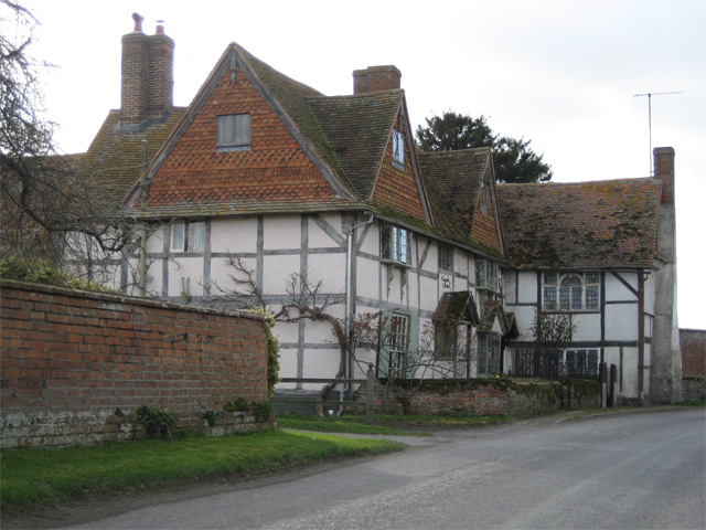
Hagbourne, East is a historic village with a rich heritage dating back centuries. It is home to several listed buildings, including St. Andrew's Church, a Grade I listed Norman church that dates back to the 12th century. The village also boasts a number of charming thatched cottages and traditional brick houses, which add to its character and appeal.

The community in Hagbourne, East is close-knit and friendly, with a strong sense of community spirit. The village has a primary school, which provides education for children aged 4 to 11, and there are several local clubs and societies that cater to a range of interests and hobbies.

For amenities, Hagbourne, East offers a village shop and post office, providing residents with essential provisions and services. There is also a pub in the village, where locals and visitors can enjoy a drink or a meal in a relaxed and welcoming atmosphere.

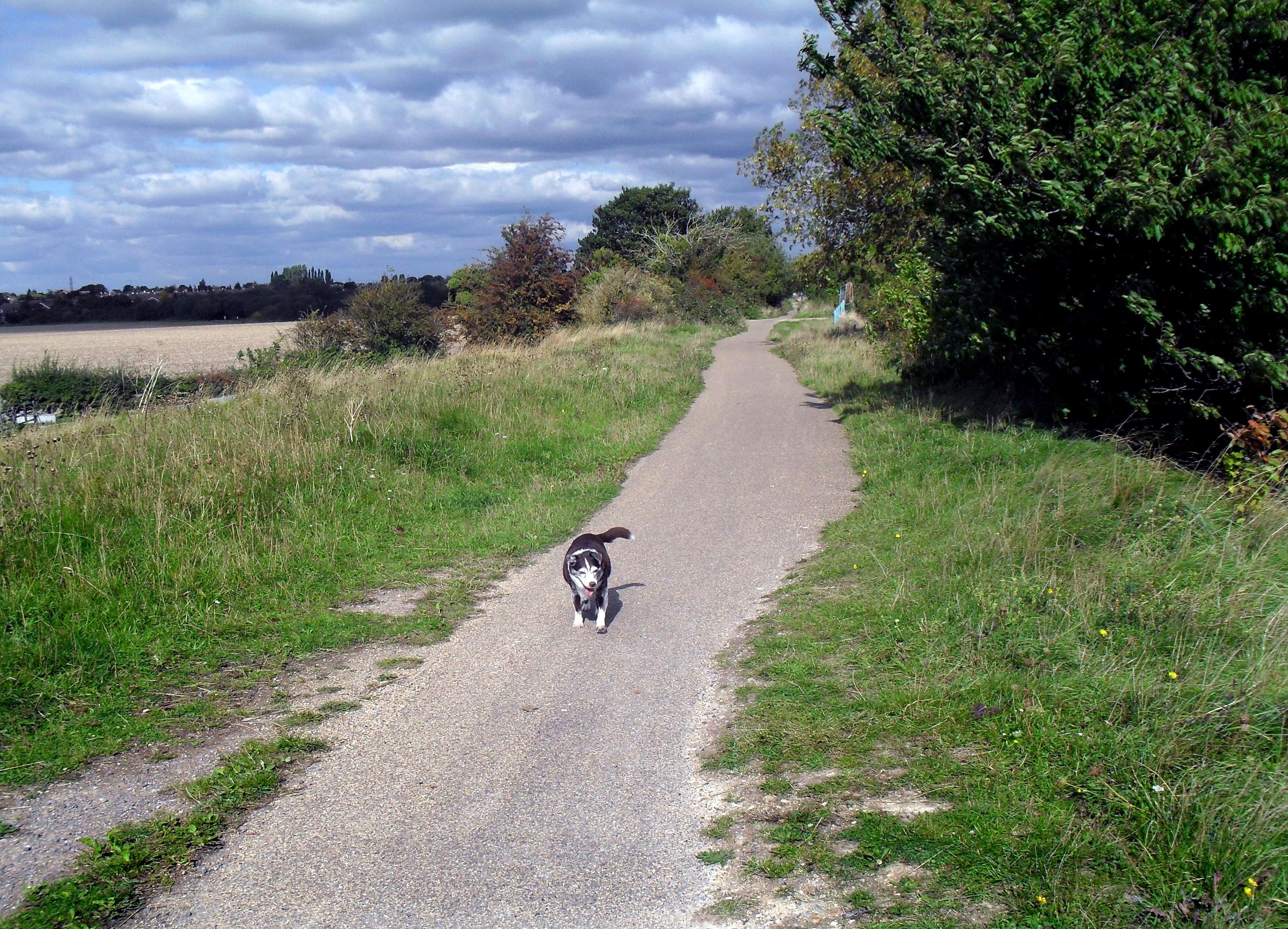
The surrounding countryside offers ample opportunities for outdoor activities, including walking, cycling, and horse riding. The village is also conveniently located for access to nearby towns and cities, with good transport links to Oxford, Reading, and London.

Overall, Hagbourne, East is a charming and idyllic village that offers a peaceful and rural lifestyle, combined with convenient access to amenities and nearby urban areas.

If you have any feedback on the listing, please let us know in the comments section below.

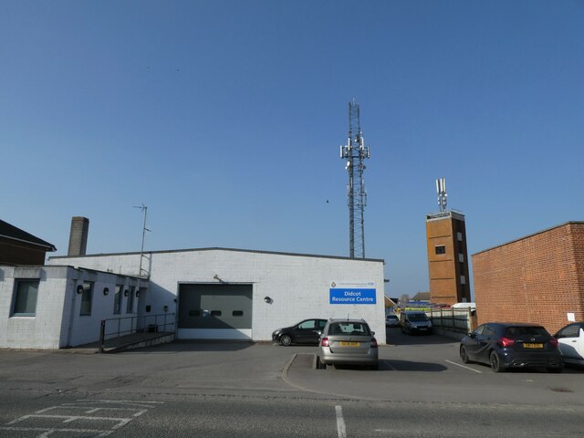
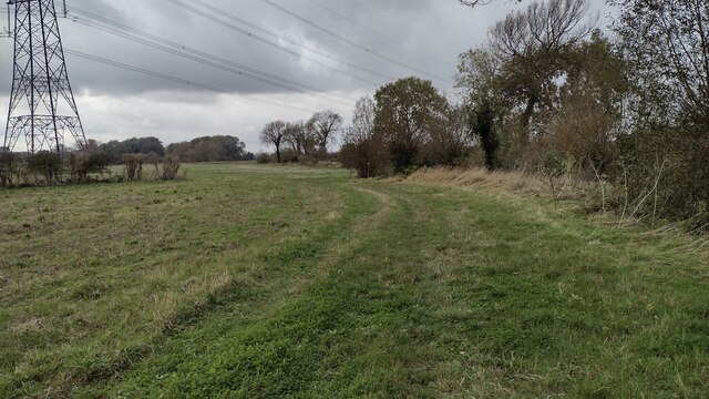
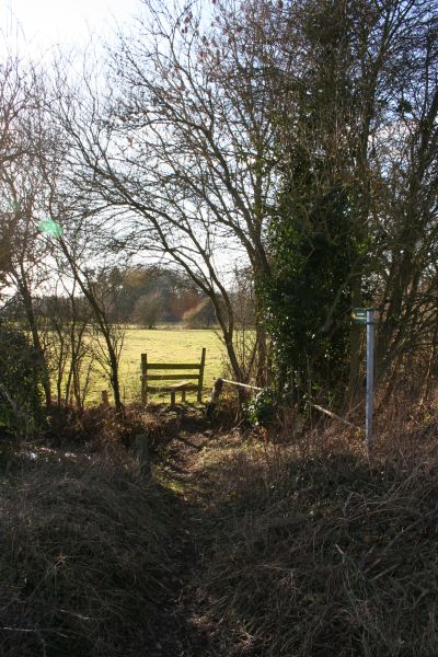
Hagbourne, East Images

Images are sourced within 2km of 51.592611/-1.235331 or Grid Reference SU5388. Thanks to Geograph Open Source API. All images are credited.

Looking from the War Memorial Gardens towards Blenheim Close
Didcot Fire Station: late March 2022
Didcot Ambulance Resource Centre: late March 2022
Looking eastwards along The Broadway
Didcot Bowls Club: late March 2022
Didcot War Memorial Gardens: late March 2022
Car park at Didcot Civic Centre: late March 2022
Smoky Towers Postbox decoration outside the old post office along Broadway Didcot
Smoky Towers
Postbox decoration outside the old post office along Broadway Didcot
Grandad's Smoky Towers Postbox decoration called Grandad's Smoky Towers along Broadway, Didcot.
Grandad's Smoky Towers
Postbox decoration called Grandad's Smoky Towers along Broadway, Didcot.
Closure Notice at HSBC Bank branch, Didcot This closure notice is in the front window of the HSBC Bank branch in Broadway and has the following wording:

              We're closing
              this branch soon

      This branch will close permanently on 9th May 2023
      The nearest HSBC UK branch will be:
      Abingdon

       For details of the services at this branch, our other branch locations
       and the services they offer, please visit at hsbc.co.uk/branch-finder

        Or you can access your remote banking services safely, securely and
        wherever you are:
        . With our mobile banking app
        . On our website at hsbc.co.uk
        . Over the phone by calling:
          Personal Customers 03457 404 404
          Business Customers 03457 60 60 60
          Customers can also access some of our services at the Post Office

     HSBC UK
Closure Notice at HSBC Bank branch, Didcot
This closure notice is in the front window of the HSBC Bank branch in Broadway and has the following wording: We're closing this branch soon This branch will close permanently on 9th May 2023 The nearest HSBC UK branch will be: Abingdon For details of the services at this branch, our other branch locations and the services they offer, please visit at hsbc.co.uk/branch-finder Or you can access your remote banking services safely, securely and wherever you are: . With our mobile banking app . On our website at hsbc.co.uk . Over the phone by calling: Personal Customers 03457 404 404 Business Customers 03457 60 60 60 Customers can also access some of our services at the Post Office HSBC UK
HSBC Bank branch, Didcot This bank branch is located at 186 Broadway, OX11 8RP. However, it is due to close on Tuesday 9th May 2023, it being one of 114 such branches to face closure between April and September 2023. A bank closure notice can be seen in the window to the right of the ATM, <a title="https://www.geograph.org.uk/photo/7474778" href="https://www.geograph.org.uk/photo/7474778">Link</a> refers.
HSBC Bank branch, Didcot
This bank branch is located at 186 Broadway, OX11 8RP. However, it is due to close on Tuesday 9th May 2023, it being one of 114 such branches to face closure between April and September 2023. A bank closure notice can be seen in the window to the right of the ATM, Link refers.
Didcot Telephone Exchange Located at 10 Station Road OX11 7LL, this TE has the code SMDC. It provides telephone and broadband services to approximately 11,101 residential and 434 non-residential premises in Didcot plus East Hagbourne, North Moreton and South Moreton nearby. This TE has the numbering ranges (01235) 51xxxx, 81xxxx, the (01235) referring to the eight TEs in the Abingdon group at <span class="nowrap"><a title="https://telephone-exchanges.org.uk/exchanges/abingdon-exchanges/" rel="nofollow ugc noopener" href="https://telephone-exchanges.org.uk/exchanges/abingdon-exchanges/">Link</a><img style="margin-left:2px;" alt="External link" title="External link - shift click to open in new window" src="https://s1.geograph.org.uk/img/external.png" width="10" height="10"/></span>.
Didcot Telephone Exchange
Located at 10 Station Road OX11 7LL, this TE has the code SMDC. It provides telephone and broadband services to approximately 11,101 residential and 434 non-residential premises in Didcot plus East Hagbourne, North Moreton and South Moreton nearby. This TE has the numbering ranges (01235) 51xxxx, 81xxxx, the (01235) referring to the eight TEs in the Abingdon group at LinkExternal link.
Tesco Superstore Didcot
Moreton Cuttings Scrapyard near Didcot
Path heading toward East Hagbourne Path from South Moreton heading under the wires toward East Hagbourne
Path heading toward East Hagbourne
Path from South Moreton heading under the wires toward East Hagbourne
Byway to West Hagbourne Byway to West Hagbourne passing right turn up to East Hagbourne
Byway to West Hagbourne
Byway to West Hagbourne passing right turn up to East Hagbourne
Byway heads under the old railway bridge From West Hagbourne the byway heads under the old railway bridge part of former Didcot to Newbury line
Byway heads under the old railway bridge
From West Hagbourne the byway heads under the old railway bridge part of former Didcot to Newbury line
Rush hour in East Hagbourne
Show me another place!

Hagbourne, East is located at Grid Ref: SU5388 (Lat: 51.592611, Lng: -1.235331)

Administrative County: Oxfordshire

District: South Oxfordshire

Police Authority: Thames Valley

What 3 Words

///parrot.difficult.launcher. Near Didcot, Oxfordshire

Related Wikis

East Hagbourne

East Hagbourne is a village and civil parish about 1 mile (1.6 km) south of Didcot and 11 miles (18 km) south of Oxford. It was part of Berkshire until...

Mowbray Fields

Mowbray Fields is a 2.2-hectare (5.4-acre) Local Nature Reserve on the southern outskirts of Didcot in Oxfordshire. It is owned by South Oxfordshire District...

St Birinus School

St Birinus School, previously known as Didcot Boy's County Modern and Didcot Senior Boys, is a boys' academy in Didcot, Oxfordshire, England. St Birinus...

Coscote

Coscote is a hamlet in the civil parish of East Hagbourne, in the Berkshire Downs 1 mile (1.6 km) south of Didcot. The hamlet was also previously referred...

British Airways Flight 5390

British Airways Flight 5390 was a flight from Birmingham Airport in England for Málaga Airport in Spain. On 10 June 1990, the BAC One-Eleven 528FL suffered...

Fulscot

Fulscot is a hamlet in South Moreton civil parish in South Oxfordshire, about 0.5 miles (800 m) west of the village. In 1974 it was transferred from Berkshire...

Didcot

Didcot ( DID-kot, -⁠kət) is a railway town and civil parish in the ceremonial county of Oxfordshire and the historic county of Berkshire. Didcot is 15...

Vauxhall Barracks

Vauxhall Barracks is a British Army installation in Didcot, Oxfordshire. It is set to close in 2034. == History == The barracks were established during...

Nearby Amenities

Located within 500m of 51.592611,-1.235331
Turning Circle
Turning Circle: hammer
Lat/Long: 51.5938156/-1.2417704
Post Box
Lat/Long: 51.5910691/-1.2395888
Post Office
East Hagbourne Post Office
Addr Postcode: OX11 9LD
Branch: East Hagbourne
Brand: Post Office
Brand Wikidata: Q1783168
Check Date: 2020-02-20
Contact Website: https://www.postoffice.co.uk/branch-finder/2281376/east-hagbourne
Ref Pol Id: 8691
Lat/Long: 51.5937131/-1.2357077
East Hagbourne
Place: village
Population: 1882
Source: NPE
Lat/Long: 51.5931992/-1.238105
Bus Stop
War Memorial
Naptan AtcoCode: 340000278MEM
Naptan Bearing: N
Naptan CommonName: War Memorial
Naptan Indicator: Bus Shelter
Naptan Landmark: Bus Shelter
Naptan NaptanCode: oxfajptp
Naptan Street: New Road
Naptan Verified: no
Public Transport: platform
Shelter: yes
Source: naptan_import
Lat/Long: 51.5927432/-1.2353986
War Memorial
Historic: memorial
Naptan AtcoCode: 340000278MEP
Naptan Bearing: SW
Naptan BusStopType: CUS
Naptan CommonName: War Memorial
Naptan Indicator: Main Road
Naptan Landmark: Green
Naptan NaptanCode: oxfajptm
Naptan Street: Main Road
Naptan Verified: no
Source: naptan_import
Lat/Long: 51.592539/-1.2353074
War Memorial
Naptan AtcoCode: 340000278NEW
Naptan Bearing: E
Naptan BusStopType: CUS
Naptan CommonName: War Memorial
Naptan Indicator: New Road Layby
Naptan Landmark: Layby
Naptan NaptanCode: oxfgjwmt
Naptan Street: New Road
Naptan Verified: no
Lat/Long: 51.5927889/-1.2365352
Bus Stop
Blewbury Road Bridge
Naptan AtcoCode: 340003296NOR
Naptan Bearing: N
Naptan CommonName: Blewbury Road Bridge
Naptan Indicator: Northbound
Naptan Landmark: Bridge
Naptan NaptanCode: oxfgjwmp
Naptan Street: Blewbury Road
Naptan Verified: no
Public Transport: platform
Source: naptan_import
Lat/Long: 51.5905356/-1.2319423
Blewbury Road Bridge
Naptan AtcoCode: 340003296SOU
Naptan Bearing: S
Naptan BusStopType: CUS
Naptan CommonName: Blewbury Road Bridge
Naptan Indicator: Southbound
Naptan Landmark: Bridge
Naptan NaptanCode: oxfgjwmj
Naptan Street: Blewbury Road
Naptan Verified: no
Source: naptan_import
Lat/Long: 51.5905618/-1.2318263
Turning Circle
Turning Circle: hammer
Lat/Long: 51.5932551/-1.2358251
Bench
Lat/Long: 51.5896759/-1.2369371
Upper Cross
Alt Name: Village Cross
Historic: memorial
Memorial: war_memorial
Source: gps_survey;Bing
Lat/Long: 51.5909099/-1.2417482
Power: pole
Source: Bing
Lat/Long: 51.5908809/-1.2294657
Power: pole
Source: Bing
Lat/Long: 51.5916407/-1.2288702
Power: pole
Source: Bing
Lat/Long: 51.5901526/-1.2300665
Power: pole
Source: Bing
Lat/Long: 51.5923855/-1.2282882
Power: pole
Source: Bing
Lat/Long: 51.5888778/-1.232046
Power: pole
Source: Bing
Lat/Long: 51.5882078/-1.2346799
Power: pole
Source: Bing
Lat/Long: 51.589386/-1.2306539
Power: pole
Source: Bing
Lat/Long: 51.5883778/-1.233312
Give Way
Source: Bing
Lat/Long: 51.5909676/-1.2418051
Give Way
Source: Bing
Lat/Long: 51.5909262/-1.2416153
Noexit: yes
Lat/Long: 51.5930234/-1.2411259
Turning Circle
Turning Circle: knuckle
Lat/Long: 51.5933612/-1.2411118
Power: pole
Lat/Long: 51.5941463/-1.2312403
Power: pole
Lat/Long: 51.5935916/-1.2312877
Power: pole
Lat/Long: 51.5930268/-1.2313512
Power: pole
Lat/Long: 51.5940874/-1.2341469
Power: pole
Lat/Long: 51.5942114/-1.2297739
Power: pole
Lat/Long: 51.5941701/-1.2312343
Power: pole
Lat/Long: 51.5941288/-1.2326976
Fixme: solar panels?
Lat/Long: 51.5965706/-1.2353157
Direction: 260
Generator Method: photovoltaic
Generator Output Electricity: yes
Generator Solar Modules: 16
Generator Source: solar
Generator Type: solar_photovoltaic_panel
Location: roof
Power: generator
Lat/Long: 51.5945151/-1.236896
Direction: 175
Generator Method: photovoltaic
Generator Output Electricity: yes
Generator Solar Modules: 16
Generator Source: solar
Generator Type: solar_photovoltaic_panel
Location: roof
Power: generator
Lat/Long: 51.5942788/-1.2327404
Direction: 175
Generator Method: photovoltaic
Generator Output Electricity: yes
Generator Solar Modules: 16
Generator Source: solar
Generator Type: solar_photovoltaic_panel
Location: roof
Power: generator
Lat/Long: 51.5945611/-1.2327902
Direction: 165
Fixme: survey for panel count
Generator Method: photovoltaic
Generator Output Electricity: yes
Generator Solar Modules: 6
Generator Source: solar
Generator Type: solar_photovoltaic_panel
Location: roof
Power: generator
Lat/Long: 51.5909959/-1.2410198
Direction: 165
Generator Method: photovoltaic
Generator Output Electricity: yes
Generator Solar Modules: 15
Generator Source: solar
Generator Type: solar_photovoltaic_panel
Location: roof
Power: generator
Lat/Long: 51.5918439/-1.2420775
Direction: 160
Generator Method: photovoltaic
Generator Output Electricity: yes
Generator Solar Modules: 7
Generator Source: solar
Generator Type: solar_photovoltaic_panel
Location: roof
Power: generator
Lat/Long: 51.5920619/-1.241481
Fixme: substation?
Lat/Long: 51.5920748/-1.2384269
Direction: 165
Generator Method: photovoltaic
Generator Output Electricity: yes
Generator Solar Modules: 8
Generator Source: solar
Generator Type: solar_photovoltaic_panel
Location: roof
Power: generator
Lat/Long: 51.5923586/-1.2407423
Direction: 175
Generator Method: photovoltaic
Generator Output Electricity: yes
Generator Solar Modules: 6
Generator Source: solar
Generator Type: solar_photovoltaic_panel
Location: roof
Power: generator
Lat/Long: 51.592655/-1.2421264
Direction: 160
Generator Method: photovoltaic
Generator Output Electricity: yes
Generator Solar Modules: 6
Generator Source: solar
Generator Type: solar_photovoltaic_panel
Location: roof
Power: generator
Lat/Long: 51.5921297/-1.2425097
Parking
Capacity: 4
Parking: street_side
Lat/Long: 51.5930401/-1.2422934
Direction: 180
Generator Method: photovoltaic
Generator Output Electricity: yes
Generator Solar Modules: 8
Generator Source: solar
Generator Type: solar_photovoltaic_panel
Location: roof
Power: generator
Lat/Long: 51.5919734/-1.2327661
Direction: 175
Generator Method: photovoltaic
Generator Output Electricity: yes
Generator Solar Modules: 14
Generator Source: solar
Generator Type: solar_photovoltaic_panel
Location: roof
Power: generator
Lat/Long: 51.5915094/-1.2325956
Direction: 260
Generator Method: photovoltaic
Generator Output Electricity: yes
Generator Solar Modules: 7
Generator Source: solar
Generator Type: solar_photovoltaic_panel
Location: roof
Power: generator
Lat/Long: 51.5911771/-1.2316251
Direction: 170
Generator Method: photovoltaic
Generator Output Electricity: yes
Generator Solar Modules: 8
Generator Source: solar
Generator Type: solar_photovoltaic_panel
Location: roof
Power: generator
Lat/Long: 51.5912254/-1.2315613
Direction: 165
Fixme: survey for panel count
Generator Method: photovoltaic
Generator Output Electricity: yes
Generator Solar Modules: 8
Generator Source: solar
Generator Type: solar_photovoltaic_panel
Location: roof
Power: generator
Lat/Long: 51.5909601/-1.2315513
Direction: 170
Generator Method: photovoltaic
Generator Output Electricity: yes
Generator Solar Modules: 8
Generator Source: solar
Generator Type: solar_photovoltaic_panel
Location: roof
Power: generator
Lat/Long: 51.5904775/-1.2309046
Direction: 80
Generator Method: photovoltaic
Generator Output Electricity: yes
Generator Solar Modules: 8
Generator Source: solar
Generator Type: solar_photovoltaic_panel
Location: roof
Power: generator
Lat/Long: 51.5905248/-1.2309145
Direction: 185
Fixme: survey for panel count
Generator Method: photovoltaic
Generator Output Electricity: yes
Generator Solar Modules: 6
Generator Source: solar
Generator Type: solar_photovoltaic_panel
Location: roof
Power: generator
Lat/Long: 51.5901712/-1.2321492
Direction: 180
Generator Method: photovoltaic
Generator Output Electricity: yes
Generator Solar Modules: 8
Generator Source: solar
Generator Type: solar_photovoltaic_panel
Location: roof
Power: generator
Lat/Long: 51.5895999/-1.2315519
Direction: 190
Generator Method: photovoltaic
Generator Output Electricity: yes
Generator Solar Modules: 9
Generator Source: solar
Generator Type: solar_photovoltaic_panel
Location: roof
Power: generator
Lat/Long: 51.5966172/-1.2360609
Fixme: solar panels?1
Lat/Long: 51.5937988/-1.2345946
Fixme: solar panels?
Lat/Long: 51.5938047/-1.2347778
Information: guidepost
Tourism: information
Lat/Long: 51.5924839/-1.2351942
Addr City: East Hagbourne
Addr Housenumber: 31
Addr Street: Main Road
Lat/Long: 51.5910876/-1.2419636
Addr City: East Hagbourne
Addr Housenumber: 29
Addr Street: Main Road
Lat/Long: 51.5910316/-1.2419359
Addr City: East Hagbourne
Addr Housenumber: 27
Addr Street: Main Road
Lat/Long: 51.5909764/-1.2419091
Addr City: East Hagbourne
Addr Housenumber: 25
Addr Street: Main Road
Lat/Long: 51.5909158/-1.2418742
Addr City: East Hagbourne
Addr Housenumber: 24A
Addr Street: Main Road
Lat/Long: 51.5910762/-1.2393729
Addr City: East Hagbourne
Addr Housenumber: 24
Addr Street: Main Road
Lat/Long: 51.5911726/-1.2392484
Waste Basket
Lat/Long: 51.5897344/-1.2369131
The data included in this document is from www.openstreetmap.org. The data is made available under ODbL.

Have you been to Hagbourne, East?

Leave your review of Hagbourne, East below (or comments, questions and feedback).