Park Copse

Wood, Forest in Sussex Chichester

England

Park Copse

Mudflats in Chichester Harbour
Mudflats in Chichester Harbour Credit: Hugh Venables

Park Copse is a picturesque woodland located in Sussex, a county in the south-east of England. This beautiful copse covers an area of approximately 10 acres and is a haven for nature enthusiasts and outdoor lovers alike.

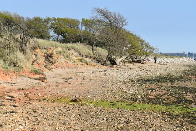
The copse is characterized by its dense canopy of trees, predominantly consisting of oak, beech, and ash. These towering trees create a tranquil and shady atmosphere, perfect for those seeking respite from the hustle and bustle of daily life. The forest floor is adorned with a rich carpet of wildflowers, ferns, and mosses, adding to the copse's enchanting appeal.

Park Copse is home to a diverse range of wildlife, making it an important ecological habitat. Visitors may spot various bird species, including woodpeckers, owls, and songbirds, as well as mammals such as deer, foxes, and badgers. The copse also provides a sanctuary for numerous insects, butterflies, and other small creatures.

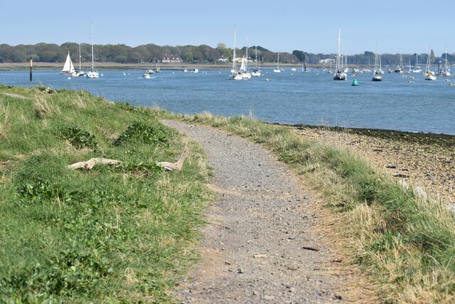
Several well-maintained walking trails wind through Park Copse, allowing visitors to explore its natural beauty at their own pace. These paths lead to secluded clearings and viewpoints, offering stunning vistas of the surrounding countryside. The copse is also intersected by a gentle stream, enhancing its idyllic charm.

Visitors to Park Copse can enjoy a range of recreational activities, including picnicking, birdwatching, and photography. The copse is open to the public throughout the year, with ample parking facilities available nearby. Whether seeking solitude or a family outing, Park Copse provides a serene and captivating escape into nature's embrace.

If you have any feedback on the listing, please let us know in the comments section below.
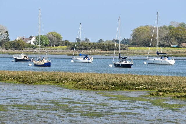
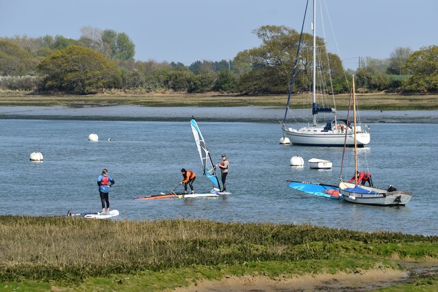
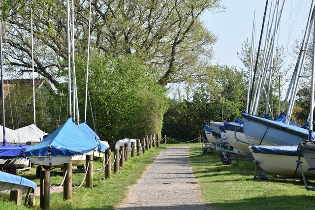
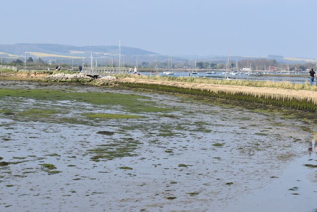
Park Copse Images

Images are sourced within 2km of 50.806089/-0.87673195 or Grid Reference SU7901. Thanks to Geograph Open Source API. All images are credited.

Mudflats in Chichester Harbour
New Lipchis Way by Chichester Harbour
Boats moored in Bosham Channel
Sailing down Bosham Channel
Windsurfing lesson in the Bosham Channel I think at this point the instructor was the only one with the sail upright, but I'm not mocking, as I'm sure I couldn't do it!
Windsurfing lesson in the Bosham Channel
I think at this point the instructor was the only one with the sail upright, but I'm not mocking, as I'm sure I couldn't do it!
Footpath through dinghy park
Chidham Walkway The coastal footpath skirts around the outside of some tidal mudflats, including two bridges.
Chidham Walkway
The coastal footpath skirts around the outside of some tidal mudflats, including two bridges.
Boat storage at West Itchenor Seen across Chichester Channel.
Boat storage at West Itchenor
Seen across Chichester Channel.
Chidham Walkway at Cobnor Point Distant view across Bosham Deeps.
Chidham Walkway at Cobnor Point
Distant view across Bosham Deeps.
On the beach by Cobnor Rithe The coastal footpath is on the beach itself along this section and signs warn that it may be impassable at some tides.
On the beach by Cobnor Rithe
The coastal footpath is on the beach itself along this section and signs warn that it may be impassable at some tides.
Beach path around Chidham Peninsula The coastal footpath is on the beach itself along this section and signs warn that it may be impassable at some tides.
Beach path around Chidham Peninsula
The coastal footpath is on the beach itself along this section and signs warn that it may be impassable at some tides.
Gorse-lined path near New Barn
Slipway and jetty, West Itchenor With a number of mooring buoy anchors, including some old train wheels.
Slipway and jetty, West Itchenor
With a number of mooring buoy anchors, including some old train wheels.
Marker post, Chichester Harbour Southerly cardinal mark "Camber" marks the point at which the Thorney Channel diverges to the north.
Marker post, Chichester Harbour
Southerly cardinal mark "Camber" marks the point at which the Thorney Channel diverges to the north.
Green marker post, Chichester Channel To be kept to port when leaving the harbour.
Green marker post, Chichester Channel
To be kept to port when leaving the harbour.
Raised gravel bank, Chichester Harbour Trying to provide a safe area for birds to nest.
Raised gravel bank, Chichester Harbour
Trying to provide a safe area for birds to nest.
Southerly cardinal beacon "Deep End" Marking the start of the Bosham Channel.
Southerly cardinal beacon "Deep End"
Marking the start of the Bosham Channel.
Mudflats by Thorney Channel
Show me another place!

Park Copse is located at Grid Ref: SU7901 (Lat: 50.806089, Lng: -0.87673195)

Administrative County: West Sussex

District: Chichester

Police Authority: Sussex

What 3 Words

///quiet.encoder.splints. Near Bosham, West Sussex

Related Wikis

West Itchenor

West Itchenor is a village and civil parish, on the Manhood Peninsula, in the Chichester District of West Sussex, England. It lies north of the B2179 Chichester...

St Nicholas Church, West Itchenor

St. Nicholas Church is the Anglican parish church of West Itchenor, a village in the Chichester district of West Sussex, United Kingdom. == History... ==

Redlands, West Wittering

Redlands is a Grade II listed country house estate in West Wittering, West Sussex, owned by The Rolling Stones' Keith Richards.In his autobiography, Richards...

Murder of Valerie Graves

Valerie Graves (25 December 1958 – 29/30 December 2013) was an artist and grandmother who was murdered in December 2013 in Bosham, West Sussex, England...

Nearby Amenities

Located within 500m of 50.806089,-0.87673195
Source: PGS
Lat/Long: 50.8079088/-0.8723826
Source: PGS
Lat/Long: 50.8077095/-0.873201
Source: PGS
Lat/Long: 50.8074465/-0.8783101
Source: PGS
Lat/Long: 50.807066/-0.8787798
Source: PGS
Lat/Long: 50.8069523/-0.879387
Source: PGS
Lat/Long: 50.8064889/-0.880143
Source: PGS
Lat/Long: 50.8064051/-0.8804291
Source: PGS
Lat/Long: 50.8059292/-0.8815352
Source: PGS
Lat/Long: 50.8050005/-0.8824796
Source: PGS
Lat/Long: 50.8047282/-0.8826688
Bench
Source: gps
Lat/Long: 50.807352/-0.8712909
Bench
Source: gps
Lat/Long: 50.8073621/-0.8702636
Bench
Source: gps
Lat/Long: 50.8075198/-0.876307
Bench
Source: gps
Lat/Long: 50.8076223/-0.8772457
Bench
Source: gps
Lat/Long: 50.8076282/-0.8773356
Seamark Beacon Lateral Category: starboard
Seamark Beacon Lateral Colour: green
Seamark Beacon Lateral Shape: stake
Seamark Beacon Lateral System: iala-a
Seamark Topmark Colour: green
Seamark Topmark Shape: cone, point up
Seamark Type: beacon_lateral
Lat/Long: 50.8094331/-0.8724153
Seamark Beacon Lateral Category: starboard
Seamark Beacon Lateral Colour: green
Seamark Beacon Lateral Shape: stake
Seamark Beacon Lateral System: iala-a
Seamark Topmark Colour: green
Seamark Topmark Shape: cone, point up
Seamark Type: beacon_lateral
Lat/Long: 50.8091145/-0.8751834
Seamark Beacon Lateral Category: starboard
Seamark Beacon Lateral Colour: green
Seamark Beacon Lateral Shape: stake
Seamark Beacon Lateral System: iala-a
Seamark Topmark Colour: green
Seamark Topmark Shape: cone, point up
Seamark Type: beacon_lateral
Lat/Long: 50.8087484/-0.8777583
Seamark Beacon Lateral Category: starboard
Seamark Beacon Lateral Colour: green
Seamark Beacon Lateral Shape: stake
Seamark Beacon Lateral System: iala-a
Seamark Topmark Colour: green
Seamark Topmark Shape: cone, point up
Seamark Type: beacon_lateral
Lat/Long: 50.8081857/-0.8806551
Seamark Buoy Lateral Category: starboard
Seamark Buoy Lateral Colour: green
Seamark Buoy Lateral Shape: conical
Seamark Buoy Lateral System: iala-a
Seamark Type: buoy_lateral
Lat/Long: 50.809728/-0.8744001
Seamark Buoy Special Purpose Colour: yellow
Seamark Buoy Special Purpose Shape: spherical
Seamark Type: buoy_special_purpose
Lat/Long: 50.8100873/-0.8752799
Seamark Type: anchorage
Lat/Long: 50.8092772/-0.8777905
Wear Point
Natural: cape
Lat/Long: 50.8056073/-0.8817657
Chalkdock Point
Natural: cape
Lat/Long: 50.8077008/-0.8767469
The data included in this document is from www.openstreetmap.org. The data is made available under ODbL.

Have you been to Park Copse?

Leave your review of Park Copse below (or comments, questions and feedback).