Church Wood

Wood, Forest in Leicestershire Harborough

England

Church Wood

Path north of Tugby Wood With a happy black labrador running towards the photographer.
Path north of Tugby Wood Credit: Neil Theasby

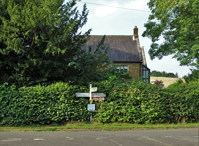
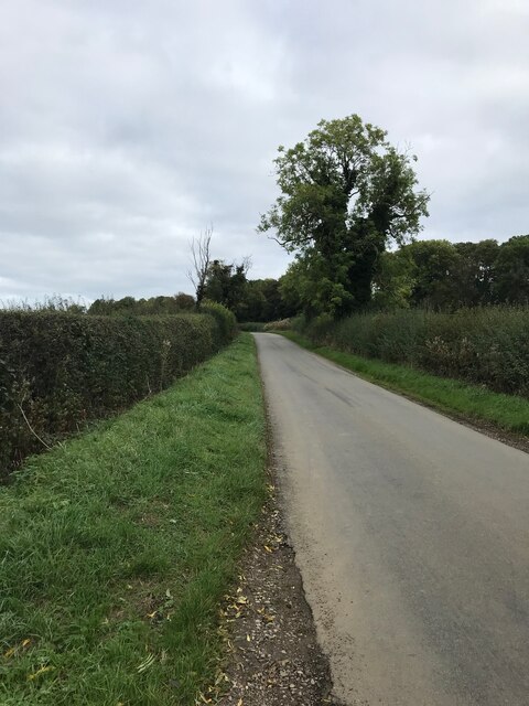
Church Wood is a picturesque woodland located in Leicestershire, England. Covering an area of approximately 30 acres, it is nestled in the heart of the county, near the village of Woodhouse Eaves. The wood is known for its diverse range of flora and fauna, making it a popular destination for nature enthusiasts and walkers.

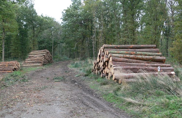
The wood is primarily composed of broadleaf trees, including oak, ash, and beech. These majestic trees create a dense canopy, providing shelter and a habitat for a variety of wildlife. Visitors can expect to encounter a wide array of bird species, such as woodpeckers, thrushes, and owls, as well as small mammals like foxes, badgers, and squirrels.

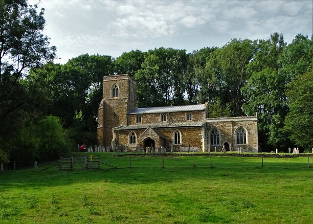
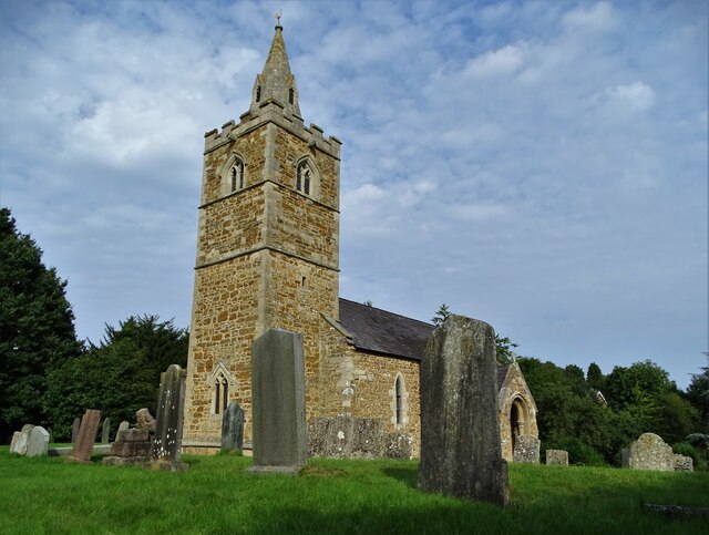
Tranquil pathways wind their way through the wood, offering visitors the opportunity to explore the natural beauty of the area. The wood is also home to several historical features, including the ruins of an ancient church, which lend an air of mystery and intrigue to the surroundings.

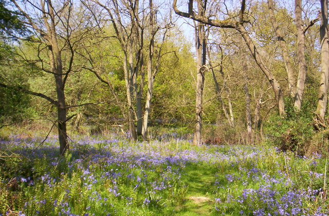
In spring, Church Wood is transformed into a vibrant display of bluebells, carpeting the forest floor with their delicate blooms. This stunning spectacle attracts visitors from far and wide, who come to witness the beauty of this natural phenomenon.

Church Wood is managed by a local conservation group, who ensure the preservation of the woodland's unique ecosystem. They organize regular guided walks and nature talks, providing educational opportunities for visitors of all ages.

Overall, Church Wood offers a tranquil escape from the hustle and bustle of everyday life, providing a haven for nature lovers and an enchanting experience for all who visit.

If you have any feedback on the listing, please let us know in the comments section below.

Church Wood Images

Images are sourced within 2km of 52.610906/-0.83926244 or Grid Reference SK7802. Thanks to Geograph Open Source API. All images are credited.

Path north of Tugby Wood With a happy black labrador running towards the photographer.
Path north of Tugby Wood
With a happy black labrador running towards the photographer.
Sheep pasture and woods east of Wood Lane In the parish of Tugby and Keythorpe
Sheep pasture and woods east of Wood Lane
In the parish of Tugby and Keythorpe
Farmhouse at Oxey Farm
Harvest time in the parish of Loddington A tractor and trailer pursue a combine harvester ready to collect grain.
Harvest time in the parish of Loddington
A tractor and trailer pursue a combine harvester ready to collect grain.
Road junction in Loddington
St Michael's Church, Loddington The earliest part of the Church of England parish church of St Michael and All Angels is the Norman south doorway, which is almost certainly 12th-century. But the church was largely rebuilt late in the 13th or early in the 14th century. Later in the Middle Ages a Perpendicular Gothic clerestory was added to the nave. Fragments of Medieval stained glass survive in one window of the chancel. The pulpit is Jacobean. The church is a Grade II* listed building.
(Copied and pasted from Wikipedia)
St Michael's Church, Loddington
The earliest part of the Church of England parish church of St Michael and All Angels is the Norman south doorway, which is almost certainly 12th-century. But the church was largely rebuilt late in the 13th or early in the 14th century. Later in the Middle Ages a Perpendicular Gothic clerestory was added to the nave. Fragments of Medieval stained glass survive in one window of the chancel. The pulpit is Jacobean. The church is a Grade II* listed building. (Copied and pasted from Wikipedia)
Loddington Lane and a Royal Mail van
Keythorpe Grange Cottages
Church of All Saints, East Norton The church dates from the 13th century and consists of a west tower (with spire behind battlements, probably 14th century), nave, chancel and north transept. In the south-west of the nave is a lancet window dating from the 13th century. Much of the church was rebuilt in 1849-1850 after being in a dilapidated condition for several years.
Church of All Saints, East Norton
The church dates from the 13th century and consists of a west tower (with spire behind battlements, probably 14th century), nave, chancel and north transept. In the south-west of the nave is a lancet window dating from the 13th century. Much of the church was rebuilt in 1849-1850 after being in a dilapidated condition for several years.
Path with Promise To the west of East Norton Hall in the village of East Norton
Path with Promise
To the west of East Norton Hall in the village of East Norton
Harrowing in September On Wood Lane Farm near Tugby. I took this photograph at 6.20pm on Tuesday September 7th 2021 as summer seemed to breathe her last breaths.
Harrowing in September
On Wood Lane Farm near Tugby. I took this photograph at 6.20pm on Tuesday September 7th 2021 as summer seemed to breathe her last breaths.
Path to Hardy's Gunsel There are at least three wooded areas in this area - each labelled "gunsel". I have been unable to pin down the history and indeed the meaning of this term.
Path to Hardy's Gunsel
There are at least three wooded areas in this area - each labelled "gunsel". I have been unable to pin down the history and indeed the meaning of this term.
Wood Lane - Tugby
Wood Lane - Tugby
Public Footpath close to Rugby
Bridleway near East Norton
Loddington Road
Loddington Road
Bridleway to Southam Holt
Track near Tugby
Track near Tugby
Show me another place!

Church Wood is located at Grid Ref: SK7802 (Lat: 52.610906, Lng: -0.83926244)

Administrative County: Leicestershire

District: Harborough

Police Authority: Leicestershire

What 3 Words

///yards.enveloped.along. Near Ridlington, Rutland

Related Wikis

Loddington, Leicestershire

Loddington is a village and civil parish in the Harborough district of Leicestershire. It is on the county boundary with Rutland, and the nearest town...

Leighfield Forest SSSI

Leighfield Forest SSSI is an 11.3 hectares (28 acres) biological Site of Special Scientific Interest east of Skeffington in Leicestershire, England. It...

Launde Woods

Launde Woods is a 99 hectares (240 acres) nature reserve north of Launde in Leicestershire. It is owned by the Leicester Diocesan Board of Finance and...

Launde Big Wood

Launde Big Wood is a 41.1 hectares (102 acres) biological Site of Special Scientific Interest east of Leicester. It is part of Launde Woods nature reserve...

East Norton

East Norton is a small village and parish located in the east of Leicestershire, adjoining the A47 Leicester to Uppingham road. According to the 2001 Census...

East Norton railway station

East Norton railway station served the village of East Norton, Leicestershire. The station was half a mile east of the village on the north side of the...

Tugby and Keythorpe

Tugby and Keythorpe is a civil parish comprising the village of Tugby and land surrounding Keythorpe Hall, Hall Farm and Lodge Farm in Leicestershire,...

Launde

Launde is a civil parish in the Harborough district of Leicestershire, bordering Rutland. The parish is the site of Launde Abbey. It gives its name to...

Nearby Amenities

Located within 500m of 52.610906,-0.83926244
Loddington
Is In County: Leicestershire
Is In District: Harborough
Place: village
Source: NPE
Lat/Long: 52.6134771/-0.8360801
Loddington Village
Naptan AtcoCode: 260080110
Naptan Bearing: NW
Naptan BusStopType: CUS
Naptan CommonName: Loddington Village
Naptan Indicator: junction of
Naptan Landmark: Loddington Lane
Naptan NaptanCode: leimadja
Naptan Notes: Non-Hourly - County
Naptan Street: Main Street
Naptan Verified: no
Source: naptan_import
Lat/Long: 52.6130103/-0.8362779
Loddington Village
Naptan AtcoCode: 260080111
Naptan Bearing: S
Naptan BusStopType: CUS
Naptan CommonName: Loddington Village
Naptan Indicator: adj
Naptan Landmark: Loddington Lane
Naptan NaptanCode: leimadjd
Naptan Notes: Non-Hourly - County
Naptan Street: Main Street
Naptan Verified: no
Source: naptan_import
Lat/Long: 52.6129539/-0.8360283
The data included in this document is from www.openstreetmap.org. The data is made available under ODbL.

Have you been to Church Wood?

Leave your review of Church Wood below (or comments, questions and feedback).