Crowell Wood

Wood, Forest in Oxfordshire South Oxfordshire

England

Crowell Wood

View looking East towards Bennett End This photo shows the track, known as Collier's Lane, looking East towards Bennett End from Hallbottom Farm. Beechwood Shaw can be seen on the left beyond the field of crops.
View looking East towards Bennett End Credit: David Hillas

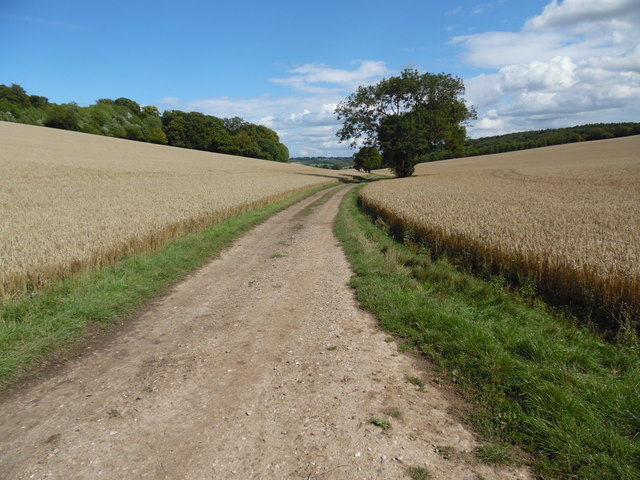
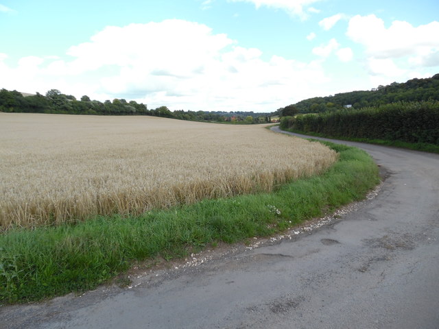
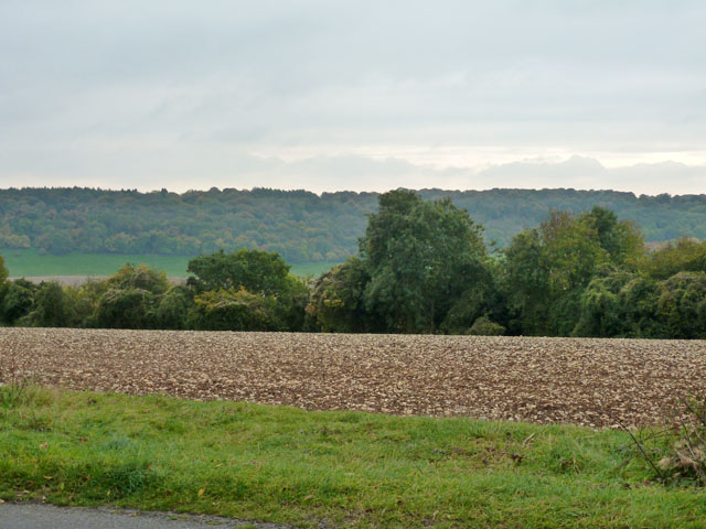
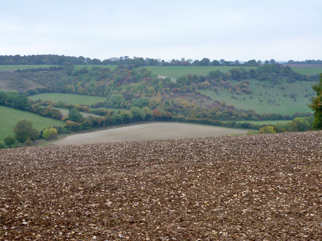
Crowell Wood is a picturesque forest located in the county of Oxfordshire, England. Covering an area of approximately 300 hectares, it is known for its diverse range of flora and fauna, making it a popular destination for nature enthusiasts and hikers alike.

The woodland consists mainly of deciduous trees such as oak, beech, and birch, which create a stunning canopy during the summer months. In addition to the towering trees, the forest floor is adorned with a variety of wildflowers, including bluebells, primroses, and foxgloves, adding a burst of color to the landscape.

The wood is home to a wide range of wildlife, including deer, foxes, badgers, and a plethora of bird species. Birdwatchers can spot woodpeckers, nuthatches, and tawny owls amongst others, making it a haven for bird enthusiasts.

Crowell Wood offers several walking trails, varying in difficulty and length, providing visitors with ample opportunities to explore its beauty. These trails meander through the forest, following ancient footpaths and bridleways, offering glimpses of stunning vistas and serene pockets of nature.

The wood has a rich history, dating back to medieval times, and remnants of its past can be found throughout. Ancient earthworks and remnants of old buildings provide a glimpse into the area's historical significance.

Overall, Crowell Wood is a tranquil and captivating destination, offering visitors the chance to immerse themselves in nature, explore its rich biodiversity, and discover the secrets of its ancient past.

If you have any feedback on the listing, please let us know in the comments section below.
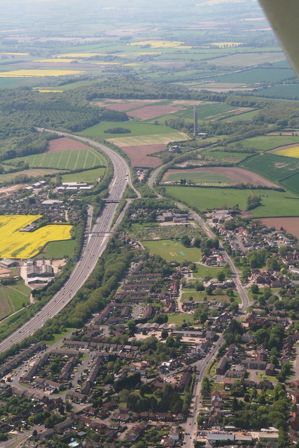
Crowell Wood Images

Images are sourced within 2km of 51.673485/-0.89244565 or Grid Reference SU7697. Thanks to Geograph Open Source API. All images are credited.

View looking East towards Bennett End This photo shows the track, known as Collier's Lane, looking East towards Bennett End from Hallbottom Farm. Beechwood Shaw can be seen on the left beyond the field of crops.
View looking East towards Bennett End
This photo shows the track, known as Collier's Lane, looking East towards Bennett End from Hallbottom Farm. Beechwood Shaw can be seen on the left beyond the field of crops.
View looking West near Hallbottom Farm This photo shows a view looking West from Collier's Lane towards the edge of the Chiltern Hills. Lott Wood can be seen towards the right of the photo, whilst the BT radio tower, Northwest of Stokenchurch can be seen on the horizon, SU7496 refers.
View looking West near Hallbottom Farm
This photo shows a view looking West from Collier's Lane towards the edge of the Chiltern Hills. Lott Wood can be seen towards the right of the photo, whilst the BT radio tower, Northwest of Stokenchurch can be seen on the horizon, SU7496 refers.
View looking East towards Bennett End This photo shows Grange Farm Road looking East towards Bennett End. Barley can be seen in this field before it is harvested.
View looking East towards Bennett End
This photo shows Grange Farm Road looking East towards Bennett End. Barley can be seen in this field before it is harvested.
The Fleur de Lis, Stokenchurch Viewed across part of the common. The village has several greens, probably the much encroached upon single large common.
The Fleur de Lis, Stokenchurch
Viewed across part of the common. The village has several greens, probably the much encroached upon single large common.
Primitive Methodist chapel, Stokenchurch Dated 1896, 'Primitive' has now been dropped from its title. It looks rather too embellished to be primitive, anyway.
Primitive Methodist chapel, Stokenchurch
Dated 1896, 'Primitive' has now been dropped from its title. It looks rather too embellished to be primitive, anyway.
Radnage church St. Mary's.
Radnage church
St. Mary's.
View south from Sprigs Holly Lane A very flinty field, often the case in high areas of chalk land where the elements have dissolved the chalk away.
View south from Sprigs Holly Lane
A very flinty field, often the case in high areas of chalk land where the elements have dissolved the chalk away.
View north-east from Sprigs Holly Lane
Way to Crowellhill Farm and bridleway The farm is round to the right, the bridleway to Crowell Wood and beyond goes straight on into the trees.
Way to Crowellhill Farm and bridleway
The farm is round to the right, the bridleway to Crowell Wood and beyond goes straight on into the trees.
Pull-off, Chinnor Hill A large but wet pull-off, handy for some walking routes.
Pull-off, Chinnor Hill
A large but wet pull-off, handy for some walking routes.
The Kings Hotel, Stokenchurch
House on the A40, Stokenchurch
Petrol station on the A40, Stokenchurch It is Shell now and was Total in 2008. It also has a toilet which is useful if anyone is visiting there in the future and reads this.
Petrol station on the A40, Stokenchurch
It is Shell now and was Total in 2008. It also has a toilet which is useful if anyone is visiting there in the future and reads this.
Petrol station on the A40, Stokenchurch
Wycombe Road, Stokenchurch
Junction on Chinnor Road
Manor Farm, Chinnor
Manor Farm, Chinnor
Sunset over Chinnor Hill
Show me another place!

Crowell Wood is located at Grid Ref: SU7697 (Lat: 51.673485, Lng: -0.89244565)

Administrative County: Oxfordshire

District: South Oxfordshire

Police Authority: Thames Valley

What 3 Words

///breed.regress.media. Near Stokenchurch, Buckinghamshire

Nearby Locations

Crowell Wood

Related Wikis

Sir Charles Napier Inn

The Sir Charles Napier Inn (commonly known as the Sir Charles Napier or simply the Charles Napier) is a gastropub in Spriggs Alley about 1.5 miles (2.4...

Stokenchurch War Memorial

Stokenchurch War Memorial is located outside the Memorial Hall, Wycombe Road, Stokenchurch, Buckinghamshire, England. It is a grade II listed building...

Stokenchurch

Stokenchurch is a village and civil parish in south-west Buckinghamshire, England. It is located in the Chiltern Hills, about 3 miles (5 km) south of Chinnor...

Radnage

Radnage is a village and civil parish in the Buckinghamshire district of Buckinghamshire, England. It is in the Chiltern Hills about two miles north east...

Bennett End

Bennett End is a hamlet near Radnage and Bledlow Ridge in Buckinghamshire, England. At the 2011 Census the population of the hamlet was included in the...

Aston Rowant Woods

Aston Rowant Woods is a 209.7-hectare (518-acre) biological Site of Special Scientific Interest near Aston Rowant in Oxfordshire and Buckinghamshire. Part...

Chiltern Hills

The Chiltern Hills are a chalk escarpment in the UK northwest of London, covering 660 square miles (1,700 km2) across Oxfordshire, Buckinghamshire, Hertfordshire...

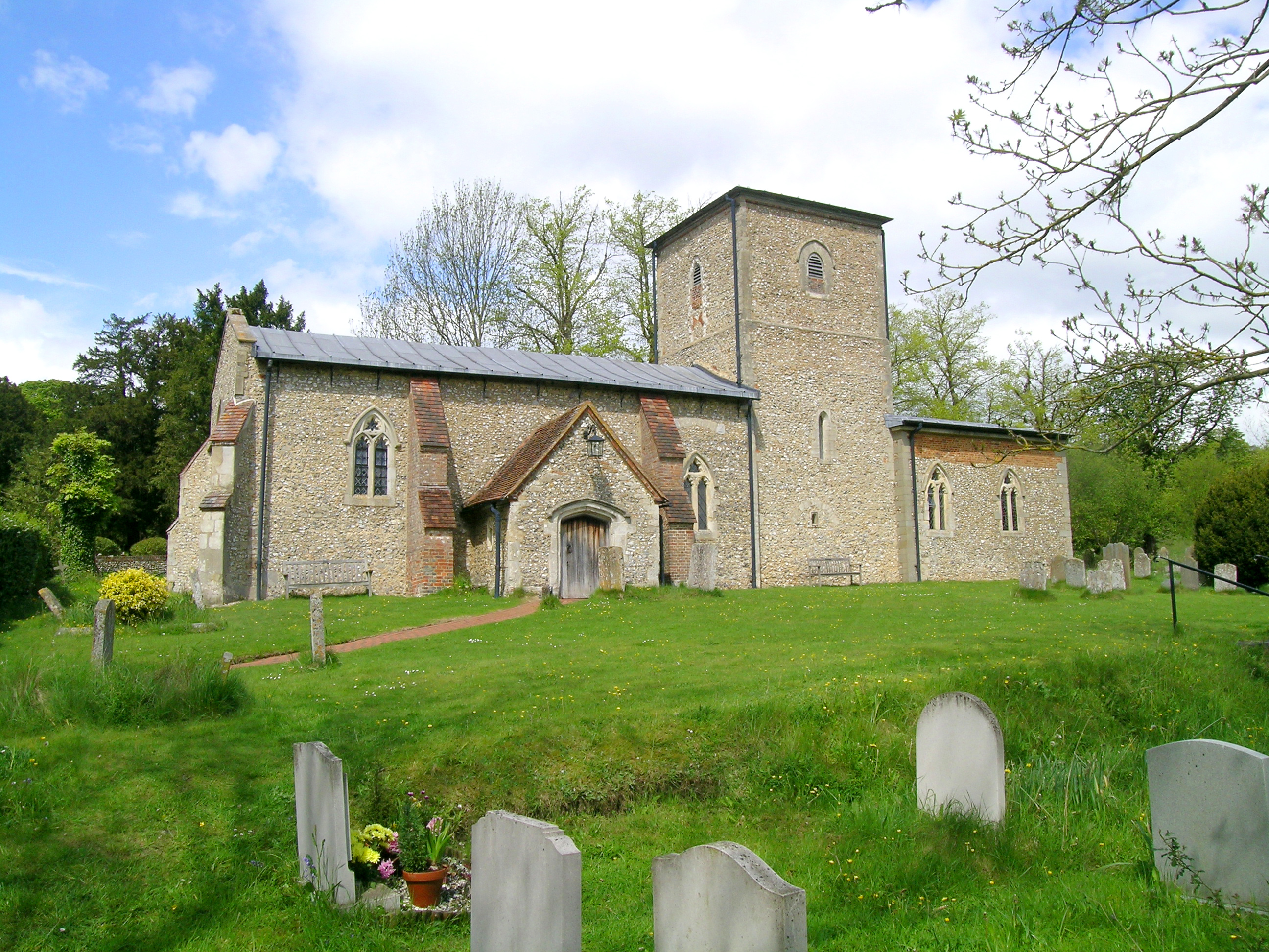
St Mary the Virgin, Radnage

St Mary the Virgin is the parish church of Radnage in Buckinghamshire, situated towards the northeastern edge of the village. The church is part of the...

Have you been to Crowell Wood?

Leave your review of Crowell Wood below (or comments, questions and feedback).