Little Moor

Wood, Forest in Hampshire East Hampshire

England

Little Moor

Traction engine turning from Waterworks Road into Long Lane
Traction engine turning from Waterworks Road into Long Lane Credit: Basher Eyre

Little Moor is a small village located in the county of Hampshire, England. Situated within the New Forest National Park, it is renowned for its picturesque woodlands and dense forests. The village is nestled amidst the natural beauty of the area, creating a tranquil and serene environment for residents and visitors alike.

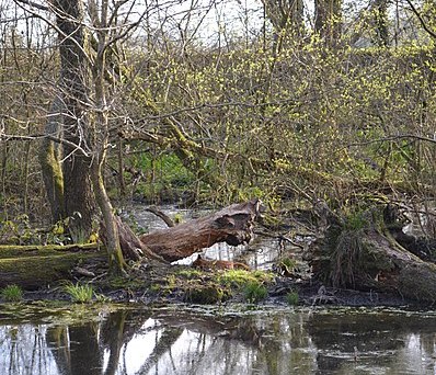
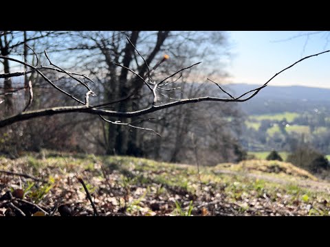
The woodlands in Little Moor are characterized by a diverse range of trees, including oak, beech, and birch. These trees provide a rich habitat for a variety of wildlife, such as deer, foxes, and numerous species of birds. The forest floor is adorned with vibrant wildflowers, adding a splash of color to the surroundings.

Walking trails and footpaths crisscross the area, offering opportunities for outdoor enthusiasts to explore and appreciate the natural wonders of the region. These paths lead adventurers through ancient woodlands, revealing hidden ponds, streams, and occasional glimpses of wildlife.

Little Moor is also known for its ancient history, with evidence of human settlement dating back to the Bronze Age. Archaeological sites, such as burial mounds and earthworks, can be found within the vicinity of the village, providing a glimpse into the lives of the early inhabitants of the area.

The village itself is quaint and charming, with a small community of residents who enjoy a close-knit and friendly atmosphere. Although primarily residential, Little Moor offers a handful of amenities, including a local pub and a village hall where community events are held.

In summary, Little Moor in Hampshire is a peaceful village surrounded by enchanting woodlands and forests, providing a haven for nature lovers and those seeking a serene escape from the hustle and bustle of everyday life.

If you have any feedback on the listing, please let us know in the comments section below.

Little Moor Images

Images are sourced within 2km of 51.021314/-0.91696543 or Grid Reference SU7625. Thanks to Geograph Open Source API. All images are credited.

Traction engine turning from Waterworks Road into Long Lane
Traction engine in Waterworks Road No, not an item of bed linen, or writing paper, but a village in Hampshire. Its history dates back over a thousand years but it has only recently become a parish <span class="nowrap"><a title="https://www.sheetparishcouncil.gov.uk/parishmap.html" rel="nofollow ugc noopener" href="https://www.sheetparishcouncil.gov.uk/parishmap.html">Link</a><img style="margin-left:2px;" alt="External link" title="External link - shift click to open in new window" src="https://s1.geograph.org.uk/img/external.png" width="10" height="10"/></span> In that same decade it also benefitted from the opening of the Petersfield by-pass, thus turning London Road from an A road connecting London to Portsmouth into a B road from the town to Rake, a hamlet on the Hampshire/ Sussex border. The church, dedicated to St Mary Magdalene, dates from 1868; and its school from 1888. It also has a pub, village hall, little used telephone box and an osteopathy clinic
Traction engine in Waterworks Road
No, not an item of bed linen, or writing paper, but a village in Hampshire. Its history dates back over a thousand years but it has only recently become a parish LinkExternal link In that same decade it also benefitted from the opening of the Petersfield by-pass, thus turning London Road from an A road connecting London to Portsmouth into a B road from the town to Rake, a hamlet on the Hampshire/ Sussex border. The church, dedicated to St Mary Magdalene, dates from 1868; and its school from 1888. It also has a pub, village hall, little used telephone box and an osteopathy clinic
Tractors in School Lane No, not an item of bed linen, or writing paper, but a village in Hampshire. Its history dates back over a thousand years but it has only recently become a parish <span class="nowrap"><a title="https://www.sheetparishcouncil.gov.uk/parishmap.html" rel="nofollow ugc noopener" href="https://www.sheetparishcouncil.gov.uk/parishmap.html">Link</a><img style="margin-left:2px;" alt="External link" title="External link - shift click to open in new window" src="https://s1.geograph.org.uk/img/external.png" width="10" height="10"/></span> In that same decade it also benefitted from the opening of the Petersfield by-pass, thus turning London Road from an A road connecting London to Portsmouth into a B road from the town to Rake, a hamlet on the Hampshire/ Sussex border. The church, dedicated to St Mary Magdalene, dates from 1868; and its school from 1888. It also has a pub, village hall, little used telephone box and an osteopathy clinic
Tractors in School Lane
No, not an item of bed linen, or writing paper, but a village in Hampshire. Its history dates back over a thousand years but it has only recently become a parish LinkExternal link In that same decade it also benefitted from the opening of the Petersfield by-pass, thus turning London Road from an A road connecting London to Portsmouth into a B road from the town to Rake, a hamlet on the Hampshire/ Sussex border. The church, dedicated to St Mary Magdalene, dates from 1868; and its school from 1888. It also has a pub, village hall, little used telephone box and an osteopathy clinic
2011 Vintage Meet at Lord's Farm (1)
2011 Vintage Meet at Lord's Farm (2) Held annually to raise money for Wessex Cancer in memory of Dame Sylvia Hughes, MBE.
2011 Vintage Meet at Lord's Farm (2)
Held annually to raise money for Wessex Cancer in memory of Dame Sylvia Hughes, MBE.
2011 Vintage Meet at Lord's Farm (3) Held annually to raise money for Wessex Cancer in memory of Dame Sylvia Hughes, MBE.
2011 Vintage Meet at Lord's Farm (3)
Held annually to raise money for Wessex Cancer in memory of Dame Sylvia Hughes, MBE.
2011 Vintage Meet at Lord's Farm (4) Held annually to raise money for Wessex Cancer in memory of Dame Sylvia Hughes, MBE.
2011 Vintage Meet at Lord's Farm (4)
Held annually to raise money for Wessex Cancer in memory of Dame Sylvia Hughes, MBE.
2011 Vintage Meet at Lord's Farm (5)
2011 Vintage Meet at Lord's Farm (6) Held annually to raise money for Wessex Cancer in memory of Dame Sylvia Hughes, MBE.
2011 Vintage Meet at Lord's Farm (6)
Held annually to raise money for Wessex Cancer in memory of Dame Sylvia Hughes, MBE.
2011 Vintage Meet at Lord's Farm (7)
2011 Vintage Meet at Lord's Farm (8) Held annually to raise money for Wessex Cancer in memory of Dame Sylvia Hughes, MBE.
2011 Vintage Meet at Lord's Farm (8)
Held annually to raise money for Wessex Cancer in memory of Dame Sylvia Hughes, MBE.
2011 Vintage Meet at Lord's Farm (9)
2011 Vintage Meet at Lord's Farm (10)
2011 Vintage Meet at Lord's Farm (11)
2011 Vintage Meet at Lord's Farm (12) Held annually to raise money for Wessex Cancer in memory of Dame Sylvia Hughes, MBE.
2011 Vintage Meet at Lord's Farm (12)
Held annually to raise money for Wessex Cancer in memory of Dame Sylvia Hughes, MBE.
2011 Vintage Meet at Lord's Farm (13)
2011 Vintage Meet at Lord's Farm (14)
2011 Vintage Meet at Lord's Farm (15) Held annually to raise money for Wessex Cancer in memory of Dame Sylvia Hughes, MBE.
2011 Vintage Meet at Lord's Farm (15)
Held annually to raise money for Wessex Cancer in memory of Dame Sylvia Hughes, MBE.
Show me another place!

Little Moor is located at Grid Ref: SU7625 (Lat: 51.021314, Lng: -0.91696543)

Administrative County: Hampshire

District: East Hampshire

Police Authority: Hampshire

What 3 Words

///fillings.impulsive.struts. Near Petersfield, Hampshire

Related Wikis

Bowyer's Common

Bowyer's Common is a village in East Hampshire, England. It is located in the East Hampshire district and part of the civil parish of Binsted.

Adhurst

Adhurst (also known as Adhurst St Mary) is a hamlet in Hampshire, United Kingdom. The settlement is within the civil parish of Steep, and is located approximately...

Sheet, Hampshire

Sheet is a village and civil parish in the East Hampshire district of Hampshire, England. It is 1.1 miles (1.8 km) northeast of Petersfield, just off the...

The Harrow, Steep

The Harrow is a Grade II listed public house at Harrow Lane, Steep, Hampshire GU32 2DA.It is on the Campaign for Real Ale's National Inventory of Historic...

Rotherlands

Rotherlands is a 7.6-hectare (19-acre) Local Nature Reserve in Petersfield in Hampshire. It is owned by Petersfield Town Council and managed by Rotherlands...

Churcher's College

Churcher's College is an independent, fee-charging day school for girls and boys, founded in 1722. The Senior School (ages 11–18) is in the market town...

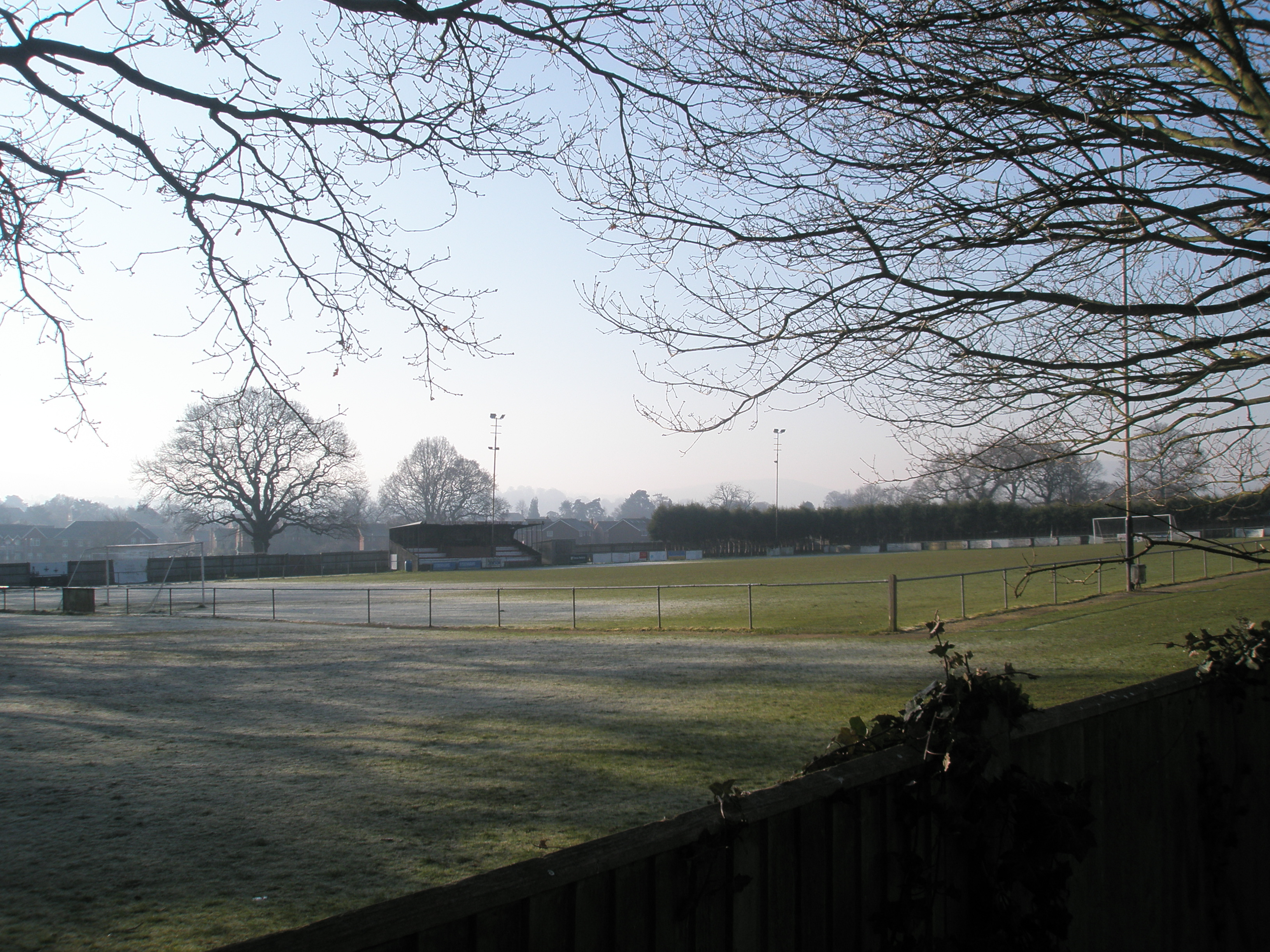
Petersfield Town F.C.

Petersfield Town Football Club are an English football club based in Petersfield, Hampshire, England. The club is affiliated to the Hampshire Football...

Bedales School

Bedales School is a public school (co-educational private school, boarding and day) in the village of Steep, near the market town of Petersfield in Hampshire...

Related Videos

Day Four | The Serpent Trail | Cocking to Petersfield | Cool Dudes Walking Club

The final day of Marek Larwood's epic voyage on this excellent walk. Starting at the Cocking Causeway and making his way to ...

DJI Osmo Pocket – Walking around and filming Steep Mill waterfall, nr Petersfield, Hampshire

A new experimental video this time from a new location Steep nr Petersfield in Hampshire and not with one of the drones, shame I ...

Winter walk along the Hanger Way

A day walk from Petersfield to Selborne in winter sunshine.

#56 Rob's Hampshire Pub Walks. The Petersfield Pond and Heath Walk

Two Hampshire walks in one with this figure of eight walk around the Hampshire market town of Petersfield and the surrounding ...

Nearby Amenities

Located within 500m of 51.021314,-0.91696543
Source: Landsat photo
Lat/Long: 51.0203091/-0.9182422
Source: Landsat photo
Lat/Long: 51.0210614/-0.9166858
Source: Landsat photo
Lat/Long: 51.0224145/-0.9133794
Source: Landsat photo
Lat/Long: 51.0230626/-0.9121147
Barrier: stile
Lat/Long: 51.0177092/-0.9182148
Barrier: stile
Lat/Long: 51.0171276/-0.9177301
Parking
Parking: layby
Lat/Long: 51.0235865/-0.9201094
Barrier: bollard
Bicycle: yes
Foot: yes
Motor Vehicle: no
Lat/Long: 51.0222512/-0.9203675
The data included in this document is from www.openstreetmap.org. The data is made available under ODbL.

Have you been to Little Moor?

Leave your review of Little Moor below (or comments, questions and feedback).