Blake's Copse
Wood, Forest in Hampshire Hart
England
Blake's Copse

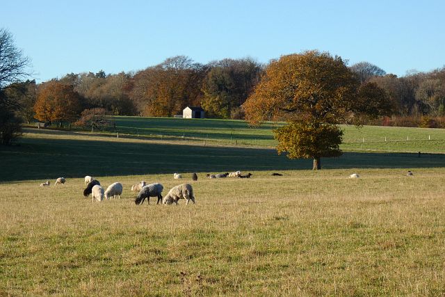
Blake's Copse is a picturesque woodland located in Hampshire, England. Covering an area of approximately 50 acres, it is a popular destination for nature enthusiasts and those seeking tranquility amidst the beauty of nature. The copse is situated in the heart of the Hampshire countryside, surrounded by rolling hills and open fields.
The woodland is predominantly made up of a mixture of broadleaf trees, including oak, beech, and birch. These towering trees provide a dense canopy that filters the sunlight, creating a dappled effect on the forest floor below. The ground is covered with a thick layer of leaf litter, adding to the natural ambiance of the copse.
Visitors to Blake's Copse can explore a network of well-maintained footpaths that wind their way through the woodland. These paths offer a variety of routes, catering to both casual strollers and more adventurous hikers. Along the way, there are several designated picnic areas where visitors can take a break and enjoy the peaceful surroundings.
The copse is home to a diverse range of wildlife, including squirrels, foxes, and a variety of bird species. Birdwatchers can spot woodpeckers, owls, and thrushes among the treetops, while small mammals scurry about on the forest floor.
Blake's Copse is open to the public year-round and offers a tranquil escape from the hustle and bustle of everyday life. Whether it's a leisurely walk, a family picnic, or an opportunity to immerse oneself in nature, this Hampshire woodland provides a serene and rejuvenating experience for all who visit.
If you have any feedback on the listing, please let us know in the comments section below.
Blake's Copse Images
Images are sourced within 2km of 51.21741/-0.91686749 or Grid Reference SU7547. Thanks to Geograph Open Source API. All images are credited.


Blake's Copse is located at Grid Ref: SU7547 (Lat: 51.21741, Lng: -0.91686749)
Administrative County: Hampshire
District: Hart
Police Authority: Hampshire
What 3 Words
///cornering.slippery.fines. Near Long Sutton, Hampshire
Nearby Locations
Related Wikis

Well, Hampshire
Well is a small village and civil parish in the Hart district of Hampshire, England. It is in the civil parish of Long Sutton. The village lies approximately...

Lord Wandsworth College
Lord Wandsworth College (LWC) is a co-educational private school in Long Sutton, Hampshire, England, for day and boarding pupils between the ages of 11...
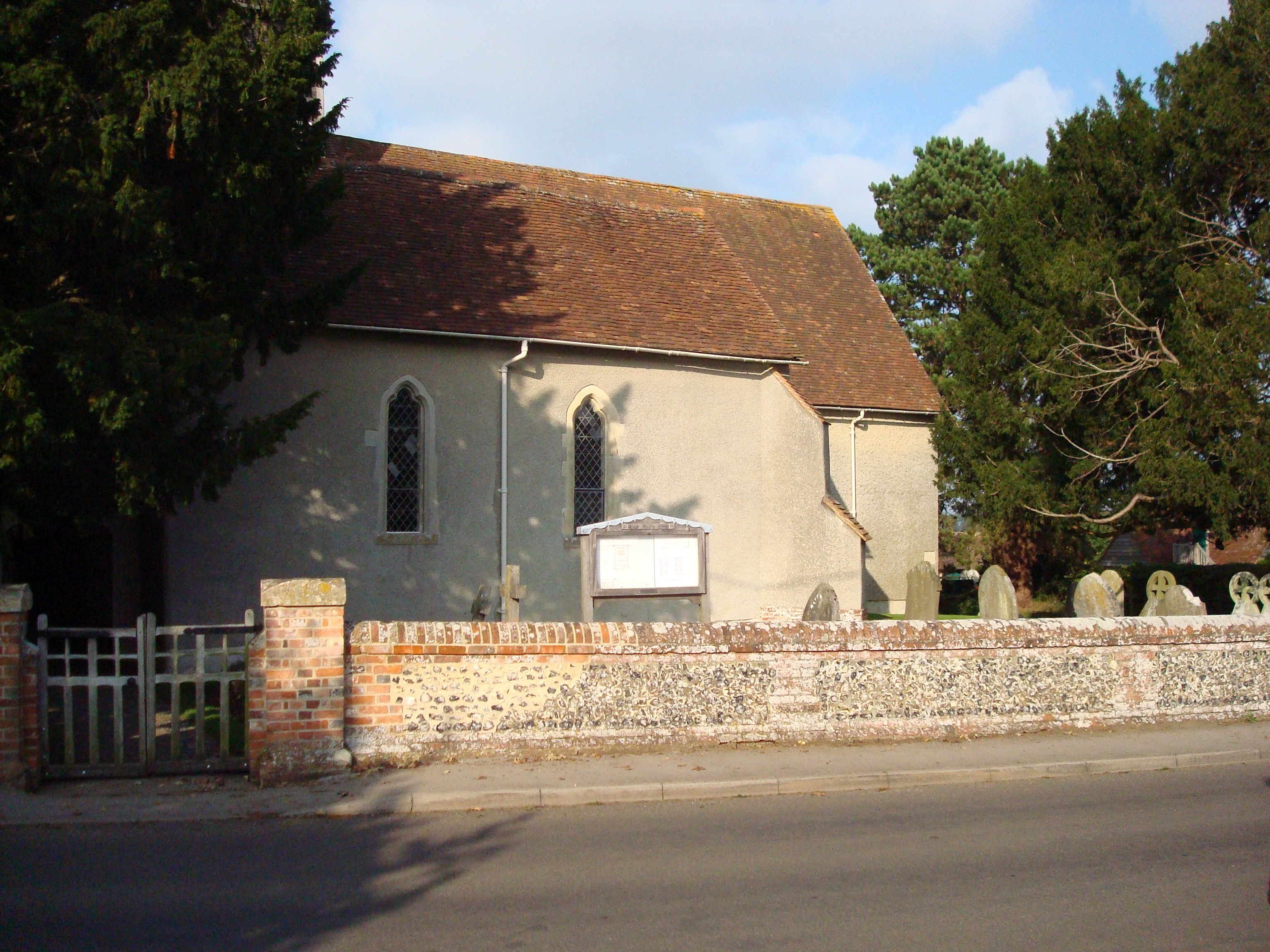
Long Sutton, Hampshire
Long Sutton is a small village and civil parish in the Hart district of Hampshire, England. The village lies about 3 miles (4.8 km) south of the town of...

North East Hampshire (UK Parliament constituency)
North East Hampshire is a constituency represented in the House of Commons of the UK Parliament by Ranil Jayawardena, a Conservative. == History == The...
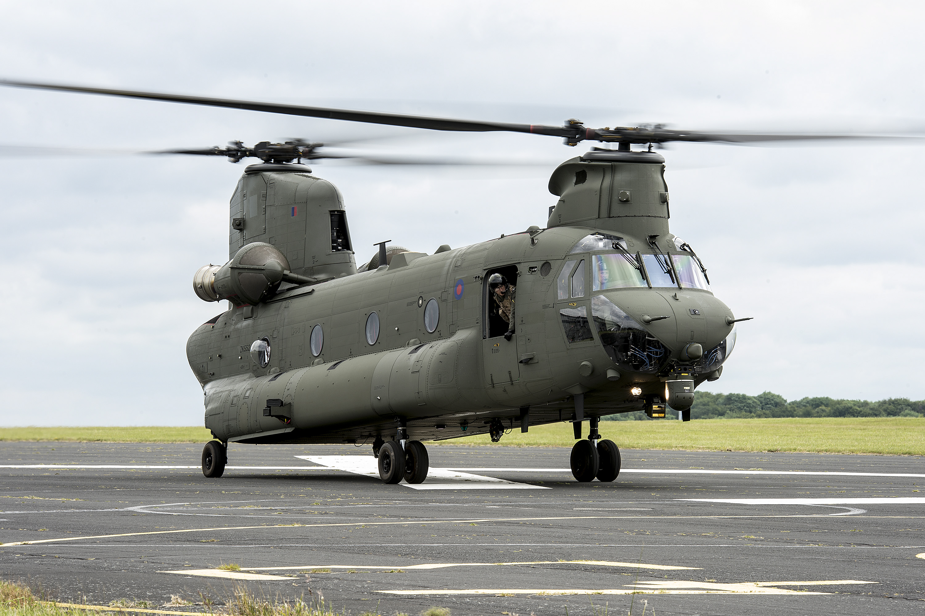
RAF Odiham
Royal Air Force Odiham or more simply RAF Odiham (IATA: ODH, ICAO: EGVO) is a Royal Air Force station situated a little to the south of the village of...

Pax Hill
Pax Hill (Peace Hill), near Bentley, Hampshire, England, was the family home of Robert Baden-Powell, founder of the Scout movement, and his wife, Olave...

South Warnborough
South Warnborough (grid reference SU722473) is a small village and civil parish in the English county of Hampshire. In the 2001 census, the population...
Blounce
Blounce is a small hamlet in the civil parish of South Warnborough in the Hart district of Hampshire, England. It lies on the B3349 road in between Alton...
Nearby Amenities
Located within 500m of 51.21741,-0.91686749Have you been to Blake's Copse?
Leave your review of Blake's Copse below (or comments, questions and feedback).