Parsonage Wood

Wood, Forest in Oxfordshire

England

Parsonage Wood

Working on the Chiltern Way The Chiltern Way is a well used path and this is a particularly steep and muddy section just here.
The path has been excavated and at a guess there are going to be steps made.
Working on the Chiltern Way Credit: Des Blenkinsopp

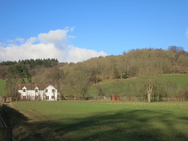
Parsonage Wood is a picturesque woodland located in Oxfordshire, England. Covering an area of approximately 30 acres, this enchanting forest is nestled in the heart of the county, providing a tranquil escape for nature lovers and outdoor enthusiasts alike.

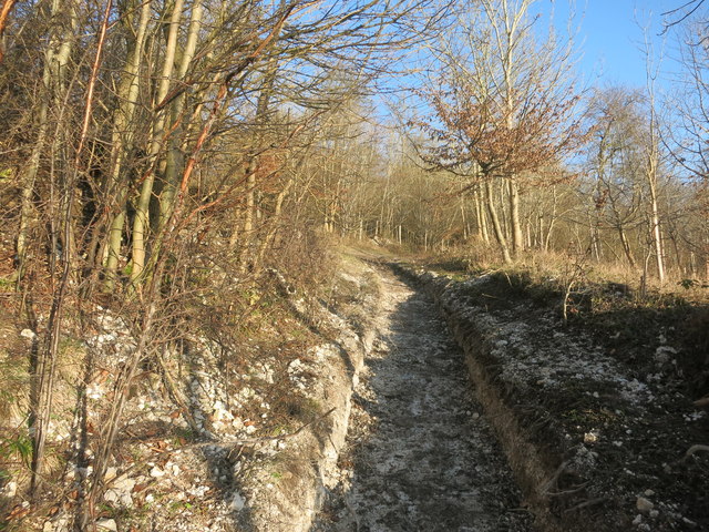
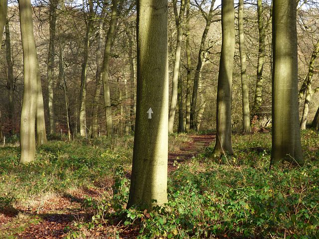
The wood is primarily composed of deciduous trees, which create a stunning display of vibrant colors during the autumn months. Ancient oaks, beeches, and birches can be found throughout, their gnarled trunks and sprawling branches adding to the woodland's rustic charm.

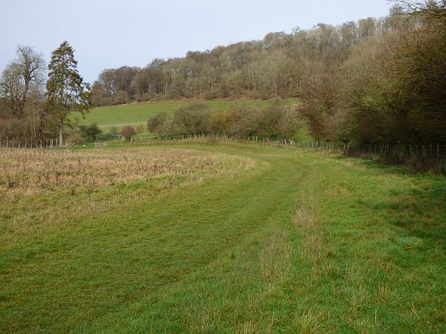
A network of well-maintained footpaths winds its way through Parsonage Wood, allowing visitors to explore the area at their leisure. As they stroll along the leafy trails, they may encounter a variety of wildlife, including squirrels, foxes, and an array of bird species. The wood is also home to a diverse range of flora, with bluebells carpeting the forest floor in the springtime and wildflowers adding splashes of color throughout the year.

Parsonage Wood is not only a haven for nature enthusiasts but also a site of historical significance. The wood is believed to have been part of an ancient hunting ground, with remnants of a medieval deer park still visible in some areas. The peaceful ambiance and rich history of Parsonage Wood make it the perfect destination for those seeking a quiet retreat or a glimpse into the past.

Overall, Parsonage Wood offers visitors a chance to immerse themselves in the beauty of nature while experiencing the charm and history of Oxfordshire. Whether it's a leisurely walk, a picnic amidst the trees, or a journey back in time, this woodland is sure to captivate all who venture into its leafy embrace.

If you have any feedback on the listing, please let us know in the comments section below.

Parsonage Wood Images

Images are sourced within 2km of 51.631182/-0.9118687 or Grid Reference SU7593. Thanks to Geograph Open Source API. All images are credited.

Working on the Chiltern Way The Chiltern Way is a well used path and this is a particularly steep and muddy section just here.
The path has been excavated and at a guess there are going to be steps made.
Working on the Chiltern Way
The Chiltern Way is a well used path and this is a particularly steep and muddy section just here. The path has been excavated and at a guess there are going to be steps made.
Towards Manor Farm This large farmhouse is in the square to the north, but the best view of its prominent hilltop site is from here.
Towards Manor Farm
This large farmhouse is in the square to the north, but the best view of its prominent hilltop site is from here.
Wooded Hillside above Ashfield Barn
Beechwood near Turville A strip of woodland along the bottom of a dry valley.
Beechwood near Turville
A strip of woodland along the bottom of a dry valley.
A Chiltern Valley near Ibstone
Track into Park Wood
Small Plaster Animal I don't know what this is about. This small figure is just standing here in the woods between two trees.
I think it's a rabbit, but it might be a squirrel. It's wearing a jacket and waistcoat, which doesn't particularly help with identification.
No trousers though. Probably a rabbit. They just don't care...
Small Plaster Animal
I don't know what this is about. This small figure is just standing here in the woods between two trees. I think it's a rabbit, but it might be a squirrel. It's wearing a jacket and waistcoat, which doesn't particularly help with identification. No trousers though. Probably a rabbit. They just don't care...
Woodland, Ibstone On the footpath heading generally north to south along the dry valley of Twigside Bottom.
Woodland, Ibstone
On the footpath heading generally north to south along the dry valley of Twigside Bottom.
Village primary school Traditional old village school.
Village primary school
Traditional old village school.
Eatery in the village A roadside hostelry.
Eatery in the village
A roadside hostelry.
Woodland, Shirburn The Chiltern Way amidst beeches in the lower part of Blackmoor Wood on the Wormsley Estate.
Woodland, Shirburn
The Chiltern Way amidst beeches in the lower part of Blackmoor Wood on the Wormsley Estate.
Pasture and woodland, Stokenchurch A bridleway running along a dry valley in the heart of the Wormsley Estate.
Pasture and woodland, Stokenchurch
A bridleway running along a dry valley in the heart of the Wormsley Estate.
Footpath in Penley Wood Two public footpaths make a cross in SU7693. The north-south one is easy going along the bottom of a dry valley. This is the east-west one which is slightly more strenuous down and up the valley sides.
Footpath in Penley Wood
Two public footpaths make a cross in SU7693. The north-south one is easy going along the bottom of a dry valley. This is the east-west one which is slightly more strenuous down and up the valley sides.
St Nicholas Church, Ibstone The church consists of a tall 12th century nave with north and south doorways. The north door is blocked and the south door protected by a timber porch.  

At the west end of the nave is an 18th century or 19th century gallery, and on the exterior above it is a weatherboarded bell turret with a tiled pyramid roof.

The chancel arch is 12th century too, but the chancel is 13th century.  A carved head is set at the apex of the chancel arch, and another is set above a south nave window outside.  The church also has a plain 12th century font.
St Nicholas Church, Ibstone
The church consists of a tall 12th century nave with north and south doorways. The north door is blocked and the south door protected by a timber porch. At the west end of the nave is an 18th century or 19th century gallery, and on the exterior above it is a weatherboarded bell turret with a tiled pyramid roof. The chancel arch is 12th century too, but the chancel is 13th century. A carved head is set at the apex of the chancel arch, and another is set above a south nave window outside. The church also has a plain 12th century font.
Thatched scoreboard at Wormsley cricket ground Sir Paul Getty became a cricket lover in the 1960s through his friendship with his Chelsea neighbour, Mick Jagger.

When Sir Paul acquired Wormsley in 1985, another great friend from the world of cricket – the legendary commentator Brian Johnston – persuaded him to create a cricket ground on the Estate. 

Harry Brind OBE, the groundsman at The Oval, was commissioned to lay the square and create a replica of the South London ground.  It was opened in 1992.
Thatched scoreboard at Wormsley cricket ground
Sir Paul Getty became a cricket lover in the 1960s through his friendship with his Chelsea neighbour, Mick Jagger. When Sir Paul acquired Wormsley in 1985, another great friend from the world of cricket – the legendary commentator Brian Johnston – persuaded him to create a cricket ground on the Estate. Harry Brind OBE, the groundsman at The Oval, was commissioned to lay the square and create a replica of the South London ground. It was opened in 1992.
T20 finals day at Wormsley cricket ground The minor counties T20 finals day is one of the highlights of the cricketing year at Wormsley. 

Sir Paul Getty became a cricket lover in the 1960s through his friendship with his Chelsea neighbour, Mick Jagger.

When Sir Paul acquired Wormsley in 1985, another great friend from the world of cricket – the legendary commentator Brian Johnston – persuaded him to create a cricket ground on the Estate. 

Harry Brind OBE, the groundsman at The Oval, was commissioned to lay the square and create a replica of the South London ground.  It was opened in 1992.
T20 finals day at Wormsley cricket ground
The minor counties T20 finals day is one of the highlights of the cricketing year at Wormsley. Sir Paul Getty became a cricket lover in the 1960s through his friendship with his Chelsea neighbour, Mick Jagger. When Sir Paul acquired Wormsley in 1985, another great friend from the world of cricket – the legendary commentator Brian Johnston – persuaded him to create a cricket ground on the Estate. Harry Brind OBE, the groundsman at The Oval, was commissioned to lay the square and create a replica of the South London ground. It was opened in 1992.
Holloway Lane, Northend
Green on Holloway Lane, Northend
Show me another place!

Parsonage Wood is located at Grid Ref: SU7593 (Lat: 51.631182, Lng: -0.9118687)

Unitary Authority: Buckinghamshire

Police Authority: Thames Valley

What 3 Words

///stick.euphoric.shuttle. Near Stokenchurch, Buckinghamshire

Related Wikis

Ibstone

Ibstone (previously Ipstone) is a village and civil parish within Wycombe district in Buckinghamshire, England. It is in the Chiltern Hills on the border...

Wormsley Chalk Banks

Wormsley Chalk Banks are six separate areas which together are a 14.1-hectare (35-acre) biological Site of Special Scientific Interest near Turville in...

Swain's Wood

Swain's Wood is a 16.2-hectare (40-acre) biological Site of Special Scientific Interest west of Turville in Buckinghamshire. It is in the Chilterns Area...

Northend, Buckinghamshire

Northend is a village that straddles the border of the two English counties of Buckinghamshire and Oxfordshire. The eastern half is in the civil parish...

Garsington Opera

Garsington Opera is an annual summer opera festival founded in 1989 by Leonard Ingrams. The Philharmonia Orchestra and The English Concert are its two...
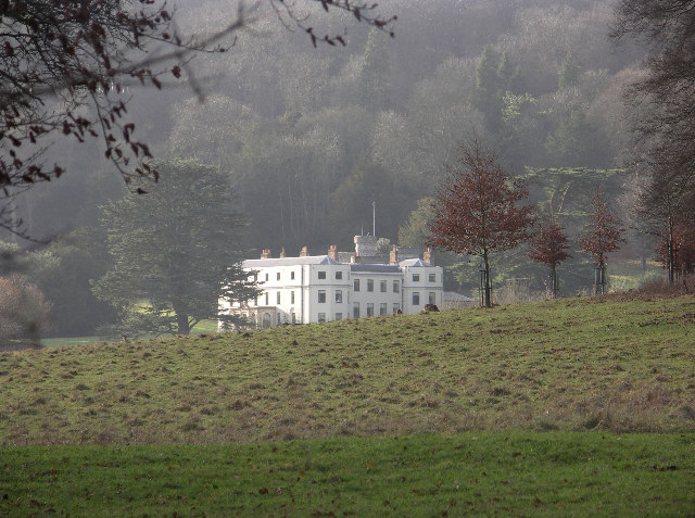
Turville Grange

Turville Grange is a large detached house in the village of Turville Heath in the English county of Buckinghamshire. It was built in the late 18th century...

Wormsley Park

Wormsley is a private estate of Mark Getty and his family, set in 2,700-acre (1,100 ha) of rolling countryside in the Chiltern Hills of Buckinghamshire...
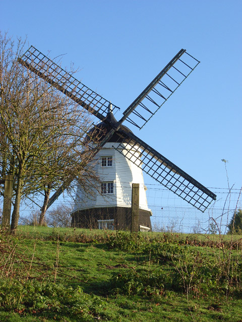
Cobstone Windmill

Cobstone Mill was built around 1816 on Turville Hill in Buckinghamshire, England, and overlooks the village of Turville. It is a smock mill that replaced...

Nearby Amenities

Located within 500m of 51.631182,-0.9118687
Ibstone
Place: village
Lat/Long: 51.6340839/-0.9099001
Barrier: kissing_gate
Lat/Long: 51.6315929/-0.9173738
Barrier: stile
Bicycle: no
Foot: yes
Material: wood
Stile: stepover
Lat/Long: 51.6275346/-0.9089427
Post Box
Collection Times: Mo-Fr 17:30; Sa 09:30
Operator: Royal Mail
Operator Wikidata: Q638098
Post Box Type: wall
Ref: HP14 107
Royal Cypher: GVIR
Royal Cypher Wikidata: Q33102169
Source: survey
Survey Date: 2016-03-19
Lat/Long: 51.6287978/-0.9074447
The data included in this document is from www.openstreetmap.org. The data is made available under ODbL.

Have you been to Parsonage Wood?

Leave your review of Parsonage Wood below (or comments, questions and feedback).