End, East

Settlement in Oxfordshire West Oxfordshire

England

End, East

Old Bridge Marker on Hanborough Bridge Bridge Marker set in the north parapet of Hanborough Bridge, River Evenlode, on the B4095 Main Road. On the boundary of Hanborough and Bladon parishes.

Milestone Society National ID: OX_HANBLA01br
Old Bridge Marker on Hanborough Bridge Credit: Roadside Relics

End, East is a small village located in Oxfordshire, England. Situated in the eastern part of the county, it is surrounded by picturesque countryside and offers a tranquil atmosphere for its residents. With a population of around 500 people, End, East is known for its tight-knit community and friendly locals.

The village is characterized by its traditional architecture, with many houses dating back to the 18th and 19th centuries. The charming village center features a few local shops, a post office, and a village hall that serves as a hub for community events and gatherings.

End, East is blessed with natural beauty, with rolling hills, green meadows, and a number of walking paths and trails for outdoor enthusiasts to explore. The village is located near the River Cherwell, providing opportunities for fishing and boating activities.

For those interested in history, End, East offers several historical landmarks. The 12th-century St. Mary's Church stands as a testament to the village's rich heritage and is a popular spot for visitors to admire its architecture and serene surroundings.

Despite its small size, End, East benefits from its proximity to larger towns and cities. The nearby market town of Bicester is just a short drive away and offers a wider range of amenities, including shopping centers, restaurants, and leisure facilities.

In summary, End, East is a charming village in Oxfordshire, known for its peaceful countryside, tight-knit community, and historical landmarks. It is an ideal destination for those seeking a rural retreat while still having access to nearby urban amenities.

If you have any feedback on the listing, please let us know in the comments section below.
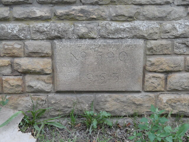
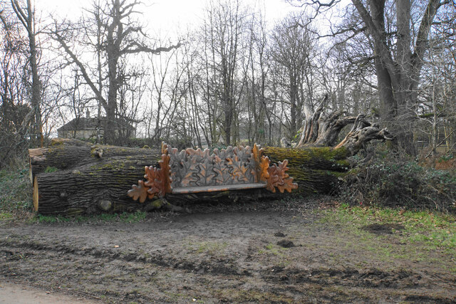
End, East Images

Images are sourced within 2km of 51.836447/-1.383139 or Grid Reference SP4215. Thanks to Geograph Open Source API. All images are credited.

Old Bridge Marker on Hanborough Bridge Bridge Marker set in the north parapet of Hanborough Bridge, River Evenlode, on the B4095 Main Road. On the boundary of Hanborough and Bladon parishes.

Milestone Society National ID: OX_HANBLA01br
Old Bridge Marker on Hanborough Bridge
Bridge Marker set in the north parapet of Hanborough Bridge, River Evenlode, on the B4095 Main Road. On the boundary of Hanborough and Bladon parishes. Milestone Society National ID: OX_HANBLA01br
Queen Pool The northern lake in Blenheim Park, seen on a bright morning.
Queen Pool
The northern lake in Blenheim Park, seen on a bright morning.
Crows in front of the Column of Victory A vista in Blenheim Park. It is a bright morning looking into the sun, which has affected the view of the palace behind.
Crows in front of the Column of Victory
A vista in Blenheim Park. It is a bright morning looking into the sun, which has affected the view of the palace behind.
Copse in Great Park One of a number of circular copses as part of the landscaping in Blenheim Park. The surrounding land is for grazing of sheep.
Copse in Great Park
One of a number of circular copses as part of the landscaping in Blenheim Park. The surrounding land is for grazing of sheep.
Path in New Park The landscaping has produced long sweeping curves. This path is part of the official Perimeter Walk which in practice runs well within the park boundaries.
Path in New Park
The landscaping has produced long sweeping curves. This path is part of the official Perimeter Walk which in practice runs well within the park boundaries.
Woodland seat in New Park Carved oak leaves have been inserted into a felled tree trunk.
Woodland seat in New Park
Carved oak leaves have been inserted into a felled tree trunk.
Woodland in New Park Part of the Blenheim estate with fairly low density planting.
Woodland in New Park
Part of the Blenheim estate with fairly low density planting.
Pond by High Lodge This is as much as you can see from the public path. I presume the fountain provides aeration.
Pond by High Lodge
This is as much as you can see from the public path. I presume the fountain provides aeration.
Gnarled trees in High Park The park allows trees to get old.
Gnarled trees in High Park
The park allows trees to get old.
Woodland track in Blenheim Park This track is private and not open to the public.
Woodland track in Blenheim Park
This track is private and not open to the public.
Path in Blenheim Park A public footpath leads to near this point, but you cannot continue on this part without paying for entrance to the park, not that anybody was checking.
Path in Blenheim Park
A public footpath leads to near this point, but you cannot continue on this part without paying for entrance to the park, not that anybody was checking.
Trees by Bladon Bridge Landscaping in Blenheim Park has used the River Glyme to create a series of lakes, of which this is one.
Trees by Bladon Bridge
Landscaping in Blenheim Park has used the River Glyme to create a series of lakes, of which this is one.
Bladon Bridge A grand bridge over the landscaped River Glyme in Blenheim Park. The road doesn't go to Bladon.
Bladon Bridge
A grand bridge over the landscaped River Glyme in Blenheim Park. The road doesn't go to Bladon.
Repairs to the ha-ha The ha-ha is doing its job as you can't see it, but the sheep are kept off the lawn.
Repairs to the ha-ha
The ha-ha is doing its job as you can't see it, but the sheep are kept off the lawn.
The Great Lake Winter hues on the lake seen from the formal gardens.
The Great Lake
Winter hues on the lake seen from the formal gardens.
Part of the water terraces It refreshing to see this with no people in view.
Part of the water terraces
It refreshing to see this with no people in view.
Hanborough railway station, Oxfordshire Opened in 1853 as "Handborough" by the Oxford, Worcester & Wolverhampton Railway, later part of the Great Western Railway, on the line from Oxford to Worcester. The name was changed to "Hanborough"  in 1992.
View south east towards Yarnton Junction and Oxford. Compare with <a href="https://www.geograph.org.uk/photo/4021348">SP4314 : Hanborough railway station, Oxfordshire, 2014</a> - The former north-bound platform to the right has disappeared into the undergrowth but the taller trees have been cut down. A new booking office on the left was opened in 2019.
Hanborough railway station, Oxfordshire
Opened in 1853 as "Handborough" by the Oxford, Worcester & Wolverhampton Railway, later part of the Great Western Railway, on the line from Oxford to Worcester. The name was changed to "Hanborough" in 1992. View south east towards Yarnton Junction and Oxford. Compare with SP4314 : Hanborough railway station, Oxfordshire, 2014 - The former north-bound platform to the right has disappeared into the undergrowth but the taller trees have been cut down. A new booking office on the left was opened in 2019.
Blenheim Palace Blenheim Palace is home to the 11th Duke and Duchess of Marlborough and the birthplace of Sir Winston Churchill.

Set in 2100 acres of beautiful parkland landscaped by ‘Capability’ Brown, the magnificent Palace is surrounded by sweeping lawns, award-winning formal gardens and the great Lake.

Situated in Woodstock, just 8 miles from Oxford, the Palace was created a World Heritage site in 1987. 
Website: <span class="nowrap"><a title="http://www.blenheimpalace.com/" rel="nofollow ugc noopener" href="http://www.blenheimpalace.com/">Link</a><img style="margin-left:2px;" alt="External link" title="External link - shift click to open in new window" src="https://s1.geograph.org.uk/img/external.png" width="10" height="10"/></span>
Blenheim Palace
Blenheim Palace is home to the 11th Duke and Duchess of Marlborough and the birthplace of Sir Winston Churchill. Set in 2100 acres of beautiful parkland landscaped by ‘Capability’ Brown, the magnificent Palace is surrounded by sweeping lawns, award-winning formal gardens and the great Lake. Situated in Woodstock, just 8 miles from Oxford, the Palace was created a World Heritage site in 1987. Website: LinkExternal link
Show me another place!

End, East is located at Grid Ref: SP4215 (Lat: 51.836447, Lng: -1.383139)

Administrative County: Oxfordshire

District: West Oxfordshire

Police Authority: Thames Valley

What 3 Words

///opts.slurping.slept. Near Woodstock, Oxfordshire

Related Wikis

Combe railway station

Combe railway station serves the village of Combe in Oxfordshire, England. It is on the Cotswold Line. This station and all trains serving it are run by...

Blenheim Park

Blenheim Park is a 224.3-hectare (554-acre) biological Site of Special Scientific Interest on the outskirts of Woodstock in Oxfordshire. It occupies most...

Combe Mill

Combe Mill is a historic sawmill adjacent to the River Evenlode and close to Combe railway station, between the villages of Combe and Long Hanborough in...

The Bell Inn, Long Hanborough

The Bell Inn, Long Hanborough is a well-established Grade II listedrestaurant and public house in the village of Long Hanborough, Oxfordshire, England...

St Laurence's Church, Combe Longa

St Laurence's Church, Combe Longa is the Church of England parish church of Combe, Oxfordshire, England. The parish is part of the Benefice of Stonesfield...

Combe, Oxfordshire

Combe is a village and civil parish about 5 miles (8 km) northeast of Witney in Oxfordshire. It is bounded to the south and southwest by the River Evenlode...

Oxford Bus Museum

The Oxford Bus Museum is a transport museum at Long Hanborough, West Oxfordshire, England, about 4 miles (6.4 km) northeast of Witney and 7 miles (11 km...

Hanborough railway station

Hanborough railway station is a railway station in the village of Long Hanborough in Oxfordshire, England, serving the village and surrounding district...

Nearby Amenities

Located within 500m of 51.836447,-1.383139
East End
Is In: Oxfordshire, England, UK
Place: hamlet
Lat/Long: 51.8361365/-1.3807814
Private Estate Entrance
Access: permissive
Lat/Long: 51.8388879/-1.3825093
Created By: Merkaartor 0.13
Lat/Long: 51.840169/-1.3819169
Post Box
Collection Times: Mo-Fr 09:00; Sa 07:00
Fixme: Survey
Royal Cypher: EIIR
Lat/Long: 51.8392681/-1.3869259
Barrier: stile
Lat/Long: 51.8375857/-1.3884762
Barrier: stile
Lat/Long: 51.837858/-1.3855604
Barrier: stile
Lat/Long: 51.8372087/-1.3814452
Barrier: stile
Lat/Long: 51.837067/-1.3808335
Power: pole
Source: Bing
Lat/Long: 51.8369184/-1.3850522
Power: pole
Source: Bing
Lat/Long: 51.8373196/-1.3874253
Power: pole
Source: Bing
Lat/Long: 51.8370983/-1.3863264
Power: pole
Source: Bing
Lat/Long: 51.8376018/-1.3893927
Power: pole
Source: Bing
Lat/Long: 51.8365293/-1.382383
Power: pole
Source: Bing
Lat/Long: 51.8367174/-1.3836582
Power: pole
Lat/Long: 51.8375283/-1.388435
The data included in this document is from www.openstreetmap.org. The data is made available under ODbL.

Have you been to End, East?

Leave your review of End, East below (or comments, questions and feedback).