Fir Grove

Wood, Forest in Oxfordshire South Oxfordshire

England

Fir Grove

Crowsley Park Wood
Crowsley Park Wood Credit: Matthew Chadwick

Fir Grove, located in Oxfordshire, is a picturesque woodland area renowned for its dense population of fir trees. Spanning over several acres, this forested region is a haven for nature enthusiasts and provides a tranquil escape from the bustling city life. Situated in close proximity to the historic city of Oxford, Fir Grove attracts visitors from all walks of life.

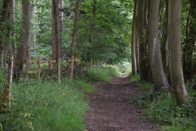
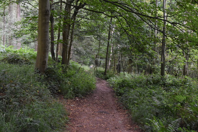
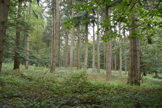
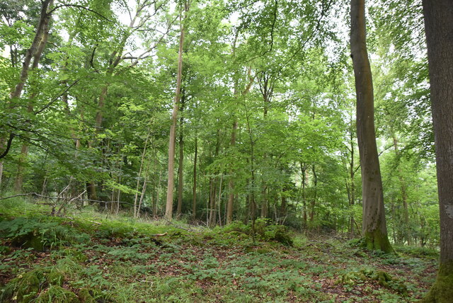
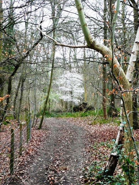
The woodland is characterized by its towering fir trees, which dominate the landscape and create a dense canopy overhead. The lush green foliage provides a serene and peaceful atmosphere, making it a popular spot for leisurely walks, picnics, and birdwatching. The forest floor is covered with a thick layer of fallen leaves, adding to the natural beauty of the area.

Fir Grove is also home to a variety of wildlife, including deer, squirrels, and a diverse range of bird species. The forest provides a natural habitat for these creatures, making it a prime location for wildlife enthusiasts and photographers.

Visitors to Fir Grove can explore the numerous walking trails that wind through the forest, offering breathtaking views and opportunities to immerse oneself in nature. The pathways are well-maintained and suitable for all ages and fitness levels, making it an ideal destination for families and individuals alike.

Overall, Fir Grove in Oxfordshire is a stunning woodland area that offers a peaceful retreat from the fast-paced urban lifestyle. With its towering fir trees, diverse wildlife, and scenic walking trails, it is a must-visit destination for nature lovers and those seeking solace in the beauty of the natural world.

If you have any feedback on the listing, please let us know in the comments section below.
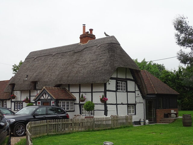
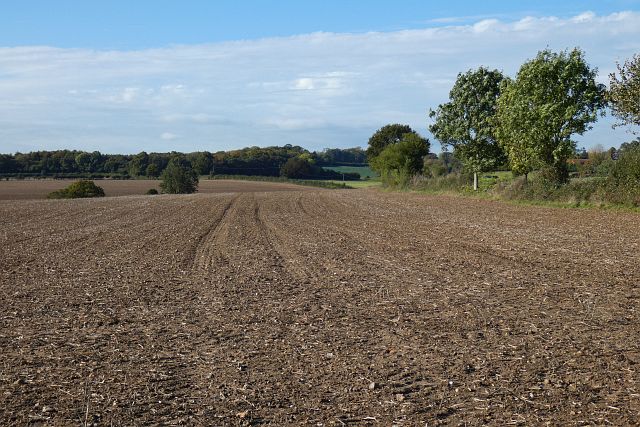
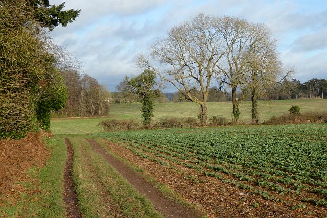
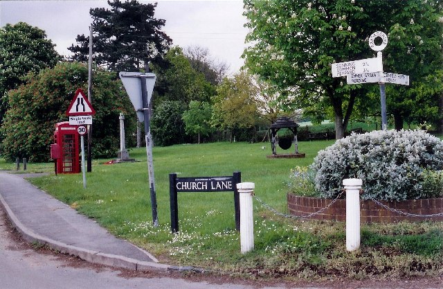
Fir Grove Images

Images are sourced within 2km of 51.507118/-0.92501316 or Grid Reference SU7479. Thanks to Geograph Open Source API. All images are credited.

Crowsley Park Wood
Crowsley Park Wood
Bottle and Glass pub
Farmland, Shiplake Arable land beside the Henley Road with Ash Copse seen beyond Hampstead Bottom.
Farmland, Shiplake
Arable land beside the Henley Road with Ash Copse seen beyond Hampstead Bottom.
Farmland, Shiplake The track here, at the edge of Lower Hailey Wood, is a permitted footpath.  A crop of oil-seed rape is to the right.
Farmland, Shiplake
The track here, at the edge of Lower Hailey Wood, is a permitted footpath. A crop of oil-seed rape is to the right.
Chiltern Way Created by the Chiltern Society as its Millennium Project, the Way originally took in all of the Chilterns from north to south across the Chilterns Area of Outstanding Natural Beauty, in a 125-miles circuit extending from Ewelme in the south west, Chorleywood in the south east and Sharpenhoe Clappers and Great Offley in the north east. It was based on an earlier unofficial route, the Chiltern Hundred.
The Way passes through some of the most attractive parts of the Chilterns, including the Bovingdon Plateau, the Chess valley, the Misbourne valley, Penn Country, the Hambleden valley, Stonor Park, Ewelme, Swyncombe Down, Bledlow Ridge, Hampden Country, Bulbourne valley and Dunstable Down.
The original 200km (125 miles) Way took in Hemel via Chalfont St Giles, the edge of Marlow, Hambleden, Bix Bottom, Ewelme, the Ridgeway, Stokenchurch, Great Hampden, Aldbury, the Dunstable Downs, Sharpenhoe Clappers and Harpenden.
Two extensions have been added in 2003: the southern adds a loop of 50km (35 miles) from Bix Bottom via Mapledurham on the Thames and the northern extension 44km (27 miles) from Sharpenhoe Clappers via the Icknield Way and the outskirts of Hitchin. A short cut from Bix Bottom creates a 16km (10 miles) loop via Ewelme.
Although officially starting at Hemel Hempstead Station, the walk can be started at many other places on the route. The Way also has links with other routes including Chiltern Heritage Trail, Ridgeway National Trail, Icknield Way Path, Oxfordshire, Swan's and South Bucks Ways and Grand Union Canal, Lea Valley and Chess Valley Walks.
Chiltern Way
Created by the Chiltern Society as its Millennium Project, the Way originally took in all of the Chilterns from north to south across the Chilterns Area of Outstanding Natural Beauty, in a 125-miles circuit extending from Ewelme in the south west, Chorleywood in the south east and Sharpenhoe Clappers and Great Offley in the north east. It was based on an earlier unofficial route, the Chiltern Hundred. The Way passes through some of the most attractive parts of the Chilterns, including the Bovingdon Plateau, the Chess valley, the Misbourne valley, Penn Country, the Hambleden valley, Stonor Park, Ewelme, Swyncombe Down, Bledlow Ridge, Hampden Country, Bulbourne valley and Dunstable Down. The original 200km (125 miles) Way took in Hemel via Chalfont St Giles, the edge of Marlow, Hambleden, Bix Bottom, Ewelme, the Ridgeway, Stokenchurch, Great Hampden, Aldbury, the Dunstable Downs, Sharpenhoe Clappers and Harpenden. Two extensions have been added in 2003: the southern adds a loop of 50km (35 miles) from Bix Bottom via Mapledurham on the Thames and the northern extension 44km (27 miles) from Sharpenhoe Clappers via the Icknield Way and the outskirts of Hitchin. A short cut from Bix Bottom creates a 16km (10 miles) loop via Ewelme. Although officially starting at Hemel Hempstead Station, the walk can be started at many other places on the route. The Way also has links with other routes including Chiltern Heritage Trail, Ridgeway National Trail, Icknield Way Path, Oxfordshire, Swan's and South Bucks Ways and Grand Union Canal, Lea Valley and Chess Valley Walks.
Crowsley Park Woods
Crowsley Park Woods
Chiltern Way Created by the Chiltern Society as its Millennium Project, the Way originally took in all of the Chilterns from north to south across the Chilterns Area of Outstanding Natural Beauty, in a 125-miles circuit extending from Ewelme in the south west, Chorleywood in the south east and Sharpenhoe Clappers and Great Offley in the north east. It was based on an earlier unofficial route, the Chiltern Hundred.
The Way passes through some of the most attractive parts of the Chilterns, including the Bovingdon Plateau, the Chess valley, the Misbourne valley, Penn Country, the Hambleden valley, Stonor Park, Ewelme, Swyncombe Down, Bledlow Ridge, Hampden Country, Bulbourne valley and Dunstable Down.
The original 200km (125 miles) Way took in Hemel via Chalfont St Giles, the edge of Marlow, Hambleden, Bix Bottom, Ewelme, the Ridgeway, Stokenchurch, Great Hampden, Aldbury, the Dunstable Downs, Sharpenhoe Clappers and Harpenden.
Two extensions have been added in 2003: the southern adds a loop of 50km (35 miles) from Bix Bottom via Mapledurham on the Thames and the northern extension 44km (27 miles) from Sharpenhoe Clappers via the Icknield Way and the outskirts of Hitchin. A short cut from Bix Bottom creates a 16km (10 miles) loop via Ewelme.
Although officially starting at Hemel Hempstead Station, the walk can be started at many other places on the route. The Way also has links with other routes including Chiltern Heritage Trail, Ridgeway National Trail, Icknield Way Path, Oxfordshire, Swan's and South Bucks Ways and Grand Union Canal, Lea Valley and Chess Valley Walks.
Chiltern Way
Created by the Chiltern Society as its Millennium Project, the Way originally took in all of the Chilterns from north to south across the Chilterns Area of Outstanding Natural Beauty, in a 125-miles circuit extending from Ewelme in the south west, Chorleywood in the south east and Sharpenhoe Clappers and Great Offley in the north east. It was based on an earlier unofficial route, the Chiltern Hundred. The Way passes through some of the most attractive parts of the Chilterns, including the Bovingdon Plateau, the Chess valley, the Misbourne valley, Penn Country, the Hambleden valley, Stonor Park, Ewelme, Swyncombe Down, Bledlow Ridge, Hampden Country, Bulbourne valley and Dunstable Down. The original 200km (125 miles) Way took in Hemel via Chalfont St Giles, the edge of Marlow, Hambleden, Bix Bottom, Ewelme, the Ridgeway, Stokenchurch, Great Hampden, Aldbury, the Dunstable Downs, Sharpenhoe Clappers and Harpenden. Two extensions have been added in 2003: the southern adds a loop of 50km (35 miles) from Bix Bottom via Mapledurham on the Thames and the northern extension 44km (27 miles) from Sharpenhoe Clappers via the Icknield Way and the outskirts of Hitchin. A short cut from Bix Bottom creates a 16km (10 miles) loop via Ewelme. Although officially starting at Hemel Hempstead Station, the walk can be started at many other places on the route. The Way also has links with other routes including Chiltern Heritage Trail, Ridgeway National Trail, Icknield Way Path, Oxfordshire, Swan's and South Bucks Ways and Grand Union Canal, Lea Valley and Chess Valley Walks.
Chiltern Way
Chiltern Way
Bones Wood
Bones Wood
Chiltern Way Created by the Chiltern Society as its Millennium Project, the Way originally took in all of the Chilterns from north to south across the Chilterns Area of Outstanding Natural Beauty, in a 125-miles circuit extending from Ewelme in the south west, Chorleywood in the south east and Sharpenhoe Clappers and Great Offley in the north east. It was based on an earlier unofficial route, the Chiltern Hundred.
The Way passes through some of the most attractive parts of the Chilterns, including the Bovingdon Plateau, the Chess valley, the Misbourne valley, Penn Country, the Hambleden valley, Stonor Park, Ewelme, Swyncombe Down, Bledlow Ridge, Hampden Country, Bulbourne valley and Dunstable Down.
The original 200km (125 miles) Way took in Hemel via Chalfont St Giles, the edge of Marlow, Hambleden, Bix Bottom, Ewelme, the Ridgeway, Stokenchurch, Great Hampden, Aldbury, the Dunstable Downs, Sharpenhoe Clappers and Harpenden.
Two extensions have been added in 2003: the southern adds a loop of 50km (35 miles) from Bix Bottom via Mapledurham on the Thames and the northern extension 44km (27 miles) from Sharpenhoe Clappers via the Icknield Way and the outskirts of Hitchin. A short cut from Bix Bottom creates a 16km (10 miles) loop via Ewelme.
Although officially starting at Hemel Hempstead Station, the walk can be started at many other places on the route. The Way also has links with other routes including Chiltern Heritage Trail, Ridgeway National Trail, Icknield Way Path, Oxfordshire, Swan's and South Bucks Ways and Grand Union Canal, Lea Valley and Chess Valley Walks.
Chiltern Way
Created by the Chiltern Society as its Millennium Project, the Way originally took in all of the Chilterns from north to south across the Chilterns Area of Outstanding Natural Beauty, in a 125-miles circuit extending from Ewelme in the south west, Chorleywood in the south east and Sharpenhoe Clappers and Great Offley in the north east. It was based on an earlier unofficial route, the Chiltern Hundred. The Way passes through some of the most attractive parts of the Chilterns, including the Bovingdon Plateau, the Chess valley, the Misbourne valley, Penn Country, the Hambleden valley, Stonor Park, Ewelme, Swyncombe Down, Bledlow Ridge, Hampden Country, Bulbourne valley and Dunstable Down. The original 200km (125 miles) Way took in Hemel via Chalfont St Giles, the edge of Marlow, Hambleden, Bix Bottom, Ewelme, the Ridgeway, Stokenchurch, Great Hampden, Aldbury, the Dunstable Downs, Sharpenhoe Clappers and Harpenden. Two extensions have been added in 2003: the southern adds a loop of 50km (35 miles) from Bix Bottom via Mapledurham on the Thames and the northern extension 44km (27 miles) from Sharpenhoe Clappers via the Icknield Way and the outskirts of Hitchin. A short cut from Bix Bottom creates a 16km (10 miles) loop via Ewelme. Although officially starting at Hemel Hempstead Station, the walk can be started at many other places on the route. The Way also has links with other routes including Chiltern Heritage Trail, Ridgeway National Trail, Icknield Way Path, Oxfordshire, Swan's and South Bucks Ways and Grand Union Canal, Lea Valley and Chess Valley Walks.
Bones Wood
Bones Wood
Chiltern Way Created by the Chiltern Society as its Millennium Project, the Way originally took in all of the Chilterns from north to south across the Chilterns Area of Outstanding Natural Beauty, in a 125-miles circuit extending from Ewelme in the south west, Chorleywood in the south east and Sharpenhoe Clappers and Great Offley in the north east. It was based on an earlier unofficial route, the Chiltern Hundred.
The Way passes through some of the most attractive parts of the Chilterns, including the Bovingdon Plateau, the Chess valley, the Misbourne valley, Penn Country, the Hambleden valley, Stonor Park, Ewelme, Swyncombe Down, Bledlow Ridge, Hampden Country, Bulbourne valley and Dunstable Down.
The original 200km (125 miles) Way took in Hemel via Chalfont St Giles, the edge of Marlow, Hambleden, Bix Bottom, Ewelme, the Ridgeway, Stokenchurch, Great Hampden, Aldbury, the Dunstable Downs, Sharpenhoe Clappers and Harpenden.
Two extensions have been added in 2003: the southern adds a loop of 50km (35 miles) from Bix Bottom via Mapledurham on the Thames and the northern extension 44km (27 miles) from Sharpenhoe Clappers via the Icknield Way and the outskirts of Hitchin. A short cut from Bix Bottom creates a 16km (10 miles) loop via Ewelme.
Although officially starting at Hemel Hempstead Station, the walk can be started at many other places on the route. The Way also has links with other routes including Chiltern Heritage Trail, Ridgeway National Trail, Icknield Way Path, Oxfordshire, Swan's and South Bucks Ways and Grand Union Canal, Lea Valley and Chess Valley Walks.
Chiltern Way
Created by the Chiltern Society as its Millennium Project, the Way originally took in all of the Chilterns from north to south across the Chilterns Area of Outstanding Natural Beauty, in a 125-miles circuit extending from Ewelme in the south west, Chorleywood in the south east and Sharpenhoe Clappers and Great Offley in the north east. It was based on an earlier unofficial route, the Chiltern Hundred. The Way passes through some of the most attractive parts of the Chilterns, including the Bovingdon Plateau, the Chess valley, the Misbourne valley, Penn Country, the Hambleden valley, Stonor Park, Ewelme, Swyncombe Down, Bledlow Ridge, Hampden Country, Bulbourne valley and Dunstable Down. The original 200km (125 miles) Way took in Hemel via Chalfont St Giles, the edge of Marlow, Hambleden, Bix Bottom, Ewelme, the Ridgeway, Stokenchurch, Great Hampden, Aldbury, the Dunstable Downs, Sharpenhoe Clappers and Harpenden. Two extensions have been added in 2003: the southern adds a loop of 50km (35 miles) from Bix Bottom via Mapledurham on the Thames and the northern extension 44km (27 miles) from Sharpenhoe Clappers via the Icknield Way and the outskirts of Hitchin. A short cut from Bix Bottom creates a 16km (10 miles) loop via Ewelme. Although officially starting at Hemel Hempstead Station, the walk can be started at many other places on the route. The Way also has links with other routes including Chiltern Heritage Trail, Ridgeway National Trail, Icknield Way Path, Oxfordshire, Swan's and South Bucks Ways and Grand Union Canal, Lea Valley and Chess Valley Walks.
Chiltern Way
Chiltern Way
Bones Wood
Bones Wood
Bones Wood
Bones Wood
Chiltern Way Created by the Chiltern Society as its Millennium Project, the Way originally took in all of the Chilterns from north to south across the Chilterns Area of Outstanding Natural Beauty, in a 125-miles circuit extending from Ewelme in the south west, Chorleywood in the south east and Sharpenhoe Clappers and Great Offley in the north east. It was based on an earlier unofficial route, the Chiltern Hundred.
The Way passes through some of the most attractive parts of the Chilterns, including the Bovingdon Plateau, the Chess valley, the Misbourne valley, Penn Country, the Hambleden valley, Stonor Park, Ewelme, Swyncombe Down, Bledlow Ridge, Hampden Country, Bulbourne valley and Dunstable Down.
The original 200km (125 miles) Way took in Hemel via Chalfont St Giles, the edge of Marlow, Hambleden, Bix Bottom, Ewelme, the Ridgeway, Stokenchurch, Great Hampden, Aldbury, the Dunstable Downs, Sharpenhoe Clappers and Harpenden.
Two extensions have been added in 2003: the southern adds a loop of 50km (35 miles) from Bix Bottom via Mapledurham on the Thames and the northern extension 44km (27 miles) from Sharpenhoe Clappers via the Icknield Way and the outskirts of Hitchin. A short cut from Bix Bottom creates a 16km (10 miles) loop via Ewelme.
Although officially starting at Hemel Hempstead Station, the walk can be started at many other places on the route. The Way also has links with other routes including Chiltern Heritage Trail, Ridgeway National Trail, Icknield Way Path, Oxfordshire, Swan's and South Bucks Ways and Grand Union Canal, Lea Valley and Chess Valley Walks.
Chiltern Way
Created by the Chiltern Society as its Millennium Project, the Way originally took in all of the Chilterns from north to south across the Chilterns Area of Outstanding Natural Beauty, in a 125-miles circuit extending from Ewelme in the south west, Chorleywood in the south east and Sharpenhoe Clappers and Great Offley in the north east. It was based on an earlier unofficial route, the Chiltern Hundred. The Way passes through some of the most attractive parts of the Chilterns, including the Bovingdon Plateau, the Chess valley, the Misbourne valley, Penn Country, the Hambleden valley, Stonor Park, Ewelme, Swyncombe Down, Bledlow Ridge, Hampden Country, Bulbourne valley and Dunstable Down. The original 200km (125 miles) Way took in Hemel via Chalfont St Giles, the edge of Marlow, Hambleden, Bix Bottom, Ewelme, the Ridgeway, Stokenchurch, Great Hampden, Aldbury, the Dunstable Downs, Sharpenhoe Clappers and Harpenden. Two extensions have been added in 2003: the southern adds a loop of 50km (35 miles) from Bix Bottom via Mapledurham on the Thames and the northern extension 44km (27 miles) from Sharpenhoe Clappers via the Icknield Way and the outskirts of Hitchin. A short cut from Bix Bottom creates a 16km (10 miles) loop via Ewelme. Although officially starting at Hemel Hempstead Station, the walk can be started at many other places on the route. The Way also has links with other routes including Chiltern Heritage Trail, Ridgeway National Trail, Icknield Way Path, Oxfordshire, Swan's and South Bucks Ways and Grand Union Canal, Lea Valley and Chess Valley Walks.
Bones Wood
Bones Wood
Bones Wood
Bones Wood
Show me another place!

Fir Grove is located at Grid Ref: SU7479 (Lat: 51.507118, Lng: -0.92501316)

Administrative County: Oxfordshire

District: South Oxfordshire

Police Authority: Thames Valley

What 3 Words

///clouding.kinder.topping. Near Henley-on-Thames, Oxfordshire

Nearby Locations

Fir Grove Mays Green

Related Wikis

Binfield Heath

Binfield Heath is a village and civil parish in South Oxfordshire, England, 2+1⁄2 miles (4 km) south-southwest of Henley-on-Thames and 3+1⁄2 miles (6 km...

Holmwood, Binfield Heath

Holmwood is a country house in the village of Binfield Heath in Oxfordshire, England. It is situated on Shiplake Row in the village of Binfield Heath near...

Harpsden Wood

Harpsden Wood is a 29.4-hectare (73-acre) biological Site of Special Scientific Interest south of Henley-on-Thames in Oxfordshire. It is owned by the Woodland...

Dunsden Green

Dunsden Green or Dunsden is a village in the civil parish of Eye & Dunsden in the South Oxfordshire ward of Sonning Common, about 3 miles (5 km) northeast...

Shiplake

Shiplake consists of three settlements: Shiplake, Shiplake Cross and Lower Shiplake. Together these villages form a civil parish situated beside the River...

Crowsley Park

Crowsley Park is a 160-acre (65 ha) country estate in South Oxfordshire, central-southern England, owned by the British Broadcasting Corporation (BBC)...

Gillotts School

Gillotts School is a coeducational secondary school with academy status in Henley-on-Thames, Oxfordshire, England. The school is sited on a 33 acre verdant...

Shiplake College

Shiplake College is a private boarding and day school in Shiplake, by the River Thames, just outside Henley-on-Thames, England. The school, with 520 pupils...

Nearby Amenities

Located within 500m of 51.507118,-0.92501316
Maxspeed: 30 mph
Traffic Sign: maxspeed
Lat/Long: 51.5078999/-0.9292935
Barrier: stile
Foot: yes
Lat/Long: 51.5030233/-0.9231039
Barrier: stile
Foot: yes
Lat/Long: 51.5091549/-0.9186914
The data included in this document is from www.openstreetmap.org. The data is made available under ODbL.

Have you been to Fir Grove?

Leave your review of Fir Grove below (or comments, questions and feedback).