Blackbush Hanger

Wood, Forest in Hampshire East Hampshire

England

Blackbush Hanger

Path on Mill Lane Millstream by path on Mill Lane
Path on Mill Lane Credit: Shaun Ferguson

Blackbush Hanger is a picturesque woodland located in Hampshire, England. Situated within the South Downs National Park, this ancient forest covers an area of approximately 70 acres. The hanger is renowned for its rich biodiversity and stunning natural beauty, attracting nature enthusiasts and hikers alike.

The woodland is predominantly composed of beech trees, which create a dense canopy that filters sunlight, giving the forest a mysterious and tranquil atmosphere. The forest floor is covered with a thick layer of leaf litter, creating a soft carpet of decaying organic matter.

Blackbush Hanger is home to a wide range of wildlife, including various species of birds, insects, and mammals. Birdwatchers will be delighted to spot species such as woodpeckers, thrushes, and owls. The forest is also home to several rare and protected species, including the silver-washed fritillary butterfly and the dormouse.

The hanger offers a network of well-maintained trails and footpaths, making it a popular destination for walkers and nature lovers. There are several viewpoints within the forest, providing breathtaking vistas of the surrounding countryside. Visitors can also find picnic areas and benches scattered throughout the woodland, offering peaceful spots to rest and admire the natural surroundings.

Blackbush Hanger is easily accessible, with nearby parking facilities and public transportation options. It is a cherished local gem and an ideal destination for those seeking solace in nature or a peaceful retreat away from the bustling city life.

If you have any feedback on the listing, please let us know in the comments section below.

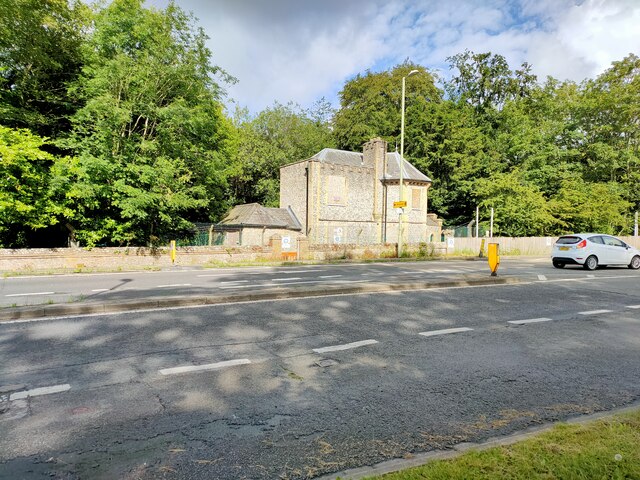
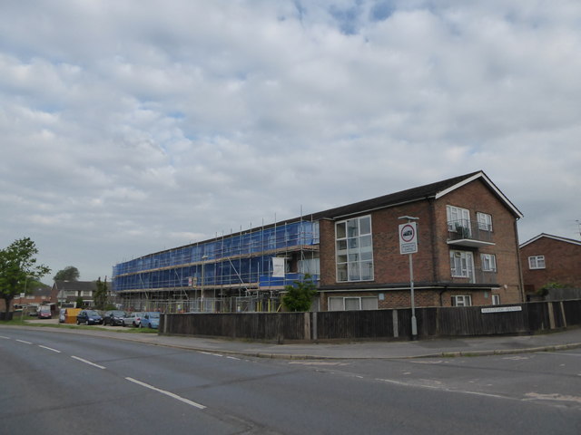
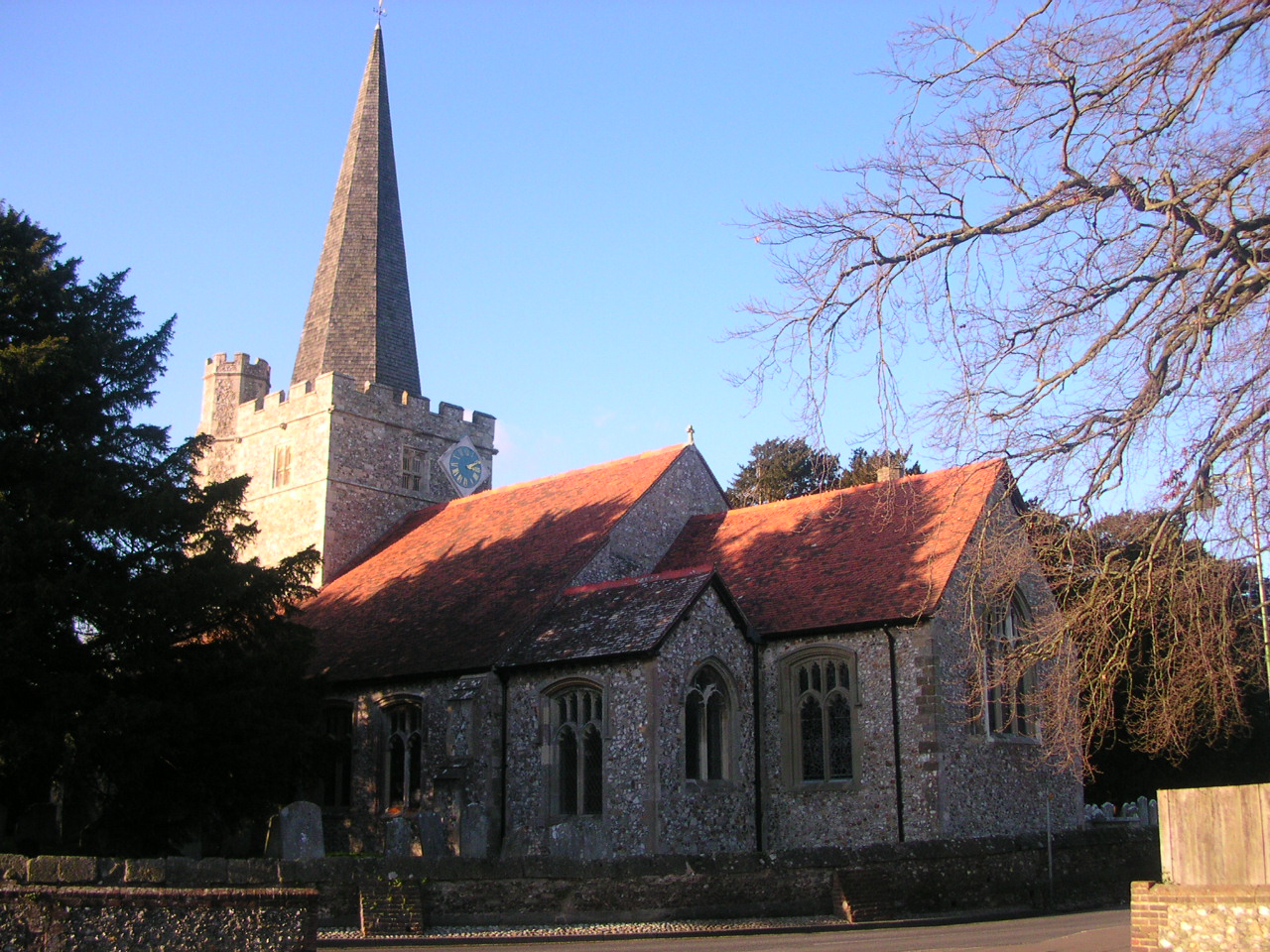
Blackbush Hanger Images

Images are sourced within 2km of 50.872295/-0.94530779 or Grid Reference SU7408. Thanks to Geograph Open Source API. All images are credited.

Path on Mill Lane Millstream by path on Mill Lane
Path on Mill Lane
Millstream by path on Mill Lane
Hollybank Woods
Hollybank Woods
Derelict House, Horndean Road
The Avenue at Stansted Park, looking towards Stansted House A 2.3 km forest ride straight from the door: this is landscape architecture on a very grand scale! The Monarch's Way long distance path passes along the left hand edge in this view.
The Avenue at Stansted Park, looking towards Stansted House
A 2.3 km forest ride straight from the door: this is landscape architecture on a very grand scale! The Monarch's Way long distance path passes along the left hand edge in this view.
The Avenue at Stansted Park, looking away from the house A 2.3km forest ride from the house towards Rowlands Castle.
The Avenue at Stansted Park, looking away from the house
A 2.3km forest ride from the house towards Rowlands Castle.
2016: a year on Geograph (Day 138) Scaffolding on Eileen Beard House
(at the junction of Bartons Road and Forestside Avenue)
2016: a year on Geograph (Day 138)
Scaffolding on Eileen Beard House (at the junction of Bartons Road and Forestside Avenue)
2016: a year on Geograph (Day 253) Contrasting homes in Wakefords Way. Mrs Thatcher would surely be proud to see how some owners gentrify their own home having bought it from the local authority!
2016: a year on Geograph (Day 253)
Contrasting homes in Wakefords Way. Mrs Thatcher would surely be proud to see how some owners gentrify their own home having bought it from the local authority!
WWII Hampshire: environs of Havant & Emsworth - Emsworth Common pillbox (5) -
Pillbox (variant): DoB ID: S0012781

Described on the national database as being of poor design and construction, it's L-shape in plan, and located in woodland at a crossroads between Horndean in the north, and Emsworth in the south. As can be seen, it is very overgrown and has been vandalised inside with paint. It might also be described as a half-section post, a classification that is not officially recognised I hasten to add! It is a design that is repeated in several similar structures in the area.

<a href="https://www.geograph.org.uk/photo/5342790">SU7308 : WWII Hampshire: environs of Havant & Emsworth - Emsworth Common pillbox (6)</a>
WWII Hampshire: environs of Havant & Emsworth - Emsworth Common pillbox (5)
- Pillbox (variant): DoB ID: S0012781 Described on the national database as being of poor design and construction, it's L-shape in plan, and located in woodland at a crossroads between Horndean in the north, and Emsworth in the south. As can be seen, it is very overgrown and has been vandalised inside with paint. It might also be described as a half-section post, a classification that is not officially recognised I hasten to add! It is a design that is repeated in several similar structures in the area. SU7308 : WWII Hampshire: environs of Havant & Emsworth - Emsworth Common pillbox (6)
WWII Hampshire: environs of Havant & Emsworth - Emsworth Common pillbox (6) -
Pillbox (variant): DoB ID: S0012781

A view which reveals the L-shaped interior.

<a href="https://www.geograph.org.uk/photo/5342802">SU7308 : WWII Hampshire: environs of Havant & Emsworth - Comley Hill area pillbox no. 1 (7)</a>
WWII Hampshire: environs of Havant & Emsworth - Emsworth Common pillbox (6)
- Pillbox (variant): DoB ID: S0012781 A view which reveals the L-shaped interior. SU7308 : WWII Hampshire: environs of Havant & Emsworth - Comley Hill area pillbox no. 1 (7)
WWII Hampshire: environs of Havant & Emsworth - Comley Hill area pillbox no. 1 (7) -
Pillbox (unclassified): DoB ID: S0012777

Somewhat ambiguously this is also classified as a pillbox/section post, presumably because it does bear some resemblance to a small section post or blockhouse. It is not L-shaped as described on the national database, but rectangular, with three south facing embrasures, and an entrance in the centre on the north side with loopholes at each end facing east and west. It is located  within private grounds that once overlooked open ground bounded by the railway, Prospect Lane, and the Emsworth - Horndean road. It is heavily overgrown.

<a href="https://www.geograph.org.uk/photo/5342819">SU7308 : WWII Hampshire: environs of Havant & Emsworth - Comley Hill area pillbox no. 1 (8)</a>
WWII Hampshire: environs of Havant & Emsworth - Comley Hill area pillbox no. 1 (7)
- Pillbox (unclassified): DoB ID: S0012777 Somewhat ambiguously this is also classified as a pillbox/section post, presumably because it does bear some resemblance to a small section post or blockhouse. It is not L-shaped as described on the national database, but rectangular, with three south facing embrasures, and an entrance in the centre on the north side with loopholes at each end facing east and west. It is located within private grounds that once overlooked open ground bounded by the railway, Prospect Lane, and the Emsworth - Horndean road. It is heavily overgrown. SU7308 : WWII Hampshire: environs of Havant & Emsworth - Comley Hill area pillbox no. 1 (8)
WWII Hampshire: environs of Havant & Emsworth - Comley Hill area pillbox no. 1 (8) -
Pillbox (unclassified): DoB ID: S0012777

Interior end-to-end view through the southeast facing loophole showing the rectangular shape of the pillbox. The entrance on the north side is in the centre on the right.

<a href="https://www.geograph.org.uk/photo/5343051">SU7309 : WWII Hampshire: environs of Havant & Emsworth - Comley Hill area pillbox no. 2 (9)</a>
WWII Hampshire: environs of Havant & Emsworth - Comley Hill area pillbox no. 1 (8)
- Pillbox (unclassified): DoB ID: S0012777 Interior end-to-end view through the southeast facing loophole showing the rectangular shape of the pillbox. The entrance on the north side is in the centre on the right. SU7309 : WWII Hampshire: environs of Havant & Emsworth - Comley Hill area pillbox no. 2 (9)
WWII Hampshire: environs of Havant & Emsworth - Comley Hill area pillbox no. 2 (9) -
Section Post: DoB ID: S0012780

A second pillbox, similar in construction to pillbox no 1 lies about 200 metres northeast overlooking the railway, close to the west side of the Emsworth - Horndean road. It has a companion (pillbox no. 3) on the other side of the road on the east side.

<a href="https://www.geograph.org.uk/photo/5343057">SU7309 : WWII Hampshire: environs of Havant & Emsworth - Comley Hill area pillbox no. 2 (10)</a>
WWII Hampshire: environs of Havant & Emsworth - Comley Hill area pillbox no. 2 (9)
- Section Post: DoB ID: S0012780 A second pillbox, similar in construction to pillbox no 1 lies about 200 metres northeast overlooking the railway, close to the west side of the Emsworth - Horndean road. It has a companion (pillbox no. 3) on the other side of the road on the east side. SU7309 : WWII Hampshire: environs of Havant & Emsworth - Comley Hill area pillbox no. 2 (10)
WWII Hampshire: environs of Havant & Emsworth - Comley Hill area pillbox no. 2 (10) -
Section Post: DoB ID: S0012780

This pillbox like others in the area, is similar to a straight section post, (albeit much smaller) being narrow and rectangular, with large loopholes along one side only, as well as loopholes at each end. The four main loops face southwest towards open ground.

<a href="https://www.geograph.org.uk/photo/5343073">SU7309 : WWII Hampshire: environs of Havant & Emsworth - Comley Hill area pillbox no. 2 (11)</a>
WWII Hampshire: environs of Havant & Emsworth - Comley Hill area pillbox no. 2 (10)
- Section Post: DoB ID: S0012780 This pillbox like others in the area, is similar to a straight section post, (albeit much smaller) being narrow and rectangular, with large loopholes along one side only, as well as loopholes at each end. The four main loops face southwest towards open ground. SU7309 : WWII Hampshire: environs of Havant & Emsworth - Comley Hill area pillbox no. 2 (11)
WWII Hampshire: environs of Havant & Emsworth - Comley Hill area pillbox no. 2 (11) -
Section Post: DoB ID: S0012780

Interior view from the west end embrasure looking towards the east end, with on the left, the entrance in the centre of the north side. Currently in use as a store. Note the 'V' (for Victory) over the swastika emblem high up on the back wall.


<a href="https://www.geograph.org.uk/photo/5343095">SU7309 : WWII Hampshire: environs of Havant & Emsworth - Comley Hill area pillbox no. 3 (12)</a>
WWII Hampshire: environs of Havant & Emsworth - Comley Hill area pillbox no. 2 (11)
- Section Post: DoB ID: S0012780 Interior view from the west end embrasure looking towards the east end, with on the left, the entrance in the centre of the north side. Currently in use as a store. Note the 'V' (for Victory) over the swastika emblem high up on the back wall. SU7309 : WWII Hampshire: environs of Havant & Emsworth - Comley Hill area pillbox no. 3 (12)
WWII Hampshire: environs of Havant & Emsworth - Comley Hill area pillbox no. 3 (12) -
Section Post: DoB ID: e41642

A section post that's now on the national database on the east side of the Emsworth - Horndean road, and literally a road width away from pillbox no. 2 on the other side. Almost identical in construction. it too has five embrasures that face south towards the railway. The view is of the blast wall protected entrance on the north side, looking south along the road towards the railway bridge.

<a href="https://www.geograph.org.uk/photo/5343121">SU7309 : WWII Hampshire: environs of Havant & Emsworth - Comley Hill area pillbox no. 3 (13)</a>
WWII Hampshire: environs of Havant & Emsworth - Comley Hill area pillbox no. 3 (12)
- Section Post: DoB ID: e41642 A section post that's now on the national database on the east side of the Emsworth - Horndean road, and literally a road width away from pillbox no. 2 on the other side. Almost identical in construction. it too has five embrasures that face south towards the railway. The view is of the blast wall protected entrance on the north side, looking south along the road towards the railway bridge. SU7309 : WWII Hampshire: environs of Havant & Emsworth - Comley Hill area pillbox no. 3 (13)
WWII Hampshire: environs of Havant & Emsworth - Comley Hill area pillbox no. 3 (13) -
Section Post: DoB ID: e41642

The entrance in the middle of the north side has steps leading down into the interior.

<a href="https://www.geograph.org.uk/photo/5343137">SU7309 : WWII Hampshire: environs of Havant & Emsworth - Comley Hill area pillbox no. 3 (14)</a>
WWII Hampshire: environs of Havant & Emsworth - Comley Hill area pillbox no. 3 (13)
- Section Post: DoB ID: e41642 The entrance in the middle of the north side has steps leading down into the interior. SU7309 : WWII Hampshire: environs of Havant & Emsworth - Comley Hill area pillbox no. 3 (14)
WWII Hampshire: environs of Havant & Emsworth - Comley Hill area pillbox no. 3 (14) -
Section Post: DoB ID: e41642

Interior view in the opposite direction.

START:- <a href="https://www.geograph.org.uk/photo/5341682">SU7506 : WWII Hampshire: environs of Havant & Emsworth -New Brighton section post (1)</a>
WWII Hampshire: environs of Havant & Emsworth - Comley Hill area pillbox no. 3 (14)
- Section Post: DoB ID: e41642 Interior view in the opposite direction. START:- SU7506 : WWII Hampshire: environs of Havant & Emsworth -New Brighton section post (1)
Shipwrights' Way 167 The bridleway continues south between fields and woodland.
Shipwrights' Way 167
The bridleway continues south between fields and woodland.
Show me another place!

Blackbush Hanger is located at Grid Ref: SU7408 (Lat: 50.872295, Lng: -0.94530779)

Administrative County: Hampshire

District: East Hampshire

Police Authority: Hampshire

What 3 Words

///famous.mute.divisions. Near Emsworth, Hampshire

Related Wikis

Hollybank House, Emsworth

Hollybank House near Emsworth in Hampshire, England, is a building of historical significance and is Grade II listed on the English Heritage Register....

Westbourne, West Sussex

Westbourne is a village, civil parish and electoral ward in the Chichester District of West Sussex, England. It is located 0.5 miles (0.80 km) north east...

Havant Academy

Havant Academy is a mixed secondary school located in the Leigh Park area of Havant in the English county of Hampshire. The school is situated at the edge...

St Alban's Church, West Leigh

St Alban's Church is a Church of England parish church situated in West Leigh, Hampshire, England. == History == The church in its original location in...

Clanfield F.C. (Hampshire)

Clanfield Football Club are a football club based in Havant, England. They play in the Wessex League Division One. The club is affiliated to the Hampshire...

Portsmouth F.C. Women

Portsmouth Women, formerly known as "Portsmouth Ladies", is a semi professional women's football club for the south coast city of Portsmouth in Hampshire...

Havant & Waterlooville F.C.

Havant & Waterlooville Football Club is a professional football club based in Havant, Hampshire, England. The club participates in the National League...

Portsmouth F.C. Reserves and Academy

Portsmouth F.C. XI and Academy consist of the reserve and academy footballers of Portsmouth F.C. == Portsmouth XI == Previously called Portsmouth Reserves...

Nearby Amenities

Located within 500m of 50.872295,-0.94530779
Bench
Backrest: yes
Check Date: 2021-09-01
Lat/Long: 50.8691814/-0.9435983
Bench
Backrest: yes
Check Date: 2021-09-01
Lat/Long: 50.8711237/-0.9415696
Remains of WW2 D-Day camp cinema
Historic: archaeological_site
Lat/Long: 50.8701686/-0.9427091
Ford: yes
Lat/Long: 50.8719242/-0.9382498
The data included in this document is from www.openstreetmap.org. The data is made available under ODbL.

Have you been to Blackbush Hanger?

Leave your review of Blackbush Hanger below (or comments, questions and feedback).