Ashill

Settlement in Devon Mid Devon

England

Ashill

Craddock : Craddock Cleve A similar photo as seen in <a href="https://www.geograph.org.uk/photo/3032732">ST0812 : Craddock : Craddock Cleve</a> and <a href="https://www.geograph.org.uk/photo/5452816">ST0812 : Craddock : Craddock Cleve</a> and <a href="https://www.geograph.org.uk/photo/4840657">ST0812 : Craddock Cleve</a>.
Craddock : Craddock Cleve Credit: Lewis Clarke

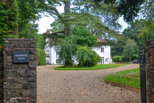
Ashill is a small village located in the county of Devon, England. Situated in the Blackdown Hills Area of Outstanding Natural Beauty, it lies approximately 10 miles southwest of the town of Taunton and 25 miles northeast of the city of Exeter. The village is nestled amidst picturesque countryside, offering breathtaking views and a tranquil atmosphere.

Ashill has a long history, with evidence of human settlement dating back to prehistoric times. The village is mentioned in the Domesday Book of 1086, highlighting its significance in medieval times. Today, Ashill retains its traditional charm with a mixture of old and new buildings, including thatched cottages and modern houses.

Although small, the village boasts a vibrant community with various amenities. It has a primary school, which serves the local children, and a parish church, St. James the Great, which dates back to the 13th century. Additionally, there is a village hall that hosts a range of events and activities for residents to enjoy.

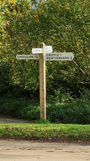
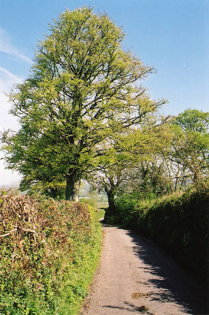
The surrounding countryside offers ample opportunities for outdoor pursuits, including walking, cycling, and horse riding. The Blackdown Hills are renowned for their natural beauty, with rolling hills, woodlands, and diverse wildlife. Ashill is also conveniently located near the A303 road, providing easy access to nearby towns and attractions.

Overall, Ashill is a charming village that offers a peaceful and idyllic setting, ideal for those seeking a rural retreat in the heart of Devon.

If you have any feedback on the listing, please let us know in the comments section below.
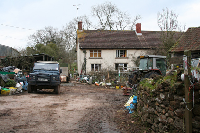
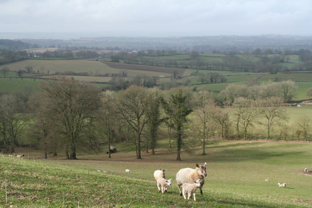
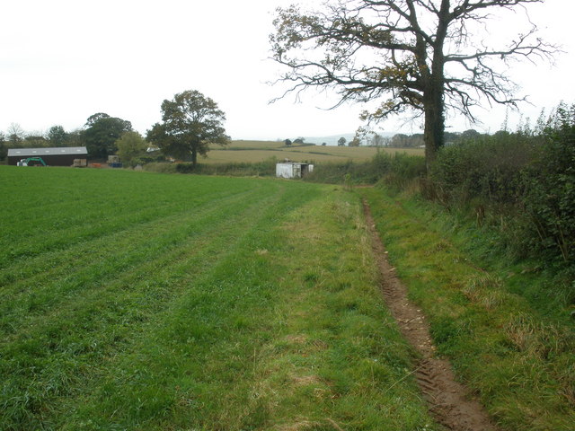
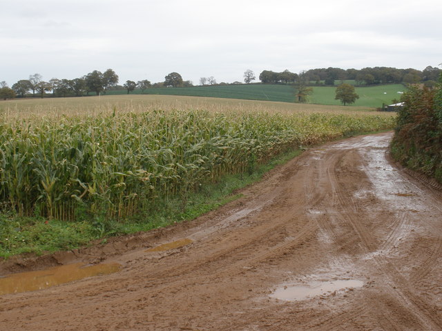
Ashill Images

Images are sourced within 2km of 50.894076/-3.29816 or Grid Reference ST0811. Thanks to Geograph Open Source API. All images are credited.

Tiverton RDC Fingerpost near Ashill One of a very small number of surviving fingerposts with Tiverton Rural District Council halo.

Milestone Society National ID: DV_ST0911
Tiverton RDC Fingerpost near Ashill
One of a very small number of surviving fingerposts with Tiverton Rural District Council halo. Milestone Society National ID: DV_ST0911
Direction Sign - Signpost west of Ashill Located on a grass triangle in the centre of the crossroads at Glen Cottage, west of Ashill. 4 arms but no finial. This replaced an older fingerpost by December 2021, see <a title="https://www.geograph.org.uk/photo/" href="https://www.geograph.org.uk/photo/">Link</a> 6102525.

Milestone Society National ID: DV_ST0711
Direction Sign - Signpost west of Ashill
Located on a grass triangle in the centre of the crossroads at Glen Cottage, west of Ashill. 4 arms but no finial. This replaced an older fingerpost by December 2021, see Link 6102525. Milestone Society National ID: DV_ST0711
Craddock : Craddock Cleve Photo taken from the public highway showing the large tree outside Craddock Cleve.
Craddock : Craddock Cleve
Photo taken from the public highway showing the large tree outside Craddock Cleve.
Uffculme : Cemetery A cemetery in Uffculme.
Uffculme : Cemetery
A cemetery in Uffculme.
Uffculme : Cemetery A cemetery in Uffculme.
Uffculme : Cemetery
A cemetery in Uffculme.
Uffculme: near Foxhill Cross View south to Blackborough
Uffculme: near Foxhill Cross
View south to Blackborough
Uffculme: edge of wood On Hackpen Hill, looking east
Uffculme: edge of wood
On Hackpen Hill, looking east
Uffculme: meadows near Lower Bodmiscombe Looking east
Uffculme: meadows near Lower Bodmiscombe
Looking east
Kentisbeare: north from Blackborough Looking north on the lane to Ashill
Kentisbeare: north from Blackborough
Looking north on the lane to Ashill
Kentisbeare: Blackborough House This mansion has seen better days. It was built in the Italianate style for the fourth and last Earl of Egremont, a member of the Wyndham family, in 1838-40, but was never entirely finished. The Grade II Listed house was on the market for £1,000,000 in 2003, with sixty rooms. The fourth earl also had a large mansion built at Silverton which has since been demolished. For some years now Blackborough House has been surrounded by a scrapyard, presently run by Blackborough Motor Salvage
Kentisbeare: Blackborough House
This mansion has seen better days. It was built in the Italianate style for the fourth and last Earl of Egremont, a member of the Wyndham family, in 1838-40, but was never entirely finished. The Grade II Listed house was on the market for £1,000,000 in 2003, with sixty rooms. The fourth earl also had a large mansion built at Silverton which has since been demolished. For some years now Blackborough House has been surrounded by a scrapyard, presently run by Blackborough Motor Salvage
Kentisbeare: Sandfield Farm A public footpath starts here and runs north through the yard to Ashill Moor
Kentisbeare: Sandfield Farm
A public footpath starts here and runs north through the yard to Ashill Moor
Kentisbeare: near Blackborough House Looking west from a public footpath
Kentisbeare: near Blackborough House
Looking west from a public footpath
Birchen Tree Cross
Birchen Tree Cross
Highwood's Farm
Highwood's Farm
Maize crop, Highwood's Farm
Stately oak tree
Stately oak tree
Road to Mortimers Farm
Show me another place!

Ashill is located at Grid Ref: ST0811 (Lat: 50.894076, Lng: -3.29816)

Administrative County: Devon

District: Mid Devon

Police Authority: Devon and Cornwall

What 3 Words

///logic.triangles.dolphins. Near Uffculme, Devon

Nearby Locations

Ashill

Related Wikis

Ashill, Devon

Ashill is a village located in the parish of Uffculme, in the English county of Devon. It has a small church, a community village hall and small public...
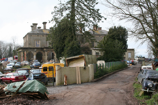
Blackborough House

Blackborough House is a grade II listed privately owned country house in Blackborough, Devon, three miles (5 km) east of Cullompton. It was built in 1838...

Uffculme railway station

Uffculme railway station was the station closest to the centre of the Culm Valley Light Railway in Devon and as such contained the passing loop. The line...

Church of St Mary the Virgin, Uffculme

The Church of St Mary the Virgin is the main Church of England parish church for the village of Uffculme, Devon, England. First mentioned in a charter...

Uffculme

Uffculme (, UF-kəm) is a village and civil parish located in the Mid Devon district, of Devon, England. Situated in the Blackdown Hills on the B3440, close...

Bodmiscombe Preceptory

Bodmiscombe Preceptory was a priory in Devon, England. It was run by the Knights Hospitaller and was possibly founded during the reign on Henry III and...

Blackborough, Devon

Blackborough is a hamlet and former manor in the parish of Kentisbeare, Devon, England. It is situated within the Mid Devon district. The nearest substantial...

Coldharbour Halt railway station

Coldharbour Halt railway station was a small station from 1929 to 1963 on the Culm Valley Light Railway. == History == The station was opened on 23 February...

Nearby Amenities

Located within 500m of 50.894076,-3.29816
Ashill
Place: village
Lat/Long: 50.8942958/-3.2971508
Pub
Ashill Inn
Addr City: Cullompton
Addr Postcode: EX15 3NL
Addr Street: Main Road
Fhrs Id: 8318
Source Addr: FHRS Open Data
Wikidata: Q26400341
Lat/Long: 50.8942542/-3.2992306
Post Box
Operator: Royal Mail
Post Box Type: lamp
Ref: EX15 377D
Royal Cypher: EIIR
Royal Cypher Wikidata: Q33102113
Lat/Long: 50.8946813/-3.2981438
Generator Method: photovoltaic
Generator Output Electricity: yes
Generator Source: solar
Generator Type: solar_photovoltaic_panel
Location: roof
Power: generator
Lat/Long: 50.8944895/-3.2964274
Generator Method: photovoltaic
Generator Output Electricity: yes
Generator Source: solar
Generator Type: solar_photovoltaic_panel
Location: roof
Power: generator
Lat/Long: 50.8950357/-3.300419
Generator Method: photovoltaic
Generator Output Electricity: yes
Generator Source: solar
Generator Type: solar_photovoltaic_panel
Location: roof
Power: generator
Lat/Long: 50.8935171/-3.2974221
Generator Method: photovoltaic
Generator Output Electricity: yes
Generator Source: solar
Generator Type: solar_photovoltaic_panel
Location: roof
Power: generator
Lat/Long: 50.8922441/-3.2994725
Generator Method: photovoltaic
Generator Output Electricity: yes
Generator Source: solar
Generator Type: solar_photovoltaic_panel
Location: roof
Power: generator
Lat/Long: 50.8922754/-3.2995704
Generator Method: photovoltaic
Generator Output Electricity: yes
Generator Source: solar
Generator Type: solar_photovoltaic_panel
Location: roof
Power: generator
Lat/Long: 50.8922162/-3.29962
Generator Method: photovoltaic
Generator Output Electricity: yes
Generator Source: solar
Generator Type: solar_photovoltaic_panel
Location: roof
Power: generator
Lat/Long: 50.8921908/-3.2995449
Poles: bipole
Power: pole
Source: bing
Transformer: distribution
Lat/Long: 50.8913837/-3.3026227
Power: pole
Source: bing
Lat/Long: 50.8917949/-3.3039585
Power: pole
Source: bing
Lat/Long: 50.8923447/-3.3041757
Power: pole
Source: bing
Lat/Long: 50.8927914/-3.3043608
Power: pole
Source: bing
Lat/Long: 50.8934986/-3.3046612
Power: pole
Source: bing
Lat/Long: 50.8955905/-3.3015619
Power: pole
Source: bing
Transformer: distribution
Lat/Long: 50.8964964/-3.3034328
Power: pole
Source: bing
Lat/Long: 50.8960075/-3.3024296
Power: pole
Source: bing
Lat/Long: 50.8953926/-3.3004193
Poles: bipole
Power: pole
Source: bing
Transformer: distribution
Lat/Long: 50.8951726/-3.2992391
Power: pole
Source: bing
Lat/Long: 50.8956743/-3.2987309
Power: pole
Source: bing
Lat/Long: 50.8955609/-3.2967836
Power: pole
Source: bing
Lat/Long: 50.8953579/-3.2954747
Power: pole
Source: bing
Lat/Long: 50.8952192/-3.29445
Power: pole
Source: bing
Lat/Long: 50.8950331/-3.2932135
Power: pole
Source: bing
Lat/Long: 50.8948436/-3.2919073
Power: pole
Source: bing
Lat/Long: 50.8957538/-3.2982212
The data included in this document is from www.openstreetmap.org. The data is made available under ODbL.

Have you been to Ashill?

Leave your review of Ashill below (or comments, questions and feedback).