Brieryfield Plantation

Wood, Forest in Oxfordshire South Oxfordshire

England

Brieryfield Plantation

Elegant beech tree, Christmas Common, Oxfordshire
Elegant beech tree, Christmas Common, Oxfordshire Credit: Oswald Bertram

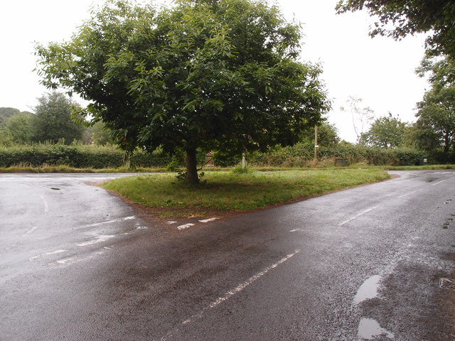
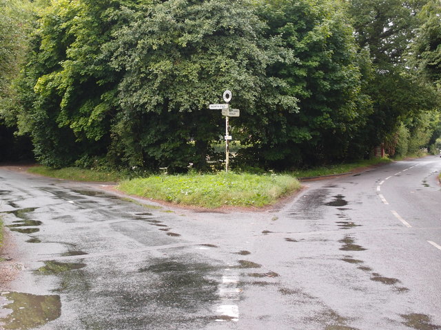
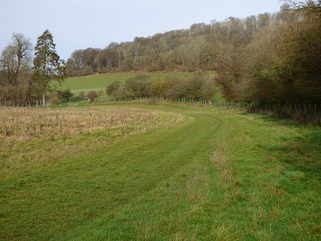
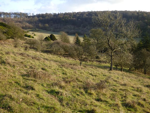
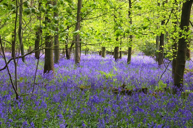
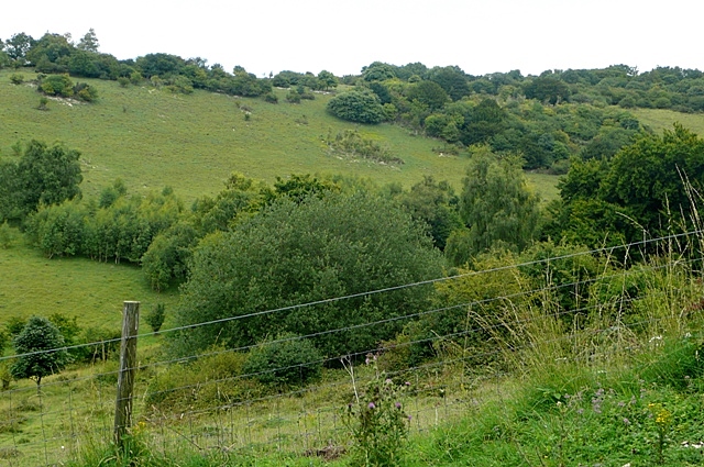
Brieryfield Plantation is a charming woodland area located in the beautiful county of Oxfordshire, England. Situated near the village of Wood, this plantation is a haven for nature enthusiasts and outdoor adventurers alike. With its lush greenery and diverse range of tree species, it offers a serene and tranquil escape from the hustle and bustle of city life.

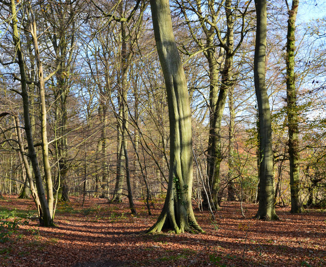
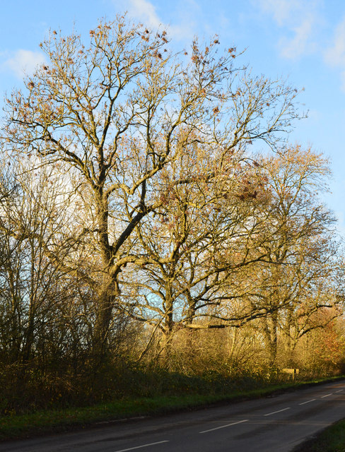
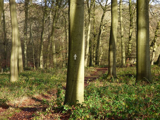
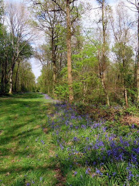
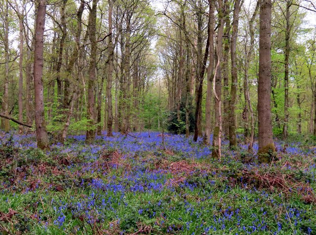
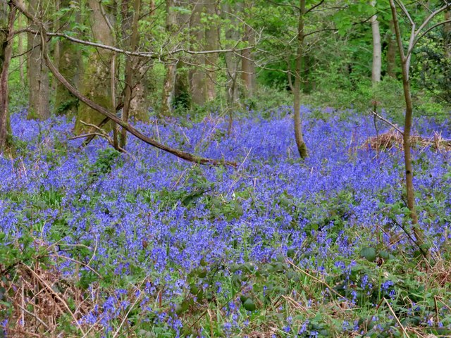
Covering an area of approximately 100 acres, Brieryfield Plantation is predominantly composed of deciduous trees such as oak, beech, and birch. These majestic trees provide a picturesque setting and create a vibrant canopy overhead, especially during the spring and summer months when the foliage is in full bloom.

The plantation is home to a variety of wildlife, serving as a natural habitat for numerous bird species, small mammals, and insects. Birdwatchers often flock to this area to catch glimpses of rare species like the Eurasian nuthatch, green woodpecker, and tawny owl. Additionally, the plantation's diverse ecosystem supports a rich variety of plant life, including wildflowers, ferns, and mosses.

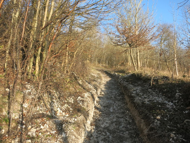
For those looking to explore the plantation, there are several well-maintained walking trails that wind their way through the woodland. These trails offer an opportunity to immerse oneself in the peaceful surroundings while enjoying the fresh air and the soothing sounds of nature.

Overall, Brieryfield Plantation in Oxfordshire is a delightful destination for nature lovers and provides an idyllic retreat for individuals seeking solace in the midst of nature's beauty.

If you have any feedback on the listing, please let us know in the comments section below.

Brieryfield Plantation Images

Images are sourced within 2km of 51.641464/-0.9489509 or Grid Reference SU7294. Thanks to Geograph Open Source API. All images are credited.

Elegant beech tree, Christmas Common, Oxfordshire
November sunshine, Christmas Common, Oxfordshire
Winter's afternoon, Christmas Common, Oxfordshire
Working on the Chiltern Way The Chiltern Way is a well used path and this is a particularly steep and muddy section just here.
The path has been excavated and at a guess there are going to be steps made.
Working on the Chiltern Way
The Chiltern Way is a well used path and this is a particularly steep and muddy section just here. The path has been excavated and at a guess there are going to be steps made.
Road junction and grass triangle Adjacent to Christmas Common.
Road junction and grass triangle
Adjacent to Christmas Common.
Road junction and grass triangle Near to Christmas Common.
Road junction and grass triangle
Near to Christmas Common.
Information Board at Watlington Hill This information board has been erected by The National Trust in its car park at the east end of Watlington Hill, its postcode being OX49 5HS. It shows a plan of the hill and has the following wording:
  
  On the left of the board
    Making a mark
  Once the local farmers stopped grazing their sheep on Watlington Hill it became overgrown with scrub. It wasn't a pleasant place for walkers and it wasn't a good place for butterflies. Now the National Trust is making a mark on the landscape. It's restoring the hill to a mosaic of chalk grassland and scrub.
  It is a great place to see Chalkhill Blue and Silver-Spotted Skipper butterflies, as well as the majestic Red Kites.
   The National Trust is grateful for funding received for this project from Natural England, Chilterns Conservation Board and Oxfordshire County Council.

   Below the plan
   The White Mark
  Edward Horner, a local squire, thought that the church which he could see from his home would look more impressive if it had a steeple. He had the huge white mark cut into the hillside to achieve this by way of an optical illusion. That's one story, anyway. There may be other explanations....

    On the right of the board
 Please help us to keep the hill unspoilt for everyone to enjoy - take your litter or dog waste home with you.

   The images show from left to right: Silver-Spotted Skipper butterfly, View of Watlington Hill in 1907, and the White Mark with the Parish Church of Saint Leonard in the foreground.
Information Board at Watlington Hill
This information board has been erected by The National Trust in its car park at the east end of Watlington Hill, its postcode being OX49 5HS. It shows a plan of the hill and has the following wording: On the left of the board Making a mark Once the local farmers stopped grazing their sheep on Watlington Hill it became overgrown with scrub. It wasn't a pleasant place for walkers and it wasn't a good place for butterflies. Now the National Trust is making a mark on the landscape. It's restoring the hill to a mosaic of chalk grassland and scrub. It is a great place to see Chalkhill Blue and Silver-Spotted Skipper butterflies, as well as the majestic Red Kites. The National Trust is grateful for funding received for this project from Natural England, Chilterns Conservation Board and Oxfordshire County Council. Below the plan The White Mark Edward Horner, a local squire, thought that the church which he could see from his home would look more impressive if it had a steeple. He had the huge white mark cut into the hillside to achieve this by way of an optical illusion. That's one story, anyway. There may be other explanations.... On the right of the board Please help us to keep the hill unspoilt for everyone to enjoy - take your litter or dog waste home with you. The images show from left to right: Silver-Spotted Skipper butterfly, View of Watlington Hill in 1907, and the White Mark with the Parish Church of Saint Leonard in the foreground.
Woodland, Shirburn The Chiltern Way amidst beeches in the lower part of Blackmoor Wood on the Wormsley Estate.
Woodland, Shirburn
The Chiltern Way amidst beeches in the lower part of Blackmoor Wood on the Wormsley Estate.
Pasture and woodland, Stokenchurch A bridleway running along a dry valley in the heart of the Wormsley Estate.
Pasture and woodland, Stokenchurch
A bridleway running along a dry valley in the heart of the Wormsley Estate.
Pastoral and wooded countryside, Lewknor On the bridleway climbing from Lower Vicar's Farm to Upper Vicar's Farm on the Wormsley Estate.
Pastoral and wooded countryside, Lewknor
On the bridleway climbing from Lower Vicar's Farm to Upper Vicar's Farm on the Wormsley Estate.
Pasture, Lewknor Sheep in a scrubby area on the southern flank of Bald Hill within the Aston Rowant National Nature Reserve.
Pasture, Lewknor
Sheep in a scrubby area on the southern flank of Bald Hill within the Aston Rowant National Nature Reserve.
Barn at Portobello Farm, Shirburn A muddy farmyard with cattle ensconced for the winter.
Barn at Portobello Farm, Shirburn
A muddy farmyard with cattle ensconced for the winter.
Shirburn Hill, Shirburn The somewhat scrubby grassland has a few larger trees including a stand of conifers to the right of picture and large areas of what appears to be box or privet to the left.
Shirburn Hill, Shirburn
The somewhat scrubby grassland has a few larger trees including a stand of conifers to the right of picture and large areas of what appears to be box or privet to the left.
Old Direction Sign - Signpost by Christmas Common, Watlington parish Annulus finial - 2 arms; Oxford CC halo by the UC road, in parish of Watlington (South Oxfordshire District), Christmas Common, Y-junction of Nettlebed Henley with Hollandridge Lane, on grass triangle.

Surveyed

Milestone Society National ID: OX_SU7193
Old Direction Sign - Signpost by Christmas Common, Watlington parish
Annulus finial - 2 arms; Oxford CC halo by the UC road, in parish of Watlington (South Oxfordshire District), Christmas Common, Y-junction of Nettlebed Henley with Hollandridge Lane, on grass triangle. Surveyed Milestone Society National ID: OX_SU7193
A bluebell lined ride in Cowleaze Wood
Bluebells in Cowleaze Wood The Forestry Commission owns Coweleaze Wood, and planted it between 1957 and 1966.
Bluebells in Cowleaze Wood
The Forestry Commission owns Coweleaze Wood, and planted it between 1957 and 1966.
Bluebells in Cowleaze Wood The Forestry Commission owns Coweleaze Wood, and planted it between 1957 and 1966.
Bluebells in Cowleaze Wood
The Forestry Commission owns Coweleaze Wood, and planted it between 1957 and 1966.
Bluebells in Cowleaze Wood The Forestry Commission owns Coweleaze Wood, and planted it between 1957 and 1966.
Bluebells in Cowleaze Wood
The Forestry Commission owns Coweleaze Wood, and planted it between 1957 and 1966.
Show me another place!

Brieryfield Plantation is located at Grid Ref: SU7294 (Lat: 51.641464, Lng: -0.9489509)

Administrative County: Oxfordshire

District: South Oxfordshire

Police Authority: Thames Valley

What 3 Words

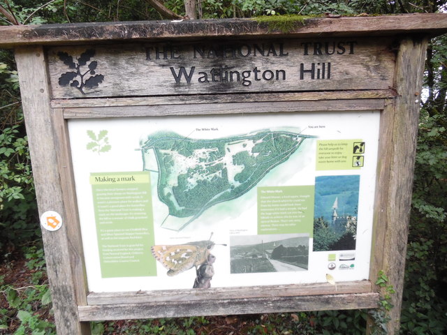
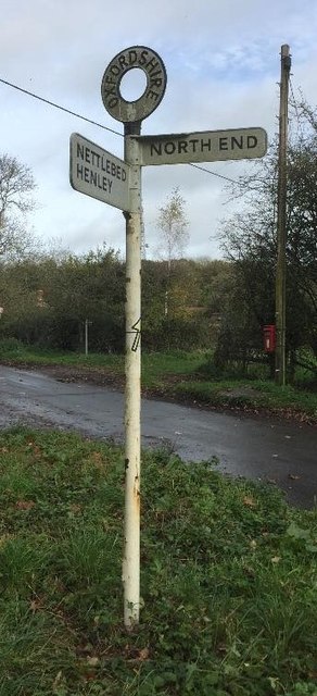
///bucket.motor.buggy. Near Watlington, Oxfordshire

Related Wikis

Wormsley Park

Wormsley is a private estate of Mark Getty and his family, set in 2,700-acre (1,100 ha) of rolling countryside in the Chiltern Hills of Buckinghamshire...

Garsington Opera

Garsington Opera is an annual summer opera festival founded in 1989 by Leonard Ingrams. The Philharmonia Orchestra and The English Concert are its two...

Cowleaze Wood

Cowleaze Wood is a 70-acre (28 ha) woodland in the Chiltern Hills, a chalk ridge in South East England. The wood is in the civil parish of Lewknor, in...

Christmas Common

Christmas Common is a hamlet in Watlington civil parish, Oxfordshire about 7+1⁄2 miles (12 km) south of Thame in Oxfordshire, close to the boundary with...

Wormsley Chalk Banks

Wormsley Chalk Banks are six separate areas which together are a 14.1-hectare (35-acre) biological Site of Special Scientific Interest near Turville in...

Northend, Buckinghamshire

Northend is a village that straddles the border of the two English counties of Buckinghamshire and Oxfordshire. The eastern half is in the civil parish...

Shirburn Hill

Shirburn Hill is a 63.7-hectare (157-acre) biological Site of Special Scientific Interest just outside and to the northeast of Watlington, Oxfordshire...

Watlington and Pyrton Hills

Watlington and Pyrton Hills is a 112.7-hectare (278-acre) biological Site of Special Scientific Interest east of Watlington in Oxfordshire. An area of...

Have you been to Brieryfield Plantation?

Leave your review of Brieryfield Plantation below (or comments, questions and feedback).