Freedom Wood

Wood, Forest in Oxfordshire South Oxfordshire

England

Freedom Wood

Path through the woods Path leading through the woodland near Nettlebed.
Path through the woods Credit: Bill Nicholls

Freedom Wood is a picturesque forest located in Oxfordshire, England. Covering an area of approximately 100 acres, it is a haven for nature enthusiasts and outdoor lovers alike. The wood is situated in the heart of the county, just a short distance from the historic city of Oxford.

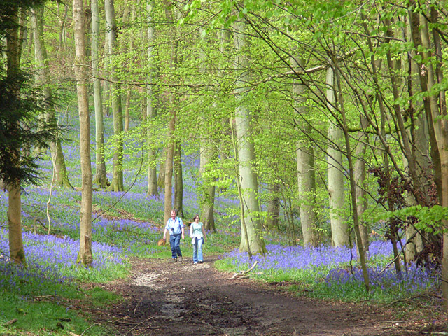
The wood is primarily composed of native broadleaf trees, including oak, beech, and birch. These majestic trees provide a dense canopy, creating a serene and tranquil atmosphere within the forest. Visitors can enjoy peaceful walks along well-maintained trails that wind through the wood, offering breathtaking views of the surrounding landscape.

Freedom Wood is home to a diverse array of wildlife, including deer, foxes, and various bird species. The forest provides a vital habitat for these animals, and birdwatchers will delight in spotting rare and migratory species throughout the year.

In addition to its natural beauty, the wood also offers various recreational activities. There are designated picnic areas and open spaces where families and friends can gather for leisurely outings. Moreover, the wood is equipped with several well-kept playgrounds, making it an ideal destination for families with children.

Freedom Wood is easily accessible, with ample parking available for visitors. It is open year-round, allowing people to enjoy its beauty in every season. Whether one seeks solitude amidst nature or a place for outdoor adventures, Freedom Wood in Oxfordshire offers a truly captivating experience.

If you have any feedback on the listing, please let us know in the comments section below.
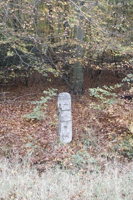
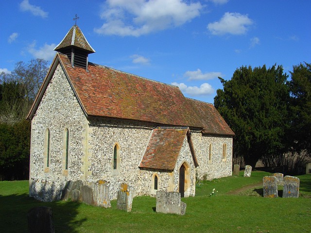
Freedom Wood Images

Images are sourced within 2km of 51.581562/-0.95808341 or Grid Reference SU7287. Thanks to Geograph Open Source API. All images are credited.

Path through the woods Path leading through the woodland near Nettlebed.
Path through the woods
Path leading through the woodland near Nettlebed.
Slab by the path I came here to see if there were any remaining signs of an old prisoner of war camp that used to be round here near Nettlebed. There are signs like this concrete slab though it is hard to say what it was off.
Slab by the path
I came here to see if there were any remaining signs of an old prisoner of war camp that used to be round here near Nettlebed. There are signs like this concrete slab though it is hard to say what it was off.
Hole near the path More signs something was built here as this hole is an old manhole.
Hole near the path
More signs something was built here as this hole is an old manhole.
Manhole in the wood I'd been looking for signs of an old prisoner of war camp in the woodland by Nettlebed.  This looks as if there was something here at one time - not every day you see an old manhole in a wood. <a href="https://www.geograph.org.uk/photo/2490595">SU7086 : Hole near the path</a>
Manhole in the wood
I'd been looking for signs of an old prisoner of war camp in the woodland by Nettlebed. This looks as if there was something here at one time - not every day you see an old manhole in a wood. SU7086 : Hole near the path
Woodland path Further along the path through the woodland near Nettlebed.
Woodland path
Further along the path through the woodland near Nettlebed.
Lumps in the wood The ground looked unusually lumpy just off the footpath and on closer inspection it turned out to be rubble.  Was this the demolished prisoner of war camp that was near Nettlebed?
Lumps in the wood
The ground looked unusually lumpy just off the footpath and on closer inspection it turned out to be rubble. Was this the demolished prisoner of war camp that was near Nettlebed?
Path towards the road View back along the path through the woodland near Nettlebed with the concrete slab beside the path.
Path towards the road
View back along the path through the woodland near Nettlebed with the concrete slab beside the path.
Mound near the road A mound of what looks like debris beside the road leading from Nettlebed
Mound near the road
A mound of what looks like debris beside the road leading from Nettlebed
Mound by the road I thought it was a mound but on closer inspection it turns out to be an old building which has been demolished. The lower walls are still in place.
Mound by the road
I thought it was a mound but on closer inspection it turns out to be an old building which has been demolished. The lower walls are still in place.
Inside the building This shot is to show the inside of the old building, if you go to either side and look you can see brickwork. I wonder if this was part of the prisoner of war camp that was here.
Inside the building
This shot is to show the inside of the old building, if you go to either side and look you can see brickwork. I wonder if this was part of the prisoner of war camp that was here.
Road to Crocker End The road through the woods which will take you to Crocker End.
Road to Crocker End
The road through the woods which will take you to Crocker End.
Building in the wood An old building in the woods near Nettlebed
Building in the wood
An old building in the woods near Nettlebed
Doors on the building I came here looking for a prisoner of war camp; was this part of it?  It looks as if it could have held military transport - couldn't tell you what it is used for now, though.
Doors on the building
I came here looking for a prisoner of war camp; was this part of it? It looks as if it could have held military transport - couldn't tell you what it is used for now, though.
Clearing near the building This area is concrete where the leaves have fallen and caused a layer over the top. Was it a staging area and building here once?
Clearing near the building
This area is concrete where the leaves have fallen and caused a layer over the top. Was it a staging area and building here once?
Building on the end This is on the end of the large building and looks as if it might have been a generator shed; there are insulators on the wall inside that look wartime so it could have been for the prisoner of war camp round here.
Building on the end
This is on the end of the large building and looks as if it might have been a generator shed; there are insulators on the wall inside that look wartime so it could have been for the prisoner of war camp round here.
View of the back View of the back of the old building which may have been for transport, the windows have been bricked up at some time.
View of the back
View of the back of the old building which may have been for transport, the windows have been bricked up at some time.
Hidden by the road View along the A4130 where over to the right is a milestone off the road.
Hidden by the road
View along the A4130 where over to the right is a milestone off the road.
Milestone off the road This was a hard one to spot as it is  below the road level. It looks eroded where the places and miles should be but the reason for this was because they were removed in World War two. It should say Henley 4, London 39 and Oxford 19.
Milestone off the road
This was a hard one to spot as it is below the road level. It looks eroded where the places and miles should be but the reason for this was because they were removed in World War two. It should say Henley 4, London 39 and Oxford 19.
Show me another place!

Freedom Wood is located at Grid Ref: SU7287 (Lat: 51.581562, Lng: -0.95808341)

Administrative County: Oxfordshire

District: South Oxfordshire

Police Authority: Thames Valley

What 3 Words

///jousting.soda.scar. Near Remenham, Berkshire

Nearby Locations

Freedom Wood

Related Wikis

Maidensgrove

Maidensgrove is a hamlet above the Stonor valley in the Chiltern Hills, adjacent to Russell's Water common. It is about 5 miles (8.0 km) northwest of...

Bix Bottom

Bix Bottom is a 102.3-hectare (253-acre) biological Site of Special Scientific Interest north-west of Henley-on-Thames in Oxfordshire. It is owned and...

Crocker End House

Crocker End House in Nettlebed in Henley-on-Thames, Oxfordshire, England is a spacious Victorian home built to replace Nettlebed's prosperous rectory in...

Berrick Trench

Berrick Trench is a 2.1-hectare (5.2-acre) biological Site of Special Scientific Interest north of Nettlebed in Oxfordshire.This is an ancient semi-natural...

Pishill with Stonor

Pishill with Stonor is a civil parish in the high Chilterns, South Oxfordshire. It includes the villages of Pishill (Ordnance Survey grid reference SU727899...

Pishill

Pishill is a village and former civil parish, now in the parish of Pishill with Stonor, in the South Oxfordshire district, in the county of Oxfordshire...

Bix, Oxfordshire

Bix is a village in the civil parish of Bix and Assendon in South Oxfordshire, about 2.5 miles (4 km) northwest of Henley-on-Thames. The village is about...

Nettlebed

Nettlebed is a village and civil parish in Oxfordshire in the Chiltern Hills about 4+1⁄2 miles (7 km) northwest of Henley-on-Thames and 6 miles (10 km...

Nearby Amenities

Located within 500m of 51.581562,-0.95808341
Barrier: kissing_gate
Foot: yes
Lat/Long: 51.5848133/-0.961361
The data included in this document is from www.openstreetmap.org. The data is made available under ODbL.

Have you been to Freedom Wood?

Leave your review of Freedom Wood below (or comments, questions and feedback).