Combe, East

Settlement in Somerset Somerset West and Taunton

England

Combe, East

Bishop’s Lydeard: St Mary’s Church The impressive four-stage Somerset tower with set-back buttresses dates from the 15th century. The churchyard contains the stumps of two medieval crosses; the church is noted for its rood screen and carved 16th century bench ends
Bishop’s Lydeard: St Mary’s Church Credit: Martin Bodman

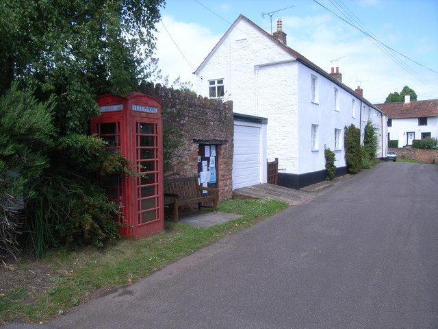
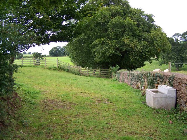
Combe is a small village located in East Somerset, England. Nestled in the picturesque countryside, it is situated in the Mendip Hills Area of Outstanding Natural Beauty. Combe is surrounded by rolling green hills, meandering streams, and charming woodland, making it an ideal destination for nature lovers and those seeking tranquility.

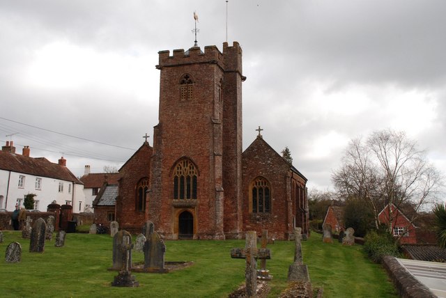
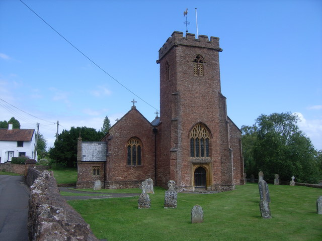
The village itself is quaint and peaceful, with a population of around 300 residents. It features a beautiful medieval church, St. Michael's Church, which dates back to the 13th century and is known for its stunning architecture and intricate stained glass windows.

Combe has a strong sense of community, with various local events and activities taking place throughout the year. The village hall serves as a gathering place for social events, meetings, and clubs. The local pub, The Combe Inn, is a popular spot for residents and visitors alike, offering a warm and friendly atmosphere.

Surrounding Combe are several walking and cycling trails, providing opportunities to explore the stunning countryside and enjoy panoramic views of the Somerset landscape. The nearby Mendip Hills offer even more outdoor activities, such as hiking, rock climbing, and caving.

Despite its rural setting, Combe is conveniently located close to major towns and cities. The historic city of Bath is just a short drive away, offering a range of amenities including shopping, dining, and cultural attractions.

In summary, Combe is a charming village in East Somerset, boasting natural beauty, a strong community spirit, and easy access to both rural and urban amenities. It is a hidden gem for those seeking a peaceful and idyllic countryside retreat.

If you have any feedback on the listing, please let us know in the comments section below.
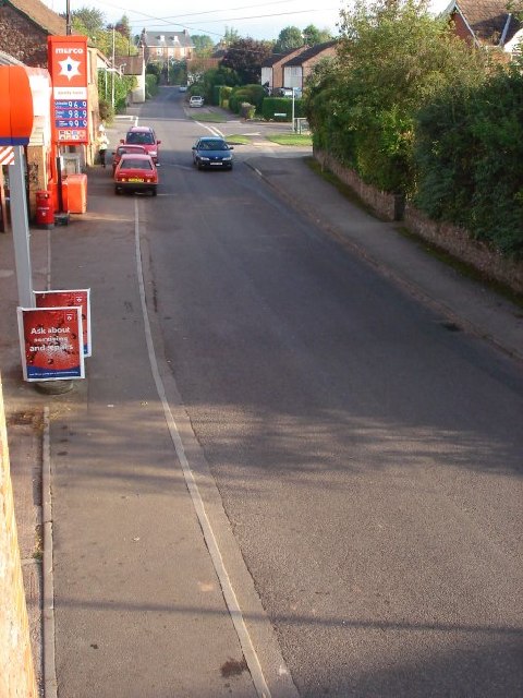
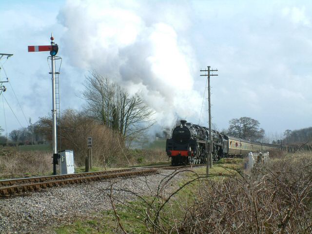
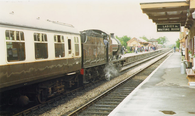
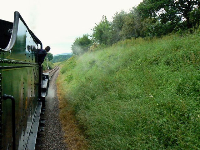
Combe, East Images

Images are sourced within 2km of 51.073036/-3.196961 or Grid Reference ST1631. Thanks to Geograph Open Source API. All images are credited.

Bishop’s Lydeard: St Mary’s Church The impressive four-stage Somerset tower with set-back buttresses dates from the 15th century. The churchyard contains the stumps of two medieval crosses; the church is noted for its rood screen and carved 16th century bench ends
Bishop’s Lydeard: St Mary’s Church
The impressive four-stage Somerset tower with set-back buttresses dates from the 15th century. The churchyard contains the stumps of two medieval crosses; the church is noted for its rood screen and carved 16th century bench ends
Bishop’s Lydeard: Pound Farm At East Lydeard, the farm offers bed and breakfast. In the late 19th century one of the barns here had machinery powered by a waterwheel: a millstone survives near the house
Bishop’s Lydeard: Pound Farm
At East Lydeard, the farm offers bed and breakfast. In the late 19th century one of the barns here had machinery powered by a waterwheel: a millstone survives near the house
Mount Street, Bishops Lydeard Mount Street, looking North North East towards Quantock Hills. Bishop's Lydeard infamous Red Garage in foreground. Bishops Lydeard isn't just about the West Somerset Railway you know!
Mount Street, Bishops Lydeard
Mount Street, looking North North East towards Quantock Hills. Bishop's Lydeard infamous Red Garage in foreground. Bishops Lydeard isn't just about the West Somerset Railway you know!
Whiskey Trail Crossing Sandy Lane is a public footpath that links Sandhill Park and Bishops Lydeard. The alternative name of Whiskey Trail came from the American servicemen billeted in the grounds of the Park during WW2. It crosses the West Somerset Railway as shown in the picture.
Whiskey Trail Crossing
Sandy Lane is a public footpath that links Sandhill Park and Bishops Lydeard. The alternative name of Whiskey Trail came from the American servicemen billeted in the grounds of the Park during WW2. It crosses the West Somerset Railway as shown in the picture.
Arrival at Bishop's Lydeard
Aboard the 16.10 from Bishops Lydeard, heading north This view is north towards the end of the cutting through which the West Somerset Railway passes in this square. There is a link to the official WSR website in this image <a title="https://www.geograph.org.uk/photo/472015" href="https://www.geograph.org.uk/photo/472015">Link</a> The unofficial site is here <span class="nowrap"><a title="http://www.wsr.org.uk/index.htm" rel="nofollow ugc noopener" href="http://www.wsr.org.uk/index.htm">Link</a><img style="margin-left:2px;" alt="External link" title="External link - shift click to open in new window" src="https://s1.geograph.org.uk/img/external.png" width="10" height="10"/></span>
Aboard the 16.10 from Bishops Lydeard, heading north
This view is north towards the end of the cutting through which the West Somerset Railway passes in this square. There is a link to the official WSR website in this image Link The unofficial site is here LinkExternal link
Bishops Lydeard, St. Mary's Churchyard. C14 Cross.
Bishops Lydeard, St. Mary's Churchyard.
C14 Cross.
Methodist Chapel, Bishops Lydeard.
Ash Priors, Holy Trinity Church
Telephone kiosk in Mount Street, Bishops Lydeard This is No 32 of 42 images of BT telephone boxes in Taunton Deane which BT is trying to cull due to their claimed 'lack of use'.
Telephone kiosk in Mount Street, Bishops Lydeard
This is No 32 of 42 images of BT telephone boxes in Taunton Deane which BT is trying to cull due to their claimed 'lack of use'.
Telephone kiosk at Ash Priors This is No 34 of 42 images of BT telephone boxes in Taunton Deane which BT is trying to cull due to their claimed 'lack of use'.
Telephone kiosk at Ash Priors
This is No 34 of 42 images of BT telephone boxes in Taunton Deane which BT is trying to cull due to their claimed 'lack of use'.
Holy Trinity Church, Ash Priors
Mount Street, Bishops Lydeard Looking down the street from Gore Square. The thatched cottage on the right is listed - see <span class="nowrap"><a title="http://www.imagesofengland.org.uk/Details/Default.aspx?id=270252&mode=adv" rel="nofollow ugc noopener" href="http://www.imagesofengland.org.uk/Details/Default.aspx?id=270252&mode=adv">Link</a><img style="margin-left:2px;" alt="External link" title="External link - shift click to open in new window" src="https://s1.geograph.org.uk/img/external.png" width="10" height="10"/></span> . A glimpse in the distance of the Quantocks.
Mount Street, Bishops Lydeard
Looking down the street from Gore Square. The thatched cottage on the right is listed - see LinkExternal link . A glimpse in the distance of the Quantocks.
Arrival from Minehead Former Somerset and Dorset Railway No 88 brings a train into Bishops Lydeard.
Arrival from Minehead
Former Somerset and Dorset Railway No 88 brings a train into Bishops Lydeard.
The Bird In Hand, Bishops Lydeard
Mount Street, Bishops Lydeard
Footpath, Ash Priors
Doorway, Holy Trinity Church, Ash Priors A Tudor style doorway at the foot of the west tower of <a href="https://www.geograph.org.uk/photo/870177">ST1529 : Ash Priors, Holy Trinity Church</a>, with attractively decorated spandrels, but it dates from the C19 <span class="nowrap"><a title="http://webapp1.somerset.gov.uk/her/details.asp?prn=40180" rel="nofollow ugc noopener" href="http://webapp1.somerset.gov.uk/her/details.asp?prn=40180">Link</a><img style="margin-left:2px;" alt="External link" title="External link - shift click to open in new window" src="https://s1.geograph.org.uk/img/external.png" width="10" height="10"/></span> .
Doorway, Holy Trinity Church, Ash Priors
A Tudor style doorway at the foot of the west tower of ST1529 : Ash Priors, Holy Trinity Church, with attractively decorated spandrels, but it dates from the C19 LinkExternal link .
Show me another place!

Combe, East is located at Grid Ref: ST1631 (Lat: 51.073036, Lng: -3.196961)

Administrative County: Somerset

District: Somerset West and Taunton

Police Authority: Avon and Somerset

What 3 Words

///giraffes.mastering.judges. Near Bishops Lydeard, Somerset

Nearby Locations

East Combe Combe, East

Related Wikis

Combe Florey

Combe Florey is a village and civil parish in Somerset, England, situated 6 miles (9.7 km) northwest of Taunton, on the West Somerset Railway. The village...

Bishops Lydeard A.F.C.

Bishops Lydeard Association Football Club is a football club based in Bishops Lydeard, near Taunton, in Somerset, England. They are currently members of...
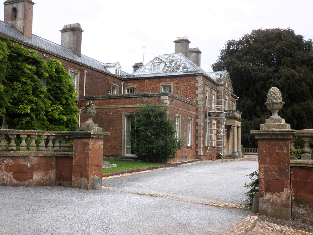
Combe Florey House

Combe Florey House in Combe Florey, Somerset, England is a country house dating from the early 18th century. It replaced an Elizabethan manor house which...

Lydeard House

Lydeard House in Bishops Lydeard, Somerset, England was built in the mid 18th century. It is a Grade II* listed building. == History == Lydeard House was...
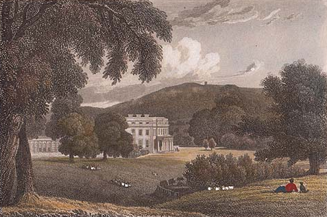
Sandhill Park

Sandhill Park in the parish of Bishops Lydeard, Somerset, England is a derelict country house built in about 1720. It was used in the 20th century as a...

Bishops Lydeard

Bishops Lydeard () is a village and civil parish located in Somerset, England, 5 miles (8 km) north-west of Taunton. The civil parish encompasses the hamlets...

Cockercombe tuff

Cockercombe Tuff is a greenish-grey, hard pyroclastic rock, formed by the compression of volcanic ash containing high quantities of chlorite, which gives...

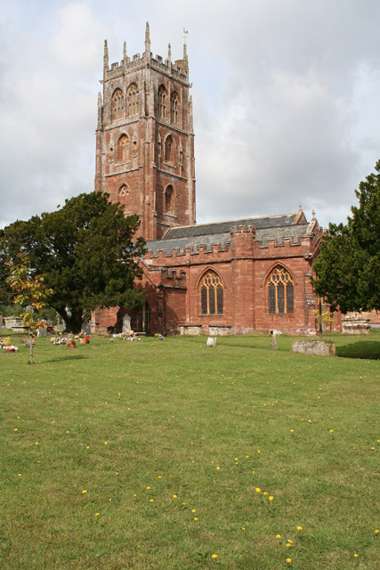
Church of the Holy Trinity, Ash Priors

The Church of the Holy Trinity in Ash Priors, Somerset, England was built in the 15th century. It is a Grade II* listed building. == History == In the...

Nearby Amenities

Located within 500m of 51.073036,-3.196961
Eastcombe
Is In: Somerset, England, UK
Place: hamlet
Source: NPE
Source Name: sign
Lat/Long: 51.0725642/-3.1992313
Eastcombe
Direction: backward
Note: OS maps label the hamlet as East Combe. However, this sign and address listings, etc. give it as Eastcombe.
Traffic Sign: city_limit
Lat/Long: 51.0716251/-3.1979445
Give Way
Direction: backward
Lat/Long: 51.0738649/-3.1909874
Give Way
Direction: forward
Lat/Long: 51.0740753/-3.1910131
Give Way
Direction: backward
Lat/Long: 51.0704667/-3.1973553
Give Way
Direction: forward
Lat/Long: 51.0728826/-3.1994165
Give Way
Direction: backward
Lat/Long: 51.0739438/-3.1913352
Access: private
Door: overhead
Entrance: yes
Motorcar: private
Lat/Long: 51.0715453/-3.1972945
Access: private
Door: overhead
Entrance: yes
Motorcar: private
Lat/Long: 51.0714849/-3.1972973
Access: private
Door: overhead
Entrance: yes
Motorcar: private
Lat/Long: 51.0712768/-3.1972223
Access: private
Door: overhead
Entrance: yes
Motorcar: private
Lat/Long: 51.071091/-3.1968804
Access: private
Door: overhead
Entrance: yes
Motorcar: private
Lat/Long: 51.0711767/-3.196935
Direction: forward
Maxspeed: 50 mph
Maxspeed Type: GB:nsl_restricted
Source Maxspeed: sign
Traffic Sign: maxspeed
Lat/Long: 51.0729154/-3.1993768
Post Box
Eastcombe
Collection Times: Mo-Fr 15:30; Sa 07:00
Colour: red
Direction: WSW
Drive Through: no
Operator: Royal Mail
Operator Wikidata: Q638098
Post Box Type: wall
Postal Code: TA4 3HU
Ref: TA4 100
Royal Cypher: EIIR
Royal Cypher Wikidata: Q33102113
Lat/Long: 51.072114/-3.1980387
Brand: National Grid
Brand Wikidata: Q1465461
Design: single-level
Frequency: 50
Location Transition: yes
Material: wood
Operator: National Grid Electricity Distribution
Operator Old: Western Power Distribution
Operator Wikidata: Q7988183
Owner: National Grid Electricity Distribution (South West) Plc
Owner Wikidata: Q114397866
Phases: 3
Power: pole
Transformer: distribution
Lat/Long: 51.0735798/-3.1998861
Eastcombe
Direction: forward
Note: OS maps label the hamlet as East Combe. However, this sign and address listings, etc. give it as Eastcombe.
Traffic Sign: city_limit
Lat/Long: 51.0737955/-3.2024691
Brand: National Grid
Brand Wikidata: Q1465461
Design: single-level
Material: wood
Operator: National Grid Electricity Distribution Plc
Operator Old: Western Power Distribution
Operator Wikidata: Q7988183
Owner: National Grid Electricity Distribution (South West) Plc
Owner Wikidata: Q114397866
Power: pole
Lat/Long: 51.0728501/-3.200554
Brand: National Grid
Brand Wikidata: Q1465461
Design: single-level
Line Management: branch
Material: wood
Operator: National Grid Electricity Distribution Plc
Operator Old: Western Power Distribution
Operator Wikidata: Q7988183
Owner: National Grid Electricity Distribution (South West) Plc
Owner Wikidata: Q114397866
Power: pole
Lat/Long: 51.0742733/-3.2025991
Brand: National Grid
Brand Wikidata: Q1465461
Design: single-level
Material: wood
Operator: National Grid Electricity Distribution Plc
Operator Old: Western Power Distribution
Operator Wikidata: Q7988183
Owner: National Grid Electricity Distribution (South West) Plc
Owner Wikidata: Q114397866
Power: pole
Lat/Long: 51.0734298/-3.2015263
Brand: National Grid
Brand Wikidata: Q1465461
Design: single-level
Material: wood
Operator: National Grid Electricity Distribution Plc
Operator Old: Western Power Distribution
Operator Wikidata: Q7988183
Owner: National Grid Electricity Distribution (South West) Plc
Owner Wikidata: Q114397866
Power: pole
Lat/Long: 51.0720757/-3.2003407
Brand: National Grid
Brand Wikidata: Q1465461
Design: single-level
Material: wood
Operator: National Grid Electricity Distribution Plc
Operator Old: Western Power Distribution
Operator Wikidata: Q7988183
Owner: National Grid Electricity Distribution (South West) Plc
Owner Wikidata: Q114397866
Power: pole
Lat/Long: 51.0714335/-3.1990231
Brand: National Grid
Brand Wikidata: Q1465461
Design: single-level
Location Transition: yes
Material: wood
Operator: National Grid Electricity Distribution Plc
Operator Old: Western Power Distribution
Operator Wikidata: Q7988183
Owner: National Grid Electricity Distribution (South West) Plc
Owner Wikidata: Q114397866
Power: pole
Lat/Long: 51.0718583/-3.1971824
Brand: National Grid
Brand Wikidata: Q1465461
Design: single-level
Guyed: yes
Material: wood
Operator: National Grid Electricity Distribution Plc
Operator Old: Western Power Distribution
Operator Wikidata: Q7988183
Owner: National Grid Electricity Distribution (South West) Plc
Owner Wikidata: Q114397866
Power: pole
Lat/Long: 51.0716097/-3.1980716
Access: private
Door: overhead
Entrance: yes
Motorcar: private
Lat/Long: 51.0708732/-3.1969192
Brand: National Grid
Brand Wikidata: Q1465461
Design: single-level
Line Management: termination
Location Transition: yes
Material: wood
Operator: National Grid Electricity Distribution
Operator Old: Western Power Distribution
Operator Wikidata: Q7988183
Owner: National Grid Electricity Distribution (South West) Plc
Owner Wikidata: Q114397866
Power: pole
Lat/Long: 51.0737886/-3.1994023
Access: private
Door: overhead
Entrance: yes
Motorcar: private
Lat/Long: 51.073892/-3.199332
Give Way
Direction: backward
Source Give Way: inferred
Lat/Long: 51.0731711/-3.2003568
Access: private
Door: overhead
Entrance: yes
Motorcar: private
Lat/Long: 51.0739557/-3.1993346
Brand: National Grid
Brand Wikidata: Q1465461
Design: single-level
Line Management: termination
Location Transition: yes
Material: wood
Operator: National Grid Electricity Distribution
Operator Old: Western Power Distribution
Operator Wikidata: Q7988183
Owner: National Grid Electricity Distribution (South West) Plc
Owner Wikidata: Q114397866
Power: pole
Lat/Long: 51.0734425/-3.2004949
Brand: National Grid
Brand Wikidata: Q1465461
Design: single-level
Material: wood
Operator: National Grid Electricity Distribution Plc
Operator Old: Western Power Distribution
Operator Wikidata: Q7988183
Owner: National Grid Electricity Distribution (South West) Plc
Owner Wikidata: Q114397866
Power: pole
Lat/Long: 51.0738722/-3.2023524
Brand: National Grid
Brand Wikidata: Q1465461
Design: single-level
Material: wood
Operator: National Grid Electricity Distribution Plc
Operator Old: Western Power Distribution
Operator Wikidata: Q7988183
Owner: National Grid Electricity Distribution (South West) Plc
Owner Wikidata: Q114397866
Power: pole
Lat/Long: 51.0738495/-3.2009013
Bus Stop
Eastcombe SE-bound
Bench: no
Bin: no
Bus: yes
Direction: backward
Naptan AtcoCode: 3600SOA31043
Naptan Bearing: SE
Naptan BusStopType: CUS
Naptan CommonName: Eastcombe
Naptan Indicator: SE-bound
Naptan NaptanCode: sotagjpj
Naptan Street: A358
Naptan Verified: no
Network: The Buses of Somerset
Network Wikidata: Q17018973
Operator: First South West
Operator Wikidata: Q5454172
Public Transport: platform
Ref: 23;28;28E
Ref SMS: sotagjpj
Shelter: no
Lat/Long: 51.0732006/-3.2004071
Bus Stop
Eastcombe NW-bound
Bench: no
Bin: no
Bus: yes
Direction: forward
Naptan AtcoCode: 3600SOA31042
Naptan Bearing: NW
Naptan BusStopType: CUS
Naptan CommonName: Eastcombe
Naptan Indicator: NW-bound
Naptan NaptanCode: sotagjpg
Naptan Street: A358
Naptan Verified: no
Network: The Buses of Somerset
Network Wikidata: Q17018973
Operator: First South West
Operator Wikidata: Q5454172
Public Transport: platform
Ref: 23;28;28E
Ref SMS: sotagjpg
Shelter: no
Lat/Long: 51.0731458/-3.2005405
Eastcombe
Bus: yes
Direction: both
Operator: Hatch Green Coaches; First South West
Public Transport: stop_position
Ref: 23;28
Ref SMS Backward: sotagjpj
Ref SMS Forward: sotagjpg
Lat/Long: 51.0731732/-3.2004738
Barrier: bollard
Material: concrete
Lat/Long: 51.0728277/-3.1995086
Barrier: bollard
Material: concrete
Lat/Long: 51.072813/-3.1994576
Access: private
Door: overhead
Entrance: yes
Motorcar: private
Lat/Long: 51.0726288/-3.1983433
The data included in this document is from www.openstreetmap.org. The data is made available under ODbL.

Have you been to Combe, East?

Leave your review of Combe, East below (or comments, questions and feedback).