Great Copse

Wood, Forest in Hampshire Havant

England

Great Copse

Havant railway station  Havant railway station and footbridge seen from the London-bound platform looking westbound. The station is operated by South Western Railway and is served also by Southern.
Havant railway station Credit: Daniel Parks

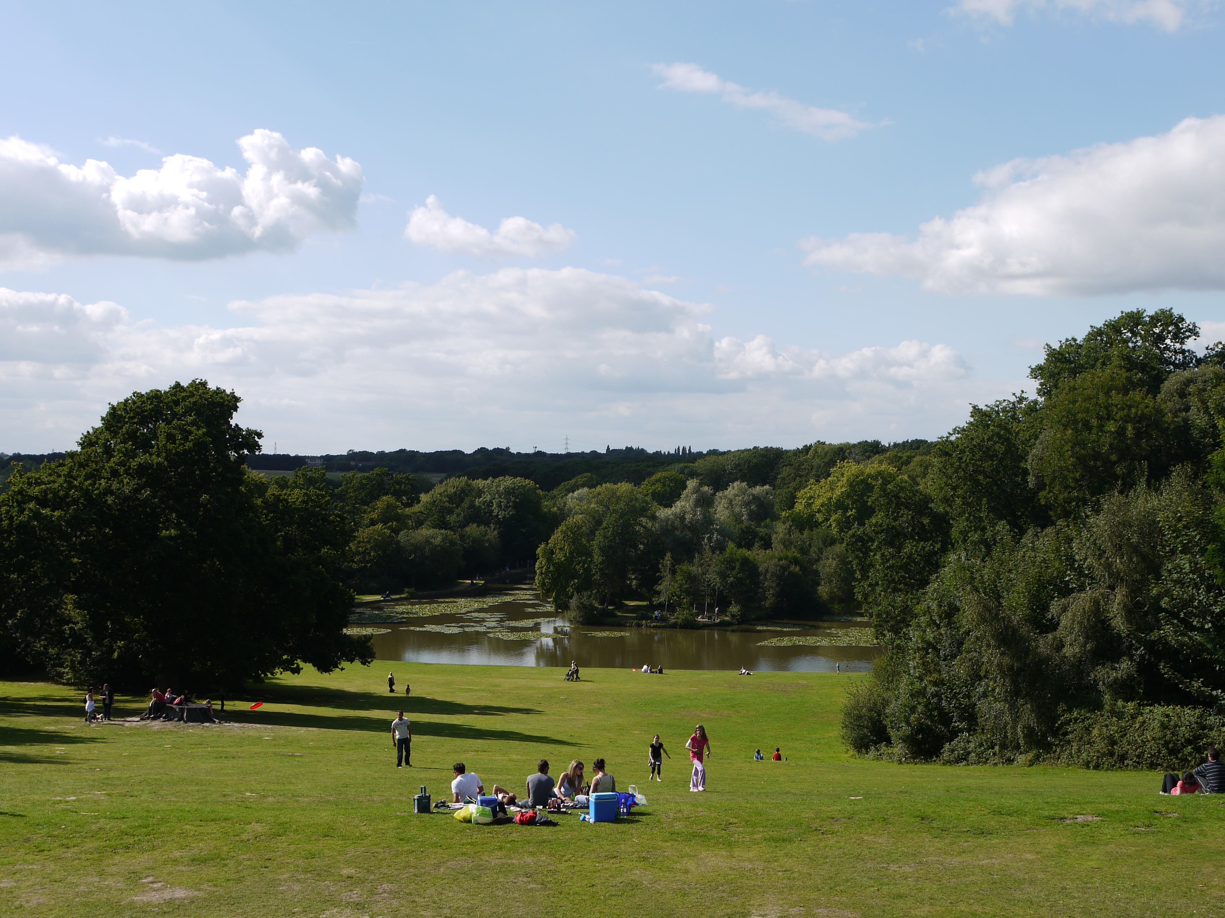
Great Copse is a picturesque woodland located in the county of Hampshire, England. Stretching over an area of approximately 100 acres, it is a haven for nature enthusiasts and outdoor lovers alike. The copse is situated near the village of Bramdean, nestled within the rolling hills of the South Downs National Park.

This ancient forest boasts a diverse range of tree species, including oak, beech, ash, and chestnut. The towering trees provide a dense canopy that filters sunlight, creating a serene and peaceful atmosphere within the woodland. The forest floor is carpeted with a rich variety of wildflowers, ferns, and mosses, further adding to the beauty of the area.

Great Copse is home to a flourishing ecosystem, supporting a wide array of wildlife. Visitors may spot a variety of bird species, including woodpeckers, owls, and songbirds, while small mammals such as foxes, rabbits, and squirrels can often be seen scurrying through the undergrowth. The copse also provides a habitat for a range of insects, including butterflies and beetles.

For those seeking outdoor activities, Great Copse offers numerous walking trails and footpaths, allowing visitors to explore the woodland at their own pace. The tranquil surroundings make it an ideal location for nature walks, birdwatching, and photography. The copse is also popular among families and picnickers, who enjoy the peaceful surroundings and the opportunity to connect with nature.

Overall, Great Copse is a natural gem in the heart of Hampshire, offering visitors a chance to immerse themselves in the beauty of a traditional English woodland.

If you have any feedback on the listing, please let us know in the comments section below.

Great Copse Images

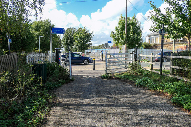
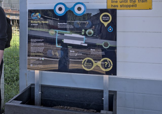
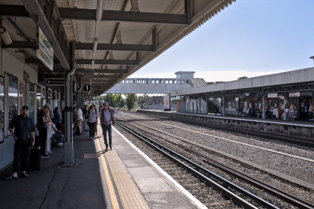
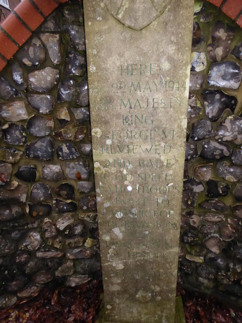
Images are sourced within 2km of 50.871218/-0.98197047 or Grid Reference SU7108. Thanks to Geograph Open Source API. All images are credited.

Havant railway station  Havant railway station and footbridge seen from the London-bound platform looking westbound. The station is operated by South Western Railway and is served also by Southern.
Havant railway station
Havant railway station and footbridge seen from the London-bound platform looking westbound. The station is operated by South Western Railway and is served also by Southern.
Class 377 EMU at Havant A Southern Railway services operated by 377419 arriving at Havant.
Class 377 EMU at Havant
A Southern Railway services operated by 377419 arriving at Havant.
Havant Rowlands Castle The view of the Travelodge in Whichers Gate Road, Rowlands Castle.
Havant Rowlands Castle
The view of the Travelodge in Whichers Gate Road, Rowlands Castle.
Harvester Pub The view of the Rowlands Castle Pub.
Harvester Pub
The view of the Rowlands Castle Pub.
Car park, Havant Station I stood about here in 1963 and watched a 'Terrier' tank being hand-coaled, ready for its next run to Hayling Island - <a href="https://www.geograph.org.uk/photo/6218419">SU7106 : The glamour of steam?</a>. 1963 was the year that the line closed, so the old yard has, inevitably, become a boring car park. Now, the only visible links between the two shots are the chimneys on the houses beyond.
Car park, Havant Station
I stood about here in 1963 and watched a 'Terrier' tank being hand-coaled, ready for its next run to Hayling Island - SU7106 : The glamour of steam?. 1963 was the year that the line closed, so the old yard has, inevitably, become a boring car park. Now, the only visible links between the two shots are the chimneys on the houses beyond.
Havant signal box Signals are still controlled locally, but I'm not sure if from this box, which is Grade II listed.
Havant signal box
Signals are still controlled locally, but I'm not sure if from this box, which is Grade II listed.
Gates on the old Hayling line trackbed The gates have retained their railway appearance but now guard the Shipwrights Way, which follows the route of the old Hayling branch line.
Gates on the old Hayling line trackbed
The gates have retained their railway appearance but now guard the Shipwrights Way, which follows the route of the old Hayling branch line.
Havant Station
Havant Station
Butterflies A notice on Havant Station about a conservation planting scheme nearby.
Butterflies
A notice on Havant Station about a conservation planting scheme nearby.
Havant Station Lots of routes require changing at Havant - the platforms are often crowded.
Havant Station
Lots of routes require changing at Havant - the platforms are often crowded.
2016: a year on Geograph (Day 53) The King's Stone, Rowlands. Castle<span class="nowrap"><a title="http://www3.hants.gov.uk/longdistance/staunton-way/rowlands-castle-to-staunton.htm" rel="nofollow ugc noopener" href="http://www3.hants.gov.uk/longdistance/staunton-way/rowlands-castle-to-staunton.htm">Link</a><img style="margin-left:2px;" alt="External link" title="External link - shift click to open in new window" src="https://s1.geograph.org.uk/img/external.png" width="10" height="10"/></span>
2016: a year on Geograph (Day 53)
The King's Stone, Rowlands. CastleLinkExternal link
King's Stone Repair Commemoration Plaque Also see <a title="https://www.geograph.org.uk/photo/4836030" href="https://www.geograph.org.uk/photo/4836030">Link</a>
King's Stone Repair Commemoration Plaque
Also see Link
Inscription on The King's Stone Also see <a title="https://www.geograph.org.uk/photo/4836030" href="https://www.geograph.org.uk/photo/4836030">Link</a>
Inscription on The King's Stone
Also see Link
The Upper Lake at Staunton Country Park Not much left of the lake now, but a very peaceful place away from the main gardens.
The Upper Lake at Staunton Country Park
Not much left of the lake now, but a very peaceful place away from the main gardens.
The Upper Lake at Staunton Country Park
Redhill Rd
Redhill Rd
Redhill Rd
Redhill Rd
Road works in Woodstock Road
Show me another place!

Great Copse is located at Grid Ref: SU7108 (Lat: 50.871218, Lng: -0.98197047)

Administrative County: Hampshire

District: Havant

Police Authority: Hampshire

What 3 Words

///voters.spray.slides. Near Havant, Hampshire

Nearby Locations

Great Copse

Related Wikis

Leigh Park

Leigh Park is a large suburb (population 27,500) of Havant, in Hampshire, England. It currently forms the bulk or whole of four electoral wards: Battins...

Portsmouth F.C. Reserves and Academy

Portsmouth F.C. XI and Academy consist of the reserve and academy footballers of Portsmouth F.C. == Portsmouth XI == Previously called Portsmouth Reserves...

Clanfield F.C. (Hampshire)

Clanfield Football Club are a football club based in Havant, England. They play in the Wessex League Division One. The club is affiliated to the Hampshire...

Portsmouth F.C. Women

Portsmouth Women, formerly known as "Portsmouth Ladies", is a semi professional women's football club for the south coast city of Portsmouth in Hampshire...

Nearby Amenities

Located within 500m of 50.871218,-0.98197047
Mini Roundabout
Direction: clockwise
Lat/Long: 50.8730244/-0.9797302
Mini Roundabout
Direction: clockwise
Lat/Long: 50.8678293/-0.9854888
Bus Stop
Crondall Avenue
Bus: yes
Naptan AtcoCode: 1900HA070276
Naptan Bearing: W
Naptan CommonName: Crondall Avenue
Naptan Crossing: Middle Park Way
Naptan NaptanCode: hamgmdwp
Naptan PlusbusZoneRef: HAVANT
Naptan Street: Crondall Avenue
Naptan Verified: no
Public Transport: platform
Source: naptan_import
Lat/Long: 50.8732688/-0.9873213
Bus Stop
Crondall Avenue
Bus: yes
Naptan AtcoCode: 1900HA070277
Naptan Bearing: E
Naptan CommonName: Crondall Avenue
Naptan Crossing: Crondall Avenue
Naptan NaptanCode: hamgmgag
Naptan PlusbusZoneRef: HAVANT
Naptan Street: Middle Park Way
Naptan Verified: no
Public Transport: platform
Source: naptan_import
Lat/Long: 50.8733195/-0.9869364
Bus Stop
Bondfields Crescent
Bus: yes
Naptan AtcoCode: 1900HA070278
Naptan Bearing: W
Naptan CommonName: Bondfields Crescent
Naptan Crossing: Bondfields Crescent
Naptan NaptanCode: hamgmgpd
Naptan PlusbusZoneRef: HAVANT
Naptan Street: Middle Park Way
Naptan Verified: no
Public Transport: platform
Source: naptan_import
Lat/Long: 50.8729605/-0.9849544
Bus Stop
Silkstead Avenue
Bus: yes
Naptan AtcoCode: 1900HA070279
Naptan Bearing: E
Naptan CommonName: Silkstead Avenue
Naptan Crossing: Bondfields Crescent
Naptan NaptanCode: hamgmgpj
Naptan PlusbusZoneRef: HAVANT
Naptan Street: Middle Park Way
Naptan Verified: no
Public Transport: platform
Source: naptan_import
Lat/Long: 50.8730899/-0.9843262
Bus Stop
High Lawn Way
Bus: yes
Naptan AtcoCode: 1900HA070280
Naptan Bearing: W
Naptan CommonName: High Lawn Way
Naptan Crossing: High Lawn Way
Naptan NaptanCode: hamgmpdt
Naptan PlusbusZoneRef: HAVANT
Naptan Street: Middle Park Way
Naptan Verified: no
Public Transport: platform
Source: naptan_import
Lat/Long: 50.8730449/-0.9791679
Bus Stop
High Lawn Way
Bus: yes
Naptan AtcoCode: 1900HA070281
Naptan Bearing: E
Naptan CommonName: High Lawn Way
Naptan Crossing: Opp High Lawn Way
Naptan NaptanCode: hamgmpgp
Naptan PlusbusZoneRef: HAVANT
Naptan Street: Middle Park Way
Naptan Verified: no
Public Transport: platform
Source: naptan_import
Lat/Long: 50.8731591/-0.9788528
Bus Stop
Staunton Park
Bus: yes
Naptan AtcoCode: 1900HA070282
Naptan Bearing: W
Naptan CommonName: Staunton Park
Naptan NaptanCode: hamgmtdp
Naptan PlusbusZoneRef: HAVANT
Naptan Street: Middle Park Way
Naptan Verified: no
Public Transport: platform
Source: naptan_import
Lat/Long: 50.873793/-0.9763852
Parking
Lat/Long: 50.8693245/-0.9775589
Parking
Lat/Long: 50.8704349/-0.9774731
Post Box
Brand: Royal Mail
Brand Wikidata: Q638098
Brand Wikipedia: en:Royal Mail
Operator: Royal Mail
Operator Wikidata: Q638098
Post Box Type: pillar
Ref: PO9 81
Royal Cypher: EIIR
Royal Cypher Wikidata: Q33102113
Lat/Long: 50.870404/-0.9778727
Parking
Lat/Long: 50.8698594/-0.9775482
Parking
Lat/Long: 50.8696495/-0.9767757
Turning Circle
Lat/Long: 50.8705139/-0.9752431
Parking
Lat/Long: 50.8698216/-0.9794461
Cafe
Regency Tearooms
Cuisine: sandwich
Lat/Long: 50.8721584/-0.9757933
Entrance: yes
Lat/Long: 50.8727584/-0.9766671
Entrance: yes
Lat/Long: 50.8728359/-0.9765989
Entrance: yes
Lat/Long: 50.8730303/-0.9769461
Entrance: yes
Lat/Long: 50.8730761/-0.9771226
Noexit: yes
Lat/Long: 50.8733045/-0.9769215
Noexit: yes
Lat/Long: 50.8733379/-0.9769376
Noexit: yes
Lat/Long: 50.8704493/-0.9859689
Noexit: yes
Lat/Long: 50.8706309/-0.9860966
Post Box
Brand: Royal Mail
Brand Wikidata: Q638098
Brand Wikipedia: en:Royal Mail
Collection Plate: CP1D
Collection Times: Mo-Fr 09:00; Sa 07:00
Operator: Royal Mail
Operator Wikidata: Q638098
Post Box Type: pillar
Ref: PO9 83D
Royal Cypher: EIIR
Royal Cypher Wikidata: Q33102113
Lat/Long: 50.8733919/-0.9874624
Telephone
Addr City: Havant
Addr Housename: Outside No
Addr Housenumber: 407
Addr Street: Middle Park Way
Addr Suburb: Leigh Park
Booth: KX300
Covered: booth
Payment Coins: yes
Phone: +44 2392 484533
Lat/Long: 50.8732652/-0.9865511
Barrier: kissing_gate
Lat/Long: 50.8741567/-0.9820242
Telephone
Addr City: Havant
Addr Housename: Upper Precinct
Addr Housenumber: 27-29
Addr Postcode: PO9 5AH
Addr Street: Greywell Road
Addr Suburb: Leigh Park
Operator: BT
Payment Coins: yes
Phone: +44 2392 482080
Sms: yes
Lat/Long: 50.8674934/-0.9847457
Telephone
Addr City: Havant
Addr Street: Somborne Drive
Addr Suburb: Leigh Park
Booth: KX100
Covered: booth
Operator: BT
Payment Coins: yes
Phone: +44 2392 492520
Lat/Long: 50.8672684/-0.9832212
Premier
Addr City: Havant
Addr Street: Middle Park Way
Addr Suburb: Leigh Park
Brand: Premier
Brand Wikidata: Q7240340
Brand Wikipedia: en:Premier Stores
Description: This store is known as Stop & Shop.
Note: This stoee has a 50p charge when paying by card.
Opening Hours: Mo-Sa 06:00-21:00; Su 07:00-18:00
Pay Point: yes
Shop: convenience
Lat/Long: 50.8733593/-0.9865011
Fast Food
Sam's The Chippy
Addr City: Havant
Addr Housenumber: 405
Addr Street: Middle Park Way
Addr Suburb: Leigh Park
Cuisine: fish_and_chips
Delivery: yes
Description: Local deliveries now available.
Drive Through: no
Opening Hours: Mo 16:00-21:00; Tu-Fr 11:45-14:00,16:00-21:30; Sa 11:45-14:00,16:00-21:00
Phone: +44 2392 470869
Smoking: no
Takeaway: only
Website: https://www.samchippy.co.uk/
Lat/Long: 50.873367/-0.9865897
Atm
Opening Hours: 24/7
Lat/Long: 50.8674984/-0.9831499
Post Office
Greywell Road Post Office
Addr City: Havant
Addr Country: GB
Addr Housenumber: 46
Addr Postcode: PO9 5AL
Addr Street: Greywell Road
Addr Village: Leigh Park
Description: This post office closed down permanently at the beginning of August 2021.
Disused Amenity: post office
Operator: Post Office Ltd
Ref Pol Id: 145699
Source: visit to Greywell Pharmacy
Lat/Long: 50.867306/-0.9835915
Crossing
Lat/Long: 50.868158/-0.9777512
Crossing
Crossing: unmarked
Lat/Long: 50.8679962/-0.9831327
Crossing
Crossing: unmarked
Lat/Long: 50.8688158/-0.9855275
Atm
Lat/Long: 50.8669321/-0.9832551
Description: This is the office for the Alpha Cars taxi firm.
Office: yes
Source: survey
Website: https://www.alpha-cars-havant.co.uk/
Lat/Long: 50.8677503/-0.9848683
Gate to Housing Estate
Tourism: viewpoint
Lat/Long: 50.8751579/-0.9845881
Disused Shop: pet
Lat/Long: 50.8672855/-0.9833407
Shop: pet
Lat/Long: 50.8675665/-0.9833032
The data included in this document is from www.openstreetmap.org. The data is made available under ODbL.

Have you been to Great Copse?

Leave your review of Great Copse below (or comments, questions and feedback).