Bottom Plantation
Wood, Forest in Nottinghamshire Rushcliffe
England
Bottom Plantation
Bottom Plantation is a picturesque woodland located in Nottinghamshire, England. Situated in the heart of the county, it covers an area of approximately 100 hectares and forms part of the larger Sherwood Forest. The plantation is known for its diverse range of tree species, including oak, beech, ash, and birch, creating a lush and vibrant landscape.
The woodland is a popular destination for nature enthusiasts and outdoor lovers, offering a tranquil escape from the hustle and bustle of city life. Visitors can explore the numerous walking trails that wind through the plantation, immersing themselves in the natural beauty of the area. The well-maintained paths make it accessible for people of all ages and abilities.
Bottom Plantation is also home to a rich variety of wildlife, making it a haven for nature lovers. Birdwatchers can spot a wide range of avian species, including woodpeckers, owls, and warblers. Small mammals such as squirrels, rabbits, and foxes can also be spotted in the woodland, adding to its enchanting atmosphere.
The plantation has a unique history, as it was once part of the legendary Sherwood Forest, famous for its association with Robin Hood. The ancient oaks and dense undergrowth evoke a sense of mystery and folklore, transporting visitors back in time. Many believe that the plantation still holds the spirit of the legendary outlaw, making it an intriguing destination for history enthusiasts.
Overall, Bottom Plantation in Nottinghamshire offers a serene escape into nature, providing visitors with a chance to connect with the natural world and immerse themselves in the beauty of Sherwood Forest.
If you have any feedback on the listing, please let us know in the comments section below.
Bottom Plantation Images
Images are sourced within 2km of 52.96459/-0.93638792 or Grid Reference SK7141. Thanks to Geograph Open Source API. All images are credited.


Bottom Plantation is located at Grid Ref: SK7141 (Lat: 52.96459, Lng: -0.93638792)
Administrative County: Nottinghamshire
District: Rushcliffe
Police Authority: Nottinghamshire
What 3 Words
///seasonal.handy.gradually. Near Bingham, Nottinghamshire
Nearby Locations
Related Wikis
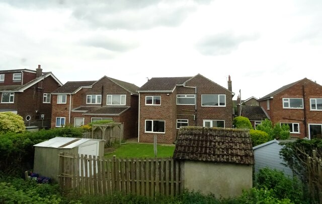
Car Colston
Car Colston is an English village and civil parish in the Rushcliffe borough of Nottinghamshire. The population of the civil parish at the time of the...
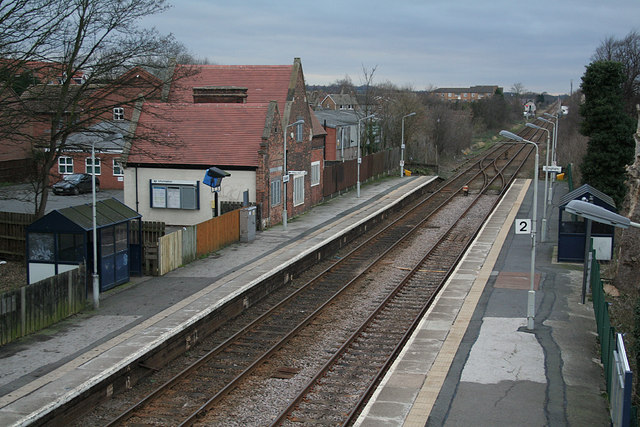
Bingham railway station
Bingham railway station serves the market town of Bingham, Nottinghamshire, England. The station is 8½ miles (14 km) east of Nottingham on the Nottingham...
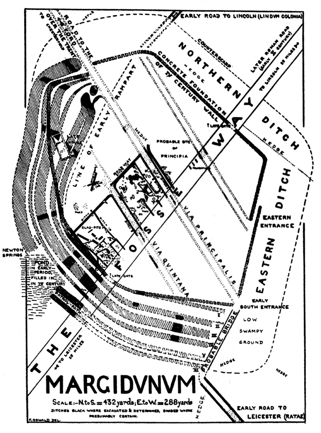
Margidunum
Margidunum was a Roman settlement on the Fosse Way at Castle Hill near present-day Bingham, in Nottinghamshire, England. The site is a protected Scheduled...
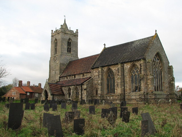
St Mary's Church, Car Colston
St Mary's Church, Car Colston is a Grade I listed parish church in the Church of England in Car Colston. == History == The church dates from the 13th century...

Bingham, Nottinghamshire
Bingham is a market town and civil parish in the Rushcliffe borough of Nottinghamshire, England, 9 miles (14 km) east of Nottingham, 12 miles (18.8 km...

Bingham Rural District
Bingham was a rural district in Nottinghamshire, England from 1894 to 1974. It was created under the Local Government Act 1894 from the Bingham rural sanitary...

Scarrington
Scarrington is an English civil parish and village in the Rushcliffe borough of Nottinghamshire, adjacent to Bingham, Car Colston, Hawksworth, Orston and...
Church of St John of Beverley, Scarrington
The Church of St John of Beverley is a 13th-century parish church of the Church of England, in the village of Scarrington, Nottinghamshire. It has been...
Have you been to Bottom Plantation?
Leave your review of Bottom Plantation below (or comments, questions and feedback).