Stancoombe Copse

Wood, Forest in Hampshire East Hampshire

England

Stancoombe Copse

Bridleway 10 ascends Sir William's Hill
Bridleway 10 ascends Sir William's Hill Credit: Robin Webster

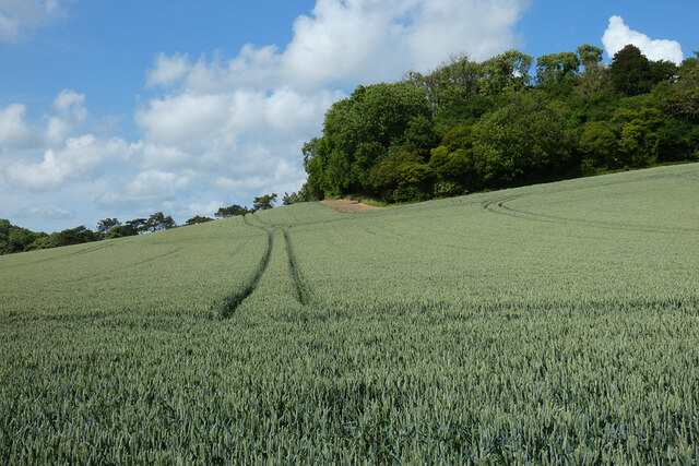
Stancoombe Copse is a picturesque woodland located in Hampshire, England. Covering an area of approximately 100 acres, it is a haven for nature enthusiasts and those seeking tranquility amidst the beauty of nature. The copse is situated near the village of Stancoombe, surrounded by rolling hills and idyllic countryside.

The woodland is predominantly composed of deciduous trees, including oak, beech, and ash. The dense canopy provides ample shade during hot summer days, making it a popular spot for picnics and leisurely walks. The forest floor is adorned with a carpet of bluebells in the spring, creating a breathtaking spectacle of color.

Stancoombe Copse is home to a diverse range of wildlife. Birdwatchers can spot various species, including woodpeckers, nuthatches, and thrushes. Squirrels scurry among the trees, while deer can occasionally be spotted grazing in the clearing. The copse is also known for its rich insect life, with butterflies and dragonflies fluttering around the meandering streams that traverse the woodland.

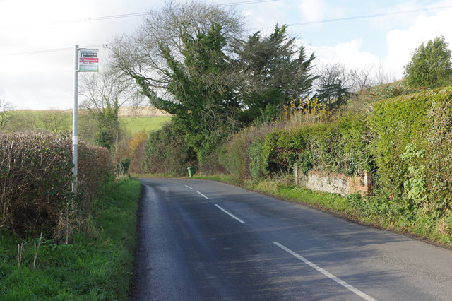
Visitors can explore Stancoombe Copse through a network of well-maintained footpaths that crisscross the area, offering different routes for hikers of varying abilities. These trails provide opportunities to discover hidden glades and ancient trees, each with its own unique character.

Stancoombe Copse is a protected site, managed by the local conservation trust to preserve its natural beauty and biodiversity. It offers a peaceful retreat for those seeking solace in nature and an escape from the hustle and bustle of everyday life.

If you have any feedback on the listing, please let us know in the comments section below.

Stancoombe Copse Images

Images are sourced within 2km of 51.003915/-0.9904714 or Grid Reference SU7023. Thanks to Geograph Open Source API. All images are credited.

Bridleway 10 ascends Sir William's Hill
Spraying fertilizer On a field below Rookham Copse.
Spraying fertilizer
On a field below Rookham Copse.
Track and farmland, Langrish A footpath descends by wheat  to meet a bridleway in the valley west of Sir William's Hill.
Track and farmland, Langrish
A footpath descends by wheat to meet a bridleway in the valley west of Sir William's Hill.
Farmland, East Meon Wheat on the western side of Barrow Hill.
Farmland, East Meon
Wheat on the western side of Barrow Hill.
A272, Bordean The A272 is a very rural A road, which follows an east to west route from near Heathfield to Winchester, passing through the Sussex countryside. It runs 86 miles from Sutton Scotney to Five Ashes <a href="https://www.geograph.org.uk/photo/6669405">TQ5523 : A267, A272 junction</a>.
<span class="nowrap"><a title="http://www.sabre-roads.org.uk/wiki/index.php?title=A272" rel="nofollow ugc noopener" href="http://www.sabre-roads.org.uk/wiki/index.php?title=A272">Link</a><img style="margin-left:2px;" alt="External link" title="External link - shift click to open in new window" src="https://s1.geograph.org.uk/img/external.png" width="10" height="10"/></span> 
Wikipedia: <span class="nowrap"><a title="http://en.wikipedia.org/wiki/A272_road" rel="nofollow ugc noopener" href="http://en.wikipedia.org/wiki/A272_road">Link</a><img style="margin-left:2px;" alt="External link" title="External link - shift click to open in new window" src="https://s1.geograph.org.uk/img/external.png" width="10" height="10"/></span>
A272, Bordean
The A272 is a very rural A road, which follows an east to west route from near Heathfield to Winchester, passing through the Sussex countryside. It runs 86 miles from Sutton Scotney to Five Ashes TQ5523 : A267, A272 junction. LinkExternal link Wikipedia: LinkExternal link
Road east of East Meon Looking towards East Meon on the road from Langrish. Unusually for a rural road, bus stop flags are provided throughout, although this one covers both directions.
Road east of East Meon
Looking towards East Meon on the road from Langrish. Unusually for a rural road, bus stop flags are provided throughout, although this one covers both directions.
Road to Langrish
Road to Langrish
The entrance to Bordean House
Winchester Road, Bordean
Farmland at the foot of Barrow Hill
Sir William's Hill The hill is ahead and to the left. The track is along the lower edge of Rookham Copse. Although well established, the track is unmarked on the 1:25000 map.
Sir William's Hill
The hill is ahead and to the left. The track is along the lower edge of Rookham Copse. Although well established, the track is unmarked on the 1:25000 map.
Road to Langrish from Frogmore
Sculptures at Pidham Farm Just a few of the interesting sculptures to be found a Pidham Farm.
Sculptures at Pidham Farm
Just a few of the interesting sculptures to be found a Pidham Farm.
Looking towards Sir William's Hill
Track to Rookham Copse Not shown on 1/50,000 map
Track to Rookham Copse
Not shown on 1/50,000 map
Bridleway to Lower Bordean
Track to Park Farm
Track to Park Farm
Footpath to Sir William's Hill
Show me another place!

Stancoombe Copse is located at Grid Ref: SU7023 (Lat: 51.003915, Lng: -0.9904714)

Administrative County: Hampshire

District: East Hampshire

Police Authority: Hampshire

What 3 Words

///remembers.feed.showcases. Near Petersfield, Hampshire

Related Wikis

Langrish

Langrish is a village and civil parish in the East Hampshire district of Hampshire, England. It is next to the civil parish of Stroud and is 2.7 miles...

Great storm of 1703

The Great storm of 1703 was a destructive extratropical cyclone that struck central and southern England on 26 November 1703. High winds caused 2,000 chimney...

Ramsdean

Ramsdean is a village in the East Hampshire district of Hampshire, England. It is 2.7 miles (4.3 km) west of Petersfield. The nearest railway station is...

Stroud, Hampshire

Stroud () is a village and civil parish in the East Hampshire district of Hampshire, England. It is 1.4 miles (2.3 km) west of Petersfield, on the A272...

Pidham Hill

Pidham Hill is a hill in the county of Hampshire, England. The summit elevation is 699 feet (213 m) AMSL. Pidham Hill is about 2 kilometres east-northeast...

Froxfield, Hampshire

Froxfield in Hampshire is a hamlet in the civil parish of Froxfield and Privett containing several small hamlets including Privett. Froxfield and Privett...

Bordean

Bordean is a hamlet in the East Hampshire district of Hampshire, England. It is in the civil parish of East Meon. It is 1 mile (1.6 km) northwest of the...

Weston, East Hampshire

Weston is a hamlet in the East Hampshire district of Hampshire, England. It is in the civil parish of Buriton. It is 1.4 miles (2.3 km) southwest of Petersfield...

Nearby Amenities

Located within 500m of 51.003915,-0.9904714
Barrier: stile
Source: survey
Lat/Long: 51.0058254/-0.9893763
Barrier: stile
Lat/Long: 51.0038045/-0.9921491
Barrier: stile
Lat/Long: 50.9998746/-0.9895099
Barrier: stile
Lat/Long: 50.9995481/-0.9900123
Barrier: stile
Lat/Long: 51.0030887/-0.991612
Barrier: stile
Source: survey
Lat/Long: 51.0051239/-0.9921186
Barrier: stile
Source: survey
Lat/Long: 51.0059289/-0.991883
North Stroud Farm
Place: farm
Lat/Long: 51.0030471/-0.9845536
The data included in this document is from www.openstreetmap.org. The data is made available under ODbL.

Have you been to Stancoombe Copse?

Leave your review of Stancoombe Copse below (or comments, questions and feedback).