Brandrith Wood

Wood, Forest in Yorkshire Ryedale

England

Brandrith Wood

St Martin's Church, Bulmer
St Martin's Church, Bulmer Credit: Ian S

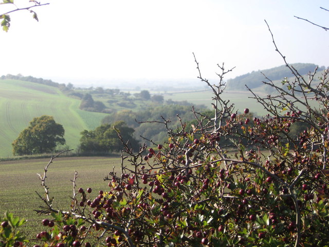
Brandrith Wood is a picturesque woodland located in the county of Yorkshire, England. Spanning across an area of approximately 200 acres, the wood is a serene haven for nature lovers and outdoor enthusiasts. Situated near the village of Kettlewell, it is easily accessible and attracts visitors from near and far.

The wood is characterized by its diverse range of tree species, including oak, ash, beech, and birch, which create a rich tapestry of colors throughout the seasons. The dense canopy offers shelter to a variety of wildlife, such as deer, badgers, and numerous bird species, making it a popular spot for birdwatching and wildlife photography.

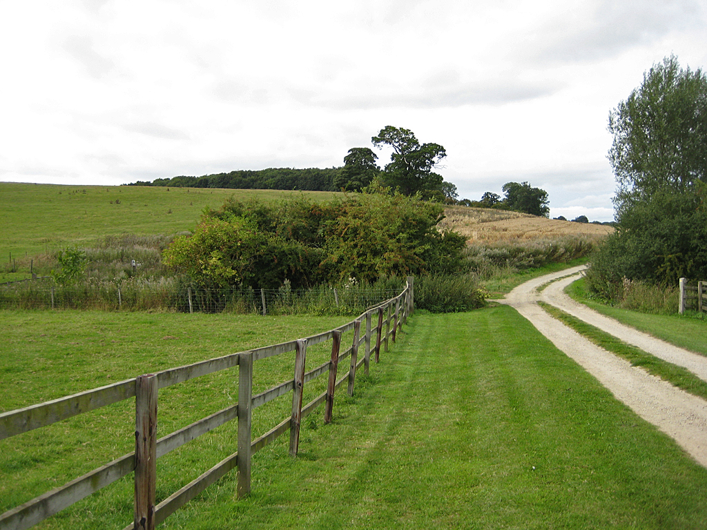
Tranquil walking trails wind through the wood, allowing visitors to explore its natural beauty at their own pace. These paths are well-maintained and suitable for all levels of fitness, making the wood an ideal destination for families, hikers, and dog walkers alike. The wood also features a picnic area, providing the perfect setting for a leisurely lunch surrounded by nature.

Brandrith Wood is not only a place of natural beauty but also holds historical significance. It is believed that the wood was once part of the ancient Royal Forest of Knaresborough and has been a woodland since at least the 13th century. Remnants of the past, such as old walls and ditches, can still be found within the wood, adding to its charm and intrigue.

Overall, Brandrith Wood offers a tranquil escape from the hustle and bustle of everyday life. Its natural beauty, diverse wildlife, and historical significance make it a must-visit destination for anyone seeking a peaceful retreat in the heart of Yorkshire.

If you have any feedback on the listing, please let us know in the comments section below.

Brandrith Wood Images

Images are sourced within 2km of 54.111719/-0.91873503 or Grid Reference SE7068. Thanks to Geograph Open Source API. All images are credited.

St Martin's Church, Bulmer
Howardian Hills near Bulmer Looking across the Howardian Hills from the public footpath north of Bulmer.
Howardian Hills near Bulmer
Looking across the Howardian Hills from the public footpath north of Bulmer.
Ganthorpe Gate and the road to Terrington View from the western fringe of the arboretum.
Ganthorpe Gate and the road to Terrington
View from the western fringe of the arboretum.
View East over Sata Pond The pond is on the western fringe of the arboretum. <span class="nowrap"><a title="http://www.kewatch.co.uk/index.html" rel="nofollow ugc noopener" href="http://www.kewatch.co.uk/index.html">Link</a><img style="margin-left:2px;" alt="External link" title="External link - shift click to open in new window" src="https://s1.geograph.org.uk/img/external.png" width="10" height="10"/></span>
View East over Sata Pond
The pond is on the western fringe of the arboretum. LinkExternal link
Autumn colour by Sata Pond Many of the specimen trees are displaying their autumn colours right now in the arboretum. This collection is by Sata Pond.
Autumn colour by Sata Pond
Many of the specimen trees are displaying their autumn colours right now in the arboretum. This collection is by Sata Pond.
St  Martin's Church  from  the  Fields This footpath comes in from south of the village
St Martin's Church from the Fields
This footpath comes in from south of the village
St  Martin's  Church  Bulmer
St Martin's Church Bulmer
Footpath  going  up  to  Bulmer From Mowthorpe to Bulmer
Footpath going up to Bulmer
From Mowthorpe to Bulmer
Field  and  Sky This footpath from Bulmer to Mowthorpe has wonderful views, but not on this side it is uphill.
Field and Sky
This footpath from Bulmer to Mowthorpe has wonderful views, but not on this side it is uphill.
View  from  a  Footpath Bulmer to Mowthorpe looking to the edge of Ox Pasture Wood coming from right, Bulmer Beck is in the dale bottom. The wood in the centre distance is Mowthorpe Wood on Mowthorpe Hill.
View from a Footpath
Bulmer to Mowthorpe looking to the edge of Ox Pasture Wood coming from right, Bulmer Beck is in the dale bottom. The wood in the centre distance is Mowthorpe Wood on Mowthorpe Hill.
No  Fishing  Today Frozen out, Ox Pasture Wood behind.
No Fishing Today
Frozen out, Ox Pasture Wood behind.
Farm  in  Mowthorpe  Dale On the footpath to Ganthorpe
Farm in Mowthorpe Dale
On the footpath to Ganthorpe
Ordnance Survey Flush Bracket 2331 This can be found on the wall of St Martins Church.
For more details see : <span class="nowrap"><a title="http://www.bench-marks.org.uk/bm75" rel="nofollow ugc noopener" href="http://www.bench-marks.org.uk/bm75">Link</a><img style="margin-left:2px;" alt="External link" title="External link - shift click to open in new window" src="https://s1.geograph.org.uk/img/external.png" width="10" height="10"/></span>
Ordnance Survey Flush Bracket 2331
This can be found on the wall of St Martins Church. For more details see : LinkExternal link
Entering Bulmer from the west A small village SW of Castle Howard.
Entering Bulmer from the west
A small village SW of Castle Howard.
Lake & boating hut southeast of Low Mowthorpe Farm near Ganthorpe
Walking towards Brandrith Farm near Ganthorpe
A thin, blue line Planted strip in The Yorkshire Arboretum. Not sure what these are - certainly not bluebells.
There are plans to create more wildflower areas in order to increase the diversity and numbers of native wildflowers.
A thin, blue line
Planted strip in The Yorkshire Arboretum. Not sure what these are - certainly not bluebells. There are plans to create more wildflower areas in order to increase the diversity and numbers of native wildflowers.
Dew pond, The Yorkshire Arboretum I almost missed this, but the tussocky grass gives away its location.
Dew pond, The Yorkshire Arboretum
I almost missed this, but the tussocky grass gives away its location.
Show me another place!

Brandrith Wood is located at Grid Ref: SE7068 (Lat: 54.111719, Lng: -0.91873503)

Division: North Riding

Administrative County: North Yorkshire

District: Ryedale

Police Authority: North Yorkshire

What 3 Words

///unfit.dynasties.routs. Near Sheriff Hutton, North Yorkshire

Nearby Locations

Brandrith Wood

Related Wikis

Henderskelfe

Henderskelfe is a civil parish in North Yorkshire, England. The parish does not contain any villages, though it is named after a previous settlement and...
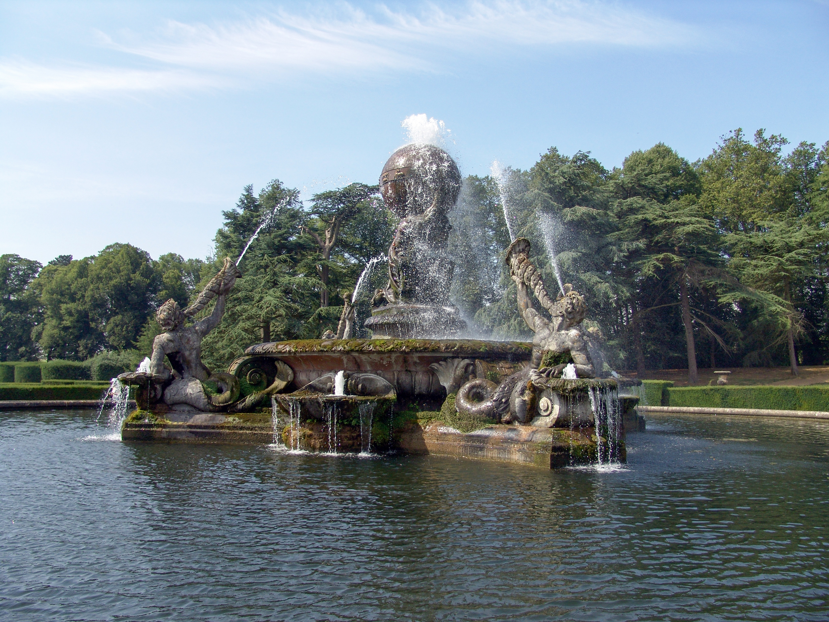
Atlas Fountain

The Atlas Fountain stands in the grounds of Castle Howard, North Yorkshire, England. It has been designated a Grade I listed building and is now recorded...

Castle Howard

Castle Howard is a stately home in North Yorkshire, England, within the civil parish of Henderskelfe, located 15 miles (24 km) north of York. It is a private...

Henderskelfe Castle

Henderskelfe Castle, or Henderskelf Castle in older texts, was a Medieval castle in the English county of North Yorkshire. It stood on what is now the...

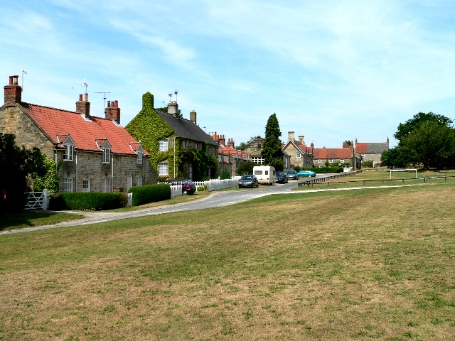
Bulmer, North Yorkshire

Bulmer is a village and civil parish in North Yorkshire, England. According to the 2001 census it had a population of 174, increasing to 202 at the census...

Welburn-on-Derwent

Welburn is a village and civil parish in North Yorkshire, England, on the north bank of the River Derwent. It lies on the edge of the Howardian Hills...

Coneysthorpe

Coneysthorpe is a small village and civil parish in North Yorkshire, England. It is situated near Castle Howard and 4 miles (6.4 km) west of Malton. The...

Crambeck

Crambeck near Crambe and Malton in Yorkshire is near the River Derwent. == History == === Roman === Crambeck is famous in antiquity as having been the Roman...

Nearby Amenities

Located within 500m of 54.111719,-0.91873503
Information: guidepost
Tourism: information
Lat/Long: 54.1130314/-0.914111
The data included in this document is from www.openstreetmap.org. The data is made available under ODbL.

Have you been to Brandrith Wood?

Leave your review of Brandrith Wood below (or comments, questions and feedback).