Cream Gorse
Wood, Forest in Leicestershire Melton
England
Cream Gorse
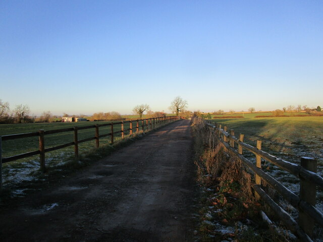
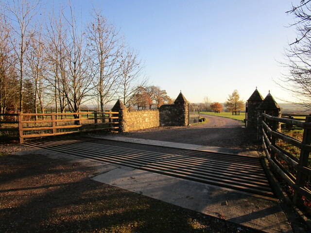
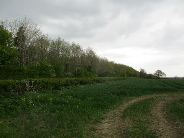
Cream Gorse is a picturesque woodland located in Leicestershire, England. It covers an area of approximately 100 acres and is known for its diverse range of flora and fauna. The woodland is situated in the heart of the county, making it easily accessible to both locals and visitors.
Cream Gorse is primarily composed of a mixture of mature broadleaf trees, including oak, beech, and ash. These towering trees create a dense canopy that provides shade and shelter for a variety of plant and animal species. The forest floor is covered in a rich carpet of ferns, bluebells, and wildflowers, adding a splash of color to the landscape during the spring and summer months.
The woodland is home to a wide range of wildlife, including deer, foxes, badgers, and numerous bird species. Birdwatchers can spot woodpeckers, owls, and various songbirds throughout the year. The tranquil atmosphere of Cream Gorse also attracts avid nature photographers and walkers who enjoy exploring the network of well-maintained footpaths.
Visitors to Cream Gorse can take advantage of the picnic areas and benches scattered throughout the woodland, making it an ideal spot for a family outing or a peaceful retreat. The forest is managed by local conservation organizations, who work tirelessly to preserve the natural beauty of the area and protect the delicate ecosystem.
Overall, Cream Gorse offers a serene escape from the hustle and bustle of everyday life, allowing visitors to immerse themselves in the beauty of nature and experience the tranquility of a Leicestershire woodland.
If you have any feedback on the listing, please let us know in the comments section below.
Cream Gorse Images
Images are sourced within 2km of 52.723828/-0.95592072 or Grid Reference SK7014. Thanks to Geograph Open Source API. All images are credited.


Cream Gorse is located at Grid Ref: SK7014 (Lat: 52.723828, Lng: -0.95592072)
Administrative County: Leicestershire
District: Melton
Police Authority: Leicestershire
What 3 Words
///opinion.tiredness.sprint. Near Asfordby, Leicestershire
Nearby Locations
Related Wikis
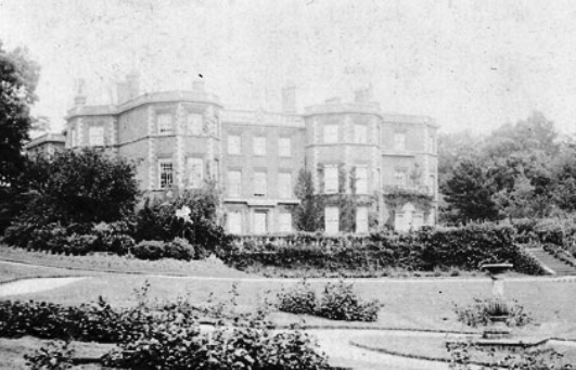
Gaddesby Hall
Gaddesby Hall is an 18th-century brick-built house in the village of Gaddesby, Leicestershire. It was built in the late 1740s as a three-storey house with...

Gaddesby
Gaddesby is a village and civil parish in the Melton borough of Leicestershire, England. The population of the civil parish (including Ashby Folville and...

Ashby Folville
Ashby Folville is a village and former civil parish, now in the parish of Gaddesby, in the Melton district of Leicestershire, England, south west of Melton...
St Mary's Church, Ashby Folville
St Mary's Church is a church in Ashby Folville, Leicestershire. It is a Grade I listed building. == History == The church was founded in 1220 by Maud Bassett...

Ashby Folville Manor
Ashby Folville Manor is a late 19th-century house in Neo-Tudor style in the village of Ashby Folville, Leicestershire. The house was substantially rebuilt...

Great Dalby railway station
Great Dalby railway station was a railway station serving the village of Great Dalby, Leicestershire on the Great Northern and London and North Western...

Frisby and Kirby
Frisby and Kirby, formerly just Frisby is a former civil parish in the Melton district, in the county of Leicestershire, England. Its principal settlements...

Kirby Bellars
Kirby Bellars is a village and civil parish near Melton Mowbray in Leicestershire, England. The population of the civil parish at the 2011 census was 369...
Nearby Amenities
Located within 500m of 52.723828,-0.95592072Have you been to Cream Gorse?
Leave your review of Cream Gorse below (or comments, questions and feedback).