Ash Plantation
Wood, Forest in Northamptonshire
England
Ash Plantation
Ash Plantation is a woodland area located in the county of Northamptonshire, England. Spanning over a vast area, it is a popular destination for nature enthusiasts and those seeking tranquility amidst nature. The plantation is primarily composed of ash trees, which dominate the landscape and give the area its name.
The woodland features a rich and diverse array of flora and fauna. The towering ash trees provide a dense canopy, creating a shaded and cool environment. Underneath, a variety of shrubs, wildflowers, and ferns thrive, adding to the overall beauty of the woodland. The forest floor is covered with a carpet of moss and fallen leaves, creating a soft and quiet pathway for visitors.
Ash Plantation offers numerous walking trails and paths, allowing visitors to explore the woodland at their own pace. These trails wind through the plantation, offering glimpses of the surrounding countryside and occasional wildlife encounters. Birdwatchers will find an abundance of avian species, including woodpeckers, owls, and various songbirds.
The woodland is managed and maintained by local authorities, ensuring its preservation and accessibility to the public. It is a designated site of special scientific interest (SSSI), highlighting its ecological importance and biodiversity. The plantation also serves as a valuable carbon sink, contributing to the reduction of greenhouse gases in the atmosphere.
Overall, Ash Plantation in Northamptonshire is a captivating woodland area, offering a peaceful and immersive experience in nature. Its lush vegetation, well-maintained trails, and diverse wildlife make it a must-visit destination for nature lovers and those seeking respite from the hustle and bustle of everyday life.
If you have any feedback on the listing, please let us know in the comments section below.
Ash Plantation Images
Images are sourced within 2km of 52.302577/-0.9783508 or Grid Reference SP6967. Thanks to Geograph Open Source API. All images are credited.


Ash Plantation is located at Grid Ref: SP6967 (Lat: 52.302577, Lng: -0.9783508)
Unitary Authority: West Northamptonshire
Police Authority: Northamptonshire
What 3 Words
///enjoys.sundial.awesome. Near Spratton, Northamptonshire
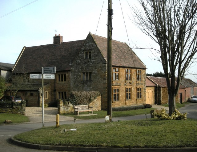
Nearby Locations
Related Wikis
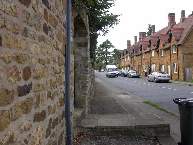
Holdenby
Holdenby is an English village and civil parish about 5.5 miles (8.9 km) north-west of Northampton in West Northamptonshire. The parish population measured...
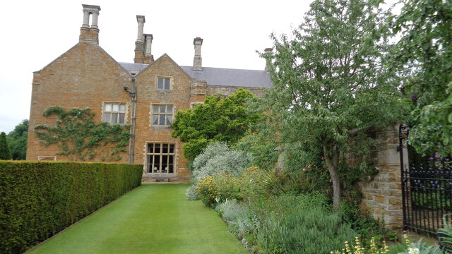
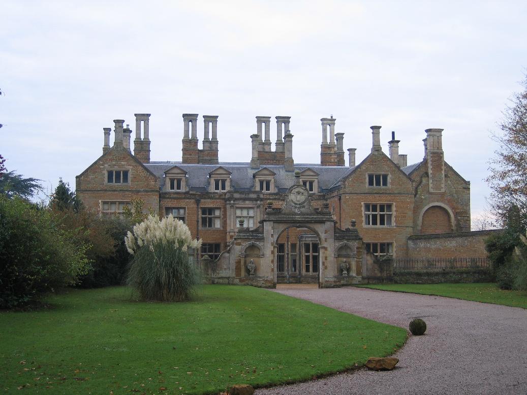
Holdenby House
Holdenby House is a historic country house in Northamptonshire, traditionally pronounced, and sometimes spelt, Holmby. The house is situated in the parish...
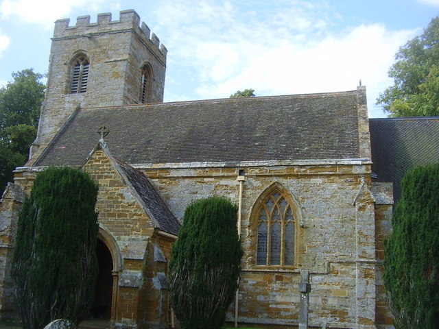
All Saints Church, Holdenby
All Saints Church is a redundant Anglican church in the village of Holdenby, Northamptonshire, England. It is recorded in the National Heritage List for...

Althorp Park railway station
Althorp Park railway station served the area of Althorp Estate in Northamptonshire, England. The station, which was situated on the Northampton Loop Line...
Chapel Brampton
Chapel Brampton is a village and former civil parish now in the parish of Church with Chapel Brampton, in the West Northamptonshire district, in the ceremonial...

Church Brampton
Church Brampton is a village and former civil parish, now in the parish of Church with Chapel Brampton, in the West Northamptonshire district, in the ceremonial...
Teeton
Teeton is a village and former civil parish, now in the parish of Hollowell, in the West Northamptonshire district, in the ceremonial county of Northamptonshire...

Church Brampton railway station
Church Brampton was a railway station on the Northampton Loop Line serving the village of Church Brampton in Northamptonshire. The station was opened on...
Related Videos

Althorp Estate
Princess Diana grew up at Althorp House in Northamptonshire until she married the Prince of Wales in 1981. The property, which ...
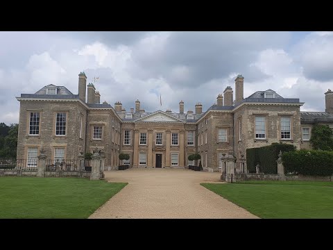
Althorp Estate - Northamptonshire
Northamptonshire Playlist: https://www.youtube.com/playlist?list=PL3rSdzPpvGrvedQ6RTr_JtpSmmteyS64s Map Location: ...

Althorp and Princess Diana's Island (Road Trip Day 11)
In this episode of the Road Trip Series, I visit the ancestral home of the Spencer family - Althorp. The gardens include the island ...

Was Princess Diana Secretly Buried Here?
diana #thecrown #princess I pay a visit to the Althorp Estate, childhood home and burial place of Princess Diana to see the private ...
Nearby Amenities
Located within 500m of 52.302577,-0.9783508Have you been to Ash Plantation?
Leave your review of Ash Plantation below (or comments, questions and feedback).