Blackdene, East

Settlement in Durham

England

Blackdene, East

Weardale hay meadow On the south side of the road between Wearhead and Ireshopeburn.
Weardale hay meadow Credit: Trevor Littlewood

Blackdene is a small village located in the county of Durham, in the northeastern region of England. Situated in the area known as the East Durham Coalfield, Blackdene has a rich history closely tied to the coal mining industry. The village is surrounded by picturesque countryside, with rolling hills and lush green fields.

Once a thriving mining community, Blackdene's population has dwindled in recent years due to the decline of the coal industry. Today, it is a quiet residential area, with a close-knit community and a peaceful atmosphere. The village is made up of a mix of traditional stone-built houses and more modern dwellings.

Blackdene is well-connected to the nearby towns and cities, with good road links to Durham, Newcastle, and Sunderland. The village is also served by a local bus service, providing transport links to the surrounding areas.

Although Blackdene does not have many amenities of its own, the neighboring towns offer a range of facilities such as shops, schools, and healthcare services. The village itself is known for its beautiful natural surroundings, making it an attractive place for those seeking a tranquil rural lifestyle.

Overall, Blackdene is a small, close community that has weathered the decline of the mining industry. It offers a peaceful and picturesque setting, with easy access to the nearby towns and cities for those seeking additional amenities and services.

If you have any feedback on the listing, please let us know in the comments section below.

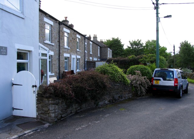
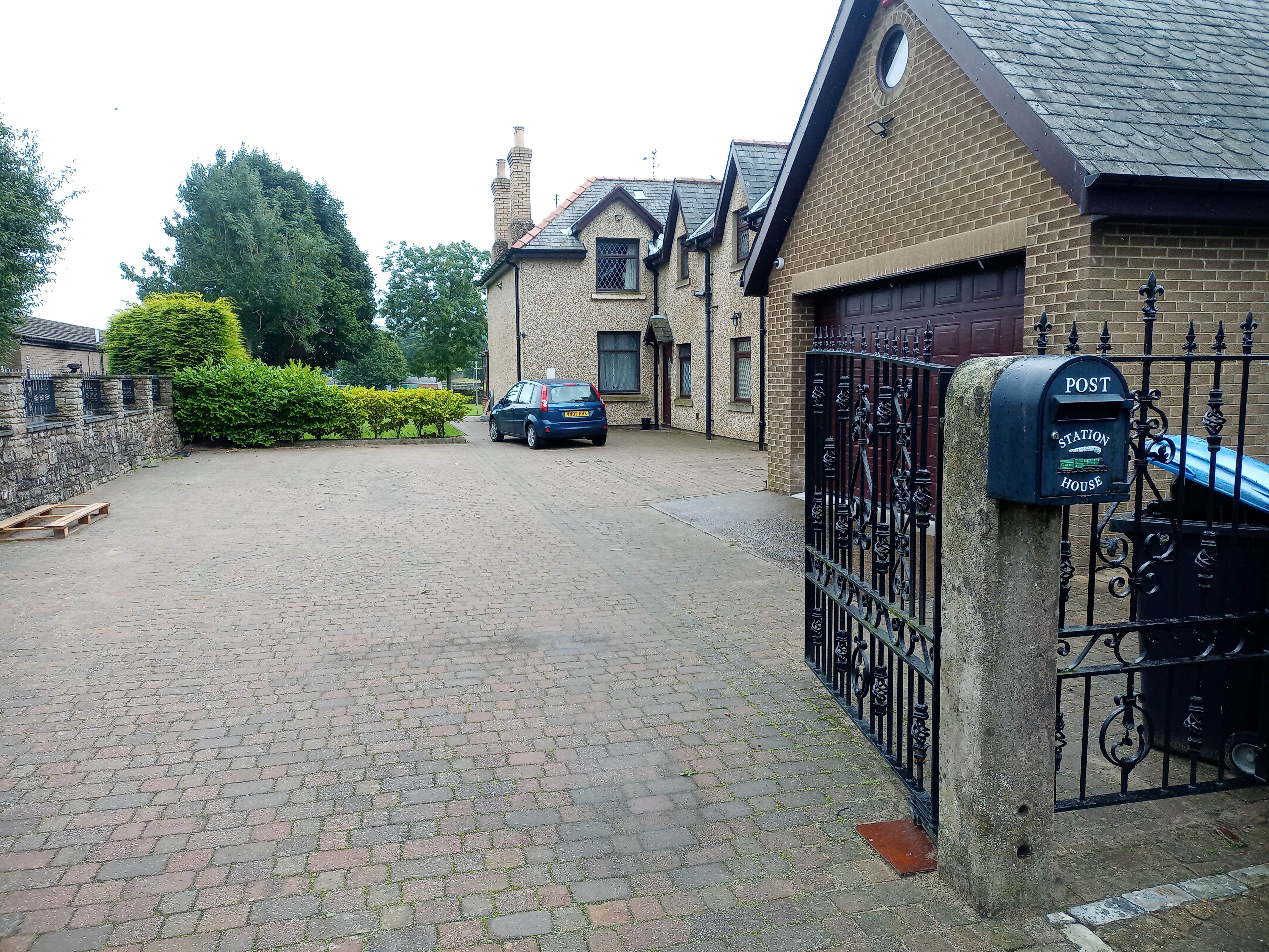
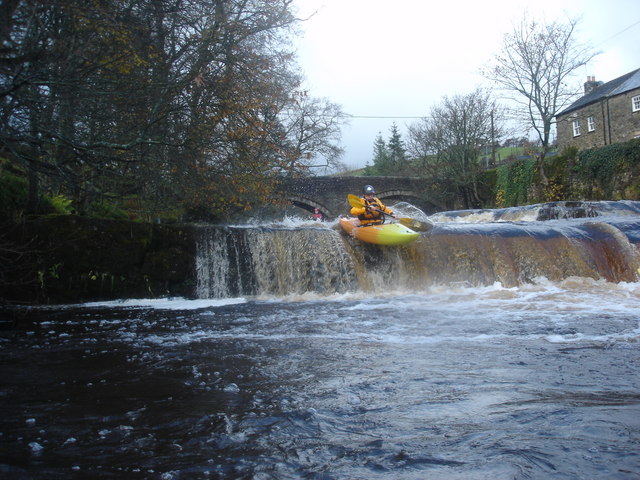
Blackdene, East Images

Images are sourced within 2km of 54.742222/-2.186395 or Grid Reference NY8838. Thanks to Geograph Open Source API. All images are credited.

Weardale hay meadow On the south side of the road between Wearhead and Ireshopeburn.
Weardale hay meadow
On the south side of the road between Wearhead and Ireshopeburn.
Gateway leading to valley of Hart Hope The valley, Hart Hope, a tributary to the River Wear is drained by the stream, West Grain. The wall (recently rebuilt) and gateway in it are on the north-west side of the minor road connecting St. John's Chapel in Weardale with Langdon Beck in Teesdale.
Gateway leading to valley of Hart Hope
The valley, Hart Hope, a tributary to the River Wear is drained by the stream, West Grain. The wall (recently rebuilt) and gateway in it are on the north-west side of the minor road connecting St. John's Chapel in Weardale with Langdon Beck in Teesdale.
Barns at Hotts A strange name. There appears to be two dwellings at Hotts which lies immediately south of the A689 west of Ireshopeburn; these outbuildings are adjacent to them and seem to be disused.
Barns at Hotts
A strange name. There appears to be two dwellings at Hotts which lies immediately south of the A689 west of Ireshopeburn; these outbuildings are adjacent to them and seem to be disused.
Field west of High Hotts A field of rough, (very rough), pasture on the south side of Weardale at Ireshopeburn. The valley below is of course that of the River Wear and the rise on the left skyline is that of Carr Brow Moor. The farm at High Hotts is in view.
Field west of High Hotts
A field of rough, (very rough), pasture on the south side of Weardale at Ireshopeburn. The valley below is of course that of the River Wear and the rise on the left skyline is that of Carr Brow Moor. The farm at High Hotts is in view.
Cold Knuckles over hay field OS Explorer Map OL31 would suggest the name Ireshope Plains for the building here but the name is apparently Cold Knuckles, it's seen from a field path to the east. The dark hills beyond are at the head of Burn Hope, a side valley of Weardale.
Cold Knuckles over hay field
OS Explorer Map OL31 would suggest the name Ireshope Plains for the building here but the name is apparently Cold Knuckles, it's seen from a field path to the east. The dark hills beyond are at the head of Burn Hope, a side valley of Weardale.
Town hall and war memorial, St John's Chapel
Blackdene
Blackdene
Blackdene Bridge
Blackdene Bridge
Carway Bank
Carway Bank
Downstream from Blackdene Bridge
House at Blackdene
House at Blackdene
Riverside houses at Blackdene
Rose Lea
Rose Lea
Upstream from Blackdene Bridge
Footpath to Whitestones Farm
Remains of a wall
Remains of a wall
Towards St John's Chapel The buildings nearest the camera are marked as Short Thorns on the map.
Towards St John's Chapel
The buildings nearest the camera are marked as Short Thorns on the map.
St John's Chapel
St John's Chapel
Show me another place!

Blackdene, East is located at Grid Ref: NY8838 (Lat: 54.742222, Lng: -2.186395)

Unitary Authority: County Durham

Police Authority: Durham

What 3 Words

///obtain.musically.cook. Near Stanhope, Co. Durham

Related Wikis

East Blackdene

East Blackdene is a hamlet in the civil parish of Stanhope, in County Durham, England. It is situated to the north of the River Wear, on the opposite side...

St John's Chapel, County Durham

St John's Chapel is a village in the civil parish of Stanhope, in County Durham, England. It is situated in Weardale, on the south side of the River Wear...

St John's Chapel railway station

St John's Chapel railway station served the village of St John's Chapel, County Durham, England, from 1895 to 1965 on the Weardale Railway. == History... ==

West Blackdene

West Blackdene is a village in the civil parish of Stanhope, in County Durham, England. It is situated to the north of the River Wear, opposite Ireshopeburn...

Ireshopeburn

Ireshopeburn ( EYE-sup-burn ) is a village in the civil parish of Stanhope, in County Durham, England. It is situated on the south side of Weardale, between...

Daddry Shield

Daddry Shield is a village in the civil parish of Stanhope, in County Durham, England. It is situated on the south side of the River Wear in Weardale,...

New House, County Durham

New House or Newhouse is a hamlet in the civil parish of Stanhope, in County Durham, England. It lies on the north side of the River Wear, opposite Ireshopeburn...

Wearhead railway station

Wearhead railway station served the village of Wearhead, County Durham, England, from 1895 to 1961 on the Weardale Railway. == History == The station opened...

Nearby Amenities

Located within 500m of 54.742222,-2.186395
Bus Stop
Tollgate House
Naptan AtcoCode: 13004532D
Naptan Bearing: SE
Naptan CommonName: Tollgate House
Naptan Indicator: south east bound
Naptan Landmark: Landmark not known
Naptan NaptanCode: durdatma
Naptan Notes: NW of 84 Hood Street (A689)- St Johns Chapel
Naptan Street: A689 Hood Street
Naptan Verified: no
Source: naptan_import
Lat/Long: 54.7391697/-2.1878599
Bus Stop
Medical Centre
Naptan AtcoCode: 13004535D
Naptan Bearing: SE
Naptan CommonName: Medical Centre
Naptan Indicator: south east bound
Naptan Landmark: Landmark not known
Naptan NaptanCode: durdatmt
Naptan Notes: Opposite 47 Hood Street- St Johns Chapel
Naptan Street: A689 Hood Street
Naptan Verified: no
Source: naptan_import
Lat/Long: 54.7379595/-2.1845778
Bus Stop
Medical Centre
Naptan AtcoCode: 13004535H
Naptan Bearing: NW
Naptan CommonName: Medical Centre
Naptan Indicator: north west bound
Naptan Landmark: Landmark not known
Naptan NaptanCode: durdatmw
Naptan Notes: 51 Hood Street- St Johns Chapel
Naptan Street: A689 Hood Street
Naptan Verified: no
Source: naptan_import
Lat/Long: 54.7381113/-2.1852308
Barrier: entrance
Lat/Long: 54.740203/-2.1825685
Bridge End ford
Ford: yes
Lat/Long: 54.7421562/-2.1931178
Power: pole
Lat/Long: 54.7412193/-2.1796402
Power: pole
Lat/Long: 54.7412547/-2.1808021
Power: pole
Lat/Long: 54.7412697/-2.1819275
Power: pole
Lat/Long: 54.7413454/-2.1850539
Power: pole
Lat/Long: 54.7418317/-2.1883803
Power: pole
Lat/Long: 54.7422458/-2.1892677
Power: pole
Lat/Long: 54.7427368/-2.1902884
Power: pole
Lat/Long: 54.7432065/-2.1913228
Power: pole
Lat/Long: 54.7433314/-2.1924927
Power: pole
Lat/Long: 54.7434586/-2.1937044
Barrier: stile
Foot: yes
Stile: squeezer
Lat/Long: 54.7423383/-2.1904853
East Blackdene
Place: hamlet
Wikidata: Q5327879
Wikipedia: en:East Blackdene
Lat/Long: 54.7420736/-2.1862471
Barrier: stile
Foot: yes
Stile: squeezer
Lat/Long: 54.7398865/-2.179846
Pryse Farm
Place: farm
Source Name: OS_OpenData_StreetView
Lat/Long: 54.7391038/-2.1892244
Sunny Bank (Farm)
Place: farm
Source: OS_OpenData_StreetView
Lat/Long: 54.7440554/-2.1893209
Barrier: entrance
Lat/Long: 54.7457756/-2.1825844
Middle Blackdene
Place: hamlet
Source Name: OS_OpenData_StreetView
Lat/Long: 54.7427998/-2.1921721
Barrier: entrance
Lat/Long: 54.7400669/-2.1841308
Post Box
Image: https://www.geograph.org.uk/photo/5519612
Ref: DL13 142
Lat/Long: 54.7392068/-2.187945
Historic: milestone
Wikidata: Q111793705
Wikimedia Commons: File:Old Milepost by the A689, Hood Street, St John's Chapel (geograph 5624120).jpg
Lat/Long: 54.7391586/-2.1877694
Power: pole
Transformer: distribution
Lat/Long: 54.7433664/-2.1924873
Power: pole
Lat/Long: 54.7412932/-2.182999
Power: pole
Lat/Long: 54.741318/-2.1838921
Power: pole
Lat/Long: 54.7413877/-2.1873602
Power: pole
Lat/Long: 54.7413583/-2.1862015
Power: pole
Lat/Long: 54.7436997/-2.1921399
Power: pole
Lat/Long: 54.7440354/-2.1919119
Power: pole
Lat/Long: 54.7441222/-2.1906188
Power: pole
Lat/Long: 54.7442109/-2.190437
Power: pole
Lat/Long: 54.7446898/-2.1895063
Power: pole
Lat/Long: 54.7450575/-2.1890165
Power: pole
Lat/Long: 54.7454045/-2.1884936
Power: pole
Lat/Long: 54.7433685/-2.1923821
Power: pole
Lat/Long: 54.7442475/-2.1917304
Power: pole
Lat/Long: 54.7451831/-2.1877353
The data included in this document is from www.openstreetmap.org. The data is made available under ODbL.

Have you been to Blackdene, East?

Leave your review of Blackdene, East below (or comments, questions and feedback).