Chalkdell Copse

Wood, Forest in Hampshire Basingstoke and Deane

England

Chalkdell Copse

Woodland clearing, Upton Grey In woods to the west of Humbly Grove.
Woodland clearing, Upton Grey Credit: Andrew Smith

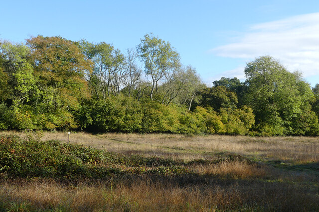
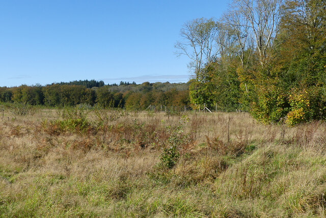
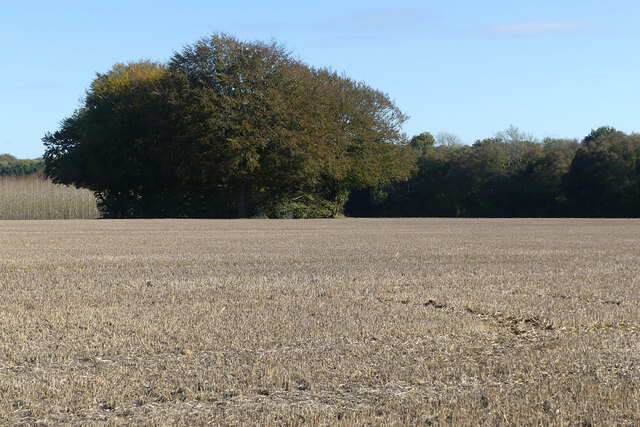
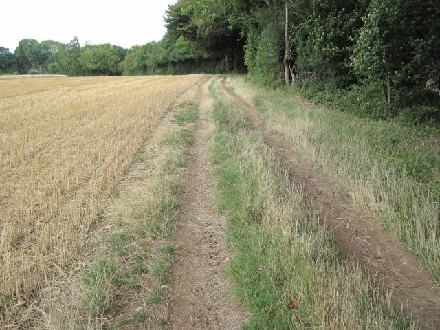
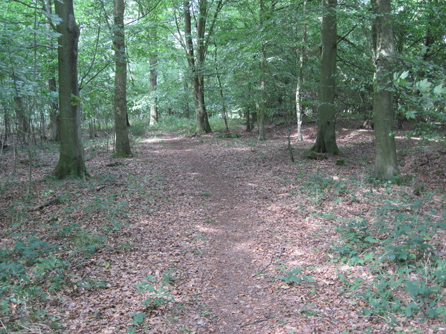
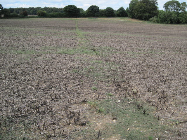
Chalkdell Copse is a picturesque woodland located in Hampshire, England. Situated in the southern part of the county, this ancient forest covers an area of approximately 50 acres. The copse is characterized by its dense canopy of trees, which primarily consists of oak, beech, and birch.

One of the notable features of Chalkdell Copse is its chalky soil, which gives the woodland its name. This unique soil composition contributes to the diversity of plant life found within the forest. Alongside the towering trees, visitors can discover a plethora of wildflowers, including bluebells, primroses, and wood anemones, which create a vibrant carpet of colors during the spring months.

The woodland is home to a variety of wildlife, making it a popular spot for nature enthusiasts and birdwatchers. Visitors may encounter species such as deer, foxes, badgers, and rabbits, as well as a multitude of bird species including woodpeckers, thrushes, and owls. The tranquil atmosphere of the copse makes it an ideal setting for birdwatching and observing the natural behavior of these creatures.

Chalkdell Copse offers several walking trails that wind through the forest, allowing visitors to explore its natural beauty. These trails provide an opportunity to immerse oneself in the peaceful surroundings and breathe in the fresh air that characterizes this rural area of Hampshire.

Overall, Chalkdell Copse is a charming woodland that offers a glimpse into the natural beauty of Hampshire. With its diverse plant life, abundant wildlife, and serene atmosphere, it is a haven for those seeking a peaceful escape into nature.

If you have any feedback on the listing, please let us know in the comments section below.

Chalkdell Copse Images

Images are sourced within 2km of 51.191724/-1.0130197 or Grid Reference SU6944. Thanks to Geograph Open Source API. All images are credited.

Woodland clearing, Upton Grey In woods to the west of Humbly Grove.
Woodland clearing, Upton Grey
In woods to the west of Humbly Grove.
Woodland, Weston Patrick Although there are few trees in the foreground, this clearing has been replanted.
Woodland, Weston Patrick
Although there are few trees in the foreground, this clearing has been replanted.
Farmland and woodland, Shalden A footpath through stubble to the west of Golden Pot approaches a plantation of youngish deciduous trees.
Farmland and woodland, Shalden
A footpath through stubble to the west of Golden Pot approaches a plantation of youngish deciduous trees.
Farmland, Shalden A copse marks the site of a disused pit to the north of Shalden Park Wood.
Farmland, Shalden
A copse marks the site of a disused pit to the north of Shalden Park Wood.
Lasham Airfield Between Basingstoke and Alton. Owned by, and the home of, the Lasham Gliding Society, one of the largest gliding clubs in the world. ATC Lasham Ltd also has an airliner maintenance facility there.  <span class="nowrap"><a title="https://en.wikipedia.org/wiki/Lasham_Airfield" rel="nofollow ugc noopener" href="https://en.wikipedia.org/wiki/Lasham_Airfield">Link</a><img style="margin-left:2px;" alt="External link" title="External link - shift click to open in new window" src="https://s1.geograph.org.uk/img/external.png" width="10" height="10"/></span>
Lasham Airfield
Between Basingstoke and Alton. Owned by, and the home of, the Lasham Gliding Society, one of the largest gliding clubs in the world. ATC Lasham Ltd also has an airliner maintenance facility there. LinkExternal link
B3349 at Golden Pot The B3349 runs 27 miles from Alton <a href="https://www.geograph.org.uk/photo/5212600">SU7038 : Junction of A339 & B3349</a> to Wokingham.
<span class="nowrap"><a title="http://www.sabre-roads.org.uk/wiki/index.php?title=B3349" rel="nofollow ugc noopener" href="http://www.sabre-roads.org.uk/wiki/index.php?title=B3349">Link</a><img style="margin-left:2px;" alt="External link" title="External link - shift click to open in new window" src="https://s1.geograph.org.uk/img/external.png" width="10" height="10"/></span>
B3349 at Golden Pot
The B3349 runs 27 miles from Alton SU7038 : Junction of A339 & B3349 to Wokingham. LinkExternal link
The Golden Pot
The Golden Pot
Entrance road to Humbly Grove Oilfield, Weston Common
Path near Gason Wood
Path towards Shalden
Bridleway towards Weston Common
Bridleway by Weston Common
Long Lane Bridleway towards Weston Patrick
Path in Closedown Wood
Path towards Weston Common
Old Milestone by the B3349, Golden Pot, Shalden Parish Concrete post by the B3349, in parish of SHALDEN (EAST HAMPSHIRE District), Golden Pot, on grass verge between road and ditch, on West side of road. Hook pillar, erected by the Basingstoke, Hartfordbridge & Blackwater (and Odiham) turnpike trust in the 19th century. Plate broken.

Inscription reads:- : 5 / MILES FROM / ODIHAM / 3 TO / Alton : : W.F. Blake. :

Milestone Society National ID: HA_ODAL05.
Old Milestone by the B3349, Golden Pot, Shalden Parish
Concrete post by the B3349, in parish of SHALDEN (EAST HAMPSHIRE District), Golden Pot, on grass verge between road and ditch, on West side of road. Hook pillar, erected by the Basingstoke, Hartfordbridge & Blackwater (and Odiham) turnpike trust in the 19th century. Plate broken. Inscription reads:- : 5 / MILES FROM / ODIHAM / 3 TO / Alton : : W.F. Blake. : Milestone Society National ID: HA_ODAL05.
Farmland, Lasham A small copse on the left of picture is, perhaps, the site of a former pit.
Farmland, Lasham
A small copse on the left of picture is, perhaps, the site of a former pit.
Farmland, Herriard Looking up to the north-eastern corner of High Wood.
Farmland, Herriard
Looking up to the north-eastern corner of High Wood.
Show me another place!

Chalkdell Copse is located at Grid Ref: SU6944 (Lat: 51.191724, Lng: -1.0130197)

Administrative County: Hampshire

District: Basingstoke and Deane

Police Authority: Hampshire

What 3 Words

///varieties.trickles.slumped. Near Alton, Hampshire

Related Wikis

Lasham Airfield

Lasham Airfield (ICAO: EGHL) is an aerodrome 3.6 miles (5.8 km) north-west of Alton in Hampshire, England, in the village of Lasham. Th airfield was built...

Southrope

Southrope is a hamlet in the civil parish of Herriard, Hampshire. It has one pub, named the Fur and Feathers. The hamlet was once considered a part of...

Golden Pot

Golden Pot is a hamlet in the East Hampshire district of Hampshire, England. It lies 2.4 miles (3.9 km) north of Alton, on the B3349 road. The nearest...

Shalden

Shalden is a village and civil parish in the East Hampshire district of Hampshire, England. It is 2.3 miles (3.7 km) northwest of Alton and 1.9 miles...

Lasham

Lasham is a village and civil parish in the East Hampshire district of Hampshire, England. It is 3.4 miles (5.5 km) northwest of Alton and 1.2 miles (1...

Herriard railway station

Herriard railway station was a railway station in the village of Herriard, Hampshire, UK. The station was a stop on the Basingstoke and Alton Light Railway...

Bagmore

Bagmore is a village in Hampshire, England.

Tunworth

Tunworth is a hamlet and civil parish in Hampshire. == Geography == === Location === Tunworth is located in North East Hampshire. Tunworth is located approximately...

Nearby Amenities

Located within 500m of 51.191724,-1.0130197
Lasham Corner
Place: locality
Source: Bing
Lat/Long: 51.187695/-1.0131435
Entrance: yes
Lat/Long: 51.1898136/-1.0107966
Restaurant
Avenue Restaurant
Source: survey
Lat/Long: 51.1896031/-1.0107696
Give Way
Lat/Long: 51.1900132/-1.0153657
The data included in this document is from www.openstreetmap.org. The data is made available under ODbL.

Have you been to Chalkdell Copse?

Leave your review of Chalkdell Copse below (or comments, questions and feedback).