Hazel Grove

Wood, Forest in Oxfordshire South Oxfordshire

England

Hazel Grove

The road to Stoke Row Going through Bear Wood
The road to Stoke Row Credit: David Howard

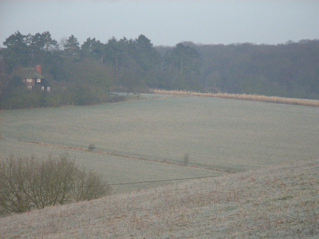
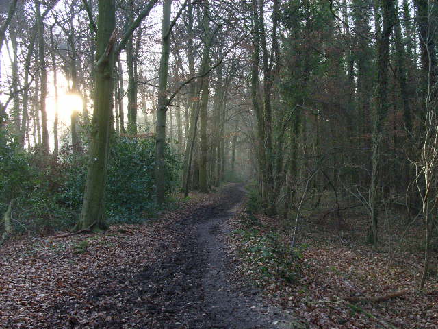
Hazel Grove, located in Oxfordshire, England, is a picturesque woodland area known for its dense hazel tree population. Situated within a forested region, it offers visitors a tranquil escape from the bustling city life. The grove is particularly renowned for its abundant wildlife and stunning natural beauty.

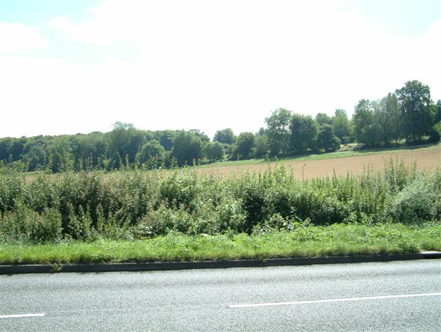
Covering an area of approximately 100 acres, Hazel Grove is a haven for nature enthusiasts and hikers alike. The woodland features a well-maintained network of walking trails that meander through the ancient trees, providing visitors with the opportunity to explore the area's diverse flora and fauna. The hazel trees, from which the grove derives its name, dominate the landscape and create a unique and enchanting atmosphere.

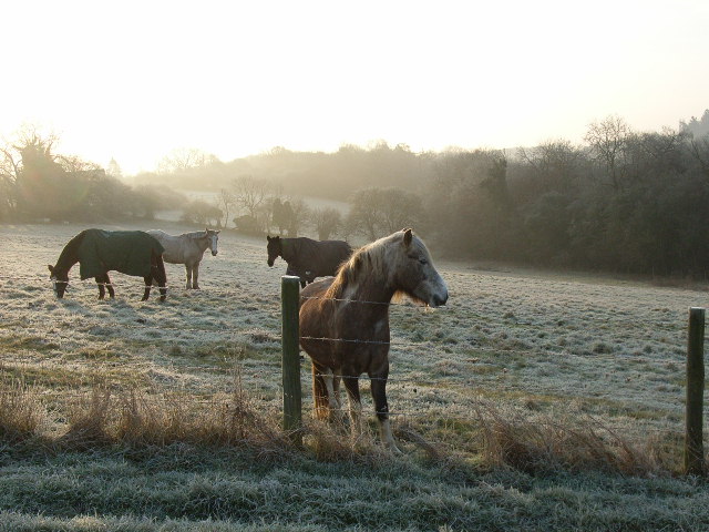
The grove boasts an array of wildlife, including various bird species, small mammals, and insects. Birdwatchers can spot species such as woodpeckers, nuthatches, and owls, while nature lovers may come across deer, foxes, and rabbits during their visit. The varied ecosystem within Hazel Grove is also home to a variety of wildflowers, adding bursts of color to the surroundings.

Hazel Grove is not only a place of natural beauty but also holds historical significance. The woodland has been protected for many years, with efforts made to conserve its ancient trees and preserve its ecological balance. It is often used as an educational site, offering visitors the chance to learn about woodland management and the importance of preserving natural habitats.

With its serene ambiance, diverse wildlife, and rich history, Hazel Grove, Oxfordshire, is a must-visit destination for those seeking a peaceful retreat in the heart of nature.

If you have any feedback on the listing, please let us know in the comments section below.

Hazel Grove Images

Images are sourced within 2km of 51.535084/-1.0057429 or Grid Reference SU6982. Thanks to Geograph Open Source API. All images are credited.

The road to Stoke Row Going through Bear Wood
The road to Stoke Row
Going through Bear Wood
Bear Wood, Stoke Row
Stoke Row The road becomes Kit Lane but the maps don't give a name till beyond the end of the village.
Stoke Row
The road becomes Kit Lane but the maps don't give a name till beyond the end of the village.
Stoke Row Green
Stoke Row Green
Stoke Row
Stoke Row
Basset Wood
Basset Wood
The north end of Stony Bottom The north end of Stony Bottom taken from SU707816 looking South towards Green Trees Farm.
The north end of Stony Bottom
The north end of Stony Bottom taken from SU707816 looking South towards Green Trees Farm.
Peppard Common Looking NW across Peppard Common towards Manor Farm.
Peppard Common
Looking NW across Peppard Common towards Manor Farm.
The Lamb, Satwell The Lamb at Satwell
The Lamb, Satwell
The Lamb at Satwell
Satwell
Satwell
The Lamb at Satwell
The Lamb at Satwell
The valley north of Peppard Looking from the hillside above Littlebottom Wood over to the house and woods in the northwestern area of the square.
The valley north of Peppard
Looking from the hillside above Littlebottom Wood over to the house and woods in the northwestern area of the square.
The bridleway in Littlebottom Wood Looking southwards from the northern end of the wood.
The bridleway in Littlebottom Wood
Looking southwards from the northern end of the wood.
Horses above Littlebottom Wood
The Unicorn PH, Peppard Hill
Peppard Farm One of the cottages adjacent to the farm, adjacent to the main road from Sonning Common to Nettlebed.
Peppard Farm
One of the cottages adjacent to the farm, adjacent to the main road from Sonning Common to Nettlebed.
The Dog, Rotherfield Peppard One of two pubs in the village, on the main road from Nettlebed to Sonning Common.
The Dog, Rotherfield Peppard
One of two pubs in the village, on the main road from Nettlebed to Sonning Common.
Path junction in Greyhone Wood This section of woodland is mixed conifer and deciduous.  It is very dark compared with other woods around, the sun barely penetrating through the canopy.  This section has bridleway designation.
Path junction in Greyhone Wood
This section of woodland is mixed conifer and deciduous. It is very dark compared with other woods around, the sun barely penetrating through the canopy. This section has bridleway designation.
Show me another place!

Hazel Grove is located at Grid Ref: SU6982 (Lat: 51.535084, Lng: -1.0057429)

Administrative County: Oxfordshire

District: South Oxfordshire

Police Authority: Thames Valley

What 3 Words

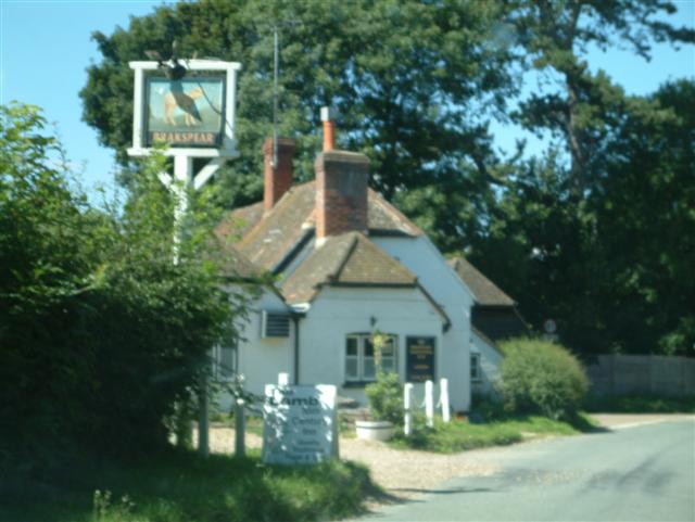
///pursuing.types.opposites. Near Rotherfield Peppard, Oxfordshire

Related Wikis

Wyfold Court

Wyfold Court is a country house at Rotherfield Peppard in south Oxfordshire. It is a Grade II* listed building. By the year 2000, the estate had been converted...

Bear, Oveys and Great Bottom Woods

Bear, Oveys and Great Bottom Woods is a 64.1-hectare (158-acre) biological Site of Special Scientific Interest west of Henley-on-Thames in Oxfordshire...

Gallowstree Common

Gallowstree Common is a hamlet in South Oxfordshire, England, about 4.5 miles (7.2 km) north of Reading, Berkshire. The village had a public house, the...

Stoke Row

Stoke Row is a village and civil parish in the Chiltern Hills, about 5 miles (8 km) west of Henley-on-Thames in South Oxfordshire and about 9 miles (14...

Hook End Recording Studios

Hook End Recording Studios was a recording studio located in Hook End Manor, a 16th-century Elizabethan house near Checkendon, Oxfordshire, England. Its...

Highmoor, Oxfordshire

Highmoor is a village and civil parish in the Chiltern Hills in Oxfordshire, about 4 miles (6.4 km) west of Henley-on-Thames. The parish includes the hamlet...

Maiden Erlegh Chiltern Edge

Maiden Erlegh Chiltern Edge (formerly Chiltern Edge Community School) is a coeducational secondary school located in Sonning Common, Oxfordshire, England...

St Peter and St Paul, Checkendon

St Peter and St Paul is the Church of England parish church of Checkendon, a village in Oxfordshire, England. Its parish is part of the Deanery of Henley...

Nearby Amenities

Located within 500m of 51.535084,-1.0057429
Turning Circle
Turning Circle: circle
Lat/Long: 51.5383162/-1.0086847
Parking
Lat/Long: 51.5353385/-1.0005357
Turning Circle
Turning Circle: hammer
Lat/Long: 51.5375015/-1.0074083
Hospital Turn
Naptan AtcoCode: 340001674CNR
Naptan Bearing: NW
Naptan BusStopType: CUS
Naptan CommonName: Hospital Turn
Naptan Indicator: Corner
Naptan Landmark: Hospital Turn
Naptan NaptanCode: oxfgdadp
Naptan Street: Stoke Row Road
Naptan Verified: no
Source: naptan_import
Lat/Long: 51.5335379/-0.9994821
Bus Stop
Hospital Turn
Naptan AtcoCode: 340001674OPP
Naptan Bearing: SE
Naptan CommonName: Hospital Turn
Naptan Indicator: Opposite
Naptan Landmark: Hospital Turn
Naptan NaptanCode: oxfgdadm
Naptan Street: Stoke Row Road
Naptan Verified: no
Source: naptan_import
Lat/Long: 51.5334997/-0.9992234
Bus Stop
The Grouse and Claret PH
Naptan AtcoCode: 340003300CNR
Naptan Bearing: SE
Naptan CommonName: The Grouse and Claret PH
Naptan Indicator: Corner
Naptan Landmark: The Grouse and Claret PH
Naptan NaptanCode: oxfgmagp
Naptan Street: Stoke Row Road
Naptan Verified: no
Source: naptan_import
Lat/Long: 51.5371687/-1.003483
Bus Stop
The Grouse and Claret PH
Bus: yes
Naptan AtcoCode: 340003300OPP
Naptan Bearing: NW
Naptan CommonName: The Grouse and Claret PH
Naptan Indicator: Opposite
Naptan Landmark: The Grouse and Claret PH
Naptan NaptanCode: oxfgmagm
Naptan Street: Stoke Row Road
Naptan Verified: no
Public Transport: platform
Source: naptan_import
Lat/Long: 51.5375949/-1.0041551
Post Box
Post Box Type: lamp
Ref: RG9 93D
Royal Cypher: EIIR
Royal Cypher Wikidata: Q33102113
Lat/Long: 51.5370837/-1.0032048
Barrier: kissing_gate
Foot: yes
Lat/Long: 51.5323007/-1.0044585
Traffic Calming: hump
Lat/Long: 51.5366936/-1.0100587
Traffic Calming: hump
Lat/Long: 51.5371043/-1.0117652
The data included in this document is from www.openstreetmap.org. The data is made available under ODbL.

Have you been to Hazel Grove?

Leave your review of Hazel Grove below (or comments, questions and feedback).