Black Wood

Wood, Forest in Oxfordshire South Oxfordshire

England

Black Wood

Pasture and woodland, Highmoor With a footpath approaching Highmoor from the north-west.
Pasture and woodland, Highmoor Credit: Andrew Smith

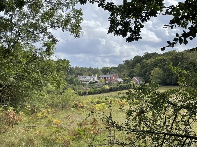
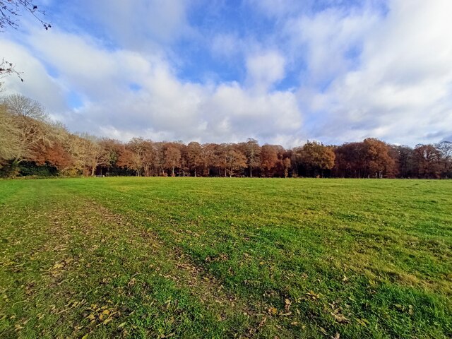
Black Wood is a dense forest located in Oxfordshire, England. Spread over an area of approximately 500 acres, this woodland is known for its rich biodiversity and scenic beauty. Situated near the village of Wood, it is easily accessible and attracts visitors from both nearby towns and beyond.

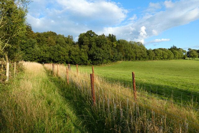
The forest is predominantly made up of deciduous trees, including oak, beech, and ash, which create a dense canopy that provides shelter and habitats for a wide range of wildlife. The woodland floor is covered in a thick layer of leaf litter and moss, making it a haven for numerous plant species, fungi, and insects.

Black Wood offers several walking trails, allowing visitors to explore the beauty of nature at their own pace. These trails are well-maintained and suitable for all ages and fitness levels. Along the way, visitors may encounter various wildlife species, such as deer, foxes, badgers, and a variety of bird species, including owls and woodpeckers.

The forest is also home to a small stream that meanders through its heart, providing a serene and peaceful atmosphere. The sound of running water adds to the tranquility of the surroundings, making it an ideal spot for picnics or simply taking a moment to connect with nature.

Overall, Black Wood in Oxfordshire offers a wonderful opportunity to immerse oneself in the beauty of a natural woodland setting. With its diverse flora and fauna, well-maintained trails, and peaceful ambiance, it is a popular destination for nature lovers and outdoor enthusiasts alike.

If you have any feedback on the listing, please let us know in the comments section below.

Black Wood Images

Images are sourced within 2km of 51.570579/-1.0063252 or Grid Reference SU6886. Thanks to Geograph Open Source API. All images are credited.

Pasture and woodland, Highmoor With a footpath approaching Highmoor from the north-west.
Pasture and woodland, Highmoor
With a footpath approaching Highmoor from the north-west.
A4130 at Port Hill
A4130 at Port Hill
Cottages on the edge of Nettlebed Common This group of cottages sit facing the northern edge of Nettlebed Common but within the parish of Swyncombe.
Cottages on the edge of Nettlebed Common
This group of cottages sit facing the northern edge of Nettlebed Common but within the parish of Swyncombe.
Digberry Farm, Huntercombe Lane The farm sits within a large square earthwork of unknown age measuring 200 metres across.
Digberry Farm, Huntercombe Lane
The farm sits within a large square earthwork of unknown age measuring 200 metres across.
Woods north east of Stoke Row
Nott Wood
Nott Wood
Nettlebed Kiln Centre of a mediaeval brick-making industry, this kiln is the last remaining vestige of the village's greatness.
Nettlebed Kiln
Centre of a mediaeval brick-making industry, this kiln is the last remaining vestige of the village's greatness.
The Dog & Duck, Highmoor The Dog & Duck, Public House, Highmoor
The Dog & Duck, Highmoor
The Dog & Duck, Public House, Highmoor
Highmoor Woods Highmoor Woods on the B481 road from Reading to Nettlebed.
Highmoor Woods
Highmoor Woods on the B481 road from Reading to Nettlebed.
Cottages in Mill Road Cottages in Mill Road, the road to Windmill Hill.
Cottages in Mill Road
Cottages in Mill Road, the road to Windmill Hill.
House and plants at Catslip The hamlet of Catslip is remote yet accessible and has a number of individual houses each with distinctive gardens.
House and plants at Catslip
The hamlet of Catslip is remote yet accessible and has a number of individual houses each with distinctive gardens.
Path in Nettlebed Woods Part of an extensive network of footpaths and bridleways in this area.  This is at Oxlands Bottom looking north-east.  Many of the paths are used by cyclists; this is a bridleway so can be used legally.
Path in Nettlebed Woods
Part of an extensive network of footpaths and bridleways in this area. This is at Oxlands Bottom looking north-east. Many of the paths are used by cyclists; this is a bridleway so can be used legally.
Junction of paths in Nettlebed Woods The extensive network of bridleways and footpaths has a local numbering system.  Here a path considered to be part of the Highmoor network (HM) leaves one of the Nettlebed ones (NE).  Although meandering through woodland, they are all easy to follow as they are regularly marked with white arrows or spots on trees.
Junction of paths in Nettlebed Woods
The extensive network of bridleways and footpaths has a local numbering system. Here a path considered to be part of the Highmoor network (HM) leaves one of the Nettlebed ones (NE). Although meandering through woodland, they are all easy to follow as they are regularly marked with white arrows or spots on trees.
Bikes shall not pass Many of the routes in this area are byways and bridleways so are used legitimately by mountain bikers.  However, some footpaths are also used, so this log has been placed across a footpath to discourage them going along here.
Bikes shall not pass
Many of the routes in this area are byways and bridleways so are used legitimately by mountain bikers. However, some footpaths are also used, so this log has been placed across a footpath to discourage them going along here.
Tudor Cottage, Lower Highmoor It seems unlikely that this cottage would have been Tudor, but the style is clear.  One of a number of properties in a hamlet of Lower Highmoor.
Tudor Cottage, Lower Highmoor
It seems unlikely that this cottage would have been Tudor, but the style is clear. One of a number of properties in a hamlet of Lower Highmoor.
The Dog and Duck, Highmoor A deservedly popular country pub on the Nettlebed to Sonning Common road.  It has a large garden to the rear.
The Dog and Duck, Highmoor
A deservedly popular country pub on the Nettlebed to Sonning Common road. It has a large garden to the rear.
Pasture at Merrimoles Looking across from the bridleway through Holly Grove.
Pasture at Merrimoles
Looking across from the bridleway through Holly Grove.
Pasture at Merrimoles Looking north-east from a bridleway passing Lower Highmoor.
Pasture at Merrimoles
Looking north-east from a bridleway passing Lower Highmoor.
Show me another place!

Black Wood is located at Grid Ref: SU6886 (Lat: 51.570579, Lng: -1.0063252)

Administrative County: Oxfordshire

District: South Oxfordshire

Police Authority: Thames Valley

What 3 Words

///claw.kickbacks.aimless. Near Rotherfield Peppard, Oxfordshire

Related Wikis

Henley Rural District

Henley was a rural district in Oxfordshire, England from 1894 to 1974.It was named after the borough of Henley-on-Thames, which it surrounded on the west...

Nettlebed

Nettlebed is a village and civil parish in Oxfordshire in the Chiltern Hills about 4+1⁄2 miles (7 km) northwest of Henley-on-Thames and 6 miles (10 km...

Highmoor, Oxfordshire

Highmoor is a village and civil parish in the Chiltern Hills in Oxfordshire, about 4 miles (6.4 km) west of Henley-on-Thames. The parish includes the hamlet...

Nuffield Place

Nuffield Place is a country house near the village of Nuffield in the Chiltern Hills in South Oxfordshire, England, just over 4 miles (6 km) east of Wallingford...

Crocker End House

Crocker End House in Nettlebed in Henley-on-Thames, Oxfordshire, England is a spacious Victorian home built to replace Nettlebed's prosperous rectory in...

HM Prison Huntercombe

HM Prison Huntercombe is a Category C men's prison, located near Nuffield in Oxfordshire, England. It is operated by His Majesty's Prison Service. ��2...

Stoke Row

Stoke Row is a village and civil parish in the Chiltern Hills, about 5 miles (8 km) west of Henley-on-Thames in South Oxfordshire and about 9 miles (14...

Nuffield, Oxfordshire

Nuffield is a village and civil parish in the Chiltern Hills in South Oxfordshire, England, just over 4 miles (6 km) east of Wallingford. The 2011 Census...

Have you been to Black Wood?

Leave your review of Black Wood below (or comments, questions and feedback).