Groveridge Wood

Wood, Forest in Oxfordshire South Oxfordshire

England

Groveridge Wood

A4130 at Nuffield village boundary
A4130 at Nuffield village boundary Credit: Colin Pyle

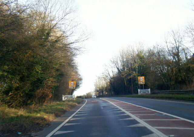
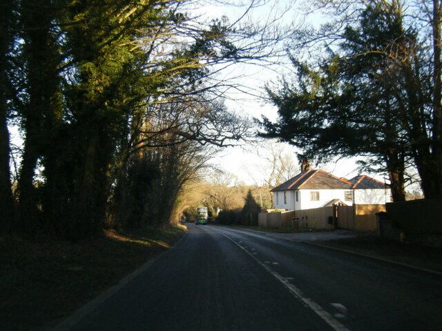
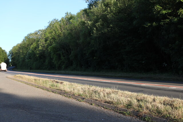
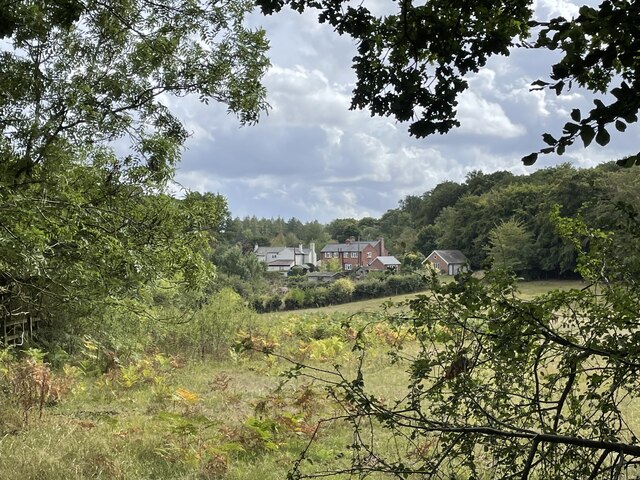
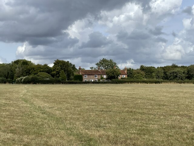
Groveridge Wood is a captivating woodland located in Oxfordshire, England. Nestled amidst the scenic countryside, it spans across a vast area of approximately 50 acres, offering visitors a serene and tranquil escape from the bustling city life.

The wood is primarily composed of deciduous trees, including oak, beech, and birch, which create a magnificent canopy, especially during the autumn months when the leaves transform into a kaleidoscope of vibrant colors. The dense foliage provides a habitat for numerous species of birds, such as woodpeckers and thrushes, making it a paradise for birdwatchers and nature enthusiasts.

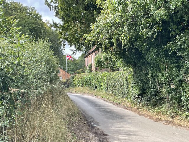
Traversing through Groveridge Wood, visitors are greeted by an intricate network of well-maintained footpaths, allowing them to explore the woodland at their leisure. These paths lead to hidden clearings, where one can find peaceful spots to relax or have a picnic amidst the enchanting surroundings.

In addition to its natural beauty, Groveridge Wood also holds historical significance. Within its boundaries, there are remnants of an ancient settlement dating back to the Iron Age, indicating that the wood has been inhabited for thousands of years.

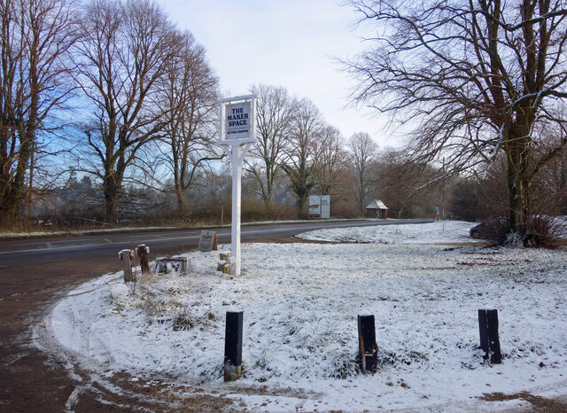
The wood is open to the public year-round and is a popular destination for hikers, dog walkers, and families seeking a day out in nature. With its breathtaking scenery, diverse wildlife, and historical remnants, Groveridge Wood is a captivating destination that showcases the natural and cultural heritage of Oxfordshire.

If you have any feedback on the listing, please let us know in the comments section below.

Groveridge Wood Images

Images are sourced within 2km of 51.58017/-1.0080644 or Grid Reference SU6887. Thanks to Geograph Open Source API. All images are credited.

A4130 at Nuffield village boundary
A4130 at Port Hill
A4130 at Port Hill
Layby on Gangsdown Hill west on Nettlebed
Light Snow at The Maker Space The Crown at Nuffield was a lovely traditional pub in the Brakspears of Henley estate, but like so many country pubs these days couldn't keep going. It was closed for a long time <a href="https://www.geograph.org.uk/photo/5583827">SU6787 : The Crown closed inn beside the A4130</a> but happily is now open again as The Maker Space (at The Crown) aiming more at the coffee, cake and light meals market, and also as a craft centre.
Light Snow at The Maker Space
The Crown at Nuffield was a lovely traditional pub in the Brakspears of Henley estate, but like so many country pubs these days couldn't keep going. It was closed for a long time SU6787 : The Crown closed inn beside the A4130 but happily is now open again as The Maker Space (at The Crown) aiming more at the coffee, cake and light meals market, and also as a craft centre.
Cottages on the edge of Nettlebed Common This group of cottages sit facing the northern edge of Nettlebed Common but within the parish of Swyncombe.
Cottages on the edge of Nettlebed Common
This group of cottages sit facing the northern edge of Nettlebed Common but within the parish of Swyncombe.
Digberry Farm, Huntercombe Lane The farm sits within a large square earthwork of unknown age measuring 200 metres across.
Digberry Farm, Huntercombe Lane
The farm sits within a large square earthwork of unknown age measuring 200 metres across.
Cottages at Park Corner Looking north along the footpath from Huntercombe End.
Cottages at Park Corner
Looking north along the footpath from Huntercombe End.
Nettlebed Kiln Centre of a mediaeval brick-making industry, this kiln is the last remaining vestige of the village's greatness.
Nettlebed Kiln
Centre of a mediaeval brick-making industry, this kiln is the last remaining vestige of the village's greatness.
Cottages in Mill Road Cottages in Mill Road, the road to Windmill Hill.
Cottages in Mill Road
Cottages in Mill Road, the road to Windmill Hill.
Soundess Farm near Nettlebed
Footpath heading to Berrick Trench From Magpies the footpath heading to Berrick Trench
Footpath heading to Berrick Trench
From Magpies the footpath heading to Berrick Trench
Village Shop Nettlebed Village Shop and Sub Post Office on Watlington Street
Village Shop
Nettlebed Village Shop and Sub Post Office on Watlington Street
Nettlebed Telephone Exchange, Oxon This modern TE lies at the far end of The Old Kiln, a cul-de-sac  near the centre of the village and has the code THNB. It replaced The Old Exchange in Chapel Lane, now a  private dwelling, somewhile ago. This TE now provides telephone and broadband services to 741 residential and 74 non-residential premises in Nettlebed plus Cookley Green, Highmoor, Highmoor Cross, Maidensgrove, Nuffield and Russell's Water nearby. There is also a preserved bottle kiln near the TE, as a reminder of brick, tile and pottery manufacture in Nettlebed from medieval times until the 20th century, SU7086 refers. This TE has the numbering ranges (01491) 641xxx, 642xxx, the (01491) referring to the Henley-on-Thames group of ten TEs, and its postcode is RG9 5BA.
Nettlebed Telephone Exchange, Oxon
This modern TE lies at the far end of The Old Kiln, a cul-de-sac near the centre of the village and has the code THNB. It replaced The Old Exchange in Chapel Lane, now a private dwelling, somewhile ago. This TE now provides telephone and broadband services to 741 residential and 74 non-residential premises in Nettlebed plus Cookley Green, Highmoor, Highmoor Cross, Maidensgrove, Nuffield and Russell's Water nearby. There is also a preserved bottle kiln near the TE, as a reminder of brick, tile and pottery manufacture in Nettlebed from medieval times until the 20th century, SU7086 refers. This TE has the numbering ranges (01491) 641xxx, 642xxx, the (01491) referring to the Henley-on-Thames group of ten TEs, and its postcode is RG9 5BA.
H 63 & 3 SV A little clump of posts in the woods near Nettlebed, just by the road going up to Soundess.
H 63 & 3 SV
A little clump of posts in the woods near Nettlebed, just by the road going up to Soundess.
Nettlebed Recreation Ground The recreation ground on Nettlebed Common at Priest's Hill dates back to 1908.  The Nettlebed & District Commons Act 1906 stated that 'within two years from the passing of this Act the said Robert Fleming shall set out level and form a recreation ground upon Nettlebed Common for the use of the inhabitants of Nettlebed and such recreation ground shall not be less than three acres in extent'.  Robert Fleming was then Lord of the Manor and soon to become grandfather of author Ian Fleming, born in 1908.
Nettlebed Recreation Ground
The recreation ground on Nettlebed Common at Priest's Hill dates back to 1908. The Nettlebed & District Commons Act 1906 stated that 'within two years from the passing of this Act the said Robert Fleming shall set out level and form a recreation ground upon Nettlebed Common for the use of the inhabitants of Nettlebed and such recreation ground shall not be less than three acres in extent'. Robert Fleming was then Lord of the Manor and soon to become grandfather of author Ian Fleming, born in 1908.
Bus stop at Nettlebed Just east of the village on the A4130.  Adjacent, to the right, are two pudding stones.  A close up, explaining the significance, is here <a href="https://www.geograph.org.uk/photo/2133550">SU7086 : Pudding stones at Nettlebed</a>
Bus stop at Nettlebed
Just east of the village on the A4130. Adjacent, to the right, are two pudding stones. A close up, explaining the significance, is here SU7086 : Pudding stones at Nettlebed
Entering Nettlebed These solid Georgian houses mark the eastern entrance to the village.  They were probably built when this was one of the coaching routes from London to Oxford.
Entering Nettlebed
These solid Georgian houses mark the eastern entrance to the village. They were probably built when this was one of the coaching routes from London to Oxford.
Former coaching inn This is almost certainly a former coaching inn, on the road from London to Oxford, probably The Bull.  At one time there were seven pubs in the village; now only the White Hart, opposite this one, remains.
Former coaching inn
This is almost certainly a former coaching inn, on the road from London to Oxford, probably The Bull. At one time there were seven pubs in the village; now only the White Hart, opposite this one, remains.
Show me another place!

Groveridge Wood is located at Grid Ref: SU6887 (Lat: 51.58017, Lng: -1.0080644)

Administrative County: Oxfordshire

District: South Oxfordshire

Police Authority: Thames Valley

What 3 Words

///impulsive.ready.glorified. Near Rotherfield Peppard, Oxfordshire

Related Wikis

HM Prison Huntercombe

HM Prison Huntercombe is a Category C men's prison, located near Nuffield in Oxfordshire, England. It is operated by His Majesty's Prison Service. ��2...

Nuffield Place

Nuffield Place is a country house near the village of Nuffield in the Chiltern Hills in South Oxfordshire, England, just over 4 miles (6 km) east of Wallingford...

Nettlebed

Nettlebed is a village and civil parish in Oxfordshire in the Chiltern Hills about 4+1⁄2 miles (7 km) northwest of Henley-on-Thames and 6 miles (10 km...

Henley Rural District

Henley was a rural district in Oxfordshire, England from 1894 to 1974.It was named after the borough of Henley-on-Thames, which it surrounded on the west...

Berrick Trench

Berrick Trench is a 2.1-hectare (5.2-acre) biological Site of Special Scientific Interest north of Nettlebed in Oxfordshire.This is an ancient semi-natural...

Nuffield, Oxfordshire

Nuffield is a village and civil parish in the Chiltern Hills in South Oxfordshire, England, just over 4 miles (6 km) east of Wallingford. The 2011 Census...

Crocker End House

Crocker End House in Nettlebed in Henley-on-Thames, Oxfordshire, England is a spacious Victorian home built to replace Nettlebed's prosperous rectory in...

Highmoor, Oxfordshire

Highmoor is a village and civil parish in the Chiltern Hills in Oxfordshire, about 4 miles (6.4 km) west of Henley-on-Thames. The parish includes the hamlet...

Nearby Amenities

Located within 500m of 51.58017,-1.0080644
Created By: osmeditor2
Lat/Long: 51.5844133/-1.0094017
Bus Stop
Hayden Lane
Naptan AtcoCode: 340001516HAY
Naptan Bearing: NW
Naptan BusStopType: CUS
Naptan CommonName: Hayden Lane
Naptan Indicator: Corner
Naptan Landmark: Hayden Lane
Naptan NaptanCode: oxfgdmjt
Naptan Street: Port Hill
Naptan Verified: no
Source: naptan_import
Lat/Long: 51.5793319/-1.0141356
Bus Stop
Hayden Lane
Naptan AtcoCode: 340001516OPP
Naptan Bearing: SE
Naptan CommonName: Hayden Lane
Naptan Indicator: Opposite
Naptan Landmark: Hayden Lane
Naptan NaptanCode: oxfgdmjp
Naptan Street: Port Hill
Naptan Verified: no
Source: naptan_import
Lat/Long: 51.5795494/-1.0143329
Barrier: stile
Bicycle: no
Foot: no
Lat/Long: 51.5794635/-1.0142254
Barrier: stile
Bicycle: no
Foot: no
Lat/Long: 51.5844386/-1.0090482
Barrier: stile
Bicycle: no
Foot: yes
Material: wood
Note: broken
Stile: stepover
Lat/Long: 51.5765396/-1.0090456
Barrier: stile
Bicycle: no
Foot: yes
Material: wood
Stile: stepover
Lat/Long: 51.5767309/-1.0088043
Barrier: stile
Foot: yes
Material: wood
Note: disused
Stile: stepover
Lat/Long: 51.5786074/-1.0026855
Power: pole
Lat/Long: 51.5769429/-1.003114
Power: pole
Lat/Long: 51.5766611/-1.0038596
Power: pole
Lat/Long: 51.5766511/-1.0057426
Power: pole
Lat/Long: 51.5766278/-1.0076791
Power: pole
Lat/Long: 51.5766111/-1.0091221
Power: pole
Lat/Long: 51.5764995/-1.0038838
Power: pole
Lat/Long: 51.5762794/-1.005418
Power: pole
Lat/Long: 51.5760727/-1.0069925
Power: pole
Lat/Long: 51.5758677/-1.0085508
Power: pole
Lat/Long: 51.5764211/-1.010651
Power: pole
Lat/Long: 51.5836183/-1.0115119
Power: pole
Lat/Long: 51.5828116/-1.0118982
Power: pole
Lat/Long: 51.5820333/-1.0123193
Power: pole
Lat/Long: 51.5812499/-1.012719
Power: pole
Lat/Long: 51.5804615/-1.0131106
Power: pole
Lat/Long: 51.5796665/-1.0135022
Power: pole
Lat/Long: 51.5791598/-1.0144785
Power: pole
Lat/Long: 51.5788797/-1.0146663
The data included in this document is from www.openstreetmap.org. The data is made available under ODbL.

Have you been to Groveridge Wood?

Leave your review of Groveridge Wood below (or comments, questions and feedback).