Ash Holt

Wood, Forest in Nottinghamshire Bassetlaw

England

Ash Holt

All Hallows' Church All Hallows' Church, Grade II* listed, 13thC with tower added 15thC
All Hallows' Church Credit: thejackrustles

Ash Holt is a small village located in the county of Nottinghamshire, England. Situated in the Ashfield district, it is nestled within the heart of the Sherwood Forest. The village is surrounded by an enchanting woodland, providing a serene and picturesque setting for its residents.

With a population of around 500 people, Ash Holt maintains a close-knit community atmosphere. The village is characterized by its charming cottages and traditional architecture, which adds to its overall rustic appeal. The local economy is mainly centered around agriculture, with farming and animal husbandry being the primary occupations.

Nature enthusiasts are drawn to Ash Holt due to its proximity to Sherwood Forest, one of the most famous and historic woodlands in the country. The forest offers a plethora of outdoor activities, including walking trails, cycling routes, and wildlife spotting. Legend has it that the legendary outlaw, Robin Hood, roamed these very woods, adding to the area's intrigue and allure.

While Ash Holt itself does not boast any major tourist attractions, it serves as an excellent base for exploring the wider Nottinghamshire area. The nearby towns of Mansfield and Nottingham offer a range of amenities, including shopping centers, restaurants, and cultural attractions. Additionally, the village is well-connected to both cities via public transportation, making it convenient for commuters.

In conclusion, Ash Holt is a tranquil village nestled in the Wood, Forest area of Nottinghamshire. With its beautiful woodland surroundings and close proximity to Sherwood Forest, it offers a peaceful and idyllic lifestyle for its residents, making it an appealing destination for nature lovers and those seeking a rural retreat.

If you have any feedback on the listing, please let us know in the comments section below.
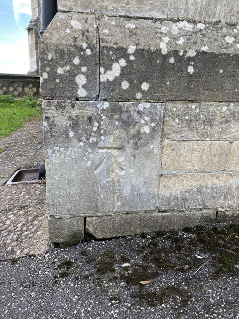
Ash Holt Images

Images are sourced within 2km of 53.311533/-0.96993167 or Grid Reference SK6879. Thanks to Geograph Open Source API. All images are credited.

All Hallows' Church All Hallows' Church, Grade II* listed, 13thC with tower added 15thC
All Hallows' Church
All Hallows' Church, Grade II* listed, 13thC with tower added 15thC
OS Cut Mark - Ordsall, All Hallows Church <span class="nowrap"><a title="https://www.bench-marks.org.uk/bm29487" rel="nofollow ugc noopener" href="https://www.bench-marks.org.uk/bm29487">Link</a><img style="margin-left:2px;" alt="External link" title="External link - shift click to open in new window" src="https://s1.geograph.org.uk/img/external.png" width="10" height="10"/></span>
OS Cut Mark - Ordsall, All Hallows Church
Location of OS Cut Mark - Ordsall, All Hallows Church <span class="nowrap"><a title="https://www.bench-marks.org.uk/bm29487" rel="nofollow ugc noopener" href="https://www.bench-marks.org.uk/bm29487">Link</a><img style="margin-left:2px;" alt="External link" title="External link - shift click to open in new window" src="https://s1.geograph.org.uk/img/external.png" width="10" height="10"/></span>
Location of OS Cut Mark - Ordsall, All Hallows Church
Graveyard, Retford
Graveyard, Retford
Houses on Bridon Close, South Retford Rough grassland on the edge of an expanding housing estate. Seen from the East Coast Mainline.
Houses on Bridon Close, South Retford
Rough grassland on the edge of an expanding housing estate. Seen from the East Coast Mainline.
Bridge over the River Idle Looking southwest to All Hallow's Church at Ordsall.
Bridge over the River Idle
Looking southwest to All Hallow's Church at Ordsall.
Weedy lake at Ordsall An inlet of a larger lake, surrounded by trees and other vegetation.
Weedy lake at Ordsall
An inlet of a larger lake, surrounded by trees and other vegetation.
Lake at Ordsall, south of Repton Seen from the East Coast Mainline, and east of the River Idle.
Lake at Ordsall, south of Repton
Seen from the East Coast Mainline, and east of the River Idle.
River Idle The River Idle is a 26 mile long river in Nottinghamshire. Its source is the confluence of the River Maun and River Meden, near Markham Moor. From there, it flows north through Retford and Bawtry before entering the River Trent at Stockwith near Misterton.
Wikipedia: <span class="nowrap"><a title="http://en.wikipedia.org/wiki/River_Idle" rel="nofollow ugc noopener" href="http://en.wikipedia.org/wiki/River_Idle">Link</a><img style="margin-left:2px;" alt="External link" title="External link - shift click to open in new window" src="https://s1.geograph.org.uk/img/external.png" width="10" height="10"/></span>
River Idle
The River Idle is a 26 mile long river in Nottinghamshire. Its source is the confluence of the River Maun and River Meden, near Markham Moor. From there, it flows north through Retford and Bawtry before entering the River Trent at Stockwith near Misterton. Wikipedia: LinkExternal link
Chesterfield Canal & Retford Town Lock
Chesterfield Canal & West Retford Lock
Outside Retford station including parking area
Retford railway station, Nottinghamshire These low level platforms were opened by British Rail in the mid 1960s, on the line from Sheffield to Gainsborough and Lincoln, which had just been lowered to burrow under the East Coast Main Line (beyond the footbridge in this image). 
View west towards Worksop and Sheffield. The line had been opened in 1849 by the Manchester, Sheffield and Lincolnshire Railway and, until the rebuilding, crossed the ECML on the level. Since <a href="https://www.geograph.org.uk/photo/3249791">SK7080 : Retford railway station, Nottinghamshire, 2007</a> was taken from a similar position, a new lift has been installed to this platform (as until 1921 it was the only platform without lift access), the vegetation cut back and the formerly open waiting shelters given a bit more protection from the elements. The walkway to/from the high level platforms (out of view) was also given a roof in 2021 - but the roof didn't extend to the footbridge, as shown here.
Retford railway station, Nottinghamshire
These low level platforms were opened by British Rail in the mid 1960s, on the line from Sheffield to Gainsborough and Lincoln, which had just been lowered to burrow under the East Coast Main Line (beyond the footbridge in this image). View west towards Worksop and Sheffield. The line had been opened in 1849 by the Manchester, Sheffield and Lincolnshire Railway and, until the rebuilding, crossed the ECML on the level. Since SK7080 : Retford railway station, Nottinghamshire, 2007 was taken from a similar position, a new lift has been installed to this platform (as until 1921 it was the only platform without lift access), the vegetation cut back and the formerly open waiting shelters given a bit more protection from the elements. The walkway to/from the high level platforms (out of view) was also given a roof in 2021 - but the roof didn't extend to the footbridge, as shown here.
Cut Benchmark on 23 Cobwell Road See <a title="https://www.geograph.org.uk/photo/7171702" href="https://www.geograph.org.uk/photo/7171702">Link</a> for a view of the building, a former canal warehouse and <span class="nowrap"><a title="https://www.bench-marks.org.uk/bm70931" rel="nofollow ugc noopener" href="https://www.bench-marks.org.uk/bm70931">Link</a><img style="margin-left:2px;" alt="External link" title="External link - shift click to open in new window" src="https://s1.geograph.org.uk/img/external.png" width="10" height="10"/></span> for details of the mark.
Cut Benchmark on 23 Cobwell Road
See Link for a view of the building, a former canal warehouse and LinkExternal link for details of the mark.
Former Canal Warehouse in Cobwell Road This building carries a cut benchmark.  See <a title="https://www.geograph.org.uk/photo/7171695" href="https://www.geograph.org.uk/photo/7171695">Link</a> for a close-up and <span class="nowrap"><a title="https://www.bench-marks.org.uk/bm70931" rel="nofollow ugc noopener" href="https://www.bench-marks.org.uk/bm70931">Link</a><img style="margin-left:2px;" alt="External link" title="External link - shift click to open in new window" src="https://s1.geograph.org.uk/img/external.png" width="10" height="10"/></span> for details of the mark.
Former Canal Warehouse in Cobwell Road
This building carries a cut benchmark. See Link for a close-up and LinkExternal link for details of the mark.
Part of Retford Railway Station This building is south of the public entrance and may well have been the stationmaster's house.  It carries a cut benchmark on the left angle.  See <a title="https://www.geograph.org.uk/photo/7171731" href="https://www.geograph.org.uk/photo/7171731">Link</a> for a close-up and <span class="nowrap"><a title="https://www.bench-marks.org.uk/bm64783" rel="nofollow ugc noopener" href="https://www.bench-marks.org.uk/bm64783">Link</a><img style="margin-left:2px;" alt="External link" title="External link - shift click to open in new window" src="https://s1.geograph.org.uk/img/external.png" width="10" height="10"/></span> for details of the mark.
Part of Retford Railway Station
This building is south of the public entrance and may well have been the stationmaster's house. It carries a cut benchmark on the left angle. See Link for a close-up and LinkExternal link for details of the mark.
Cut Benchmark on Retford Railway Station See <a title="https://www.geograph.org.uk/photo/7171725" href="https://www.geograph.org.uk/photo/7171725">Link</a> for a wider view and <span class="nowrap"><a title="https://www.bench-marks.org.uk/bm64783" rel="nofollow ugc noopener" href="https://www.bench-marks.org.uk/bm64783">Link</a><img style="margin-left:2px;" alt="External link" title="External link - shift click to open in new window" src="https://s1.geograph.org.uk/img/external.png" width="10" height="10"/></span> for details of the mark.
Cut Benchmark on Retford Railway Station
See Link for a wider view and LinkExternal link for details of the mark.
Show me another place!

Ash Holt is located at Grid Ref: SK6879 (Lat: 53.311533, Lng: -0.96993167)

Administrative County: Nottinghamshire

District: Bassetlaw

Police Authority: Nottinghamshire

What 3 Words

///royal.excellent.greed. Near Babworth, Nottinghamshire

Nearby Locations

Ash Holt

Related Wikis

Babworth

Babworth is a village and civil parish in the Bassetlaw district of Nottinghamshire, England, about 1½ miles west of Retford. According to the 2001 census...

Ordsall Hall School

Ordsall Hall Comprehensive School was a comprehensive school situated on Ordsall Road in the market town of East Retford in the district of Bassetlaw,...

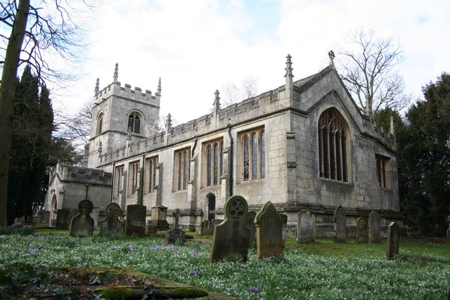
All Saints' Church, Babworth

All Saints' Church, is a Grade I listed parish church in the Church of England in Babworth, Nottinghamshire. == History == The church was built in the...

Ordsall, Nottinghamshire

Ordsall is an area and former civil parish in Retford, in the Bassetlaw district of Nottinghamshire, England. The Bassetlaw ward of the same name had a...

Retford Oaks Academy

Retford Oaks Academy is a coeducational secondary school and sixth form located in the market town of Retford, Nottinghamshire, England, situated in the...

Retford F.C.

Retford Football Club is an English football club based in Retford, Nottinghamshire. They currently play in the Northern Counties East League Division...

Retford railway station

Retford railway station is on the East Coast Main Line serving the town of Retford, Nottinghamshire, England. It is 138 miles 49 chains (223.1 km) down...

All Hallows' Church, Ordsall

All Hallows' Church is a Grade II* listed parish church in the Church of England in Ordsall, Nottinghamshire. == History == The church dates from the 13th...

Nearby Amenities

Located within 500m of 53.311533,-0.96993167
Power: pole
Lat/Long: 53.3100174/-0.9756459
Power: pole
Lat/Long: 53.3101983/-0.9759281
Power: pole
Lat/Long: 53.3103616/-0.9745275
Power: pole
Lat/Long: 53.3105217/-0.9733214
Power: pole
Lat/Long: 53.3106925/-0.9719997
Power: pole
Lat/Long: 53.3106967/-0.9699327
Power: pole
Lat/Long: 53.3108554/-0.9707013
Power: pole
Lat/Long: 53.3115954/-0.9653623
Down
Railway: switch
Lat/Long: 53.3114022/-0.9642299
Up
Railway: switch
Lat/Long: 53.3109578/-0.9690759
Thrumpton West Junctions
Alt Name: Whisker Hill Junction
Railway: junction
Lat/Long: 53.3113511/-0.9648772
Power: pole
Lat/Long: 53.3117638/-0.9639479
Power: pole
Lat/Long: 53.3112/-0.9682533
Power: pole
Lat/Long: 53.3112737/-0.9671281
Power: pole
Lat/Long: 53.3110511/-0.9692974
The data included in this document is from www.openstreetmap.org. The data is made available under ODbL.

Have you been to Ash Holt?

Leave your review of Ash Holt below (or comments, questions and feedback).