Crompton's Plantation
Wood, Forest in Leicestershire Melton
England
Crompton's Plantation

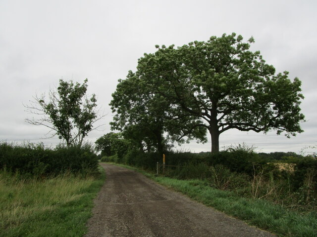
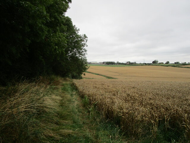
Crompton's Plantation, located in Leicestershire, is a picturesque woodland area known for its rich history and natural beauty. Situated in the heart of the county, this plantation spans over a vast area, making it a popular destination for nature enthusiasts and those seeking tranquility.
The plantation is primarily composed of various species of trees, including oak, birch, and beech, creating a diverse and vibrant ecosystem. Walking through the woodland, visitors can enjoy the sight of towering trees, lush foliage, and a carpet of wildflowers during the spring and summer months.
Historically, Crompton's Plantation has been used for timber production, providing a valuable resource for the local community. Today, the area is managed by the local authorities, ensuring the preservation of its natural habitat and promoting sustainable practices.
Visitors to Crompton's Plantation can explore the numerous walking trails that wind through the woodland, offering opportunities for leisurely strolls or more challenging hikes. The plantation is also home to various wildlife species, including deer, squirrels, and a wide variety of bird species, making it a haven for birdwatchers and wildlife enthusiasts.
For those interested in the history of the area, there are remnants of old structures and ruins scattered throughout the plantation, providing glimpses into its past. These historical features add an intriguing element to the overall charm of the woodland.
With its serene atmosphere, diverse flora and fauna, and historical significance, Crompton's Plantation is a cherished natural gem in Leicestershire, offering visitors a chance to reconnect with nature and experience the tranquility of the countryside.
If you have any feedback on the listing, please let us know in the comments section below.
Crompton's Plantation Images
Images are sourced within 2km of 52.805841/-0.98258831 or Grid Reference SK6823. Thanks to Geograph Open Source API. All images are credited.


Crompton's Plantation is located at Grid Ref: SK6823 (Lat: 52.805841, Lng: -0.98258831)
Administrative County: Leicestershire
District: Melton
Police Authority: Leicestershire
What 3 Words
///tram.jumped.putty. Near Grimston, Leicestershire
Nearby Locations
Related Wikis

Old Dalby Test Track
The Old Dalby Test Track is a railway in the United Kingdom which is used for testing new designs of trains and railway infrastructure. It runs between...

Old Dalby railway station
Old Dalby railway station served Old Dalby in the English county of Leicestershire. It was opened on the Nottingham direct line of the Midland Railway...
Dalby Preceptory
Dalby Preceptory, also known as Dalby and Heather Preceptory, was a preceptory of the Knights Hospitaller, in the village of Old Dalby, Leicestershire...
Old Dalby
Old Dalby is a village and former civil parish, now in the parish of Broughton and Old Dalby, in the Melton district, in the county of Leicestershire,...

Home Farm, Old Dalby
Home Farm is an historic farmhouse in Old Dalby, Leicestershire, England. It was built in 1635 and is a Grade II listed building. Dating to the Georgian...
Broughton and Old Dalby
Broughton and Old Dalby is a civil parish in the Melton district of Leicestershire, England. According to the 2001 census it had a population of 1,400...

Hickling, Nottinghamshire
Hickling is a village in the Rushcliffe borough of Nottinghamshire, England. It is located close to the border with Leicestershire, approximately 8 miles...

Upper Broughton
Upper Broughton or Broughton-Sulney or Over-Broughton is a village and civil parish about seven miles north west of Melton Mowbray, in the Rushcliffe district...
Nearby Amenities
Located within 500m of 52.805841,-0.98258831Have you been to Crompton's Plantation?
Leave your review of Crompton's Plantation below (or comments, questions and feedback).