Forkeddean Bottom Shaw

Wood, Forest in Oxfordshire South Oxfordshire

England

Forkeddean Bottom Shaw

No Trace of The Fox This place now has no resemblance to earlier photos here.
Graham Horn's picture from 15 years ago shows the building which used to be on this site until a few years ago. Then it was a large pub "The Fox" <a href="https://www.geograph.org.uk/photo/348561">SU6779 : The Fox at Cane End</a>
A later picture of mine <a href="https://www.geograph.org.uk/photo/2083210">SU6779 : Palm Tree  (Ex Fox)</a> shows it as an Indian restaurant "The Palm Tree."  
In my caption at the time I wished them luck in this tricky out of town location.
Not to be. After yet another spell as a Thai restaurant the place finally closed its doors.
Now demolished and replaced by these new houses. The only clues are the pub style sign post which now carries the developer's name board and the new cul de sac which is called Fox Heath Gardens..
No Trace of The Fox Credit: Des Blenkinsopp

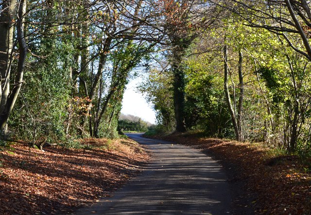
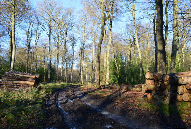
Forkeddean Bottom Shaw is a picturesque woodland located in Oxfordshire, England. Situated in the heart of the countryside, this enchanting forest covers an area of approximately 50 acres. The shaw is characterized by its dense collection of trees, including oak, beech, and birch, which create a lush and vibrant environment.

The woodland is a haven for wildlife, providing a diverse habitat for a range of species. Birdwatchers can spot a variety of birds, including woodpeckers, owls, and songbirds, while nature enthusiasts may encounter mammals such as deer, foxes, and rabbits. The forest floor is adorned with an array of wildflowers and ferns, enhancing the beauty of the wood.

Forkeddean Bottom Shaw offers a tranquil escape from the hustle and bustle of city life. Its winding pathways invite visitors to explore and immerse themselves in the natural surroundings. The forest also features a small stream that meanders through the trees, adding to its charm.

The woodland is a popular destination for outdoor activities such as hiking, picnicking, and nature walks. It is also a favored spot for photographers, who are drawn to its scenic beauty throughout the changing seasons.

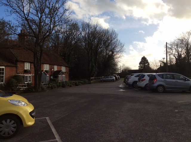
Access to Forkeddean Bottom Shaw is convenient, with nearby parking available for visitors. The forest is managed by a local conservation group, ensuring its preservation and protection for future generations to enjoy.

If you have any feedback on the listing, please let us know in the comments section below.

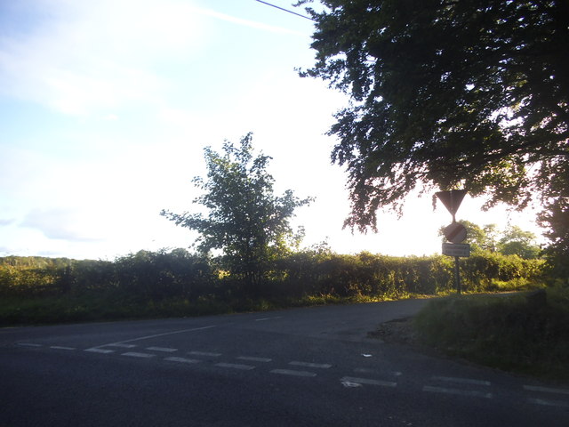
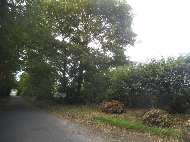
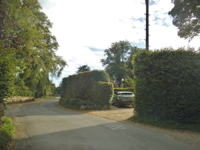
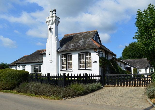
Forkeddean Bottom Shaw Images

Images are sourced within 2km of 51.505007/-1.0207048 or Grid Reference SU6878. Thanks to Geograph Open Source API. All images are credited.

No Trace of The Fox This place now has no resemblance to earlier photos here.
Graham Horn's picture from 15 years ago shows the building which used to be on this site until a few years ago. Then it was a large pub "The Fox" <a href="https://www.geograph.org.uk/photo/348561">SU6779 : The Fox at Cane End</a>
A later picture of mine <a href="https://www.geograph.org.uk/photo/2083210">SU6779 : Palm Tree  (Ex Fox)</a> shows it as an Indian restaurant "The Palm Tree."  
In my caption at the time I wished them luck in this tricky out of town location.
Not to be. After yet another spell as a Thai restaurant the place finally closed its doors.
Now demolished and replaced by these new houses. The only clues are the pub style sign post which now carries the developer's name board and the new cul de sac which is called Fox Heath Gardens..
No Trace of The Fox
This place now has no resemblance to earlier photos here. Graham Horn's picture from 15 years ago shows the building which used to be on this site until a few years ago. Then it was a large pub "The Fox" SU6779 : The Fox at Cane End A later picture of mine SU6779 : Palm Tree (Ex Fox) shows it as an Indian restaurant "The Palm Tree." In my caption at the time I wished them luck in this tricky out of town location. Not to be. After yet another spell as a Thai restaurant the place finally closed its doors. Now demolished and replaced by these new houses. The only clues are the pub style sign post which now carries the developer's name board and the new cul de sac which is called Fox Heath Gardens..
The New Inn, Kidmore End
Sheepway Lane at the junction of the A4074
Wood Lane entering Gallowstree Common
House entrances on Wood Lane, Kidmore End
Reading Road, Cane End
Reading Road in Green Dean Wood
Kidmore Lane, Kidmore End
Horsepond Road, Cane End
The King Charles Head, Goring Heath, Oxfordshire The history of this building from pub to private house can be seen here <a href="https://www.geograph.org.uk/photo/26752">SU6678 : Gutteridge Wood and The King Charles Head between Nunney Wood and Collins End</a>and here <a href="https://www.geograph.org.uk/photo/1166729">SU6678 : The King Charles Head</a>.
The King Charles Head, Goring Heath, Oxfordshire
The history of this building from pub to private house can be seen here SU6678 : Gutteridge Wood and The King Charles Head between Nunney Wood and Collins Endand here SU6678 : The King Charles Head.
The Old School, Trench Green, Oxfordshire
Country lane, Gallowstree Common, Oxfordshire
The Pack Horse The Pack Horse, a 17th century former farmhouse on the Mapledurham House estate <span class="nowrap"><a title="https://www.homecountiespubs.co.uk/packhorse/history/" rel="nofollow ugc noopener" href="https://www.homecountiespubs.co.uk/packhorse/history/">Link</a><img style="margin-left:2px;" alt="External link" title="External link - shift click to open in new window" src="https://s1.geograph.org.uk/img/external.png" width="10" height="10"/></span> , has now become quite a gastro pub, with an extremely long gin list.
The Pack Horse
The Pack Horse, a 17th century former farmhouse on the Mapledurham House estate LinkExternal link , has now become quite a gastro pub, with an extremely long gin list.
Bridleway, Nuney Green, Oxfordshire
Field boundary, Cross Lanes, Oxfordshire
Farmland, Mapledurham, Oxfordshire
Church of St John the Baptist, Kidmore End, Oxfordshire 1852. By Arthur Billing. Vestry added 1894. Knapped flint with stone dressings; plain tile roof. 4-bay nave with apse. Early English style. Gabled porch to right of centre with 2-centred arched doorway with glazed C20 double door. Single lancet to each bay except paired lancet to left. Octagonal apse with lancet window to each face. 2 lancet windows to west end with quatrefoil window above. Lancet windows to south side. Vestry in similar style under catslide roof. Gabled roof to nave with hipped roof to apse. Bellcote to west end gable. Interior: Stone octagonal font with carved panels to principal faces, on marble columns with stepped base. Stone pulpit with Salviati mosaic panels to left of apse arch. Organ to right of apse arch with painted decoration to pipes. Piscina to left of altar. Sedilia to right of altar. Reredos of blind trefoil arches to three sides of the apse. Ornamental glazed faience tiles to floor of apse. Wooden truss roof to nave. Painted brick vault to apse with decorated ribs. A small church with good fittings. (Buildings of England: 0xfordshire, p.672-3).

(Source:Historic England)
Church of St John the Baptist, Kidmore End, Oxfordshire
1852. By Arthur Billing. Vestry added 1894. Knapped flint with stone dressings; plain tile roof. 4-bay nave with apse. Early English style. Gabled porch to right of centre with 2-centred arched doorway with glazed C20 double door. Single lancet to each bay except paired lancet to left. Octagonal apse with lancet window to each face. 2 lancet windows to west end with quatrefoil window above. Lancet windows to south side. Vestry in similar style under catslide roof. Gabled roof to nave with hipped roof to apse. Bellcote to west end gable. Interior: Stone octagonal font with carved panels to principal faces, on marble columns with stepped base. Stone pulpit with Salviati mosaic panels to left of apse arch. Organ to right of apse arch with painted decoration to pipes. Piscina to left of altar. Sedilia to right of altar. Reredos of blind trefoil arches to three sides of the apse. Ornamental glazed faience tiles to floor of apse. Wooden truss roof to nave. Painted brick vault to apse with decorated ribs. A small church with good fittings. (Buildings of England: 0xfordshire, p.672-3). (Source:Historic England)
The Reformation Public House This Brakspear pub is on Horseponds Rd in Gallowtrees Bottom on the extreme western edge of the grid square
The Reformation Public House
This Brakspear pub is on Horseponds Rd in Gallowtrees Bottom on the extreme western edge of the grid square
Show me another place!

Forkeddean Bottom Shaw is located at Grid Ref: SU6878 (Lat: 51.505007, Lng: -1.0207048)

Administrative County: Oxfordshire

District: South Oxfordshire

Police Authority: Thames Valley

What 3 Words

///sending.sulk.mouths. Near Sonning Common, Oxfordshire

Related Wikis

Trench Green

Trench Green is a hamlet in Oxfordshire about 1 mile (1.6 km) northeast of the village of Mapledurham and about 4 miles (6.4 km) northwest of Reading in...

1947 Thames flood

The 1947 Thames flood was the most severe flood of the River Thames in the 20th century, affecting much of the Thames Valley as well as elsewhere in England...

Kidmore End

Kidmore End is a village and civil parish in South Oxfordshire, centred 6 miles (10 km) NNW of Reading, Berkshire, an important regional centre of commerce...

Chazey Heath

Chazey Heath is a hamlet in Oxfordshire, England, about 3 miles (4.8 km) north of Reading, Berkshire. It is situated on the A4074 road, between Caversham...

Tokers Green

Tokers Green is a hamlet in South Oxfordshire, England, about 4 miles (6.4 km) north of Reading, Berkshire. Its village neighbours are Chazey Heath and...

Maiden Erlegh Chiltern Edge

Maiden Erlegh Chiltern Edge (formerly Chiltern Edge Community School) is a coeducational secondary school located in Sonning Common, Oxfordshire, England...

Kidmore House

Kidmore House is a Grade II* listed stately home in the village of Kidmore End, in Oxfordshire, England.It was built in 1680 and is described by Historic...

Hardwick House, Oxfordshire

Hardwick House is a Tudor house on the banks of the River Thames on a slight rise at Whitchurch-on-Thames in the English county of Oxfordshire. It is reputed...

Nearby Amenities

Located within 500m of 51.505007,-1.0207048
Created By: osmeditor2
Lat/Long: 51.5056651/-1.0141628
Bicycle: no
Foot: yes
Lat/Long: 51.5090818/-1.0226362
Bicycle: no
Foot: yes
Lat/Long: 51.5089857/-1.0225689
Barrier: stile
Bicycle: no
Foot: yes
Material: wood
Stile: stepover
Lat/Long: 51.5072029/-1.0225441
Man Made: utility_pole
Lat/Long: 51.5024794/-1.0263912
Man Made: utility_pole
Lat/Long: 51.501871/-1.0247372
Man Made: utility_pole
Lat/Long: 51.5010578/-1.0220656
The data included in this document is from www.openstreetmap.org. The data is made available under ODbL.

Have you been to Forkeddean Bottom Shaw?

Leave your review of Forkeddean Bottom Shaw below (or comments, questions and feedback).