East Anstey

Settlement in Devon North Devon

England

East Anstey

East Anstey: Waddicombe Looking north east from the start of a bridleway to Badlake Farm. There is some evidence for a medieval watermill at Waddicombe
East Anstey: Waddicombe Credit: Martin Bodman

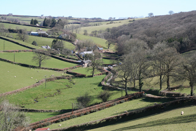
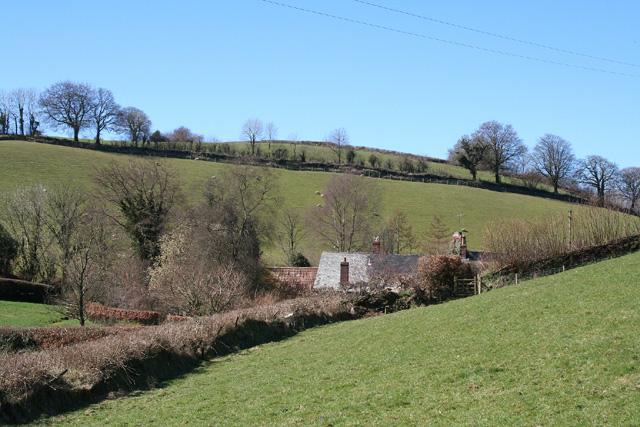
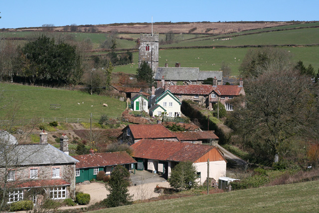
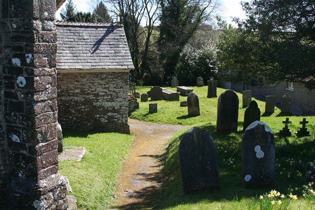
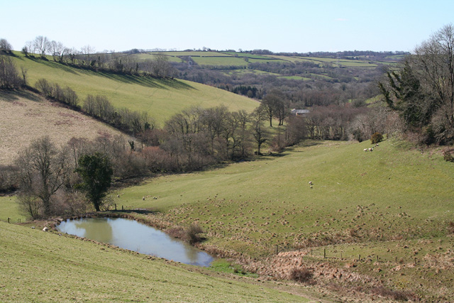
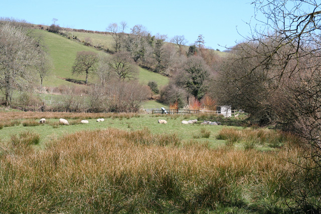
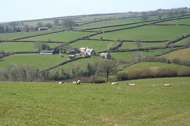
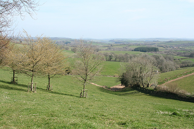
East Anstey is a small village located in the county of Devon, England. Situated in the heart of the Exmoor National Park, this picturesque village offers stunning natural beauty and a tranquil atmosphere. It is nestled in a valley between rolling hills and surrounded by lush green fields, making it an ideal destination for nature enthusiasts and outdoor lovers.

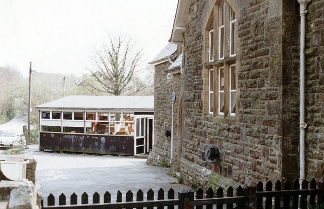
The village itself consists of a cluster of traditional stone cottages, many of which date back to the 17th and 18th centuries, giving it a charming and timeless feel. The local community is close-knit and friendly, with a population of around 300 residents.

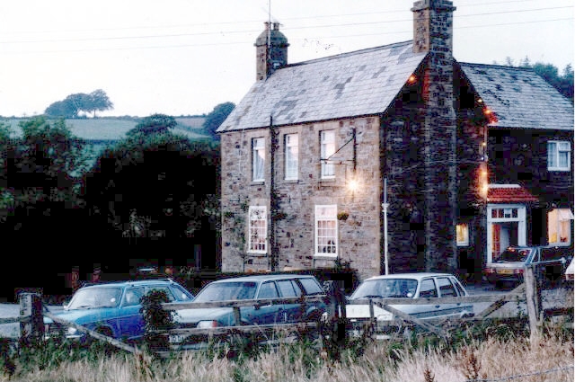
Although small, East Anstey is well-equipped with essential amenities for both residents and visitors. There is a village hall that serves as a hub for social gatherings and community events. Additionally, a local pub provides a cozy spot for locals and tourists alike to enjoy a drink and traditional pub food.

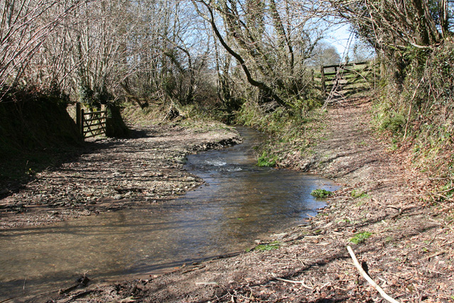
The surrounding countryside offers a plethora of outdoor activities. Numerous walking trails can be found in the area, allowing visitors to explore the stunning landscapes and enjoy breathtaking views. The nearby rivers and streams provide opportunities for fishing, and the rolling hills are perfect for cycling and horseback riding.

Overall, East Anstey is a hidden gem in the heart of Devon, offering a peaceful and idyllic retreat for those seeking a break from the hustle and bustle of city life.

If you have any feedback on the listing, please let us know in the comments section below.

East Anstey Images

Images are sourced within 2km of 51.026663/-3.617824 or Grid Reference SS8626. Thanks to Geograph Open Source API. All images are credited.

East Anstey: Waddicombe Looking north east from the start of a bridleway to Badlake Farm. There is some evidence for a medieval watermill at Waddicombe
East Anstey: Waddicombe
Looking north east from the start of a bridleway to Badlake Farm. There is some evidence for a medieval watermill at Waddicombe
East Anstey: approaching Oak Farm Looking west-south-west on a bridleway from Waddicombe to Dunsley
East Anstey: approaching Oak Farm
Looking west-south-west on a bridleway from Waddicombe to Dunsley
West Anstey: village Looking north from the Two Moors Way
West Anstey: village
Looking north from the Two Moors Way
West Anstey: churchyard The present church was dedicated in November 1319 and was heavily restored in 1880. It is now St Petrock’s but may have been dedicated to the Holy Trinity in the 14th century. A Norman font survives from an earlier church
West Anstey: churchyard
The present church was dedicated in November 1319 and was heavily restored in 1880. It is now St Petrock’s but may have been dedicated to the Holy Trinity in the 14th century. A Norman font survives from an earlier church
West Anstey: towards Dunsley Mill Looking south west from the bridleway below Badlake Farm
West Anstey: towards Dunsley Mill
Looking south west from the bridleway below Badlake Farm
East Anstey: ford on bridleway Looking west-south-west on bridleway from Waddicombe to Dunsley
East Anstey: ford on bridleway
Looking west-south-west on bridleway from Waddicombe to Dunsley
West Anstey: near Dunsley Looking north towards Dunsley Mill. The Two Moors Way runs by the hedgeline on the skyline on the left, towards West Anstey village
West Anstey: near Dunsley
Looking north towards Dunsley Mill. The Two Moors Way runs by the hedgeline on the skyline on the left, towards West Anstey village
East Anstey - The Froude Arms Now closed and a private residence.
East Anstey - The Froude Arms
Now closed and a private residence.
East Anstey School A cold morning!
East Anstey School
A cold morning!
Houses at East Anstey
Brushford: overhead power line A transmission line on Hawtree Moors. Looking south east
Brushford: overhead power line
A transmission line on Hawtree Moors. Looking south east
Brushford: Oldways End A hamlet near the B3227 and on the road to East Anstey. Also on the Somerset – Devon border. Looking east-south-east
Brushford: Oldways End
A hamlet near the B3227 and on the road to East Anstey. Also on the Somerset – Devon border. Looking east-south-east
Dulverton: cottages at Oldways End The Dulverton and Brushford parish boundaries meet here as does the Somerset – Devon border. Looking north west
Dulverton: cottages at Oldways End
The Dulverton and Brushford parish boundaries meet here as does the Somerset – Devon border. Looking north west
East Anstey: by Yanhey Moor Woodland by the entrance to Higher Radnidge Farm and Radnidge House. Looking south-south-east
East Anstey: by Yanhey Moor
Woodland by the entrance to Higher Radnidge Farm and Radnidge House. Looking south-south-east
East Anstey: East Liscombe A farmhouse with self-catering holiday cottages rated 4-star by the English Tourism Council. The barn on the right retains an old threshing machine which was powered by horses in a round house attached to the building. Looking west-north-west. See also <span class="nowrap"><a title="http://www.ansteymillscottagedevon.co.uk" rel="nofollow ugc noopener" href="http://www.ansteymillscottagedevon.co.uk">Link</a><img style="margin-left:2px;" alt="External link" title="External link - shift click to open in new window" src="https://s1.geograph.org.uk/img/external.png" width="10" height="10"/></span>
East Anstey: East Liscombe
A farmhouse with self-catering holiday cottages rated 4-star by the English Tourism Council. The barn on the right retains an old threshing machine which was powered by horses in a round house attached to the building. Looking west-north-west. See also LinkExternal link
East Anstey: West Liscombe Looking south west by the path from Dulverton to Waddicombe
East Anstey: West Liscombe
Looking south west by the path from Dulverton to Waddicombe
East Anstey: towards West Liscombe
Dulverton: near Ridlers By the bridleway to Bere and Knowle. Looking east-south-east over a west Somerset landscape
Dulverton: near Ridlers
By the bridleway to Bere and Knowle. Looking east-south-east over a west Somerset landscape
Show me another place!

East Anstey is located at Grid Ref: SS8626 (Lat: 51.026663, Lng: -3.617824)

Administrative County: Devon

District: North Devon

Police Authority: Devon and Cornwall

What 3 Words

///nooks.hurray.goodbyes. Near Dulverton, Somerset

Related Wikis

Oldways End

Oldways End is a hamlet in the civil parish of East Anstey in the North Devon district of Devon, England. Its nearest town is Tiverton, which lies approximately...

East Anstey

East Anstey is a village and civil parish in the North Devon district of Devon, England. The parish is located in an area which has been designated as...

West Anstey

West Anstey is a village and civil parish on the River Yeo, about 5 miles west of Dulverton, in the North Devon district, in the county of Devon, England...

Briggins Moor

Briggins Moor is a 15.3 hectare biological Site of Special Scientific Interest in Somerset, notified in 1994. The site is south of Dulverton and close...

Nearby Amenities

Located within 500m of 51.026663,-3.617824
East Anstey
Place: village
Source: OS_OpenData_StreetView
Lat/Long: 51.0258214/-3.6152001
Generator Method: photovoltaic
Generator Output Electricity: yes
Generator Source: solar
Generator Type: solar_photovoltaic_panel
Location: roof
Power: generator
Lat/Long: 51.0240918/-3.6157934
The data included in this document is from www.openstreetmap.org. The data is made available under ODbL.

Have you been to East Anstey?

Leave your review of East Anstey below (or comments, questions and feedback).