East Allington

Settlement in Devon South Hams

England

East Allington

Turning to Woolcombe Farm ahead, on the A381
Turning to Woolcombe Farm ahead, on the A381 Credit: Rob Purvis

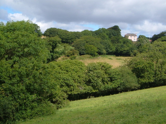
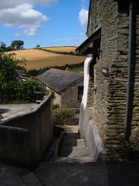
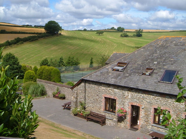
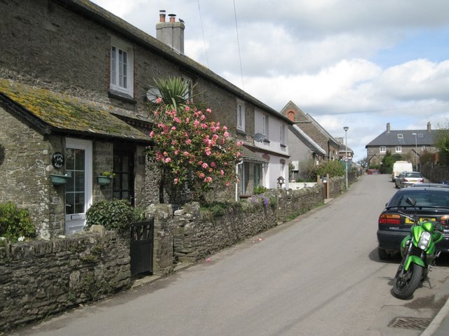
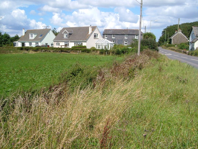
East Allington is a small village located in the South Hams district of Devon, England. Situated approximately 5 miles west of the town of Kingsbridge, it is nestled amidst picturesque countryside and offers a tranquil and scenic setting. The village is surrounded by rolling hills, lush green fields, and charming rural landscapes, making it a popular destination for nature lovers and those seeking a peaceful retreat.

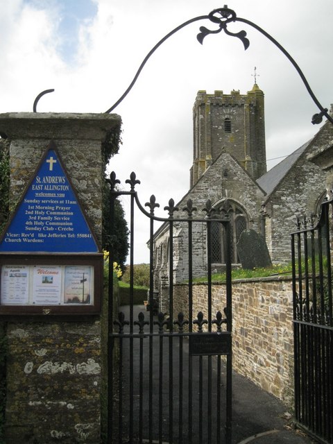
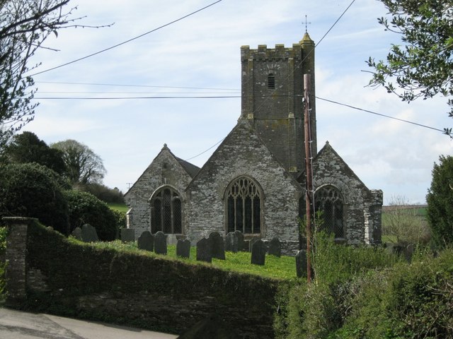
With a population of around 500 residents, East Allington exudes a quintessential English village charm. The heart of the village is dominated by the historic St. Andrew's Church, which dates back to the 13th century and serves as a focal point for the community. The church features a beautiful tower and stained glass windows, adding to its architectural appeal.

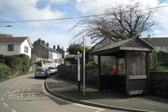
East Allington also boasts a vibrant community spirit, with a range of amenities and activities available for residents and visitors alike. The village hall hosts various events throughout the year, including social gatherings, concerts, and exhibitions. The local pub, The Fortescue Arms, is a popular spot for both locals and tourists, offering a warm and friendly atmosphere along with a delicious menu of traditional pub fare.

For outdoor enthusiasts, East Allington provides ample opportunities for exploring the surrounding natural beauty. The nearby countryside is crisscrossed by footpaths and bridleways, making it ideal for walking, cycling, and horse riding. The village is also conveniently located within a short drive from the stunning South Devon coastline, where visitors can enjoy sandy beaches, rugged cliffs, and breathtaking sea views.

In summary, East Allington offers a charming and idyllic countryside retreat, with its picturesque landscapes, historic landmarks, and strong sense of community. Whether it's for a peaceful getaway or an exploration of Devon's natural beauty, this village provides a delightful destination for visitors of all ages.

If you have any feedback on the listing, please let us know in the comments section below.

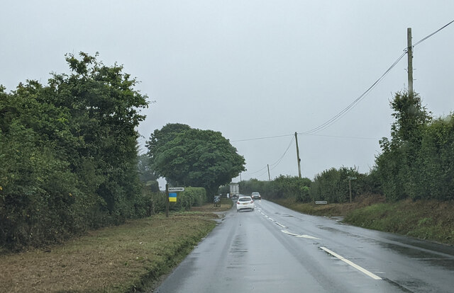
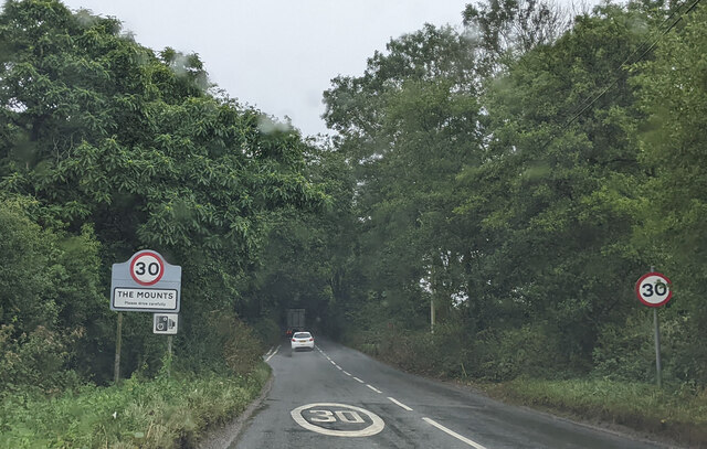
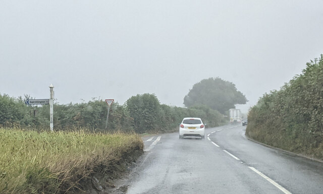
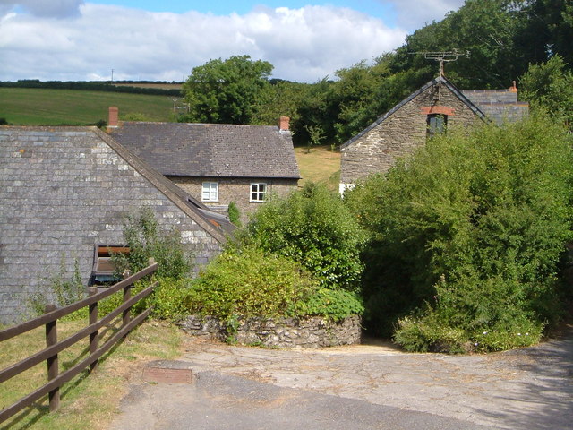
East Allington Images

Images are sourced within 2km of 50.32325/-3.729866 or Grid Reference SX7648. Thanks to Geograph Open Source API. All images are credited.

Turning to Woolcombe Farm ahead, on the A381
Field near Pasture Farm Five years after <a href="https://www.geograph.org.uk/photo/5434376">SX7849 : Field near Pasture Farm</a>, and during the drought of 2022, hence the contrast in colours.
Field near Pasture Farm
Five years after SX7849 : Field near Pasture Farm, and during the drought of 2022, hence the contrast in colours.
Approaching The Mounts on the A381, heading south
Firs Cross in the rain, on the A381 heading south
Field of barley at Green Lane End Beyond, lanes head south across the South Hams.
Field of barley at Green Lane End
Beyond, lanes head south across the South Hams.
Pitt Farm A farm near East Allington that has been extensively developed for tourism accommodation, with indoor pool and tennis court.
Pitt Farm
A farm near East Allington that has been extensively developed for tourism accommodation, with indoor pool and tennis court.
Cuttery House Pink hilltop farmhouse near the A381 north of Kingsbridge; seen from the bridleway from Pitt Farm.
Cuttery House
Pink hilltop farmhouse near the A381 north of Kingsbridge; seen from the bridleway from Pitt Farm.
Pitt Farm Two of the converted outbuildings at Pitt Farm near East Allington.
Pitt Farm
Two of the converted outbuildings at Pitt Farm near East Allington.
Pitt Farm A converted outbuilding at this farm north of east Allington which offers superior holiday accommodation - note the tennis court. Beyond, the ground rises towards the ridgetop A381.
Pitt Farm
A converted outbuilding at this farm north of east Allington which offers superior holiday accommodation - note the tennis court. Beyond, the ground rises towards the ridgetop A381.
Converted building at Pitt Farm A smart conversion (now called Martingale) of a farm outbuilding at Pitt Farm north of East Allington. The bridleway to the village passes by on the left.
Converted building at Pitt Farm
A smart conversion (now called Martingale) of a farm outbuilding at Pitt Farm north of East Allington. The bridleway to the village passes by on the left.
East Allington: wind-blown tree Near the entrance to Higher Pasture Farm. The road acts as the boundary between East Allington and Blackawton parishes
East Allington: wind-blown tree
Near the entrance to Higher Pasture Farm. The road acts as the boundary between East Allington and Blackawton parishes
Bus stop, Efford Corner  Postbox number TQ9 102; Dartmouth Road goes up the hill.
Bus stop, Efford Corner
Postbox number TQ9 102; Dartmouth Road goes up the hill.
Cottages, Vineyard Terrace  Sheltered parts of the South Hams are almost sub-tropical. Here is a Camellia in flower beside a Cordyline.
Cottages, Vineyard Terrace
Sheltered parts of the South Hams are almost sub-tropical. Here is a Camellia in flower beside a Cordyline.
Houses, Addlehole  A small development on the west side of the village.
Houses, Addlehole
A small development on the west side of the village.
Below the church  The Fortescue Arms stands on the corner of the main street and Greenhill.
Below the church
The Fortescue Arms stands on the corner of the main street and Greenhill.
Masonry near Bunkers Farm  The pieces of rubble in the wall reveal folds in the parent rock.
Masonry near Bunkers Farm
The pieces of rubble in the wall reveal folds in the parent rock.
Gates to St Andrew's Church
St Andrew's Church from the east  The church clings to the hillside above the village.
St Andrew's Church from the east
The church clings to the hillside above the village.
Show me another place!

East Allington is located at Grid Ref: SX7648 (Lat: 50.32325, Lng: -3.729866)

Administrative County: Devon

District: South Hams

Police Authority: Devon and Cornwall

What 3 Words

///pads.dignify.deals. Near Kingsbridge, Devon

Related Wikis

East Allington

East Allington is a village and civil parish in the South Hams district of Devon, England, three miles (5 km) south of Halwell and just off the A381 road...

The Mounts

The Mounts is a small hamlet, containing only 17 houses, situated on the A381 road between Totnes and Kingsbridge in Devon, England. It is part of the...

Buckland-Tout-Saints

Buckland-Tout-Saints is a village and civil parish in the South Hams district of Devon, England. In the 2001 census it had a population of 178, up from...

Abbotsleigh, Devon

Abbotsleigh is a hamlet in the county of Devon, England. Abbotsleigh is in the civil parish of Blackawton, within the district council of South Hams in...

Nearby Amenities

Located within 500m of 50.32325,-3.729866
Churchill Cross
Place: locality
Lat/Long: 50.3220744/-3.7291027
Efford Corner
Place: locality
Lat/Long: 50.3248056/-3.729515
East Allington
Is In: Devon, England, UK
Place: village
Lat/Long: 50.3242999/-3.729585
Turning Circle
Lat/Long: 50.323739/-3.7328482
Turning Circle
Lat/Long: 50.3238691/-3.7288178
Efford Corner
Bus: yes
Public Transport: stop_position
Lat/Long: 50.3248117/-3.7294952
Post Box
Brand: Royal Mail
Brand Wikidata: Q638098
Brand Wikipedia: en:Royal Mail
Collection Times: Mo-Fr 09:00; Sa 07:00; Su off
Operator: Royal Mail
Operator Wikidata: Q638098
Post Box Design: 2010_pattern
Post Box Mounting: pier
Post Box Type: lamp
Ref: TQ9 102D
Royal Cypher: EIIR
Royal Cypher Wikidata: Q33102113
Source: streetlevel imagery;aerial imagery
Lat/Long: 50.3247637/-3.7294006
Telephone
Booth: K6
Check Date: 2023-07-17
Covered: booth
Lat/Long: 50.3248966/-3.7285253
Generator Method: photovoltaic
Generator Output Electricity: yes
Generator Source: solar
Generator Type: solar_photovoltaic_panel
Location: roof
Power: generator
Lat/Long: 50.3235297/-3.7301709
Generator Method: photovoltaic
Generator Output Electricity: yes
Generator Source: solar
Generator Type: solar_photovoltaic_panel
Location: roof
Power: generator
Lat/Long: 50.3235263/-3.7302326
Generator Method: photovoltaic
Generator Output Electricity: yes
Generator Source: solar
Generator Type: solar_photovoltaic_panel
Location: roof
Power: generator
Lat/Long: 50.3220681/-3.7286983
Generator Method: photovoltaic
Generator Output Electricity: yes
Generator Source: solar
Generator Type: solar_photovoltaic_panel
Location: roof
Power: generator
Lat/Long: 50.3238953/-3.7331159
Generator Method: photovoltaic
Generator Output Electricity: yes
Generator Source: solar
Generator Type: solar_photovoltaic_panel
Location: roof
Power: generator
Lat/Long: 50.3238739/-3.7330583
Generator Method: photovoltaic
Generator Output Electricity: yes
Generator Source: solar
Generator Type: solar_photovoltaic_panel
Location: roof
Power: generator
Lat/Long: 50.3240623/-3.7296613
Generator Method: photovoltaic
Generator Output Electricity: yes
Generator Source: solar
Generator Type: solar_photovoltaic_panel
Location: roof
Power: generator
Lat/Long: 50.324064/-3.7297323
Generator Method: photovoltaic
Generator Output Electricity: yes
Generator Source: solar
Generator Type: solar_photovoltaic_panel
Location: roof
Power: generator
Lat/Long: 50.3238397/-3.7308267
Generator Method: photovoltaic
Generator Output Electricity: yes
Generator Source: solar
Generator Type: solar_photovoltaic_panel
Location: roof
Power: generator
Lat/Long: 50.3238397/-3.7308723
Generator Method: photovoltaic
Generator Output Electricity: yes
Generator Source: solar
Generator Type: solar_photovoltaic_panel
Location: roof
Power: generator
Lat/Long: 50.324874/-3.7303868
Generator Method: photovoltaic
Generator Output Electricity: yes
Generator Source: solar
Generator Type: solar_photovoltaic_panel
Location: roof
Power: generator
Lat/Long: 50.3248397/-3.7303962
Generator Method: photovoltaic
Generator Output Electricity: yes
Generator Source: solar
Generator Type: solar_photovoltaic_panel
Location: roof
Power: generator
Lat/Long: 50.3241761/-3.7307583
Generator Method: photovoltaic
Generator Output Electricity: yes
Generator Source: solar
Generator Type: solar_photovoltaic_panel
Location: roof
Power: generator
Lat/Long: 50.3241761/-3.7308066
Generator Method: photovoltaic
Generator Output Electricity: yes
Generator Source: solar
Generator Type: solar_photovoltaic_panel
Location: roof
Power: generator
Lat/Long: 50.3241419/-3.7301789
Direction: SSE
Generator Method: photovoltaic
Generator Output Electricity: yes
Generator Solar Modules: 8
Generator Source: solar
Generator Type: solar_photovoltaic_panel
Location: roof
Power: generator
Lat/Long: 50.3251169/-3.7294246
Direction: SSE
Generator Method: photovoltaic
Generator Output Electricity: yes
Generator Solar Modules: 10
Generator Source: solar
Generator Type: solar_photovoltaic_panel
Location: ground
Power: generator
Lat/Long: 50.3252584/-3.7280479
Direction: W
Generator Method: photovoltaic
Generator Output Electricity: yes
Generator Solar Modules: 16
Generator Source: solar
Generator Type: solar_photovoltaic_panel
Location: roof
Power: generator
Lat/Long: 50.3251441/-3.7277636
Power: pole
Lat/Long: 50.3232276/-3.7353296
Power: pole
Lat/Long: 50.324052/-3.7341231
Power: pole
Lat/Long: 50.3250331/-3.7326836
Power: pole
Lat/Long: 50.3253856/-3.7321816
Power: pole
Lat/Long: 50.326294/-3.7308826
Power: pole
Lat/Long: 50.3276004/-3.7289388
The data included in this document is from www.openstreetmap.org. The data is made available under ODbL.

Have you been to East Allington?

Leave your review of East Allington below (or comments, questions and feedback).