Dibble Bridge Wood

Wood, Forest in Yorkshire Scarborough

England

Dibble Bridge Wood

View from John Breckon Road Looking SE across Westerdale from John Breckon Road.
View from John Breckon Road Credit: T Eyre

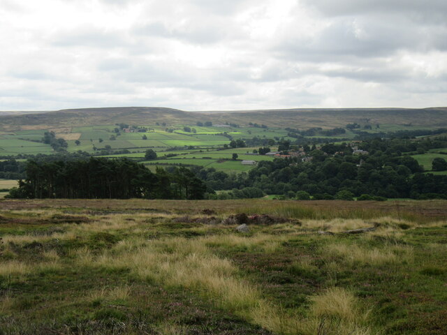
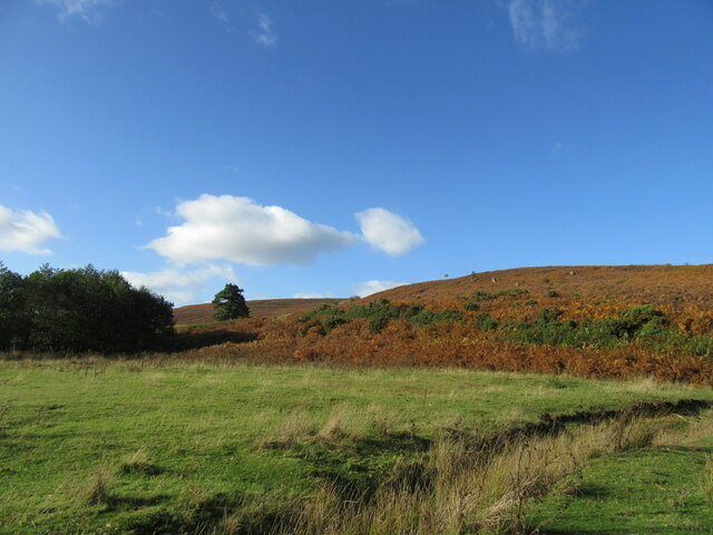
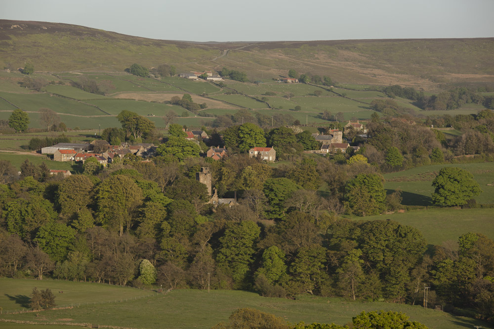
Dibble Bridge Wood is a picturesque woodland located in Yorkshire, England. Nestled in the heart of the county, this enchanting forest covers an area of approximately 100 hectares. It is situated near the village of Hebden, providing locals and visitors with a serene and tranquil escape from the bustling city life.

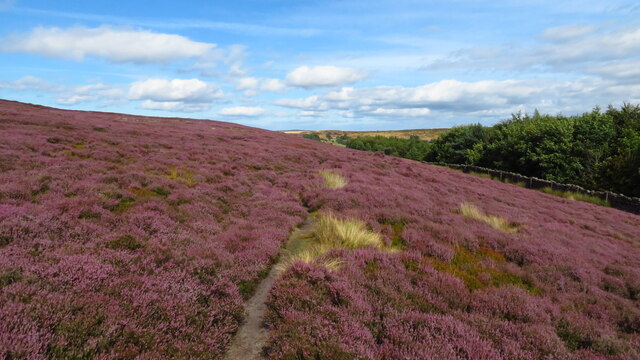
The wood is characterized by its diverse range of flora and fauna, making it an important ecological site. It is home to a variety of tree species, including oak, beech, and birch, which create a vibrant canopy that filters sunlight and creates a serene ambiance. The forest floor is carpeted with bluebells and wildflowers during spring, adding a pop of color to the surroundings.

Dibble Bridge Wood is crisscrossed by a network of footpaths, allowing visitors to explore the area and enjoy the natural beauty at their own pace. The paths wind through the trees, offering glimpses of wildlife such as deer, foxes, and various bird species. The sound of birdsong fills the air, creating a soothing atmosphere for those seeking solace in nature.

The wood is also home to Dibble Bridge, a charming stone bridge that spans a small stream. This picturesque feature adds to the overall charm of the woodland and provides a picturesque spot for photographers and nature enthusiasts.

Overall, Dibble Bridge Wood is a hidden gem in Yorkshire, offering a peaceful retreat for nature lovers and a chance to immerse oneself in the beauty of the natural world. Whether it's a leisurely stroll, birdwatching, or simply enjoying the tranquility, this woodland is a must-visit destination for anyone seeking a connection with nature.

If you have any feedback on the listing, please let us know in the comments section below.

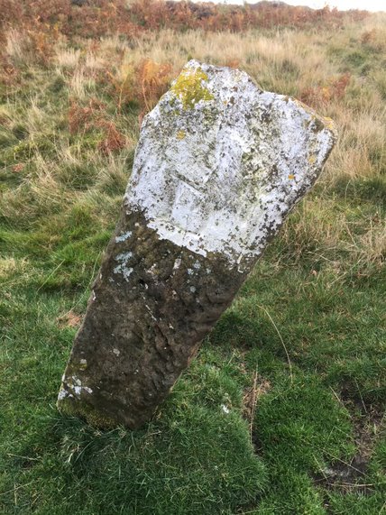
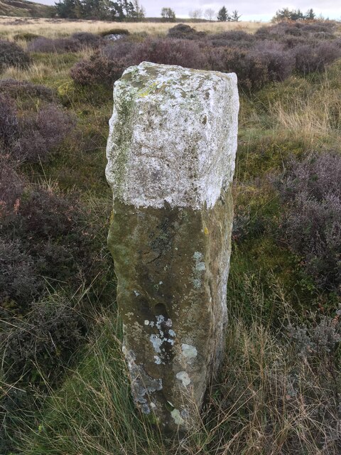
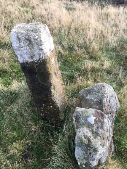
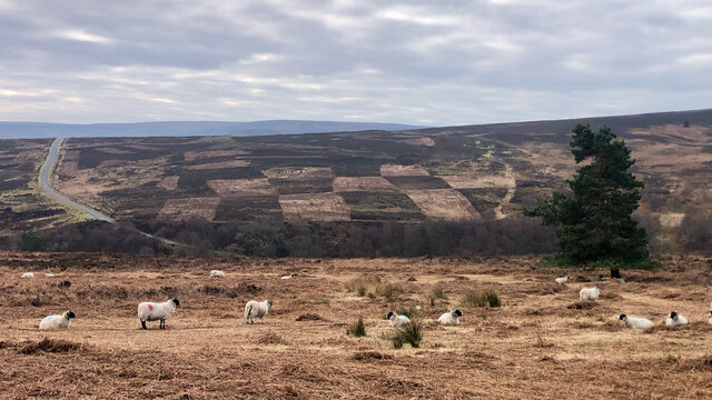
Dibble Bridge Wood Images

Images are sourced within 2km of 54.461566/-0.96596749 or Grid Reference NZ6707. Thanks to Geograph Open Source API. All images are credited.

View from John Breckon Road Looking SE across Westerdale from John Breckon Road.
View from John Breckon Road
Looking SE across Westerdale from John Breckon Road.
Scale Cross This little known 'cross' has been used as a gatepost.
Scale Cross
This little known 'cross' has been used as a gatepost.
Near Castleton Looking NE.
Near Castleton
Looking NE.
Old Boundary Marker on New Road Parish Boundary Marker 12 metres northwest of New Road north of Carr House. On the boundary of Westerdale and Danby parishes. Inscribed D and W on opposite faces.

Milestone Society National ID: YN_WESDAN26pb
Old Boundary Marker on New Road
Parish Boundary Marker 12 metres northwest of New Road north of Carr House. On the boundary of Westerdale and Danby parishes. Inscribed D and W on opposite faces. Milestone Society National ID: YN_WESDAN26pb
Old Boundary Marker southeast of New Road Parish Boundary Marker 40 metres southeast of New Road north of Carr House. On the boundary of Westerdale and Danby parishes. Inscribed D and W on opposite faces.

Milestone Society National ID: YN_WESDAN27pb
Old Boundary Marker southeast of New Road
Parish Boundary Marker 40 metres southeast of New Road north of Carr House. On the boundary of Westerdale and Danby parishes. Inscribed D and W on opposite faces. Milestone Society National ID: YN_WESDAN27pb
Old Boundary Marker southeast of New Road Parish Boundary Marker 85 metres southeast of New Road north of Carr House. On the boundary of Westerdale and Danby parishes. Inscribed D and W on opposite faces.

Milestone Society National ID: YN_WESDAN28pb
Old Boundary Marker southeast of New Road
Parish Boundary Marker 85 metres southeast of New Road north of Carr House. On the boundary of Westerdale and Danby parishes. Inscribed D and W on opposite faces. Milestone Society National ID: YN_WESDAN28pb
Old Boundary Marker south of New Road Parish Boundary Marker 120 metres south of New Road north of Carr House. On the boundary of Westerdale and Danby parishes. Inscribed D and W on opposite faces.

Milestone Society National ID: YN_WESDAN29pb
Old Boundary Marker south of New Road
Parish Boundary Marker 120 metres south of New Road north of Carr House. On the boundary of Westerdale and Danby parishes. Inscribed D and W on opposite faces. Milestone Society National ID: YN_WESDAN29pb
Old Boundary Marker south of New Road Parish Boundary Marker 150 metres south of New Road northeast of Carr House. On the boundary of Westerdale and Danby parishes. Inscribed D and W on opposite faces.

Milestone Society National ID: YN_WESDAN30pb
Old Boundary Marker south of New Road
Parish Boundary Marker 150 metres south of New Road northeast of Carr House. On the boundary of Westerdale and Danby parishes. Inscribed D and W on opposite faces. Milestone Society National ID: YN_WESDAN30pb
Old Boundary Marker south of New Road Parish Boundary Marker 240 metres south of New Road northeast of Carr House. On the boundary of Westerdale and Danby parishes. Inscribed D and W on opposite faces.

Milestone Society National ID: YN_WESDAN31pb
Old Boundary Marker south of New Road
Parish Boundary Marker 240 metres south of New Road northeast of Carr House. On the boundary of Westerdale and Danby parishes. Inscribed D and W on opposite faces. Milestone Society National ID: YN_WESDAN31pb
Old Boundary Marker south of New Road Parish Boundary Marker 300 metres south of New Road northeast of Carr House. On the boundary of Westerdale and Danby parishes. Inscribed D and W on opposite faces.

Milestone Society National ID: YN_WESDAN32pb
Old Boundary Marker south of New Road
Parish Boundary Marker 300 metres south of New Road northeast of Carr House. On the boundary of Westerdale and Danby parishes. Inscribed D and W on opposite faces. Milestone Society National ID: YN_WESDAN32pb
Old Boundary Marker southeast of Birk Field Road Parish Boundary Marker on the southeast side of Birk Field Bank northeast of Carr House. Perhaps next to an older marker stone. On the boundary of Westerdale and Danby parishes. Inscribed D and W on opposite faces.

Milestone Society National ID: YN_WESDAN33pb
Old Boundary Marker southeast of Birk Field Road
Parish Boundary Marker on the southeast side of Birk Field Bank northeast of Carr House. Perhaps next to an older marker stone. On the boundary of Westerdale and Danby parishes. Inscribed D and W on opposite faces. Milestone Society National ID: YN_WESDAN33pb
Old Boundary Marker southeast of Birk Field Road Parish Boundary Marker against the wire fence of a reservoir 45 metres southeast of Birk Field Bank northeast of Carr House. On the boundary of Westerdale and Danby parishes. Inscribed D and W on opposite faces.

Milestone Society National ID: YN_WESDAN34pb
Old Boundary Marker southeast of Birk Field Road
Parish Boundary Marker against the wire fence of a reservoir 45 metres southeast of Birk Field Bank northeast of Carr House. On the boundary of Westerdale and Danby parishes. Inscribed D and W on opposite faces. Milestone Society National ID: YN_WESDAN34pb
Old Boundary Marker west of Blakey Lane Parish Boundary Marker 75 metres west of Blakey Lane and close to the wire fence of a reservoir. On the boundary of Westerdale and Danby parishes. Grade II Listed details <span class="nowrap"><a title="https://historicengland.org.uk/listing/the-list/list-entry/1148606" rel="nofollow ugc noopener" href="https://historicengland.org.uk/listing/the-list/list-entry/1148606">Link</a><img style="margin-left:2px;" alt="External link" title="External link - shift click to open in new window" src="https://s1.geograph.org.uk/img/external.png" width="10" height="10"/></span>. See also <a title="https://www.geograph.org.uk/photo/6050650" href="https://www.geograph.org.uk/photo/6050650">Link</a>.

Inscribed:
GALLOW HOW
D (for Danby) 
W (for Westerdale) 1835

Milestone Society National ID: YN_WESDAN20pb
Old Boundary Marker west of Blakey Lane
Parish Boundary Marker 75 metres west of Blakey Lane and close to the wire fence of a reservoir. On the boundary of Westerdale and Danby parishes. Grade II Listed details LinkExternal link. See also Link. Inscribed: GALLOW HOW D (for Danby) W (for Westerdale) 1835 Milestone Society National ID: YN_WESDAN20pb
Chequerboard swiddens I suppose it would be petty of me to whine about this anthropogenic change to the moors created by mowing of the heather moorland.

I should be thankful that this moor is no longer being burned and great plumes of smoke waft across the skyline but I fear the random patches of the old black swiddens did seem more pleasing than this new chequerboard effect.

‘Swiddens’, as you may recall, are the burnt patches of heather, and swiddening is a centuries old practice, pre-dating its ‘modern’ purpose of promoting the growth of young heather as food for the grouse chicks. It was the first step in turf graving, the cutting and gathering of the underlying peat for use as fuel, a practice no longer in use. In a record of the manor court of Fylingdales of 1682, the burnt moor looked “like a quilt that had been worked’’.

Swiddening also provided an opportunity to gather the ling ‘gouldens’, the name of the partly-burnt storks, tie them in bundles and send them into towns to be sold as ‘kindling’. A task usually carried out by the older women.

It may take up to fourteen years for a new growth of heather to become established after a burn, however during this time the swidden may be colonised by a variety of other plants. It’ll be interesting to see what the recovery and diversity of mowed heather is like. Diversity is of course the enemy of grouse management.

In a hard to read dialect poem by the Yorkshire poet, Stanley Umpleby (1887-1953), the task of swiddening is depicted:

Hoo can a poor fella ‘at’s choak’d up wi’ smeek
I’ t’toon, where he’s sattled ti addle his keak.
Fergit his au’d frinnds, an’ hoo all used ti sing
Awaay ower t’moors bonnin’ swiddens o’ ling.

An’ noo we ‘a’e March here. Ah knaw they’ll be,
Oor Jack, Bill an’ Tommy. Aye! all theer bud me.
An’ if war wiv ’em Ah seear Ah a’ud sing,
Awaay ower t’moors bonnin’ swiddens o’ ling.

For sources and references see my blog <span class="nowrap"><a title="http://www.fhithich.uk/?p=27656" rel="nofollow ugc noopener" href="http://www.fhithich.uk/?p=27656">Link</a><img style="margin-left:2px;" alt="External link" title="External link - shift click to open in new window" src="https://s1.geograph.org.uk/img/external.png" width="10" height="10"/></span>
Chequerboard swiddens
I suppose it would be petty of me to whine about this anthropogenic change to the moors created by mowing of the heather moorland. I should be thankful that this moor is no longer being burned and great plumes of smoke waft across the skyline but I fear the random patches of the old black swiddens did seem more pleasing than this new chequerboard effect. ‘Swiddens’, as you may recall, are the burnt patches of heather, and swiddening is a centuries old practice, pre-dating its ‘modern’ purpose of promoting the growth of young heather as food for the grouse chicks. It was the first step in turf graving, the cutting and gathering of the underlying peat for use as fuel, a practice no longer in use. In a record of the manor court of Fylingdales of 1682, the burnt moor looked “like a quilt that had been worked’’. Swiddening also provided an opportunity to gather the ling ‘gouldens’, the name of the partly-burnt storks, tie them in bundles and send them into towns to be sold as ‘kindling’. A task usually carried out by the older women. It may take up to fourteen years for a new growth of heather to become established after a burn, however during this time the swidden may be colonised by a variety of other plants. It’ll be interesting to see what the recovery and diversity of mowed heather is like. Diversity is of course the enemy of grouse management. In a hard to read dialect poem by the Yorkshire poet, Stanley Umpleby (1887-1953), the task of swiddening is depicted: Hoo can a poor fella ‘at’s choak’d up wi’ smeek I’ t’toon, where he’s sattled ti addle his keak. Fergit his au’d frinnds, an’ hoo all used ti sing Awaay ower t’moors bonnin’ swiddens o’ ling. An’ noo we ‘a’e March here. Ah knaw they’ll be, Oor Jack, Bill an’ Tommy. Aye! all theer bud me. An’ if war wiv ’em Ah seear Ah a’ud sing, Awaay ower t’moors bonnin’ swiddens o’ ling. For sources and references see my blog LinkExternal link
Royal Observer Corps monitoring post at High Castleton NYM NP HER No: 18112
Royal Observer Corps monitoring post at High Castleton
NYM NP HER No: 18112
Commondale
Commondale
Hob Hole The grassy area at Hob Hole.
Hob Hole
The grassy area at Hob Hole.
On Esk Valley walk - heather moorland at foot of Westerdale Moor
Show me another place!

Dibble Bridge Wood is located at Grid Ref: NZ6707 (Lat: 54.461566, Lng: -0.96596749)

Division: North Riding

Administrative County: North Yorkshire

District: Scarborough

Police Authority: North Yorkshire

What 3 Words

///quitter.emails.companies. Near Danby, North Yorkshire

Related Wikis

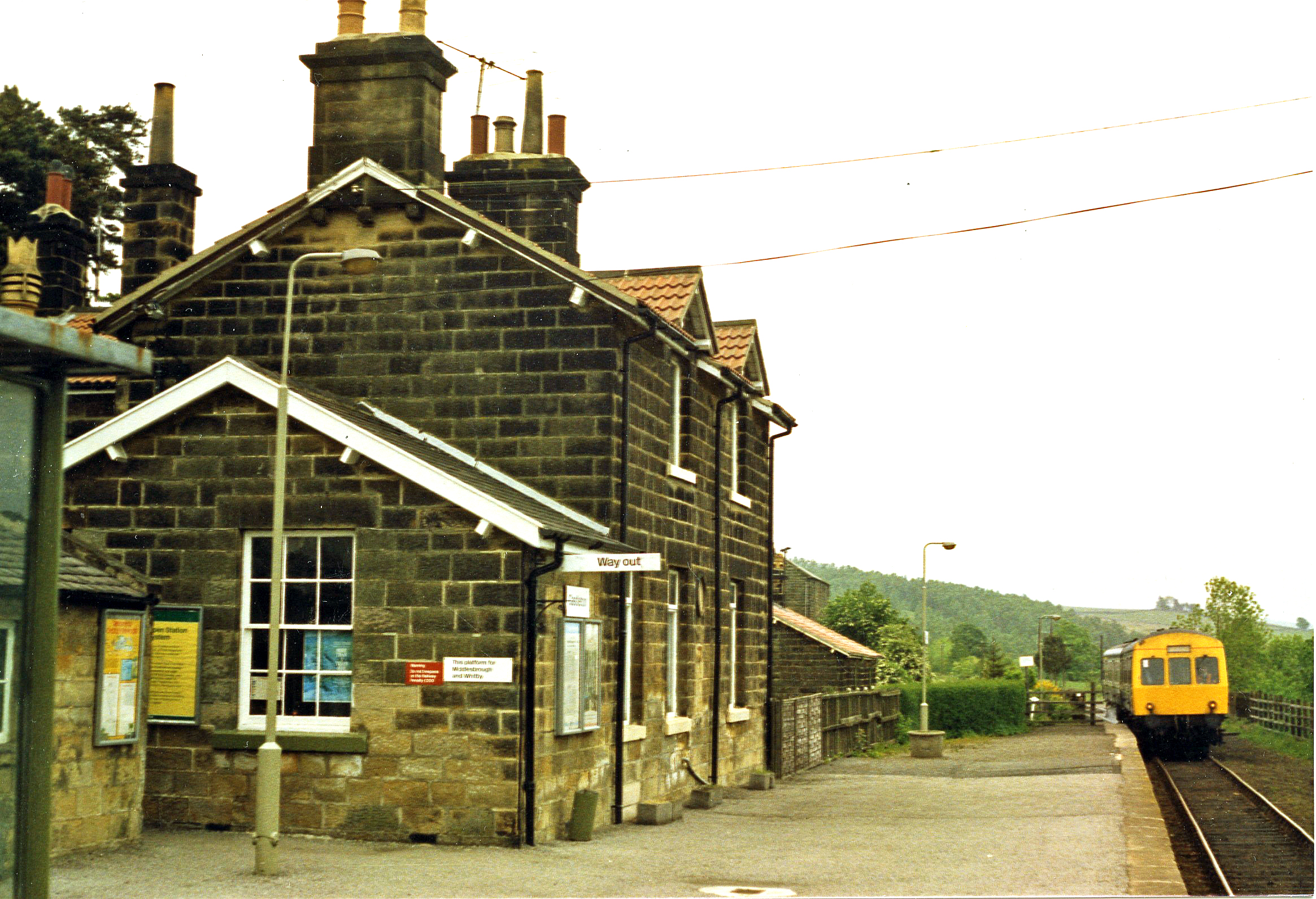
Castleton Moor railway station

Castleton Moor is a railway station on the Esk Valley Line, which runs between Middlesbrough and Whitby via Nunthorpe. The station, situated 16 miles 45...

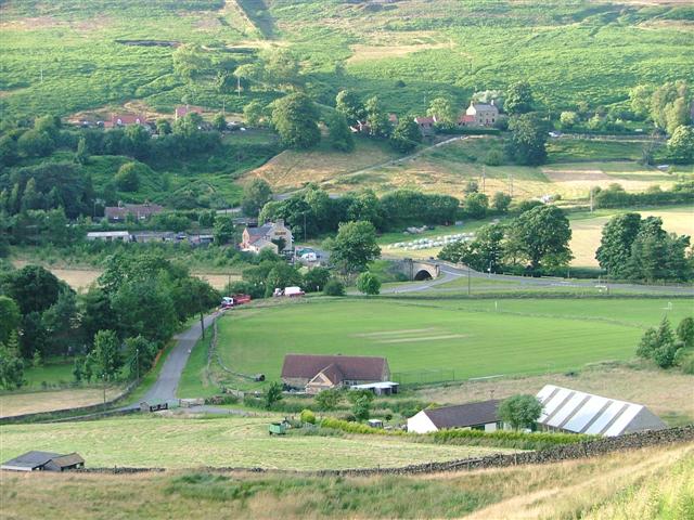
Castleton, North Yorkshire

Castleton is a village on the River Esk, part of the civil parish of Danby in the county of North Yorkshire in England. It can be found 7.1 miles (11.5...

Westerdale Preceptory

Westerdale Preceptory was a priory in Westerdale, North Yorkshire, England. The land was donated to the Knights Templar by Guido de Bovingcourt in 1203...

Commondale railway station

Commondale is a railway station on the Esk Valley Line, which runs between Middlesbrough and Whitby via Nunthorpe. The station, situated 16 miles 72 chains...

Westerdale

Westerdale is a village, civil parish and dale within the Scarborough district of North Yorkshire, England. The Esk Valley Walk runs through part of the...

Commondale

Commondale is a village and civil parish in the Scarborough district of North Yorkshire, England that lies within the North York Moors National Park....

Ainthorpe

Ainthorpe is a village in the civil parish of Danby and the Scarborough district of the county of North Yorkshire, England. It is situated within the...

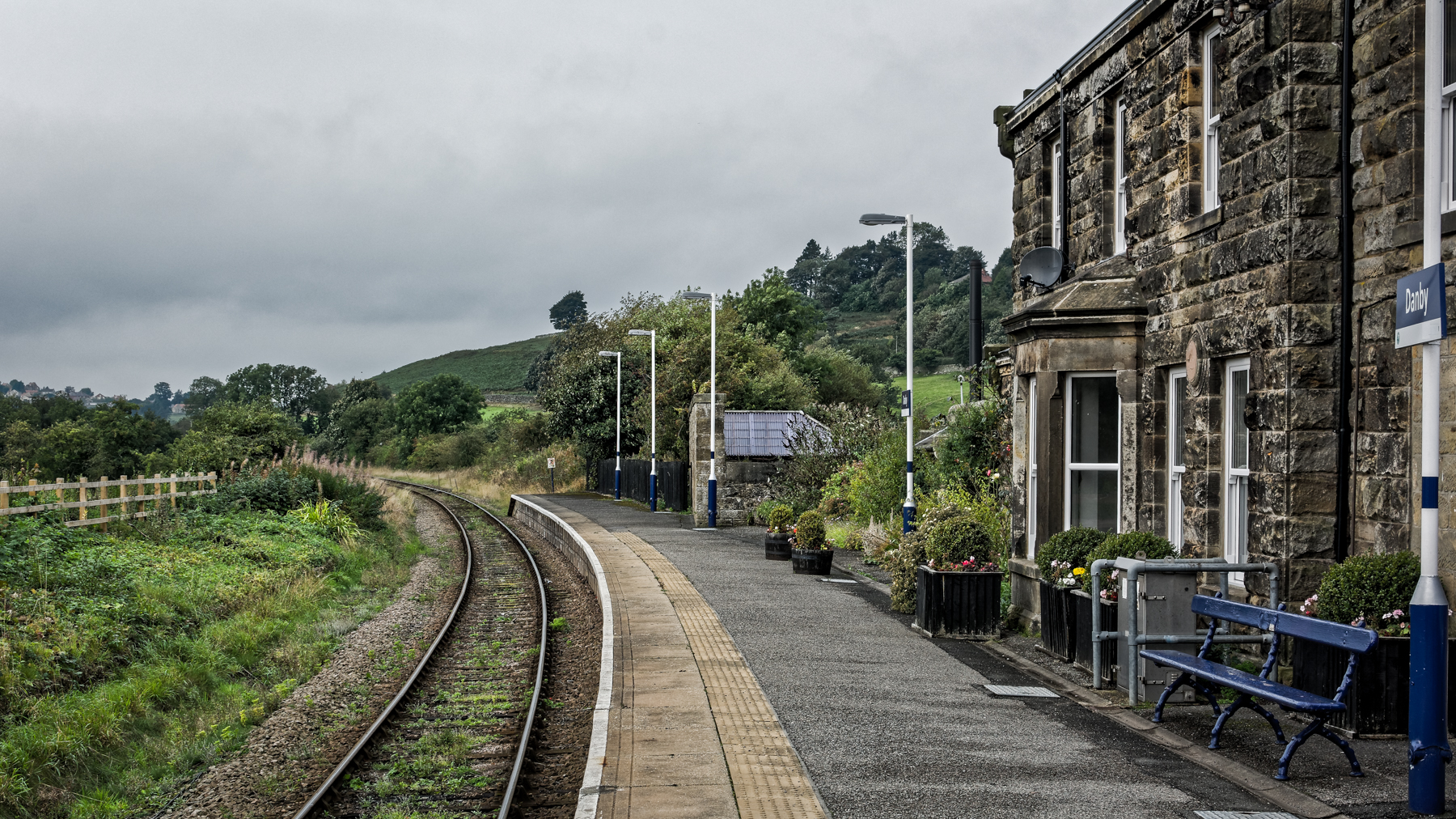
Danby railway station

Danby is a railway station on the Esk Valley Line, which runs between Middlesbrough and Whitby via Nunthorpe. The station, situated 15 miles 9 chains...

Nearby Amenities

Located within 500m of 54.461566,-0.96596749
Turning Circle
Lat/Long: 54.462894/-0.9699694
Note: Not really a place
Source: survey
Lat/Long: 54.463053/-0.9699084
Barrier: cattle_grid
Lat/Long: 54.4630921/-0.9648296
Dibble Bridge Farm
Place: farm
Lat/Long: 54.4613584/-0.9616221
Note: Not really a place
Source: survey
Lat/Long: 54.4629798/-0.963607
Maddy House
Place: farm
Lat/Long: 54.4635722/-0.9633173
Information: guidepost
Tourism: information
Lat/Long: 54.458562/-0.9636892
Information: guidepost
Tourism: information
Lat/Long: 54.4584272/-0.9645205
The data included in this document is from www.openstreetmap.org. The data is made available under ODbL.

Have you been to Dibble Bridge Wood?

Leave your review of Dibble Bridge Wood below (or comments, questions and feedback).