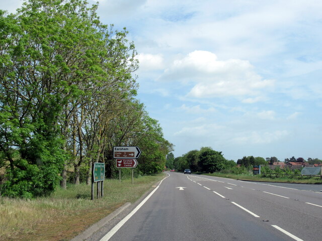
Earsham

Settlement in Norfolk South Norfolk

England

Earsham

4-8, Earsham Street, Bungay (Listed Building) C17 and early C18, 2 storey and attic.  C19 wood shop front to No 4. 

List Entry Number: 1234532 <span class="nowrap"><a title="https://historicengland.org.uk/listing/the-list/list-entry/1234532" rel="nofollow ugc noopener" href="https://historicengland.org.uk/listing/the-list/list-entry/1234532">Link</a><img style="margin-left:2px;" alt="External link" title="External link - shift click to open in new window" src="https://s1.geograph.org.uk/img/external.png" width="10" height="10"/></span>
4-8, Earsham Street, Bungay (Listed Building) Credit: Roger Jones

Earsham is a village located in the county of Norfolk, England. It lies approximately five miles south of the market town of Bungay and six miles west of the town of Beccles. The village is situated on the River Waveney, which forms part of the border between Norfolk and Suffolk.

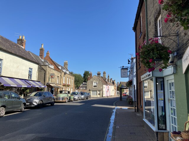
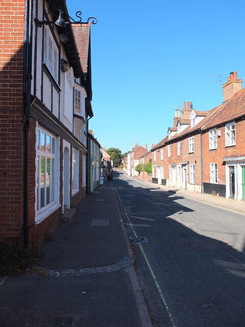
Earsham is a small, picturesque village with a population of around 400 residents. It is known for its charming rural character and historic buildings. The village is surrounded by beautiful countryside, with fields, meadows, and woodland areas providing a scenic backdrop.

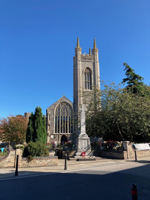
One of the notable landmarks in Earsham is the Holy Trinity Church, a Grade II* listed building that dates back to the 14th century. The church features impressive medieval architecture and contains several interesting historical artifacts.

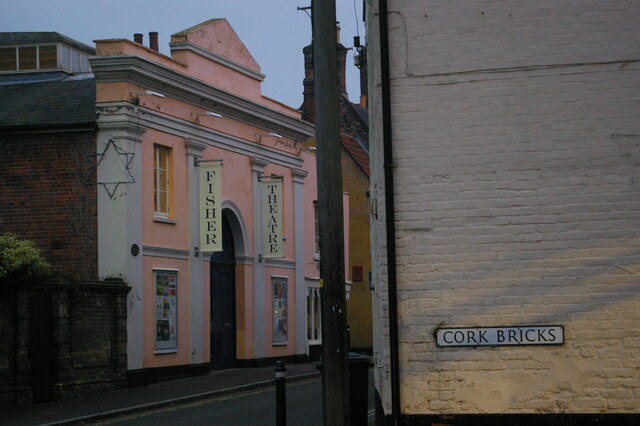
The village also has a pub called The Queens Head, which is a popular spot for locals and visitors alike. It offers a cozy atmosphere and serves a range of traditional pub food and local ales.

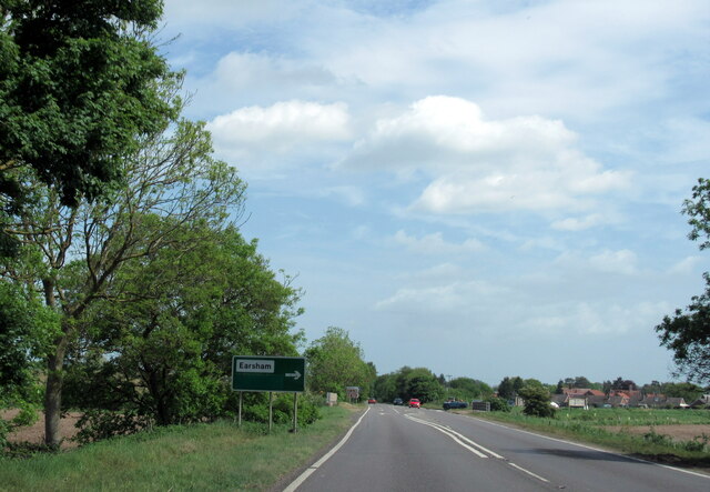
Earsham is well-connected to nearby towns and cities via road networks, with the A143 passing through the village. This allows for easy access to amenities and attractions in the surrounding area. The village also benefits from its proximity to the Norfolk Broads, a network of rivers and lakes that offer opportunities for boating, fishing, and wildlife watching.

In summary, Earsham is a delightful village in Norfolk, offering a tranquil and picturesque setting, historic architecture, and easy access to the countryside and nearby towns.

If you have any feedback on the listing, please let us know in the comments section below.
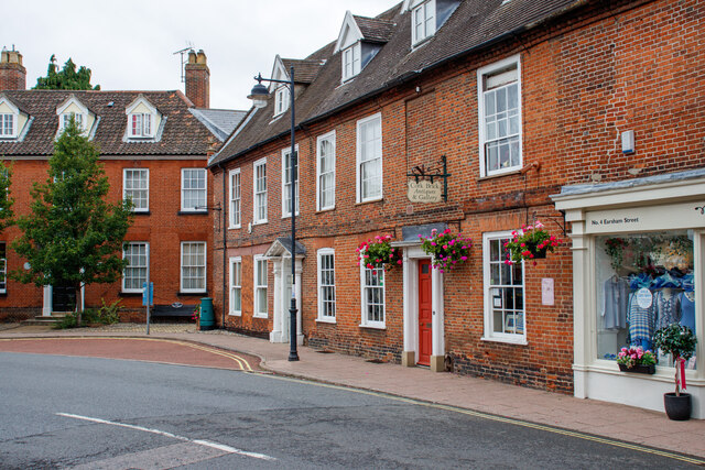
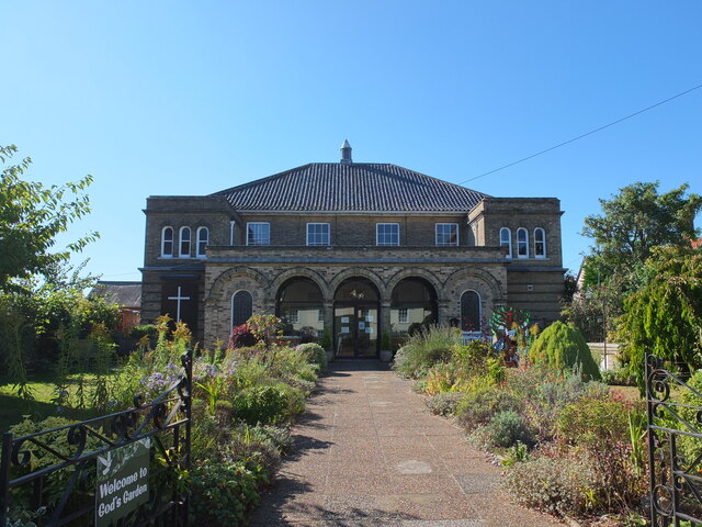
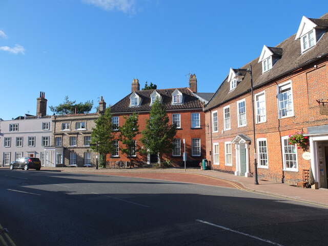
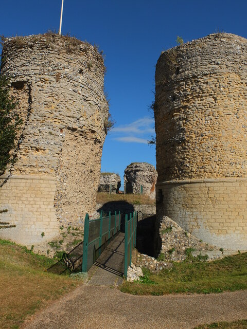
Earsham Images

Images are sourced within 2km of 52.450455/1.416697 or Grid Reference TM3289. Thanks to Geograph Open Source API. All images are credited.

4-8, Earsham Street, Bungay (Listed Building) C17 and early C18, 2 storey and attic.  C19 wood shop front to No 4. 

List Entry Number: 1234532 <span class="nowrap"><a title="https://historicengland.org.uk/listing/the-list/list-entry/1234532" rel="nofollow ugc noopener" href="https://historicengland.org.uk/listing/the-list/list-entry/1234532">Link</a><img style="margin-left:2px;" alt="External link" title="External link - shift click to open in new window" src="https://s1.geograph.org.uk/img/external.png" width="10" height="10"/></span>
4-8, Earsham Street, Bungay (Listed Building)
C17 and early C18, 2 storey and attic. C19 wood shop front to No 4. List Entry Number: 1234532 LinkExternal link
Emmanuel Church, Upper Olland Street, Bungay
Houses on the corner of Earsham Street, Bungay
Bungay Castle
Bungay Castle
St Mary's church, Bungay St Mary's is a magnificent church which is now redundant and is cared for by The Church Conservation Trust and the Friends of St Mary’s Church: <span class="nowrap"><a title="https://stmaryschurchbungay.co.uk/" rel="nofollow ugc noopener" href="https://stmaryschurchbungay.co.uk/">Link</a><img style="margin-left:2px;" alt="External link" title="External link - shift click to open in new window" src="https://s1.geograph.org.uk/img/external.png" width="10" height="10"/></span>
St Mary's church, Bungay
St Mary's is a magnificent church which is now redundant and is cared for by The Church Conservation Trust and the Friends of St Mary’s Church: LinkExternal link
Earsham Street, Bungay
Upper Olland Street, Bungay
A143 east at turning for Earsham
Earsham turning on A143 east
A143 east at Suffolk County border sign
Market Place, Bungay
Street sign, Popson Street, Bungay This design of street sign is common in Bungay and some, like this one, carry the date 1919 in the corner.
Street sign, Popson Street, Bungay
This design of street sign is common in Bungay and some, like this one, carry the date 1919 in the corner.
Fisher Theatre, Broad Street, Bungay Fisher Theatre is now a cinema.  On the right, the entrance to the pleasingly-named Cork Bricks, a short alley that cuts through to the next street.
Fisher Theatre, Broad Street, Bungay
Fisher Theatre is now a cinema. On the right, the entrance to the pleasingly-named Cork Bricks, a short alley that cuts through to the next street.
Earsham Hall: Car parking area
Drift House, Bungay The building has the appearance of being a church.
Drift House, Bungay
The building has the appearance of being a church.
Alms houses in Outney Road, Bungay St Edmund’s Almshouse, built in 1895 to the designs of E Banham, using funds donated by Frederick Smith (1833-1903), a local solicitor, is listed at Grade II, built of red brick laid in Flemish bond with stone dressings and plain red tiled roof covering.
Alms houses in Outney Road, Bungay
St Edmund’s Almshouse, built in 1895 to the designs of E Banham, using funds donated by Frederick Smith (1833-1903), a local solicitor, is listed at Grade II, built of red brick laid in Flemish bond with stone dressings and plain red tiled roof covering.
St Edmund's alms houses, Bungay - plaque detail The central gable, which is taller than those flanking it, contains this carved stone plaque with Gothic trefoil arches bearing the date of 1895 and St Edmund’s Homes with the entwined letters SE above.
St Edmund's alms houses, Bungay - plaque detail
The central gable, which is taller than those flanking it, contains this carved stone plaque with Gothic trefoil arches bearing the date of 1895 and St Edmund’s Homes with the entwined letters SE above.
St Edmund's alms houses, Bungay - chimney detail Above the steeply pitched roof are five tall octagonal chimneys shafts with moulded brick bases and star tops.
St Edmund's alms houses, Bungay - chimney detail
Above the steeply pitched roof are five tall octagonal chimneys shafts with moulded brick bases and star tops.
Show me another place!

Earsham is located at Grid Ref: TM3289 (Lat: 52.450455, Lng: 1.416697)

Administrative County: Norfolk

District: South Norfolk

Police Authority: Norfolk

What 3 Words

///sofas.slide.dearest. Near Bungay, Suffolk

Related Wikis

Earsham

Earsham is a village and civil parish in the English county of Norfolk. Earsham is located 1.7 kilometres (1.1 mi) west of its postal town of Bungay and...

Earsham railway station

Earsham was a railway station in Earsham, Norfolk, England. It was located on the Waveney Valley Line which connected Beccles with the Great Eastern Main...

Bungay railway station

Bungay railway station was located on the now disused Waveney Valley Line which ran between Tivetshall and Beccles. The station was closed in 1953 and...

Bungay Castle

Bungay Castle is a Grade I listed building in the town of Bungay, Suffolk. == History == The site was originally a Norman castle built by Roger Bigod in...

Bungay

Bungay () is a market town, civil parish and electoral ward in the English county of Suffolk. It lies in the Waveney Valley, 5.5 miles (9 km) west of Beccles...

St Mary's Church, Bungay

St Mary's Church is a redundant Anglican church in the town of Bungay, Suffolk, England. The church and the ruins of the adjacent priory are recorded...

Bungay Priory

Bungay Priory was a Benedictine nunnery in the town of Bungay in the English county of Suffolk. It was founded c. 1160-1185 by the Countess Gundreda, wife...

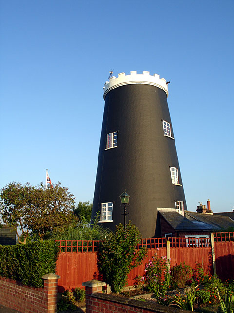
Flixton Road Mill, Bungay

Flixton Road Mill is a tower mill at Bungay, Suffolk, England which has been truncated and converted to residential accommodation. The structure is a Grade...

Nearby Amenities

Located within 500m of 52.450455,1.416697
Earsham
Place: village
Source: npe
Lat/Long: 52.4502075/1.4172979
Bus Stop
Queens Head, adj
Bus: yes
Naptan AtcoCode: 2900E011
Naptan Bearing: E
Naptan CommonName: Queens Head
Naptan Indicator: adj
Naptan Landmark: public house
Naptan Locality: Earsham
Naptan NaptanCode: nfoapajg
Naptan Street: The Street
Naptan Verified: no
Public Transport: platform
Source: naptan_import
Lat/Long: 52.4503051/1.4160896
Bus Stop
Kingsway, adj
Bus: yes
Naptan AtcoCode: 2900E012
Naptan Bearing: E
Naptan CommonName: Kingsway
Naptan Indicator: adj
Naptan Landmark: Kingsway
Naptan Locality: Earsham
Naptan NaptanCode: nfoapajm
Naptan Street: The Street
Naptan Verified: no
Public Transport: platform
Source: naptan_import
Lat/Long: 52.451447/1.4189015
Bus Stop
Queens Head, opp
Alt Name: Earsham- Bus Shelter
Bus: yes
Naptan AltCommonName: Earsham- Bus Shelter
Naptan AtcoCode: 2900E013
Naptan Bearing: W
Naptan CommonName: Queens Head
Naptan Indicator: opp
Naptan Landmark: bus shelter
Naptan Locality: Earsham
Naptan NaptanCode: nfoapajp
Naptan Street: The Street
Naptan Verified: no
Public Transport: platform
Source: naptan_import
Lat/Long: 52.4501953/1.4161547
Bus Stop
Kingsway, opp
Bus: yes
Naptan AtcoCode: 2900E014
Naptan Bearing: W
Naptan BusStopType: CUS
Naptan CommonName: Kingsway
Naptan Indicator: opp
Naptan Landmark: Kingsway
Naptan Locality: Earsham
Naptan NaptanCode: nfoapajt
Naptan Street: The Street
Naptan Verified: no
Public Transport: platform
Source: naptan_import
Lat/Long: 52.4512966/1.4188163
Bus Stop
The Street, adj
Bus: yes
Naptan AtcoCode: 2900E016
Naptan Bearing: NE
Naptan BusStopType: CUS
Naptan CommonName: The Street
Naptan Indicator: adj
Naptan Landmark: The Elms
Naptan Locality: Earsham
Naptan NaptanCode: nfoapama
Naptan ShortCommonName: The Street
Naptan Street: The Street
Naptan Verified: no
Public Transport: platform
Source: naptan_import
Lat/Long: 52.4530411/1.4222493
Barrier: cycle_barrier
Bicycle: yes
Lat/Long: 52.4496746/1.4186611
Barrier: cycle_barrier
Bicycle: yes
Lat/Long: 52.450289/1.4174766
Turning Circle
Lat/Long: 52.4494981/1.4177118
Earsham
Historic Railway: station
Railway: site
Source: OS 1:25k
Wikidata: Q5326982
Wikipedia: en:Earsham railway station
Lat/Long: 52.4509503/1.4135335
Give Way
Lat/Long: 52.4504102/1.4163246
Give Way
Lat/Long: 52.4520911/1.4114054
Passing Place
Lat/Long: 52.4524264/1.4111806
Entrance: main
Lat/Long: 52.4477309/1.4214173
Turning Circle
Source: Bing
Lat/Long: 52.4524619/1.4180355
Power: pole
Lat/Long: 52.4531659/1.4137218
Power: pole
Lat/Long: 52.4531146/1.4129325
Power: pole
Lat/Long: 52.4530223/1.4115448
Power: pole
Transformer: distribution
Lat/Long: 52.4529145/1.4106898
Power: pole
Lat/Long: 52.451565/1.4105286
Power: pole
Lat/Long: 52.4511449/1.4107316
Power: pole
Lat/Long: 52.4522325/1.4100601
Power: pole
Lat/Long: 52.4531005/1.4144082
Give Way
Lat/Long: 52.4489501/1.4165499
Earsham
Inscription: This sign was sponsored by Jim Bennett / S.W.& C.Bone / Corral Coal / D-Way Travel / Earsham Estate / Earsham Gravels / Earsham Hall / Earsham Park Farm / P.Gladwell / LaFarge / J.H.Lambert Ltd / V.Lewis / New Atlantic / B.Nursey / Queens Head /
Inscription 2: D.J.Revell & Son / Jig Snelling / The Earsham Charity / Tubes Scaffolding Ltd / April 2010 / It is known that Earsham Mill in 1793 was as shown on this sign. The Domesday book records a mill at Earsham on this site. 1920 / WI / 1980
Man Made: village_sign
Material: metal
Start Date: 2010
Lat/Long: 52.4502843/1.416439
Post Box
Collection Times: Mo-Fr 16:00; Sa 09:30
Operator: Royal Mail
Post Box Mounting: pier
Post Box Type: lamp
Ref: NR35 3539
Royal Cypher: EIIR
Royal Cypher Wikidata: Q33102113
Lat/Long: 52.4506846/1.4153869
Barrier: cycle_barrier
Lat/Long: 52.4511666/1.4140968
Power: pole
Transformer: distribution
Lat/Long: 52.4475306/1.4147955
Power: pole
Lat/Long: 52.4477154/1.4135376
Power: pole
Lat/Long: 52.4478756/1.4123172
Power: pole
Lat/Long: 52.4479557/1.4117888
Power: pole
Lat/Long: 52.4484543/1.4102948
Power: pole
Lat/Long: 52.4488891/1.4122662
Give Way
Lat/Long: 52.4493148/1.4142593
Power: pole
Lat/Long: 52.4493754/1.41442
Power: pole
Lat/Long: 52.4494662/1.4142296
Power: pole
Lat/Long: 52.4497849/1.4135832
Power: pole
Transformer: distribution
Lat/Long: 52.4502884/1.4126927
Power: pole
Lat/Long: 52.4507347/1.4116493
Give Way
Lat/Long: 52.4518941/1.4117467
Give Way
Lat/Long: 52.4519799/1.4112903
Defibrillator
Emergency: defibrillator
Ref GB The Circuit: 676BA690-C9F9-4C2E-B256-AE1D00DBF57E
Lat/Long: 52.4503516/1.4169088
Social Facility
Moorings Residential Care Home
Social Facility: group_home
Social Facility For: senior
Lat/Long: 52.4479705/1.4186449
Power: pole
Lat/Long: 52.450393/1.4238171
Give Way
Lat/Long: 52.4507101/1.4154963
Crossing
Crossing: unmarked
Lat/Long: 52.4506018/1.415392
Give Way
Lat/Long: 52.4511968/1.4138559
Inscription: To commemorate the centenary of the First World War / 4th August 2014
Man Made: flower_pot
Lat/Long: 52.4503808/1.4165966
Inscription: To commemorate the centenary of the First World War / 4th August 2014
Man Made: flower_pot
Lat/Long: 52.4504155/1.4166697
Historic: memorial
Inscription: For god / for king, for country. In grateful memory of the men from Earsham who gave their lives in the Great War / 1914 – 1919 / "Their name liveth for evermore."
Material: stone
Memorial: war_memorial
Website: http://www.roll-of-honour.com/Norfolk/Earsham.html
Lat/Long: 52.4503971/1.4166322
Recycling
Recycling Clothes: yes
Recycling Shoes: yes
Recycling Type: container
Lat/Long: 52.4503146/1.4168021
Give Way
Lat/Long: 52.4505189/1.4165664
Give Way
Lat/Long: 52.4502909/1.4162412
Barrier: cycle_barrier
Bicycle: no
Lat/Long: 52.4501417/1.4178177
Waste Basket
Colour: red
Waste: dog_excrement
Lat/Long: 52.4500918/1.4177238
Give Way
Lat/Long: 52.4496142/1.4166324
Give Way
Lat/Long: 52.449782/1.416497
Give Way
Lat/Long: 52.4500918/1.4178633
Waste Basket
Colour: red
Waste: dog_excrement
Lat/Long: 52.4482548/1.4209472
Give Way
Lat/Long: 52.448245/1.421151
Power: pole
Lat/Long: 52.4502377/1.4219436
The data included in this document is from www.openstreetmap.org. The data is made available under ODbL.

Have you been to Earsham?

Leave your review of Earsham below (or comments, questions and feedback).