Cornwell Copse

Wood, Forest in Oxfordshire South Oxfordshire

England

Cornwell Copse

Pasture, Tetsworth As in many of the pastoral fields to the west of Tetsworth, ridge and furrow is in evidence in this field crossed by a footpath near Manor Farm.
Pasture, Tetsworth Credit: Andrew Smith

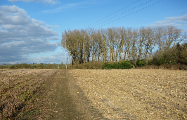
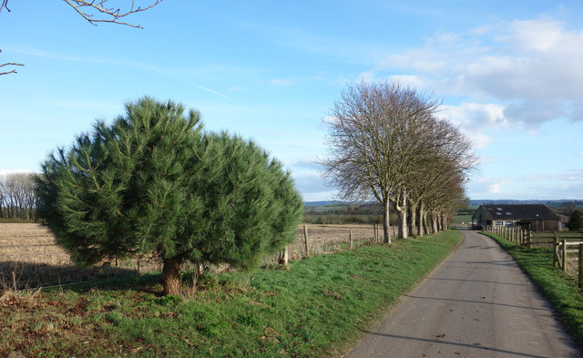
Cornwell Copse is a captivating woodland located in Oxfordshire, England. Covering an area of approximately 100 acres, it is a remarkable example of a well-preserved ancient forest. The copse is nestled within the idyllic Cotswold Hills, providing a stunning backdrop for nature lovers and outdoor enthusiasts.

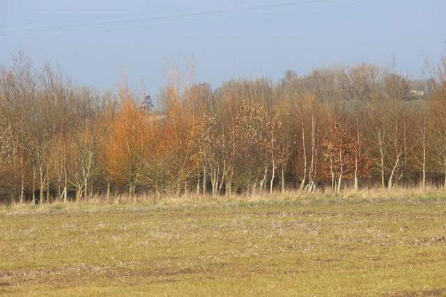
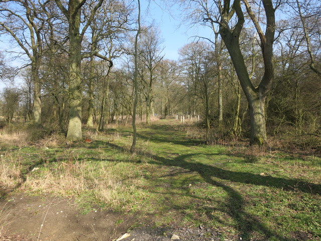
The woodland boasts a diverse range of flora and fauna, making it a haven for biodiversity. Tall, majestic oak and beech trees dominate the canopy, creating a dense and verdant atmosphere. Beneath the towering giants, a rich understory flourishes, consisting of wildflowers, ferns, and mosses. The forest floor is a tapestry of vibrant colors, with bluebells, primroses, and wood anemones adorning the landscape during springtime.

Cornwell Copse is home to a variety of wildlife. Birdwatchers will delight in the melodic songs of warblers, woodpeckers, and tawny owls. Red foxes, badgers, and roe deer are among the mammals that call this woodland their home. The copse also provides a habitat for numerous insects, such as butterflies and beetles, creating a thriving ecosystem.

The woodland offers an array of recreational activities for visitors. Well-maintained footpaths wind through the copse, providing opportunities for peaceful walks and hikes. The enchanting atmosphere of the forest makes it an ideal location for nature photography and painting. Additionally, the copse is a popular spot for camping and picnicking, allowing visitors to immerse themselves in the beauty of their surroundings.

In summary, Cornwell Copse is a captivating woodland oasis in Oxfordshire, offering a stunning display of flora and fauna. Whether it's exploring the diverse ecosystem, embarking on a leisurely stroll, or simply enjoying a tranquil picnic, this ancient forest is a true gem of natural beauty.

If you have any feedback on the listing, please let us know in the comments section below.

Cornwell Copse Images

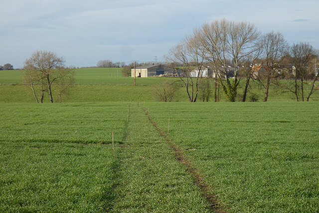
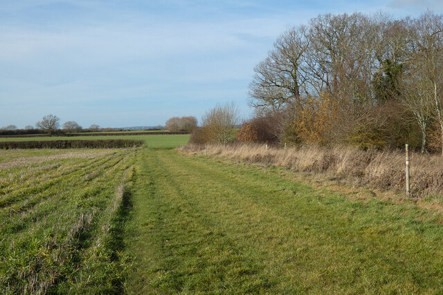
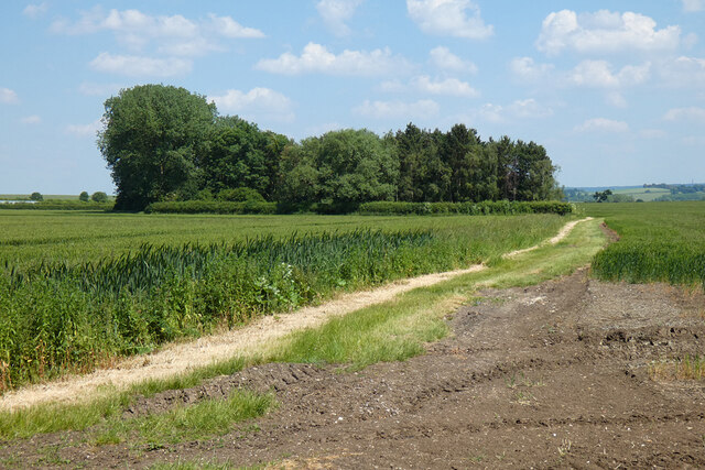
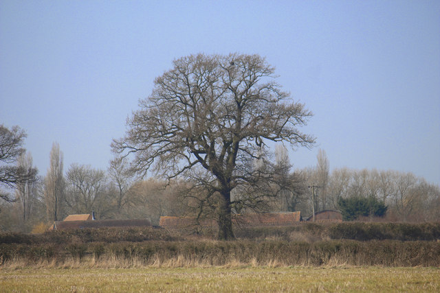
Images are sourced within 2km of 51.699019/-1.0349 or Grid Reference SP6600. Thanks to Geograph Open Source API. All images are credited.

Pasture, Tetsworth As in many of the pastoral fields to the west of Tetsworth, ridge and furrow is in evidence in this field crossed by a footpath near Manor Farm.
Pasture, Tetsworth
As in many of the pastoral fields to the west of Tetsworth, ridge and furrow is in evidence in this field crossed by a footpath near Manor Farm.
Farmland, Pyrton A footpath crossing arable fields and pasture to the south of Peggs Farm.
Farmland, Pyrton
A footpath crossing arable fields and pasture to the south of Peggs Farm.
Track, farmland and barns, Great Haseley A crop of beans is in this field beside the bridleway approaching Latchford from Tetsworth.
Track, farmland and barns, Great Haseley
A crop of beans is in this field beside the bridleway approaching Latchford from Tetsworth.
Farmland, Wheatfield Arable fields and a copse beside the footpath passing Lower Farm.
Farmland, Wheatfield
Arable fields and a copse beside the footpath passing Lower Farm.
Pasture, Tetsworth The footpath west of Oxhouse Farm follows this former field boundary.
Pasture, Tetsworth
The footpath west of Oxhouse Farm follows this former field boundary.
Farmland, Great Haseley A cereal crop crossed by the bridleway between Peggs Farm and Latchford.
Farmland, Great Haseley
A cereal crop crossed by the bridleway between Peggs Farm and Latchford.
Farmland, Stoke Talmage Stubble alongside the north-western edge of Cornwell Copse.
Farmland, Stoke Talmage
Stubble alongside the north-western edge of Cornwell Copse.
Farmland and Poppets Hill Farm, Pyrton A view across the mixed farming landscape crossed by Stoney Lane.
Farmland and Poppets Hill Farm, Pyrton
A view across the mixed farming landscape crossed by Stoney Lane.
Farmland, Pyrton Wheat and a copse  at Standhill in the northernmost part of the strip parish and very remote from the village itself.
Farmland, Pyrton
Wheat and a copse at Standhill in the northernmost part of the strip parish and very remote from the village itself.
Stoke Grange SP6700 is quite a secretive square with only a short bit of rather neglected public footpath in one corner.
Photographically it's fields and woods and a limited view of Stoke Grange from around 500m away.
Stoke Grange
SP6700 is quite a secretive square with only a short bit of rather neglected public footpath in one corner. Photographically it's fields and woods and a limited view of Stoke Grange from around 500m away.
Towards Stoke Grange Outbuilding at the Grange just about visible through the trees. Nearly all of this square has no public access.
Towards Stoke Grange
Outbuilding at the Grange just about visible through the trees. Nearly all of this square has no public access.
Winter Tree Colours A small wood near Stoke Grange.
Winter Tree Colours
A small wood near Stoke Grange.
Derelict House at Goldpits Farm Goldpits Farm and Manor Farm seem to be side by side on the same site. A lot of signs of things going on all around in the yard but the house itself is going to ruin.
Derelict House at Goldpits Farm
Goldpits Farm and Manor Farm seem to be side by side on the same site. A lot of signs of things going on all around in the yard but the house itself is going to ruin.
Cornwell Copse A small wood beside the footpath.
Cornwell Copse
A small wood beside the footpath.
Feeder & Footpath Farmer's food for fatter pheasants.
Remains of a gate with footpath way mark still just about standing in the hedge.
Feeder & Footpath
Farmer's food for fatter pheasants. Remains of a gate with footpath way mark still just about standing in the hedge.
End of Bridleway This is a bit curious. Exactly as shown on the map, there is a bridleway out to here in the middle of nowhere much where it just stops. 
There is a building shown in the middle of this bit of woodland. An old barn that needed horse access at one time maybe?
Anyway, there's no sign of any horses being here recently, and to be fair, why would you?
End of Bridleway
This is a bit curious. Exactly as shown on the map, there is a bridleway out to here in the middle of nowhere much where it just stops. There is a building shown in the middle of this bit of woodland. An old barn that needed horse access at one time maybe? Anyway, there's no sign of any horses being here recently, and to be fair, why would you?
Bridleway near Peggs Farm This is officially a bridleway but as it comes to a sudden stop in the field beyond the trees it doesn't look very much used by horses.
Bridleway near Peggs Farm
This is officially a bridleway but as it comes to a sudden stop in the field beyond the trees it doesn't look very much used by horses.
A Small Round Pine Tree A lone specimen beside the road to Peggs Farm.
A Small Round Pine Tree
A lone specimen beside the road to Peggs Farm.
Show me another place!

Cornwell Copse is located at Grid Ref: SP6600 (Lat: 51.699019, Lng: -1.0349)

Administrative County: Oxfordshire

District: South Oxfordshire

Police Authority: Thames Valley

What 3 Words

///pranced.bulletins.broad. Near Chalgrove, Oxfordshire

Nearby Locations

Cornwell Copse

Related Wikis

Stoke Talmage

Stoke Talmage is a village and civil parish 4+1⁄2 miles (7 km) south of Thame in Oxfordshire. The 2001 Census recorded the parish population as 49. Because...

Tetsworth

Tetsworth is a village and civil parish about 3 miles (5 km) south of Thame in Oxfordshire. Its Parish Council is made up of six elected Councillors. The...

The Swan, Tetsworth

The Swan is an historic former Grade II* Elizabethan coaching inn in Tetsworth built about 1600 CE with 17th-century and 18th-century additions.It is now...

Wheatfield, Oxfordshire

Wheatfield is a civil parish and deserted medieval village about 4 miles (6.4 km) south of Thame in Oxfordshire. Wheatfield's toponym is derived from...

Have you been to Cornwell Copse?

Leave your review of Cornwell Copse below (or comments, questions and feedback).