Knight's Wood

Wood, Forest in Hampshire East Hampshire

England

Knight's Wood

Path junction on track near West Tisted
Path junction on track near West Tisted Credit: Chris Wimbush

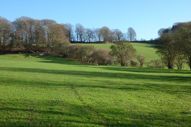
Knight's Wood is a picturesque forest located in the county of Hampshire, England. Covering an area of approximately 500 acres, it is one of the largest woodlands in the region and is known for its diverse range of flora and fauna.

The wood is predominantly made up of broadleaf trees, including oak, beech, and birch, which create a dense canopy that provides shade and shelter to a variety of wildlife. The forest floor is carpeted with bluebells, wild garlic, and ferns, creating a beautiful and vibrant undergrowth.

Knight's Wood is a popular destination for nature lovers and outdoor enthusiasts. It offers numerous walking trails and pathways, allowing visitors to explore the woodland's hidden gems. One of the main attractions within the wood is a tranquil lake, which is home to a variety of waterfowl and other aquatic species. The lake also provides a serene spot for picnics and relaxation.

The woodland is teeming with wildlife, including deer, rabbits, and a wide array of bird species. Nature enthusiasts can often spot woodpeckers, owls, and various songbirds while exploring the forest. The wood also features several bird hides and observation points, allowing visitors to observe and photograph the wildlife undisturbed.

Knight's Wood is managed and maintained by the local authorities, who ensure the preservation of its natural beauty and ecological balance. It is open to the public year-round, with designated parking areas and facilities for visitors. The wood offers a peaceful retreat from the hustle and bustle of daily life, providing a perfect opportunity to connect with nature and enjoy the tranquil surroundings.

If you have any feedback on the listing, please let us know in the comments section below.

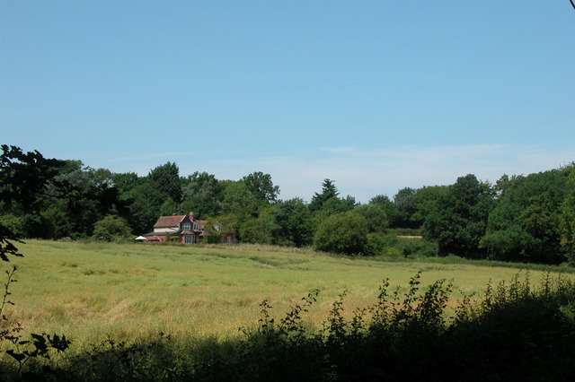
Knight's Wood Images

Images are sourced within 2km of 51.066001/-1.048648 or Grid Reference SU6630. Thanks to Geograph Open Source API. All images are credited.

Path junction on track near West Tisted
Old Direction Sign - Signpost opposite Smugglers Lane, Ropley Lost finial - 3 arms; by the UC road, in parish of Ropley (East Hampshire District), at Smugglers Lane, T-junction.

Surveyed

Milestone Society National ID: HA_SU6531
Old Direction Sign - Signpost opposite Smugglers Lane, Ropley
Lost finial - 3 arms; by the UC road, in parish of Ropley (East Hampshire District), at Smugglers Lane, T-junction. Surveyed Milestone Society National ID: HA_SU6531
Hill Farm Road Hill Farm predates most buildings in Monkwood and is behind the hedge to the left. The buildings are now converted to residential units.
Hill Farm Road
Hill Farm predates most buildings in Monkwood and is behind the hedge to the left. The buildings are now converted to residential units.
Postbox in Merryfield Road Monkwood is a small and fairly dispersed rural settlement. Until the 20th century there was only handful of farms and houses, but a fair amount of residential development took place mostly in the mid-20th century, judging by the style of the buildings. There is a 'priority postbox' (pictured), but no shop or pub. The village 'phone box has also disappeared.
Postbox in Merryfield Road
Monkwood is a small and fairly dispersed rural settlement. Until the 20th century there was only handful of farms and houses, but a fair amount of residential development took place mostly in the mid-20th century, judging by the style of the buildings. There is a 'priority postbox' (pictured), but no shop or pub. The village 'phone box has also disappeared.
Monkwood Village Gateway A view as we enter Monkwood from the west along Merryfield Road. Many of the lanes hereabouts resemble this - tidy hedges with oaks and a narrow strip of tarmac with wide verges.
Monkwood Village Gateway
A view as we enter Monkwood from the west along Merryfield Road. Many of the lanes hereabouts resemble this - tidy hedges with oaks and a narrow strip of tarmac with wide verges.
Lane Junction near Monkwood Merryfield Road crosses left to right at this junction. Smugglers Lane  carries straight on. Smugglers Lane is narrow and feels closed-in. The three other lanes are wide, with trimmed hedges with oaks and a narrow strip of tarmac between wide verges. Perhaps they are younger and a product of an enclosure landscape.
Lane Junction near Monkwood
Merryfield Road crosses left to right at this junction. Smugglers Lane carries straight on. Smugglers Lane is narrow and feels closed-in. The three other lanes are wide, with trimmed hedges with oaks and a narrow strip of tarmac between wide verges. Perhaps they are younger and a product of an enclosure landscape.
Farmland, Ropley A large field to the west of Charlwood has been recently ploughed with sheep in the next field feeding on a crop of turnips.
Farmland, Ropley
A large field to the west of Charlwood has been recently ploughed with sheep in the next field feeding on a crop of turnips.
Farmland, Ropley The line of a footpath heading towards Charlwood across arable fields.
Farmland, Ropley
The line of a footpath heading towards Charlwood across arable fields.
Pasture, Ropley A view to the east from a footpath above Lyewood House.
Pasture, Ropley
A view to the east from a footpath above Lyewood House.
Farmland, West Tisted A footpath drops down across an arable field and is seen from the junction with a bridleway. There's also damage caused by rainwater.
Farmland, West Tisted
A footpath drops down across an arable field and is seen from the junction with a bridleway. There's also damage caused by rainwater.
Pasture, West Tisted Hereford cattle were in this field to the west of Brewer's Farm.
Pasture, West Tisted
Hereford cattle were in this field to the west of Brewer's Farm.
Farmland, West Tisted A hedgerow and its trees in the arable landscape to the east of the village.
Farmland, West Tisted
A hedgerow and its trees in the arable landscape to the east of the village.
Farmland, West Tisted A view across an arable field from a footpath to the south of the village.
Farmland, West Tisted
A view across an arable field from a footpath to the south of the village.
Farmland, West Tisted A field of grass with a wildlife margin to the left.  A footpath follows this edge.
Farmland, West Tisted
A field of grass with a wildlife margin to the left. A footpath follows this edge.
Line of trees and former vicarage, West Tisted There is no indication on the ground that this was the vicarage, but it has the appearance, confirmed by historic OS mapping.
Line of trees and former vicarage, West Tisted
There is no indication on the ground that this was the vicarage, but it has the appearance, confirmed by historic OS mapping.
Houses at West Tisted
Church of St Mary Magdalene, West Tisted The church can only be reached via a footpath from the road.
Church of St Mary Magdalene, West Tisted
The church can only be reached via a footpath from the road.
Farmland, West Tisted Fields of clover crossed by the bridleway to the west of Woodside Farm.
Farmland, West Tisted
Fields of clover crossed by the bridleway to the west of Woodside Farm.
Show me another place!

Knight's Wood is located at Grid Ref: SU6630 (Lat: 51.066001, Lng: -1.048648)

Administrative County: Hampshire

District: East Hampshire

Police Authority: Hampshire

What 3 Words

///unzips.hikes.roaring. Near Four Marks, Hampshire

Related Wikis

Monkwood

Monkwood is a Hamlet in the south of Ropley parish. Although currently it is spread between Petersfield Road and Hill Farm Road, historically it referred...

Privett railway station

Privett station was an intermediate station on the Meon Valley line which ran from Alton to Fareham during the first half of the 20th century. Named after...

Charlwood, Hampshire

Charlwood is a small hamlet in the East Hampshire district of Hampshire, England. It is in the large civil parish of Ropley and partially in East Tisted...

West Tisted

West Tisted is a small village in the East Hampshire district of Hampshire, England. It is 6.7 miles (10.8 km) northwest of Petersfield, just off the A32...

Basing Park

Basing Park was a country house in Privett, Hampshire, notable for being the family home of the Nicholson family. The 1878 'White's Directory of Hampshire...

Ropley

Ropley is a village and large civil parish in the East Hampshire district of Hampshire, England. It has an acreage of 4,684 acres (1,896 ha), situated...

Privett

Privett is a small village, conservation area and former civil parish, now in the parish of Froxfield and Privett, in the East Hampshire district of Hampshire...

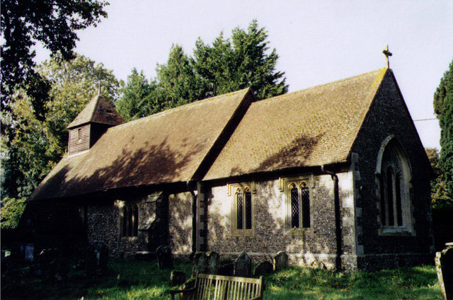
Holy Trinity Church, Privett

The Church of the Holy Trinity, Privett, is a redundant Anglican church in the parish of Froxfield, Hampshire. It is recorded in the National Heritage...

Nearby Amenities

Located within 500m of 51.066001,-1.048648
Bus Stop
Smugglers Lane
Naptan AtcoCode: 1900HA020224
Naptan Bearing: W
Naptan CommonName: Smugglers Lane
Naptan Crossing: Soame's Lane
Naptan NaptanCode: hamgdpjt
Naptan Street: Hill Farm Road
Naptan Verified: no
Source: naptan_import
Lat/Long: 51.0696198/-1.051852
Bus Stop
Smugglers Lane
Naptan AtcoCode: 1900HA020225
Naptan Bearing: W
Naptan CommonName: Smugglers Lane
Naptan Crossing: Soame's Lane
Naptan NaptanCode: hamgdpma
Naptan Street: Hill Farm Road
Naptan Verified: no
Source: naptan_import
Lat/Long: 51.0696371/-1.051766
Post Box
Collection Plate: CP7
Collection Times: Mo-Fr 16:00; Sa 07:00
Last Checked: 2021-09-04
Note: This postbox is of a brand new EIIR lamp design.
Operator: Royal Mail
Operator Wikidata: Q638098
Post Box Type: lamp
Ref: SO24 127
Royal Cypher: EIIR
Royal Cypher Wikidata: Q33102113
Source: survey
Lat/Long: 51.0698852/-1.0492163
Barrier: stile
Source: survey
Lat/Long: 51.0675308/-1.0423921
South Downs National Park
Board Type: welcome_sign
Information: board
Tourism: information
Lat/Long: 51.0696542/-1.0516794
The data included in this document is from www.openstreetmap.org. The data is made available under ODbL.

Have you been to Knight's Wood?

Leave your review of Knight's Wood below (or comments, questions and feedback).