Deer's Wood

Wood, Forest in Oxfordshire South Oxfordshire

England

Deer's Wood

Woodland, Checkendon Beeches to the west of Checkendon Court.
Woodland, Checkendon Credit: Andrew Smith

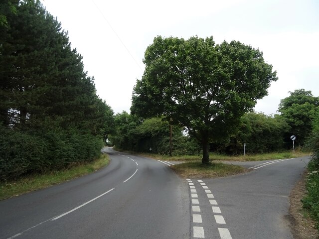
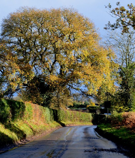
Deer's Wood is a picturesque woodland located in Oxfordshire, England. Covering an area of approximately 100 acres, it is a popular destination for nature enthusiasts and those seeking tranquility amidst the lush greenery. The wood is situated in close proximity to the charming village of Deer's Hill, which adds to its allure.

The woodland is predominantly composed of native tree species such as oak, beech, and ash, creating a diverse and vibrant ecosystem. These towering trees provide a dense canopy that filters sunlight, creating a cool and shaded environment underneath. The forest floor is adorned with a variety of wildflowers, ferns, and mosses, further enhancing its natural beauty.

One of the distinctive features of Deer's Wood is its rich wildlife. As the name suggests, the woodland is home to a population of deer, which can often be spotted grazing or roaming freely. Additionally, the wood provides a habitat for various bird species including woodpeckers, owls, and thrushes, making it a haven for birdwatchers.

The wood is intersected by several walking trails, allowing visitors to explore its enchanting surroundings. These trails offer glimpses of stunning vistas, tranquil ponds, and meandering streams. They also provide opportunities for recreational activities such as hiking, jogging, and picnicking.

Deer's Wood is a true gem of natural beauty in Oxfordshire. Its serene atmosphere, diverse flora and fauna, and well-maintained trails make it an ideal destination for nature lovers and those looking to escape the hustle and bustle of everyday life.

If you have any feedback on the listing, please let us know in the comments section below.

Deer's Wood Images

Images are sourced within 2km of 51.537697/-1.0442122 or Grid Reference SU6682. Thanks to Geograph Open Source API. All images are credited.

Woodland, Checkendon Beeches to the west of Checkendon Court.
Woodland, Checkendon
Beeches to the west of Checkendon Court.
Pasture and farm buildings, Checkendon Corker's Farm viewed from the footpath passing to its west.
Pasture and farm buildings, Checkendon
Corker's Farm viewed from the footpath passing to its west.
Remains of the Polish Village After WW2 there were a lot of displaced Polish people who needed somewhere to live. Old military buildings provided accommodation for a Polish community here up until the 1960s.
Abandoned buildings from that time can still be seen in the woods.
History on <span class="nowrap"><a title="https://www.polishresettlementcampsintheuk.co.uk/checkendon.htm" rel="nofollow ugc noopener" href="https://www.polishresettlementcampsintheuk.co.uk/checkendon.htm">Link</a><img style="margin-left:2px;" alt="External link" title="External link - shift click to open in new window" src="https://s1.geograph.org.uk/img/external.png" width="10" height="10"/></span>
Remains of the Polish Village
After WW2 there were a lot of displaced Polish people who needed somewhere to live. Old military buildings provided accommodation for a Polish community here up until the 1960s. Abandoned buildings from that time can still be seen in the woods. History on LinkExternal link
Another Hut in the Woods Another one of the derelict buildings left over from WW2 which can still be seen in the woods round here. These were lived in up until the 1960s by community of Polish people displaced by the war.
History on <span class="nowrap"><a title="https://www.polishresettlementcampsintheuk.co.uk/checkendon.htm" rel="nofollow ugc noopener" href="https://www.polishresettlementcampsintheuk.co.uk/checkendon.htm">Link</a><img style="margin-left:2px;" alt="External link" title="External link - shift click to open in new window" src="https://s1.geograph.org.uk/img/external.png" width="10" height="10"/></span>
Another Hut in the Woods
Another one of the derelict buildings left over from WW2 which can still be seen in the woods round here. These were lived in up until the 1960s by community of Polish people displaced by the war. History on LinkExternal link
Sign for the Red Lion, Woodcote See <a href="https://www.geograph.org.uk/photo/7246410">SU6482 : The Red Lion, Woodcote</a> for context.
Sign for the Red Lion, Woodcote
Woodcote Village Hall
War Memorial, Woodcote
Fingerpost, Woodcote
Junction of Oxford Road / Tidmore Lane
Basset Wood
Basset Wood
1 Langtree Cottages, Checkendon, Oxfordshire 1906 by Maxwell Ayrton in Arts and Crafts style. 

(Source:Historic England)
1 Langtree Cottages, Checkendon, Oxfordshire
1906 by Maxwell Ayrton in Arts and Crafts style. (Source:Historic England)
Foundry Cottage, Checkendon, Oxfordshire C17 with C20 windows. Brick ground floor with areas of flint; timber frame to first floor, rendered panels to left, brick infill to right. Old plain tile roof; brick stacks. 2-unit plan. 2-storey, 3-window range. Central 2-panel door with C20 gabled tile porch. 2-light casement to left. 2 single-light casements to right. Three 2-light casements to first floor. Roof hipped to right. Ridge stack to right and end stack to left.

(Source:Historic England)
Foundry Cottage, Checkendon, Oxfordshire
C17 with C20 windows. Brick ground floor with areas of flint; timber frame to first floor, rendered panels to left, brick infill to right. Old plain tile roof; brick stacks. 2-unit plan. 2-storey, 3-window range. Central 2-panel door with C20 gabled tile porch. 2-light casement to left. 2 single-light casements to right. Three 2-light casements to first floor. Roof hipped to right. Ridge stack to right and end stack to left. (Source:Historic England)
Lane through the beech woods, Hook End, Oxfordshire
After rain, Stoke Row, Oxfordshire
Handsome beech trees, Hook End, Oxfordshire
Byway, Checkendon, Oxfordshire
Autumn colours, Checkendon, Oxfordshire
Langtree Cottages in Checkendon
Show me another place!

Deer's Wood is located at Grid Ref: SU6682 (Lat: 51.537697, Lng: -1.0442122)

Administrative County: Oxfordshire

District: South Oxfordshire

Police Authority: Thames Valley

What 3 Words

///pebbles.toothpick.tragedy. Near Rotherfield Peppard, Oxfordshire

Related Wikis

St Peter and St Paul, Checkendon

St Peter and St Paul is the Church of England parish church of Checkendon, a village in Oxfordshire, England. Its parish is part of the Deanery of Henley...

Checkendon

Checkendon is a village and civil parish about 6 miles (10 km) west of Henley-on-Thames in South Oxfordshire and about 9 miles (14 km) north west of Reading...

Exlade Street

Exlade Street is a hamlet in Checkendon civil parish in Oxfordshire, about 6 miles (9.7 km) northwest of Reading, in the Chiltern Hills. The hamlet is...

The Oratory School

The Oratory School () is an HMC co-educational private Roman Catholic boarding and day school for pupils aged 11–18 located in Woodcote, 6 miles (9.7 km...

Hook End Recording Studios

Hook End Recording Studios was a recording studio located in Hook End Manor, a 16th-century Elizabethan house near Checkendon, Oxfordshire, England. Its...

Langtree School

Langtree School is a coeducational secondary school located in the village of Woodcote in South Oxfordshire, England. The school has approximately 624...

Wyfold Court

Wyfold Court is a country house at Rotherfield Peppard in south Oxfordshire. It is a Grade II* listed building. By the year 2000, the estate had been converted...

Woodcote

Woodcote is a village and civil parish in South Oxfordshire, about 5 miles (8 km) southeast of Wallingford and about 7 miles (11 km) northwest of Reading...

Nearby Amenities

Located within 500m of 51.537697,-1.0442122
Disused
Four Horseshoes
Disused: pub
Lat/Long: 51.5410809/-1.0454239
Barrier: kissing_gate
Bicycle: no
Foot: yes
Lat/Long: 51.5345233/-1.0490698
Barrier: kissing_gate
Bicycle: no
Foot: yes
Lat/Long: 51.5369349/-1.0457258
Barrier: kissing_gate
Bicycle: no
Foot: yes
Lat/Long: 51.5375738/-1.0451306
Barrier: kissing_gate
Bicycle: no
Foot: yes
Lat/Long: 51.5379199/-1.0490157
Barrier: kissing_gate
Bicycle: no
Foot: yes
Lat/Long: 51.5380314/-1.0489848
Barrier: kissing_gate
Bicycle: no
Foot: yes
Lat/Long: 51.5400469/-1.0481618
Barrier: stile
Foot: yes
Material: wood
Note: disused
Stile: stepover
Lat/Long: 51.5420915/-1.0427932
Direction: 135
Fixme: survey for panel count
Generator Method: photovoltaic
Generator Output Electricity: yes
Generator Solar Modules: 14
Generator Source: solar
Generator Type: solar_photovoltaic_panel
Location: roof
Power: generator
Lat/Long: 51.5415286/-1.0446939
The data included in this document is from www.openstreetmap.org. The data is made available under ODbL.

Have you been to Deer's Wood?

Leave your review of Deer's Wood below (or comments, questions and feedback).