Nancole Copse

Wood, Forest in Hampshire East Hampshire

England

Nancole Copse

Lasham Airfield Between Basingstoke and Alton. Owned by, and the home of, the Lasham Gliding Society, one of the largest gliding clubs in the world. ATC Lasham Ltd also has an airliner maintenance facility there.  <span class="nowrap"><a title="https://en.wikipedia.org/wiki/Lasham_Airfield" rel="nofollow ugc noopener" href="https://en.wikipedia.org/wiki/Lasham_Airfield">Link</a><img style="margin-left:2px;" alt="External link" title="External link - shift click to open in new window" src="https://s1.geograph.org.uk/img/external.png" width="10" height="10"/></span>
Lasham Airfield Credit: M J Richardson

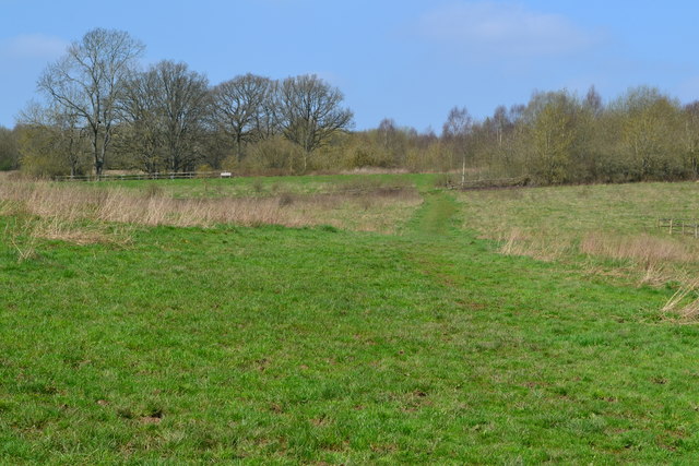
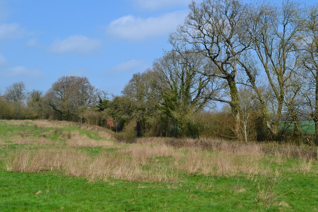
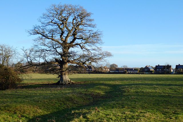
Nancole Copse is a beautiful woodland located in the county of Hampshire, England. Covering an area of approximately 50 acres, it is a popular destination for nature lovers and outdoor enthusiasts. The copse is situated near the village of Nancole, nestled within the rolling hills and picturesque countryside of Hampshire.

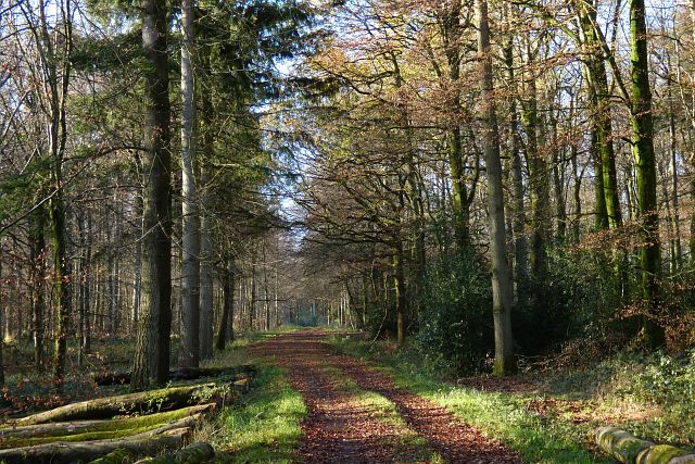
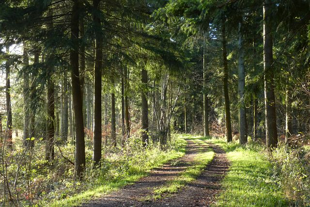
The woodland is predominantly made up of native tree species, including oak, beech, and ash trees, which form a dense canopy overhead. The forest floor is covered in a lush carpet of ferns, mosses, and wildflowers, creating a serene and tranquil atmosphere. Walking trails wind their way through the copse, allowing visitors to explore its natural beauty at their own pace.

Nancole Copse is known for its rich biodiversity, providing a habitat for a variety of wildlife species. Birdwatchers will be delighted to spot a range of feathered inhabitants, including woodpeckers, owls, and various songbirds. Small mammals such as squirrels, rabbits, and hedgehogs can also be found within the woodland.

Visitors to Nancole Copse can enjoy a range of activities, including hiking, birdwatching, and photography. The copse is particularly popular during the spring and summer months when the woodland is alive with vibrant colors and the songs of birds fill the air.

Overall, Nancole Copse offers a peaceful retreat for those seeking to connect with nature and escape the hustle and bustle of everyday life. Its natural beauty and diverse wildlife make it a must-visit destination for anyone in Hampshire.

If you have any feedback on the listing, please let us know in the comments section below.

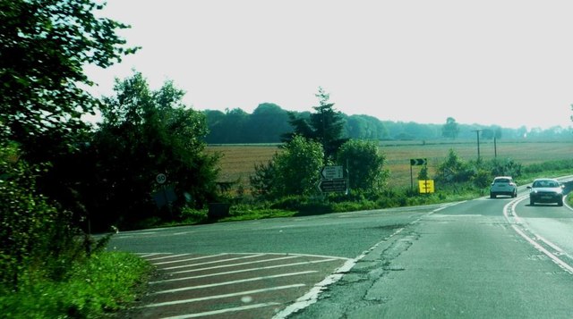
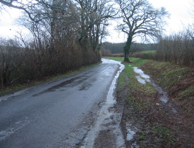
Nancole Copse Images

Images are sourced within 2km of 51.173424/-1.0553514 or Grid Reference SU6642. Thanks to Geograph Open Source API. All images are credited.

Lasham Airfield Between Basingstoke and Alton. Owned by, and the home of, the Lasham Gliding Society, one of the largest gliding clubs in the world. ATC Lasham Ltd also has an airliner maintenance facility there.  <span class="nowrap"><a title="https://en.wikipedia.org/wiki/Lasham_Airfield" rel="nofollow ugc noopener" href="https://en.wikipedia.org/wiki/Lasham_Airfield">Link</a><img style="margin-left:2px;" alt="External link" title="External link - shift click to open in new window" src="https://s1.geograph.org.uk/img/external.png" width="10" height="10"/></span>
Lasham Airfield
Between Basingstoke and Alton. Owned by, and the home of, the Lasham Gliding Society, one of the largest gliding clubs in the world. ATC Lasham Ltd also has an airliner maintenance facility there. LinkExternal link
Junction with The Avenue on A339 Road here leads to airfield and Lasham Gliding Centre
Junction with The Avenue on A339
Road here leads to airfield and Lasham Gliding Centre
Hill and bends on A339 Near Lasham
Hill and bends on A339
Near Lasham
A very damp Spain Lane
Road to Lasham Both ways to Lasham have 'No motor vehicles except for access' signs, probably to inhibit through traffic to Lasham airfield.
Road to Lasham
Both ways to Lasham have 'No motor vehicles except for access' signs, probably to inhibit through traffic to Lasham airfield.
Lane to Lasham Signed, at least at the A339 end, 'No motor vehicles except for access', probably to inhibit through traffic to Lasham airfield.
Lane to Lasham
Signed, at least at the A339 end, 'No motor vehicles except for access', probably to inhibit through traffic to Lasham airfield.
Path across field at Home Farm
Field edge at Home Farm
The Royal Oak at Lasham
Pond and house at Lasham
St Mary's Church, Lasham
Old Milestone in Lasham, Herriard parish Metal plate attached to stone post by the UC road, in parish of Herriard (Basingstoke and Deane District), Lasham, on grass verge at road junction, on West side of road. Candover block, erected by the Basingstoke, Preston Candover & Alton turnpike trust in the 19th century. 

Inscription reads:-
: B'STOKE / 7 : : ALTON / 4 :

Grade II listed.
List Entry Number: 1391750 <span class="nowrap"><a title="https://historicengland.org.uk/listing/the-list/list-entry/1391750" rel="nofollow ugc noopener" href="https://historicengland.org.uk/listing/the-list/list-entry/1391750">Link</a><img style="margin-left:2px;" alt="External link" title="External link - shift click to open in new window" src="https://s1.geograph.org.uk/img/external.png" width="10" height="10"/></span>

Milestone Society National ID: HA_BAAL07
Old Milestone in Lasham, Herriard parish
Metal plate attached to stone post by the UC road, in parish of Herriard (Basingstoke and Deane District), Lasham, on grass verge at road junction, on West side of road. Candover block, erected by the Basingstoke, Preston Candover & Alton turnpike trust in the 19th century. Inscription reads:- : B'STOKE / 7 : : ALTON / 4 : Grade II listed. List Entry Number: 1391750 LinkExternal link Milestone Society National ID: HA_BAAL07
Pasture, Bentworth An oak beside a footpath to the east of the church. Houses on Gleble Close and Glebe Fields are in the background.
Pasture, Bentworth
An oak beside a footpath to the east of the church. Houses on Gleble Close and Glebe Fields are in the background.
Farmland, Bentworth Alongside the byway to the east of Ham Farm.
Farmland, Bentworth
Alongside the byway to the east of Ham Farm.
Woodland, Herriard The bridleway heading westwards in Middle Common Wood.
Woodland, Herriard
The bridleway heading westwards in Middle Common Wood.
Woodland, Herriard The bridleway near the southern edge of Herriard Common.
Woodland, Herriard
The bridleway near the southern edge of Herriard Common.
Farmland, Bentworth Arable land beside the road from Burkham.
Farmland, Bentworth
Arable land beside the road from Burkham.
Farmland, Bentworth A soggy patch on a footpath heading towards the village from the west.
Farmland, Bentworth
A soggy patch on a footpath heading towards the village from the west.
Show me another place!

Nancole Copse is located at Grid Ref: SU6642 (Lat: 51.173424, Lng: -1.0553514)

Administrative County: Hampshire

District: East Hampshire

Police Authority: Hampshire

What 3 Words

///aside.stint.author. Near Alton, Hampshire

Related Wikis

Tickley

Tickley is a small hamlet in the large civil parish of Bentworth in Hampshire, England. It is considered a part of neighbouring Burkham which is situated...

Bentworth and Lasham railway station

Bentworth and Lasham railway station in Hampshire, England was on the Basingstoke and Alton Light Railway between the villages of Bentworth to the south...

Lasham

Lasham is a village and civil parish in the East Hampshire district of Hampshire, England. It is 3.4 miles (5.5 km) northwest of Alton and 1.2 miles (1...

Burkham

Burkham is a hamlet in the large civil parish of Bentworth in Hampshire, England including a large country house, Burkham House. The nearest town is Alton...

Bagmore

Bagmore is a village in Hampshire, England.

Bentworth

Bentworth is a village and civil parish in the East Hampshire district of Hampshire, England. The nearest town is Alton, which lies about 3 miles (5 km...

Lasham Airfield

Lasham Airfield (ICAO: EGHL) is an aerodrome 3.6 miles (5.8 km) north-west of Alton in Hampshire, England, in the village of Lasham. Th airfield was built...

Ashley, East Hampshire

Ashley is a hamlet in the large civil parish of Bentworth in the East Hampshire district of Hampshire, England. Its nearest town is Alton, which lies approximately...

Nearby Amenities

Located within 500m of 51.173424,-1.0553514
Access: permissive
Barrier: kissing_gate
Material: metal
Lat/Long: 51.1765329/-1.059597
Access: permissive
Barrier: kissing_gate
Material: metal
Lat/Long: 51.1748591/-1.0574544
Power: pole
Lat/Long: 51.1692264/-1.0554063
Power: pole
Lat/Long: 51.1696375/-1.0572719
Power: pole
Lat/Long: 51.1697443/-1.0593016
Power: pole
Lat/Long: 51.1770024/-1.0511631
Power: pole
Lat/Long: 51.1759144/-1.0505971
Power: pole
Lat/Long: 51.1748382/-1.0500366
Power: pole
Lat/Long: 51.1736027/-1.0485285
Power: pole
Lat/Long: 51.1740579/-1.0491434
Haleydean
Place: locality
Lat/Long: 51.1711724/-1.0508188
Archaeological Site: burial
Historic: archaeological_site
Historic Civilization: bronze-age
Lat/Long: 51.1739113/-1.049707
Access: permissive
Barrier: kissing_gate
Material: metal
Lat/Long: 51.1746273/-1.056557
Access: permissive
Barrier: kissing_gate
Foot: yes
Material: metal
Vehicle: no
Wheelchair: yes
Lat/Long: 51.1744203/-1.0583688
Access: permissive
Barrier: kissing_gate
Foot: yes
Material: metal
Vehicle: no
Wheelchair: yes
Lat/Long: 51.1697607/-1.058981
Access: permissive
Barrier: kissing_gate
Foot: yes
Material: metal
Vehicle: no
Wheelchair: yes
Lat/Long: 51.1746658/-1.0566616
Access: permissive
Barrier: kissing_gate
Foot: yes
Material: metal
Vehicle: no
Wheelchair: yes
Lat/Long: 51.1729791/-1.0566891
Access: permissive
Barrier: kissing_gate
Foot: yes
Material: metal
Vehicle: no
Wheelchair: yes
Lat/Long: 51.1732056/-1.056951
Leisure: picnic_table
Lat/Long: 51.1768312/-1.0596623
The data included in this document is from www.openstreetmap.org. The data is made available under ODbL.

Have you been to Nancole Copse?

Leave your review of Nancole Copse below (or comments, questions and feedback).