Bushby Spinney

Wood, Forest in Leicestershire Harborough

England

Bushby Spinney

Leicester Airport: aerial 2021
Leicester Airport: aerial 2021 Credit: Chris

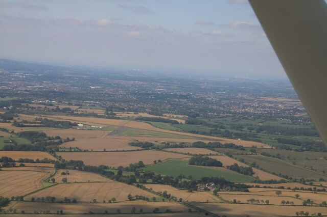
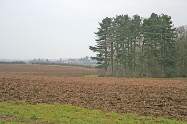
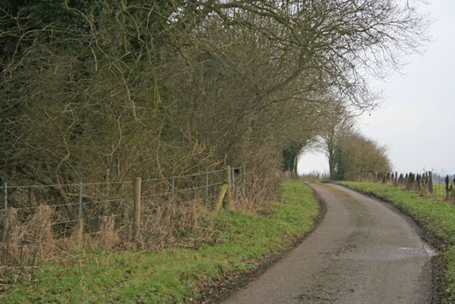
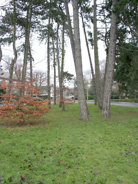
Bushby Spinney is a charming woodland located in Leicestershire, England. Nestled in the heart of the county, this small but picturesque forest covers an area of approximately 20 acres. Known for its dense and diverse vegetation, it offers visitors a tranquil escape from the hustle and bustle of city life.

The woodland predominantly consists of native species such as oak, beech, and birch trees, providing a lush canopy that dapples sunlight onto the forest floor. The rich undergrowth is home to an array of flora, including bluebells, wild garlic, and ferns, creating a vibrant and colorful landscape throughout the seasons.

Bushby Spinney boasts a network of well-maintained footpaths, allowing visitors to explore the forest and immerse themselves in its natural beauty. The peaceful atmosphere makes it an ideal location for nature walks, birdwatching, or simply enjoying a picnic surrounded by the sounds of wildlife.

This woodland also serves as an important habitat for various species of fauna. It is a haven for birds, with sightings of woodpeckers, nuthatches, and tawny owls, among others. Small mammals such as rabbits, squirrels, and hedgehogs also call Bushby Spinney their home.

With its accessibility and tranquil ambiance, Bushby Spinney appeals to nature enthusiasts, families, and individuals seeking a peaceful retreat in the heart of Leicestershire. Whether it's a leisurely stroll or a day spent reconnecting with nature, this beautiful woodland offers a slice of tranquility for all who visit.

If you have any feedback on the listing, please let us know in the comments section below.

Bushby Spinney Images

Images are sourced within 2km of 52.624269/-1.0252278 or Grid Reference SK6603. Thanks to Geograph Open Source API. All images are credited.

Leicester Airport: aerial 2021
Somerby Road, Thurnby
Station Road, Thurnby At the end of Somerby Road
Station Road, Thurnby
At the end of Somerby Road
Somerby Road, Thurnby At the entrance to Fernvale Primary School
Somerby Road, Thurnby
At the entrance to Fernvale Primary School
Sedgefield Drive, Thurnby
Sedgebrook Road, Evington At its junction with Delaware Road (left).
Sedgebrook Road, Evington
At its junction with Delaware Road (left).
Delaware Road, Evington (2) Seen from Sedgebrook Road.
Delaware Road, Evington (2)
Seen from Sedgebrook Road.
James Coles Plant Nursery, Thurnby, Leicester On the main A47 at the corner of Uppingham Road and Station Road, this large commercial nursery and garden centre occupies a large proportion of this square. The building with the green roof, centre left, is the Swallow public house.
James Coles Plant Nursery, Thurnby, Leicester
On the main A47 at the corner of Uppingham Road and Station Road, this large commercial nursery and garden centre occupies a large proportion of this square. The building with the green roof, centre left, is the Swallow public house.
Wadkins Way, Bushby, Leicester Modern executive housing on the eastern edge of Leicester. Thurnby brook runs in the valley just beyond the houses and Scraptoft Hill Farm in <a href="https://www.geograph.org.uk/gridref/SK6605">SK6605</a> can just be made out in the distance.
Wadkins Way, Bushby, Leicester
Modern executive housing on the eastern edge of Leicester. Thurnby brook runs in the valley just beyond the houses and Scraptoft Hill Farm in SK6605 can just be made out in the distance.
Thurnby near Leicester Looking east along Main Street from the corner of Hollies Way
Thurnby near Leicester
Looking east along Main Street from the corner of Hollies Way
The green, Bushby, Leicester On Main Street a dramatic group of pines on the green breaks up the village scene in the middle of old Bushby. The A47 runs just to the north dividing the more modern housing, (<a href="https://www.geograph.org.uk/gridref/SK6504">SK6504</a>), from the old village.
The green, Bushby, Leicester
On Main Street a dramatic group of pines on the green breaks up the village scene in the middle of old Bushby. The A47 runs just to the north dividing the more modern housing, (SK6504), from the old village.
The Rose and Crown, Thurnby near Leicester On Main Street this pub sports a fine newly thatched roof.
The Rose and Crown, Thurnby near Leicester
On Main Street this pub sports a fine newly thatched roof.
Footpath at Thurnby near Leicester Behind the Rose and Crown this footpath drops down a steep valley to cross the Bushby Brook before climbing the hill in the distance on its way to Stoughton, <a href="https://www.geograph.org.uk/gridref/SK6402">SK6402</a>
Footpath at Thurnby near Leicester
Behind the Rose and Crown this footpath drops down a steep valley to cross the Bushby Brook before climbing the hill in the distance on its way to Stoughton, SK6402
Farmland near Stoughton, Leicester Looking NW towards Thurnby, <a href="https://www.geograph.org.uk/gridref/SK6403">SK6403</a>, from Houghton Lane
Farmland near Stoughton, Leicester
Looking NW towards Thurnby, SK6403, from Houghton Lane
Houghton Lane, near Stoughton This prominent stand of woodland is called Clarke's Bush
Houghton Lane, near Stoughton
This prominent stand of woodland is called Clarke's Bush
The Garden Centre at Coles Nursery
Show me another place!

Bushby Spinney is located at Grid Ref: SK6603 (Lat: 52.624269, Lng: -1.0252278)

Administrative County: Leicestershire

District: Harborough

Police Authority: Leicestershire

What 3 Words

///figure.rots.dice. Near Houghton on the Hill, Leicestershire

Nearby Locations

Bushby Spinney

Related Wikis

Houghton on the Hill

Houghton on the Hill is a village and civil parish lying six miles (10 km) to the east of Leicester in the Harborough district, in Leicestershire, East...

Thurnby and Bushby

Thurnby and Bushby, sometimes known as Thurnby, is a civil parish in the Harborough district of Leicestershire, England. According to the 2001 census it...

Bushby

Bushby is a village and former civil parish, now in the parish of Thurnby and Bushby, in the Harborough district, in Leicestershire, England. In 1931 the...

Thurnby

Thurnby is a village and former civil parish, now in the parish of Thurnby and Bushby, in the Harborough district, in the county of Leicestershire, England...

RAF Leicester East

Royal Air Force Leicester East, more commonly known as RAF Leicester East (ICAO: EGBG), is a former Royal Air Force station, near the village of Stoughton...

Leicester Airport

Leicester Airport (IATA: None, ICAO: EGBG) is an aerodrome located to the east of Stoughton, Leicestershire, England, about 5 nautical miles (9.3 km; 5...

Thurnby and Scraptoft railway station

Thurnby and Scraptoft railway station was a railway station in Thurnby, Leicestershire on the Great Northern Railway Leicester branch. Thurnby & Scraptoft...

City of Leicester College

The City of Leicester College (TCOLC) is a coeducational secondary school and sixth form located in Evington, Leicester, England. It has around 2,000 pupils...

Have you been to Bushby Spinney?

Leave your review of Bushby Spinney below (or comments, questions and feedback).