Auclum Copse

Wood, Forest in Berkshire

England

Auclum Copse

Island Farm Road There is an Island Farm up the road, but the Island bit is far from apparent.
Island Farm Road Credit: Robin Webster

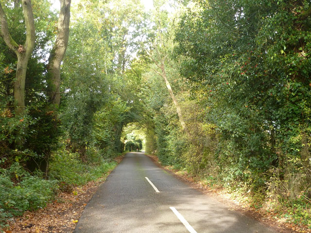
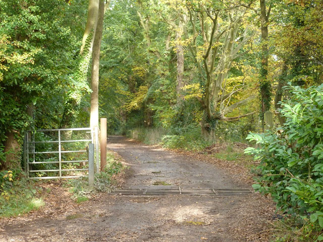
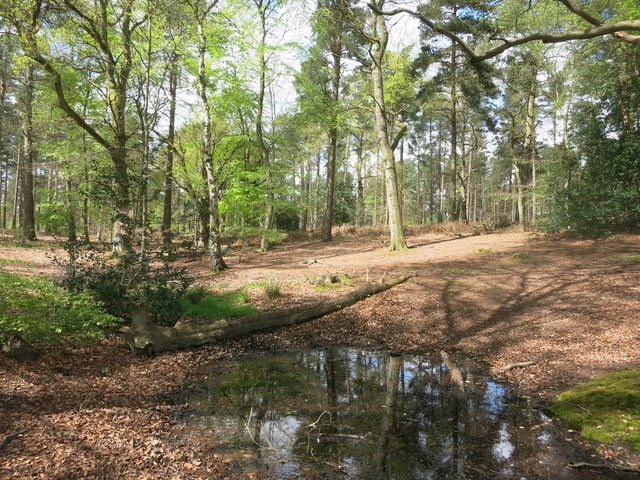
Auclum Copse is a picturesque woodland located in Berkshire, England. Covering an area of approximately 50 hectares, it is a prominent feature of the local landscape and a popular destination for nature enthusiasts.

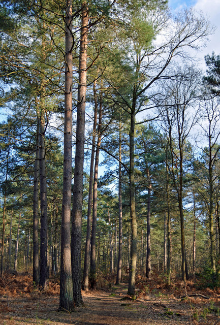
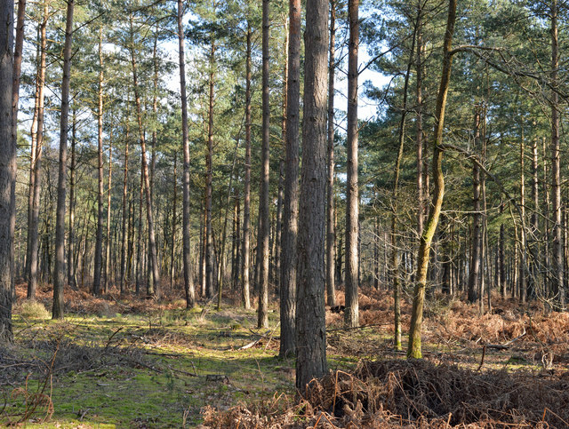
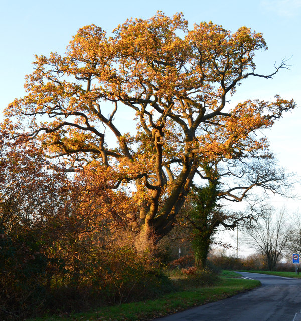
The copse is primarily composed of deciduous trees, such as oak, beech, and birch, which provide a stunning canopy of foliage during the summer months. These trees create a vibrant and diverse ecosystem that supports a wide range of flora and fauna.

The forest floor is adorned with a variety of wildflowers and ferns, adding to the charm and beauty of the copse. The undergrowth provides a habitat for small mammals, including voles, shrews, and hedgehogs, while the trees provide nesting sites for a variety of bird species, such as woodpeckers, tits, and finches.

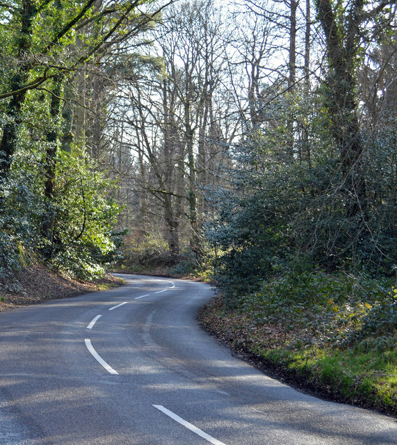
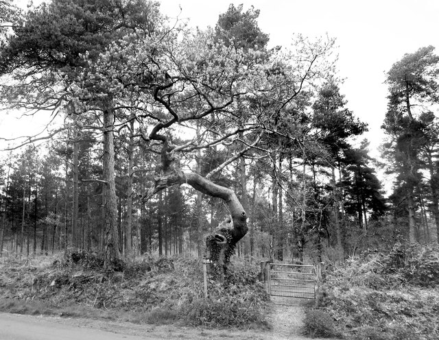
Tranquil footpaths wind their way through the copse, inviting visitors to explore its natural wonders. The paths are well-maintained, making it accessible to all ages and fitness levels. Along the way, walkers may encounter babbling brooks, small ponds, and hidden clearings, adding to the enchantment of the woodland experience.

Auclum Copse is also home to a diverse range of wildlife, including deer, foxes, and a multitude of bird species. It serves as an important conservation area, providing a protected habitat for these creatures and contributing to the overall biodiversity of the region.

Overall, Auclum Copse is a true gem of Berkshire, offering visitors a chance to immerse themselves in nature and experience the tranquility of a traditional English woodland.

If you have any feedback on the listing, please let us know in the comments section below.

Auclum Copse Images

Images are sourced within 2km of 51.397752/-1.0546058 or Grid Reference SU6566. Thanks to Geograph Open Source API. All images are credited.

Island Farm Road There is an Island Farm up the road, but the Island bit is far from apparent.
Island Farm Road
There is an Island Farm up the road, but the Island bit is far from apparent.
Bridleway to Burghfield Common Also access to Firlands Farm.
Bridleway to Burghfield Common
Also access to Firlands Farm.
Maple leaves in Burghfield Common, Berkshire Autumn colour and a sliver of sunshine.
Maple leaves in Burghfield Common, Berkshire
Autumn colour and a sliver of sunshine.
Rural houses, Wokefield, Berkshire
Cottage at Christmas, Wokefield, Berkshire
Modern house, Burghfield Common, Berkshire
Woodland path, Wokefield, Berkshire
Country road, Mortimer, Berkshire
Woodland, Wokefield, Berkshire
Late afternoon sunshine, Ufton Nervet, Berkshire
Patriotic Plastic Red white and blue containers in a field north of Mortimer.
Patriotic Plastic
Red white and blue containers in a field north of Mortimer.
Gnarled tree by the gate A fine specimen of gnarlyness. The footpath is one of the mysterious Berkshire Circular Routes which still appear as LDPs on some Ordnance Survey maps but have no other info or way marking.
The theory is that these routes were an initiative by the old Berkshire County Council which never got progressed after that council was wound up in 1998.
Gnarled tree by the gate
A fine specimen of gnarlyness. The footpath is one of the mysterious Berkshire Circular Routes which still appear as LDPs on some Ordnance Survey maps but have no other info or way marking. The theory is that these routes were an initiative by the old Berkshire County Council which never got progressed after that council was wound up in 1998.
Small Pond on the Footpath It's been wet recently, and this pool has formed in a dip where the path crosses. Fortunately, that handy fallen log makes a dry way across.
Small Pond on the Footpath
It's been wet recently, and this pool has formed in a dip where the path crosses. Fortunately, that handy fallen log makes a dry way across.
Double roundabout on Goring Lane, Burghfield
Houses on Goring Lane, Burghfield
Island Farm Road, Burghfield
Boldrewood, Burghfield Common A residential street in this very suburban village.
Boldrewood, Burghfield Common
A residential street in this very suburban village.
Paths on Wokefield Common A wooded area with very good public access along numerous tracks.
Paths on Wokefield Common
A wooded area with very good public access along numerous tracks.
Show me another place!

Auclum Copse is located at Grid Ref: SU6566 (Lat: 51.397752, Lng: -1.0546058)

Unitary Authority: West Berkshire

Police Authority: Thames Valley

What 3 Words

///whites.skins.dust. Near Stratfield Mortimer, Berkshire

Related Wikis

Great Auclum National Speed Hill Climb

Great Auclum National Speed Hill Climb was a motorcar course close to Burghfield Common in the English county of Berkshire. It was based in the grounds...

Goddard's Green, Berkshire

Goddard's Green is a hamlet and part of the civil parish of Wokefield in Berkshire, England. The settlement lies between the villages of Burghfield Common...

The Willink School

The Willink School is a comprehensive community school in Burghfield Common, Berkshire, United Kingdom. Founded in 1957, the school is co-educational and...

Lockram Brook

Lockram Brook is a small stream in southern England. It rises near the Berkshire village of Mortimer, and is a tributary of Burghfield Brook. == Route... ==

Burghfield

Burghfield is a village and large civil parish in West Berkshire, England, with a boundary with Reading. Burghfield can trace its history back to before...

Arlington Square, Bracknell

Arlington Square Business Park is a business park in Bracknell, England, owned and operated by Goodman Group. The park houses a number of well-known companies...

Wokefield

Wokefield is a hamlet and civil parish in the West Berkshire district of Berkshire, England, south of Reading. The parish includes the hamlets of Goddard...

Mortimer Common

Mortimer Common, generally referred to as Mortimer, is a village in the civil parish of Stratfield Mortimer in Berkshire. Mortimer is in the local government...

Nearby Amenities

Located within 500m of 51.397752,-1.0546058
Turning Circle
Lat/Long: 51.3967907/-1.0589451
Turning Circle
Lat/Long: 51.3970617/-1.0575838
Turning Circle
Lat/Long: 51.3981084/-1.0573103
Post Box
Operator: Royal Mail
Post Box Type: lamp
Ref: RG7 130D
Royal Cypher: EIIR
Royal Cypher Wikidata: Q33102113
Lat/Long: 51.3985549/-1.0554868
Turning Loop
Lat/Long: 51.3980942/-1.0606455
Post Box
Operator: Royal Mail
Post Box Type: wall
Ref: RG7 44D
Royal Cypher: GR
Royal Cypher Wikidata: Q33102273
Lat/Long: 51.4006085/-1.0535035
Turning Circle
Lat/Long: 51.4015909/-1.0539519
Turning Circle
Lat/Long: 51.4012173/-1.0549121
Turning Circle
Lat/Long: 51.4004772/-1.0554056
Turning Circle
Lat/Long: 51.4009204/-1.0560802
Turning Circle
Lat/Long: 51.3992419/-1.0570732
Turning Circle
Lat/Long: 51.3996864/-1.0566684
Turning Circle
Lat/Long: 51.4017348/-1.0552501
Turning Circle
Lat/Long: 51.4018619/-1.056152
Turning Circle
Lat/Long: 51.4011632/-1.0575451
Turning Circle
Lat/Long: 51.3999649/-1.0556905
Warings Bakery
Addr Postcode: RG7 3BL
Addr Street: Reading Road
Shop: bakery
Source: local-knowledge
Website: https://www.waringsbakery.co.uk/
Lat/Long: 51.4005418/-1.0540978
Turning Circle
Lat/Long: 51.4008838/-1.0596436
Turning Circle
Lat/Long: 51.4007399/-1.0594657
Turning Circle
Lat/Long: 51.3986397/-1.058566
Turning Circle
Lat/Long: 51.398229/-1.0593747
Turning Circle
Lat/Long: 51.3984936/-1.0599188
Turning Circle
Lat/Long: 51.4014129/-1.0587868
Turning Circle
Lat/Long: 51.4013132/-1.0588865
Bus Stop
Holmdene (opp)
Bus: yes
Departures Board: timetable
Naptan AtcoCode: 030053190001
Naptan NaptanCode: brkgwda
Network: Lime 2a
Operator: Reading Buses
Public Transport: platform
Shelter: no
Lat/Long: 51.3995108/-1.0553744
Bus Stop
Manns Hill (adj)
Bus: yes
Departures Board: timetable
Naptan AtcoCode: 030053860001
Naptan NaptanCode: brkmamp
Network: Lime 2a
Operator: Reading Buses
Public Transport: platform
Shelter: no
Lat/Long: 51.4004807/-1.053553
Bus Stop
Manns Hill (opp)
Bus: yes
Departures Board: timetable
Naptan AtcoCode: 030053860002
Naptan NaptanCode: brkmamt
Network: Lime 2a
Operator: Reading Buses
Public Transport: platform
Shelter: no
Lat/Long: 51.4006707/-1.0533698
Forge Garage
Shop: car_repair
Source: knowledge
Website: http://www.forgegarageburghfield.co.uk/
Lat/Long: 51.4002921/-1.0541901
Turning Circle
Lat/Long: 51.4012944/-1.0502736
Turning Circle
Tarragon Way
Surface: paved
Lat/Long: 51.3982523/-1.0557151
Turning Circle
Lat/Long: 51.3958727/-1.0597226
Turning Circle
Lat/Long: 51.3956388/-1.0571091
Turning Circle
Lat/Long: 51.3955203/-1.0570032
Source: GPS, knowledge
Lat/Long: 51.4014518/-1.0523045
Turning Circle
Lat/Long: 51.4015957/-1.0525331
Wellers - The Fruit Shop
Addr Housename: White Cottage
Addr Postcode: RG7 3BL
Addr Street: Reading Road
Shop: greengrocer
Source: local knowledge
Website: http://www.the-fruit-shop.co.uk/
Lat/Long: 51.4005142/-1.054142
Marshalls Pet Store
Addr Postcode: RG7 3BL
Addr Street: Reading Road
Designation: Pet supplies
Shop: pet
Source: local-knowledge
Website: http://petfoodstore.co.uk/
Lat/Long: 51.4005696/-1.0540534
Turning Circle
Lat/Long: 51.3971673/-1.0539038
Veterinary
Source: knowledge
Lat/Long: 51.398339/-1.0565038
Turning Circle
Lat/Long: 51.3973877/-1.0528086
Crossing
Barrier: kerb
Crossing: uncontrolled
Crossing Island: yes
Kerb: lowered
Source: Bing
Tactile Paving: yes
Wheelchair: yes
Lat/Long: 51.3985676/-1.0570638
Crossing
Barrier: kerb
Crossing: uncontrolled
Crossing Island: yes
Kerb: lowered
Source: Bing
Tactile Paving: yes
Wheelchair: yes
Lat/Long: 51.3986184/-1.0571094
Crossing
Barrier: kerb
Crossing: uncontrolled
Crossing Island: yes
Kerb: lowered
Source: Bing
Tactile Paving: yes
Wheelchair: yes
Lat/Long: 51.3985306/-1.0567515
Crossing
Barrier: kerb
Crossing: uncontrolled
Crossing Island: yes
Kerb: lowered
Source: Bing
Tactile Paving: yes
Wheelchair: yes
Lat/Long: 51.3985075/-1.0568307
Crossing
Barrier: kerb
Crossing: uncontrolled
Crossing Island: yes
Kerb: lowered
Source: Bing
Tactile Paving: yes
Wheelchair: yes
Lat/Long: 51.3987396/-1.0567173
Crossing
Crossing: uncontrolled
Crossing Island: yes
Kerb: lowered
Source: Bing
Tactile Paving: yes
Wheelchair: yes
Lat/Long: 51.3987898/-1.0570184
Crossing
Barrier: kerb
Crossing: uncontrolled
Crossing Island: yes
Kerb: lowered
Source: Bing
Tactile Paving: yes
Wheelchair: yes
Lat/Long: 51.3987888/-1.0567938
Crossing
Barrier: kerb
Crossing: uncontrolled
Crossing Island: yes
Kerb: lowered
Source: Bing
Tactile Paving: yes
Wheelchair: yes
Lat/Long: 51.3987725/-1.0570658
Crossing
Barrier: kerb
Crossing: traffic_signals
Crossing Ref: pelican
Kerb: lowered
Tactile Paving: yes
Wheelchair: yes
Lat/Long: 51.3970505/-1.0608587
Traffic Signals
Traffic Signals: pedestrian_crossing
Traffic Signals Direction: forward
Lat/Long: 51.3970303/-1.0609128
Traffic Signals
Traffic Signals: pedestrian_crossing
Traffic Signals Direction: backward
Lat/Long: 51.3970888/-1.0607786
Barrier: kerb
Lat/Long: 51.3969343/-1.0611142
Bus Stop
Blands Court (adj)
Bus: yes
Departures Board: timetable
Naptan AtcoCode: 030050600002
Naptan NaptanCode: brkgapg
Network: Lime 2a
Operator: Reading Buses
Public Transport: platform
Shelter: no
Lat/Long: 51.3972241/-1.0605011
Bus Stop
Blands Court (opp)
Bus: yes
Departures Board: timetable
Naptan AtcoCode: 030050600001
Naptan NaptanCode: brkadam
Network: Lime 2a
Operator: Reading Buses
Public Transport: platform
Shelter: no
Lat/Long: 51.3971923/-1.0603643
Bus Stop
Holmdene (adj)
Bus: yes
Departures Board: timetable
Naptan AtcoCode: 030053190002
Naptan NaptanCode: brkpjdm
Network: Lime 2a
Operator: Reading Buses
Public Transport: platform
Shelter: no
Lat/Long: 51.3995384/-1.0554173
Colour: green
Man Made: street_cabinet
Operator: Openreach
Street Cabinet: telecom
Utility: telecom
Lat/Long: 51.4010329/-1.052534
Colour: green
Man Made: street_cabinet
Operator: Openreach
Street Cabinet: telecom
Utility: telecom
Lat/Long: 51.4009622/-1.052503
Speed Camera
Direction: 240
Maxspeed: 30 mph
Lat/Long: 51.3975887/-1.0596515
The data included in this document is from www.openstreetmap.org. The data is made available under ODbL.

Have you been to Auclum Copse?

Leave your review of Auclum Copse below (or comments, questions and feedback).