Burghfield Shaw

Wood, Forest in Berkshire

England

Burghfield Shaw

Roundabout and houses, Sheffield Bottom The roundabout is a fairly recent replacement for a three-way junction with a fairly large grass triangle. The houses were aligned with one side of the triangle, and a fragment remains for access.
Roundabout and houses, Sheffield Bottom Credit: Robin Webster

Burghfield Shaw is a small village located in the county of Berkshire, England. Situated in the southern part of the county, it is part of the larger civil parish of Burghfield, which encompasses several other nearby hamlets and villages.

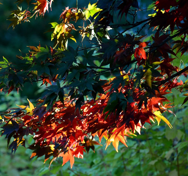
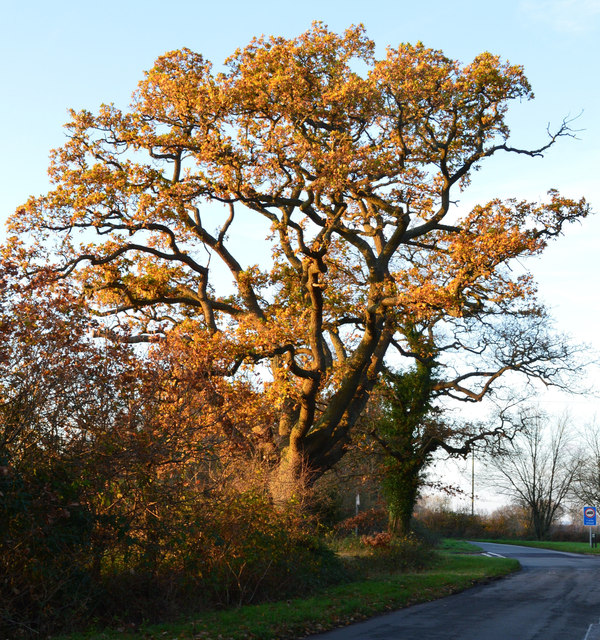
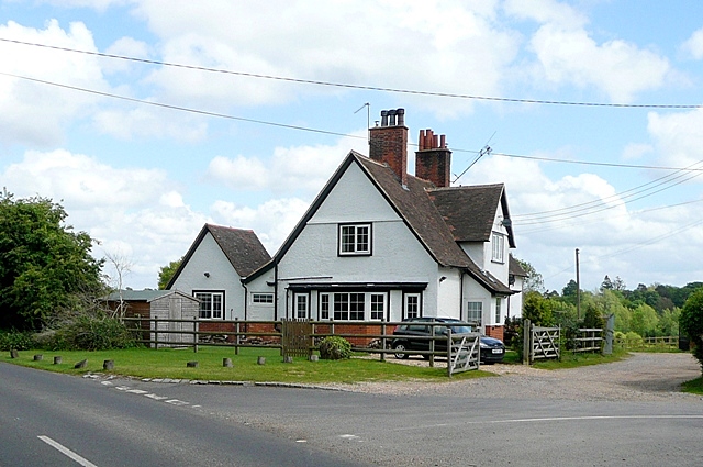
The village is known for its picturesque setting, surrounded by lush woodlands and forests. The natural beauty of the area makes it a popular destination for nature lovers and outdoor enthusiasts. The woodlands in and around Burghfield Shaw provide ample opportunities for hiking, walking, and birdwatching.

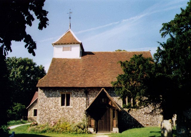
Burghfield Shaw is also home to a number of historical landmarks and buildings. The village church, St. Mary's, is a prominent feature, with its striking architecture and rich history. The church dates back to the 12th century and is a testament to the village's long-standing presence in the area.

In terms of amenities, Burghfield Shaw offers a range of facilities to cater to the needs of its residents. These include a local primary school, a village hall, and a few shops and pubs. The village has a close-knit community, and residents often come together for various events and activities throughout the year.

Overall, Burghfield Shaw is a charming village that offers a peaceful and idyllic lifestyle amidst the natural beauty of Berkshire's woodlands and forests. Its historical significance and sense of community make it a desirable place to live or visit.

If you have any feedback on the listing, please let us know in the comments section below.

Burghfield Shaw Images

Images are sourced within 2km of 51.410669/-1.0586242 or Grid Reference SU6568. Thanks to Geograph Open Source API. All images are credited.

Roundabout and houses, Sheffield Bottom The roundabout is a fairly recent replacement for a three-way junction with a fairly large grass triangle. The houses were aligned with one side of the triangle, and a fragment remains for access.
Roundabout and houses, Sheffield Bottom
The roundabout is a fairly recent replacement for a three-way junction with a fairly large grass triangle. The houses were aligned with one side of the triangle, and a fragment remains for access.
Maple leaves in Burghfield Common, Berkshire Autumn colour and a sliver of sunshine.
Maple leaves in Burghfield Common, Berkshire
Autumn colour and a sliver of sunshine.
Evening light, Sulhamstead, Berkshire
Modern house, Burghfield Common, Berkshire
Farmland, Burghfield, Berkshire
Late afternoon sunshine, Ufton Nervet, Berkshire
Bottom Lane at the junction of Jaques Lane
Roundabout on Jaques Lane, Sherfield Bottom
Bennett's Hill at the junction of Deans Copse Road
The entrance to Hadley Skip Hire, Sheffield Bottom
The entrance to Hadley Waste Disposal, Trash Green
Boldrewood, Burghfield Common A residential street in this very suburban village.
Boldrewood, Burghfield Common
A residential street in this very suburban village.
Pump on the lawn An old pump over a well or borehole in front of The Hollies, a former large house now converted to a care home.
Pump on the lawn
An old pump over a well or borehole in front of The Hollies, a former large house now converted to a care home.
Gate to Highwoods One of several large properties in this square which are set back from the road and approached by a driveway.
Gate to Highwoods
One of several large properties in this square which are set back from the road and approached by a driveway.
Hanningtons Way A short residential no through road on the edge of Burghfield Common.
Hanningtons Way
A short residential no through road on the edge of Burghfield Common.
Hosehill Lake One of many old gravel pits around here, now a nature reserve.
Hosehill Lake
One of many old gravel pits around here, now a nature reserve.
Business Park, Sheffield Bottom A small commercial estate on a patch of land that hasn't been quarried away by gravel digging.
Business Park, Sheffield Bottom
A small commercial estate on a patch of land that hasn't been quarried away by gravel digging.
The entrance to Hadley Skip Hire, Sheffield Bottom
Show me another place!

Burghfield Shaw is located at Grid Ref: SU6568 (Lat: 51.410669, Lng: -1.0586242)

Unitary Authority: West Berkshire

Police Authority: Thames Valley

What 3 Words

///pulse.crab.area. Near Calcot, Berkshire

Related Wikis

Arlington Square, Bracknell

Arlington Square Business Park is a business park in Bracknell, England, owned and operated by Goodman Group. The park houses a number of well-known companies...

Burghfield

Burghfield is a village and large civil parish in West Berkshire, England, with a boundary with Reading. Burghfield can trace its history back to before...

Hosehill Lake

Hosehill Lake is a 23.6-hectare (58-acre) Local Nature Reserve west of Reading in Berkshire. It is owned by West Berkshire Council and managed by the...

Great Auclum National Speed Hill Climb

Great Auclum National Speed Hill Climb was a motorcar course close to Burghfield Common in the English county of Berkshire. It was based in the grounds...

The Willink School

The Willink School is a comprehensive community school in Burghfield Common, Berkshire, United Kingdom. Founded in 1957, the school is co-educational and...

RAF Theale

Royal Air Force Theale or more simply RAF Theale is a former Royal Air Force satellite station located south of Theale, Berkshire, England. The following...

Sulhamstead

Sulhamstead is a village and civil parish in West Berkshire, England. It occupies an approximate rectangle of land south of the (Old) Bath Road (A4) between...

Goddard's Green, Berkshire

Goddard's Green is a hamlet and part of the civil parish of Wokefield in Berkshire, England. The settlement lies between the villages of Burghfield Common...

Nearby Amenities

Located within 500m of 51.410669,-1.0586242
Post Box
Post Box Type: lamp
Lat/Long: 51.4078846/-1.0547096
Turning Circle
Lat/Long: 51.408579/-1.0532996
Turning Circle
Lat/Long: 51.4086235/-1.0559459
Turning Circle
Lat/Long: 51.40943/-1.0554633
Bus Stop
Elm Drive (adj)
Bus: yes
Departures Board: timetable
Naptan AtcoCode: 030052100002
Naptan NaptanCode: brkgmwd
Network: Lime 2
Operator: Reading Buses
Public Transport: platform
Route Ref: 2
Shelter: no
Lat/Long: 51.4077956/-1.0536299
Bus Stop
Elm Drive (opp)
Bus: yes
Departures Board: timetable
Naptan AtcoCode: 030052100001
Naptan NaptanCode: brkgmwa
Network: Lime 2
Operator: Reading Buses
Public Transport: platform
Shelter: no
Lat/Long: 51.4072156/-1.0542692
Power: pole
Lat/Long: 51.4119117/-1.0532579
Power: pole
Lat/Long: 51.4114734/-1.0551649
Power: pole
Lat/Long: 51.411179/-1.0565785
Power: pole
Lat/Long: 51.4107139/-1.0585821
Power: pole
Lat/Long: 51.4104044/-1.0599607
Power: pole
Lat/Long: 51.4100246/-1.0616881
Power: pole
Lat/Long: 51.4096766/-1.0631606
Power: pole
Lat/Long: 51.4093186/-1.0647136
Power: pole
Lat/Long: 51.413516/-1.0608888
Power: pole
Lat/Long: 51.413051/-1.0587671
Power: pole
Lat/Long: 51.4125926/-1.0565731
Power: pole
Lat/Long: 51.4121225/-1.0543844
The data included in this document is from www.openstreetmap.org. The data is made available under ODbL.

Have you been to Burghfield Shaw?

Leave your review of Burghfield Shaw below (or comments, questions and feedback).