Eaglesham

Settlement in Renfrewshire

Scotland

Eaglesham

National Trust for Scotland small houses restoration plaque A cottage <a title="https://www.geograph.org.uk/photo/1871213" href="https://www.geograph.org.uk/photo/1871213">Link</a> in Polnoon Street was one of the first houses to be restored in Eaglesham.  A plaque indicates that this single-storey cottage was restored in association with the National Trust for Scotland.
National Trust for Scotland small houses restoration plaque Credit: Kenneth Mallard

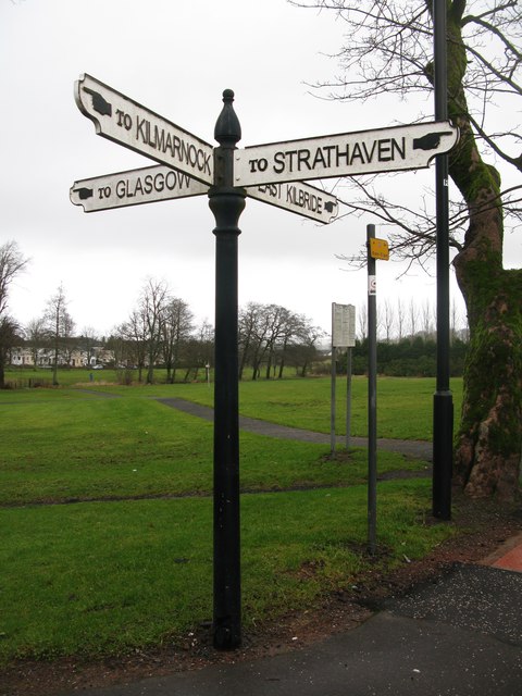
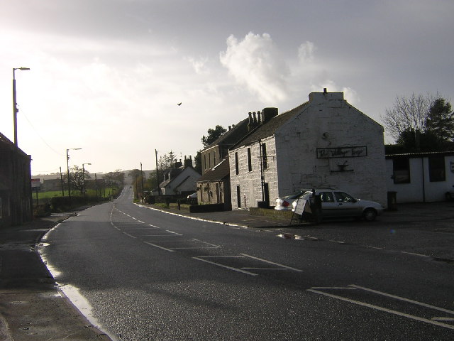
Eaglesham is a charming village located in Renfrewshire, Scotland. Situated approximately 10 miles south of Glasgow, it is nestled amidst rolling countryside and offers a picturesque setting for its residents and visitors alike. The village has a population of around 3,000 people and has a rich history dating back to the 13th century.

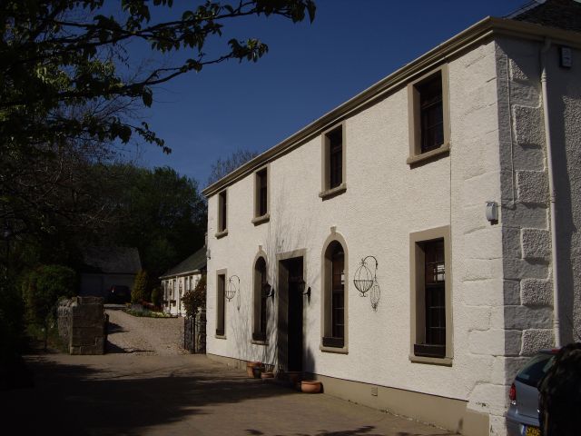
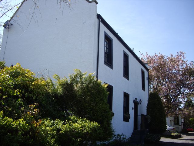
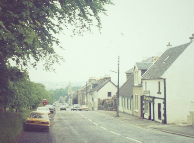
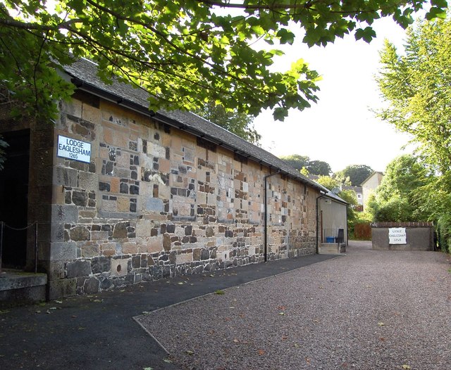
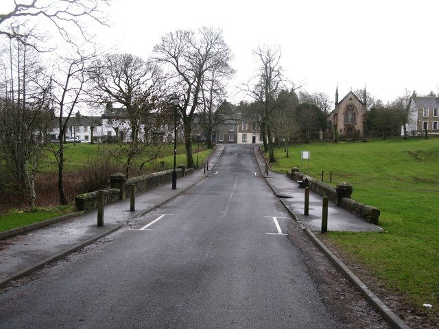
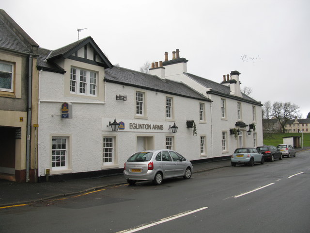
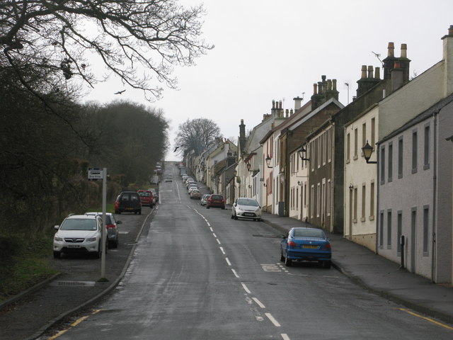
One of the notable features of Eaglesham is its well-preserved architecture, with many buildings dating back to the 18th and 19th centuries. The village is known for its traditional Scottish sandstone houses, which add to its character and charm. The main street, Montgomery Street, is lined with these historic buildings and is a popular spot for a leisurely stroll.

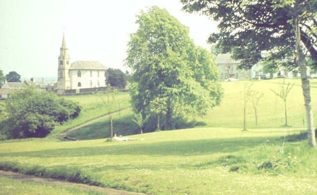
Eaglesham is also renowned for its beautiful green spaces and outdoor recreational opportunities. The nearby Eaglesham Moor and Caldwell Golf Club provide opportunities for nature walks, hiking, and golfing, attracting both locals and visitors. The village is also home to several parks and gardens, including the stunning Orry Mill Gardens and the James Arthur Park, which offer peaceful retreats and recreational facilities.

In terms of amenities, Eaglesham has a range of local shops, cafes, and pubs that cater to the needs of its residents. The village also has a primary school, a medical center, and various community facilities, ensuring that residents have access to essential services.

Overall, Eaglesham is a delightful village that seamlessly combines its historical heritage with modern amenities. Its idyllic setting, well-preserved architecture, and abundance of recreational opportunities make it an attractive place to live or visit in Renfrewshire.

If you have any feedback on the listing, please let us know in the comments section below.

Eaglesham Images

Images are sourced within 2km of 55.74148/-4.274535 or Grid Reference NS5752. Thanks to Geograph Open Source API. All images are credited.

National Trust for Scotland small houses restoration plaque A cottage <a title="https://www.geograph.org.uk/photo/1871213" href="https://www.geograph.org.uk/photo/1871213">Link</a> in Polnoon Street was one of the first houses to be restored in Eaglesham.  A plaque indicates that this single-storey cottage was restored in association with the National Trust for Scotland.
National Trust for Scotland small houses restoration plaque
A cottage Link in Polnoon Street was one of the first houses to be restored in Eaglesham. A plaque indicates that this single-storey cottage was restored in association with the National Trust for Scotland.
Eaglesham Old Mill The first or Old Mill in Eaglesham was established in 1791 at Townhead.  Part of the mill wall survives in the garden of Picketlaw House.
Eaglesham Old Mill
The first or Old Mill in Eaglesham was established in 1791 at Townhead. Part of the mill wall survives in the garden of Picketlaw House.
Coo Lane Coo Lane once led to the pastures behind Polnoon Street. The building in the foreground was once a United Presbyterian Church before the congregation moved to a new building in Montgomery Street. Click on these links to discover about the churches and Covenanters <a title="https://www.geograph.org.uk/photo/1424798" href="https://www.geograph.org.uk/photo/1424798">Link</a> <a title="https://www.geograph.org.uk/photo/1897780" href="https://www.geograph.org.uk/photo/1897780">Link</a> <a title="https://www.geograph.org.uk/photo/1432415" href="https://www.geograph.org.uk/photo/1432415">Link</a> <a title="https://www.geograph.org.uk/photo/2385555" href="https://www.geograph.org.uk/photo/2385555">Link</a> .
Coo Lane
Coo Lane once led to the pastures behind Polnoon Street. The building in the foreground was once a United Presbyterian Church before the congregation moved to a new building in Montgomery Street. Click on these links to discover about the churches and Covenanters Link Link Link Link .
Glendinning Place The Secession Church broke away from the established church in 1733 and established a church of the Burgher Faction, the Cameronian Church in Glendinning Place. Sometime after the church closed, the meeting house became the Old Concert Hall for a time before being converted to a private residence. Click on these links to discover about the churches and Covenanters <a title="https://www.geograph.org.uk/photo/1424798" href="https://www.geograph.org.uk/photo/1424798">Link</a> <a title="https://www.geograph.org.uk/photo/1897780" href="https://www.geograph.org.uk/photo/1897780">Link</a> <a title="https://www.geograph.org.uk/photo/1432415" href="https://www.geograph.org.uk/photo/1432415">Link</a> .
Glendinning Place
The Secession Church broke away from the established church in 1733 and established a church of the Burgher Faction, the Cameronian Church in Glendinning Place. Sometime after the church closed, the meeting house became the Old Concert Hall for a time before being converted to a private residence. Click on these links to discover about the churches and Covenanters Link Link Link .
The foot of Hayhill Road Hayhill Road meets Eaglesham Road, between Jackton and Eaglesham.
The foot of Hayhill Road
Hayhill Road meets Eaglesham Road, between Jackton and Eaglesham.
Montgomerie Armorial Arms Panel The Montgomerie armorial arms panel from Polnoon Castle <a title="https://www.geograph.org.uk/photo/1480519" href="https://www.geograph.org.uk/photo/1480519">Link</a> can be seen above the doorway of the former Cross Keys Inn <a title="https://www.geograph.org.uk/photo/1875376" href="https://www.geograph.org.uk/photo/1875376">Link</a> tacked in 1773. The panel was originally been set in a recess above the entrance to Polnoon Castle commemorates Sir John de Montgomerie's marriage to Elizabeth, daughter and heiress of Sir Hugh Eglinton of that Ilk, one of the two Justicaries of Scotland in 1361. Sir John de Montgomerie quartered with his own, the Eglinton arms which were "three gules, three rings or gemmed azure".
Montgomerie Armorial Arms Panel
The Montgomerie armorial arms panel from Polnoon Castle Link can be seen above the doorway of the former Cross Keys Inn Link tacked in 1773. The panel was originally been set in a recess above the entrance to Polnoon Castle commemorates Sir John de Montgomerie's marriage to Elizabeth, daughter and heiress of Sir Hugh Eglinton of that Ilk, one of the two Justicaries of Scotland in 1361. Sir John de Montgomerie quartered with his own, the Eglinton arms which were "three gules, three rings or gemmed azure".
Eaglesham, The Common View across the elongated triangular village green towards the parish church.
<span class="nowrap"><a title="http://en.wikipedia.org/wiki/Eaglesham" rel="nofollow ugc noopener" href="http://en.wikipedia.org/wiki/Eaglesham">Link</a><img style="margin-left:2px;" alt="External link" title="External link - shift click to open in new window" src="https://s1.geograph.org.uk/img/external.png" width="10" height="10"/></span>
Eaglesham, The Common
View across the elongated triangular village green towards the parish church. LinkExternal link
Eaglesham, Montgomery Street Main street, named after the Earls of Eglinton, in the planned village of Eaglesham.
Eaglesham, Montgomery Street
Main street, named after the Earls of Eglinton, in the planned village of Eaglesham.
Masonic Lodge, Eaglesham, Scotland. Lodge Eaglesham No.1265, Eaglesham, Scotland.
Masonic Lodge, Eaglesham, Scotland.
Lodge Eaglesham No.1265, Eaglesham, Scotland.
Mid Road, Eaglesham Looking across a bridge over Eaglesham Burn towards Montgomery Street.
Mid Road, Eaglesham
Looking across a bridge over Eaglesham Burn towards Montgomery Street.
Old Signpost in Eaglesham At the main crossroads in Eaglesham.
Old Signpost in Eaglesham
At the main crossroads in Eaglesham.
Eglinton Arms, Eaglesham Hotel on Gilmour Street in Eaglesham.
Eglinton Arms, Eaglesham
Hotel on Gilmour Street in Eaglesham.
Polnoon Street, Eaglesham Looking up Polnoon Street from Gilmour Street.
Polnoon Street, Eaglesham
Looking up Polnoon Street from Gilmour Street.
Belle Craig Roundabout The intersection of the A726, East Kilbride to Kimarnock road, and the B767, Eaglesham to Busby road, from which the photograph is taken.
Belle Craig Roundabout
The intersection of the A726, East Kilbride to Kimarnock road, and the B767, Eaglesham to Busby road, from which the photograph is taken.
North Kirktonmoor Farm West of Eaglesham on Kirkton Moor Road.
North Kirktonmoor Farm
West of Eaglesham on Kirkton Moor Road.
Mini-Roundabout at the southern end of Eaglesham Looking from Moor Road towards the junction with Polnoon Street (left) and Montgomery Street (right).
Mini-Roundabout at the southern end of Eaglesham
Looking from Moor Road towards the junction with Polnoon Street (left) and Montgomery Street (right).
Road Bridge over the Borland Burn On Humbie Road just outside Eaglesham.
Road Bridge over the Borland Burn
On Humbie Road just outside Eaglesham.
Entrance to Castlehill Farm On Humbie Road near Eaglesham.
Entrance to Castlehill Farm
On Humbie Road near Eaglesham.
Show me another place!

Eaglesham is located at Grid Ref: NS5752 (Lat: 55.74148, Lng: -4.274535)

Unitary Authority: East Renfrewshire

Police Authority: Greater Glasgow

What 3 Words

///broker.brain.fumes. Near Eaglesham, East Renfrewshire

Related Wikis

Eaglesham

Eaglesham ( EE-gəl-səm) is a village in East Renfrewshire, Scotland, situated about 10 miles (16 km) south of Glasgow, 3 miles (5 km) southeast of Newton...
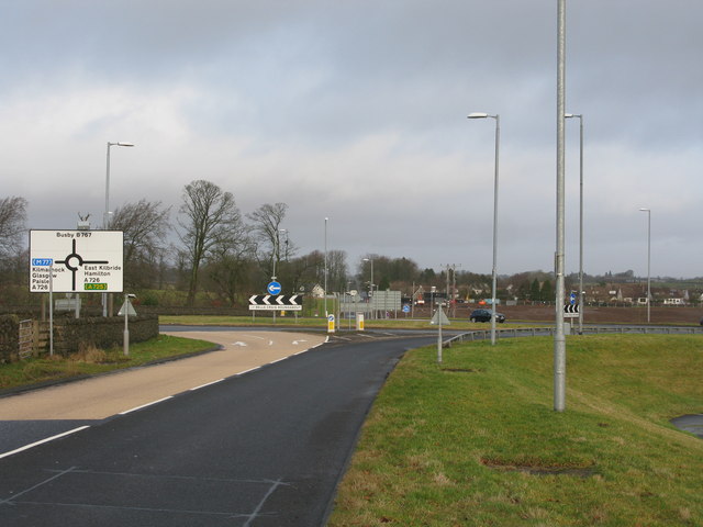
A726 road

The A726 road in Scotland is a major route with several distinct sections with different characteristics and names; owing to its stages of construction...

Millhall

Millhall is a hamlet in East Renfrewshire, in the Central Lowlands of Scotland. It lies 0.8 miles (1.3 km) southeast of Eaglesham, 8.3 miles (13.4 km)...

Jackton

Jackton is a small village lying just on the western periphery of East Kilbride in South Lanarkshire, on the B764 road (otherwise known as the 'Eaglesham...

Nearby Amenities

Located within 500m of 55.74148,-4.274535
Traffic Signals
Source: survey
Lat/Long: 55.7399901/-4.2725119
Eaglesham
Name En: Eaglesham
Name Gd: Baile na h-Eaglais
Place: village
Population: 3172
Wikidata: Q638046
Wikipedia: en:Eaglesham
Lat/Long: 55.7407281/-4.2738525
Shop: convenience
Lat/Long: 55.7441451/-4.2764372
Crossing
Crossing: zebra
Lat/Long: 55.7417187/-4.2748888
Crossing
Crossing: zebra
Lat/Long: 55.7438105/-4.2767733
Bicycle Parking
Capacity: 2
Lat/Long: 55.743583/-4.2763325
Bicycle Parking
Capacity: 2
Covered: no
Lat/Long: 55.740123/-4.2723658
Bus Stop
Naptan AtcoCode: 6120337
Naptan NaptanCode: 37323479
Lat/Long: 55.7376534/-4.2714337
Barrier: bollard
Lat/Long: 55.7381231/-4.2727084
Bicycle Parking
Access: destination
Bicycle Parking: stands
Capacity: 40
Covered: no
Lat/Long: 55.7386937/-4.269707
Bus Stop
Lat/Long: 55.7451465/-4.2772271
Shop: bakery
Lat/Long: 55.7437547/-4.2764171
Post Box
Source: survey
Lat/Long: 55.7439022/-4.2764774
Post Box
Source: survey
Lat/Long: 55.7381117/-4.2781937
Shop: hairdresser
Lat/Long: 55.7436791/-4.2763619
Cafe
Lime
Lat/Long: 55.7438059/-4.2763994
Shop: gift
Lat/Long: 55.7440323/-4.2765121
Pharmacy
Lat/Long: 55.7439249/-4.2764453
Restaurant
Peking Village
Addr Housenumber: 89-91
Addr Postcode: G76 0LH
Addr Street: Gilmour Street
Cuisine: chinese
Fhrs Id: 82441
Source Addr: FHRS Open Data
Lat/Long: 55.7422961/-4.2760078
Dentist
Lat/Long: 55.7420817/-4.275745
Subaru
Shop: car
Lat/Long: 55.7417918/-4.2754285
Bonnyton
Place: quarter
Lat/Long: 55.7404193/-4.2816145
Power: pole
Lat/Long: 55.7436818/-4.2695269
Power: pole
Lat/Long: 55.7440783/-4.2700312
Power: pole
Lat/Long: 55.7447339/-4.2693415
Addr Housenumber: 41
Addr Street: Holehouse Road
Lat/Long: 55.7448885/-4.2735683
The data included in this document is from www.openstreetmap.org. The data is made available under ODbL.

Have you been to Eaglesham?

Leave your review of Eaglesham below (or comments, questions and feedback).