Hammond's Wood

Wood, Forest in Oxfordshire South Oxfordshire

England

Hammond's Wood

Woodland, Checkendon Beeches to the west of Checkendon Court.
Woodland, Checkendon Credit: Andrew Smith

Hammond's Wood is a picturesque woodland located in Oxfordshire, England. Covering an area of approximately 100 acres, the wood is nestled in the heart of the county, surrounded by lush green countryside and rolling hills. It is a popular destination for nature enthusiasts and locals seeking a tranquil escape from the bustling city life.

The wood boasts a diverse range of native tree species, including oak, beech, and birch, which create a stunning canopy of vibrant colors during the autumn season. The forest floor is blanketed with a rich carpet of bluebells and wildflowers in the spring, offering a breathtaking sight to visitors.

Several well-maintained walking trails wind their way through Hammond's Wood, providing visitors with the opportunity to explore its natural beauty. The trails offer varying degrees of difficulty, catering to both casual walkers and avid hikers. Along the way, walkers may encounter an abundance of wildlife, such as deer, foxes, and a wide array of bird species.

The wood also features a small pond, teeming with aquatic life, and serves as a watering hole for various birds and animals. This serene spot provides visitors with a peaceful location for relaxation and birdwatching.

Hammond's Wood is a protected area, managed by local conservation organizations, ensuring the preservation of its natural beauty and wildlife. It is easily accessible, with ample parking facilities and clear signposting. Whether it's for a leisurely stroll, a family picnic, or a chance to immerse oneself in nature's tranquility, Hammond's Wood offers a delightful experience for all who visit.

If you have any feedback on the listing, please let us know in the comments section below.

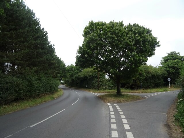
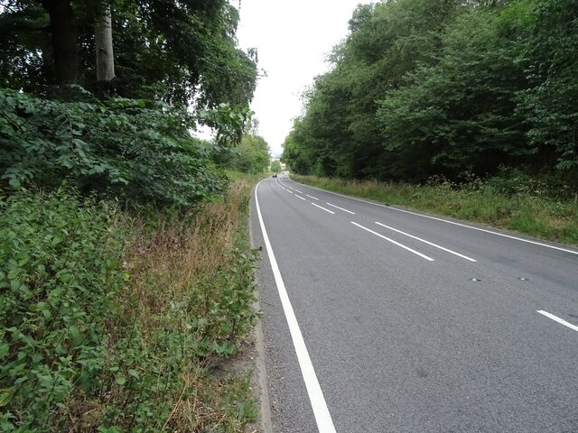
Hammond's Wood Images

Images are sourced within 2km of 51.545339/-1.0664767 or Grid Reference SU6483. Thanks to Geograph Open Source API. All images are credited.

Woodland, Checkendon Beeches to the west of Checkendon Court.
Woodland, Checkendon
Beeches to the west of Checkendon Court.
Pasture and farm buildings, Checkendon Corker's Farm viewed from the footpath passing to its west.
Pasture and farm buildings, Checkendon
Corker's Farm viewed from the footpath passing to its west.
Direction Sign – Signpost on the B471 in Woodcote parish Located on the northwest side of the junction of the B471 Goring Road and Whitehouse Road in Woodcote parish. 3 arms and pawn finial. The Goring Heath / Reading arm had been lost by 2017.

Milestone Society National ID: OX_SU6481
Direction Sign – Signpost on the B471 in Woodcote parish
Located on the northwest side of the junction of the B471 Goring Road and Whitehouse Road in Woodcote parish. 3 arms and pawn finial. The Goring Heath / Reading arm had been lost by 2017. Milestone Society National ID: OX_SU6481
Remains of the Polish Village After WW2 there were a lot of displaced Polish people who needed somewhere to live. Old military buildings provided accommodation for a Polish community here up until the 1960s.
Abandoned buildings from that time can still be seen in the woods.
History on <span class="nowrap"><a title="https://www.polishresettlementcampsintheuk.co.uk/checkendon.htm" rel="nofollow ugc noopener" href="https://www.polishresettlementcampsintheuk.co.uk/checkendon.htm">Link</a><img style="margin-left:2px;" alt="External link" title="External link - shift click to open in new window" src="https://s1.geograph.org.uk/img/external.png" width="10" height="10"/></span>
Remains of the Polish Village
After WW2 there were a lot of displaced Polish people who needed somewhere to live. Old military buildings provided accommodation for a Polish community here up until the 1960s. Abandoned buildings from that time can still be seen in the woods. History on LinkExternal link
Another Hut in the Woods Another one of the derelict buildings left over from WW2 which can still be seen in the woods round here. These were lived in up until the 1960s by community of Polish people displaced by the war.
History on <span class="nowrap"><a title="https://www.polishresettlementcampsintheuk.co.uk/checkendon.htm" rel="nofollow ugc noopener" href="https://www.polishresettlementcampsintheuk.co.uk/checkendon.htm">Link</a><img style="margin-left:2px;" alt="External link" title="External link - shift click to open in new window" src="https://s1.geograph.org.uk/img/external.png" width="10" height="10"/></span>
Another Hut in the Woods
Another one of the derelict buildings left over from WW2 which can still be seen in the woods round here. These were lived in up until the 1960s by community of Polish people displaced by the war. History on LinkExternal link
House on Goring Road
Roadworks on Goring Road (B471)
Recreation ground, Woodcote
Village sign, Woodcote
The Red Lion, Woodcote On Goring Road.
See <a href="https://www.geograph.org.uk/photo/7246411">SU6482 : Sign for the Red Lion, Woodcote</a> for sign.
The Red Lion, Woodcote
On Goring Road. See SU6482 : Sign for the Red Lion, Woodcote for sign.
Sign for the Red Lion, Woodcote See <a href="https://www.geograph.org.uk/photo/7246410">SU6482 : The Red Lion, Woodcote</a> for context.
Sign for the Red Lion, Woodcote
George VI postbox on Goring Road, Woodcote Postbox No. RG8 356.
George VI postbox on Goring Road, Woodcote
Postbox No. RG8 356.
Woodcote Village Hall
War Memorial, Woodcote
Fingerpost, Woodcote
Junction of Oxford Road / Tidmore Lane
Red Lane (A4074) Towards Oxford.
Red Lane (A4074)
Towards Oxford.
Stubble field off Red Lane
Show me another place!

Hammond's Wood is located at Grid Ref: SU6483 (Lat: 51.545339, Lng: -1.0664767)

Administrative County: Oxfordshire

District: South Oxfordshire

Police Authority: Thames Valley

What 3 Words

///remedy.strongman.lighter. Near Goring, Oxfordshire

Related Wikis

Woodcote

Woodcote is a village and civil parish in South Oxfordshire, about 5 miles (8 km) southeast of Wallingford and about 7 miles (11 km) northwest of Reading...

Langtree School

Langtree School is a coeducational secondary school located in the village of Woodcote in South Oxfordshire, England. The school has approximately 624...

Checkendon

Checkendon is a village and civil parish about 6 miles (10 km) west of Henley-on-Thames in South Oxfordshire and about 9 miles (14 km) north west of Reading...

St Peter and St Paul, Checkendon

St Peter and St Paul is the Church of England parish church of Checkendon, a village in Oxfordshire, England. Its parish is part of the Deanery of Henley...

The Oratory School

The Oratory School () is an HMC co-educational private Roman Catholic boarding and day school for pupils aged 11–18 located in Woodcote, 6 miles (9.7 km...

Braziers Park

Braziers Park is a Grade II* country house and estate on the edge of Ipsden - a small village near Wallingford, Oxfordshire, England - housing a secular...

Wood (festival)

Wood is an annual small early summer folk and roots music festival and environmental gathering, which takes place in Braziers Park, Ipsden near Wallingford...

Exlade Street

Exlade Street is a hamlet in Checkendon civil parish in Oxfordshire, about 6 miles (9.7 km) northwest of Reading, in the Chiltern Hills. The hamlet is...

Nearby Amenities

Located within 500m of 51.545339,-1.0664767
Barrier: stile
Lat/Long: 51.5480442/-1.0693191
Barrier: stile
Note: squeeze stile
Lat/Long: 51.5438507/-1.0658626
Turning Loop
Lat/Long: 51.5490702/-1.0674669
The data included in this document is from www.openstreetmap.org. The data is made available under ODbL.

Have you been to Hammond's Wood?

Leave your review of Hammond's Wood below (or comments, questions and feedback).