Church Plantation

Wood, Forest in Berkshire

England

Church Plantation

Padworth Common, Berkshire
Padworth Common, Berkshire Credit: Oswald Bertram

Church Plantation is a small woodland area located in the county of Berkshire, England. Situated near the town of Wood and surrounded by lush forests, it offers a tranquil and picturesque setting for nature enthusiasts and those seeking a peaceful retreat.

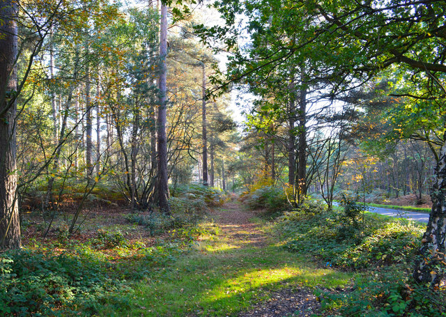
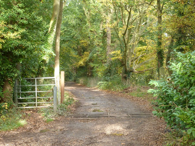
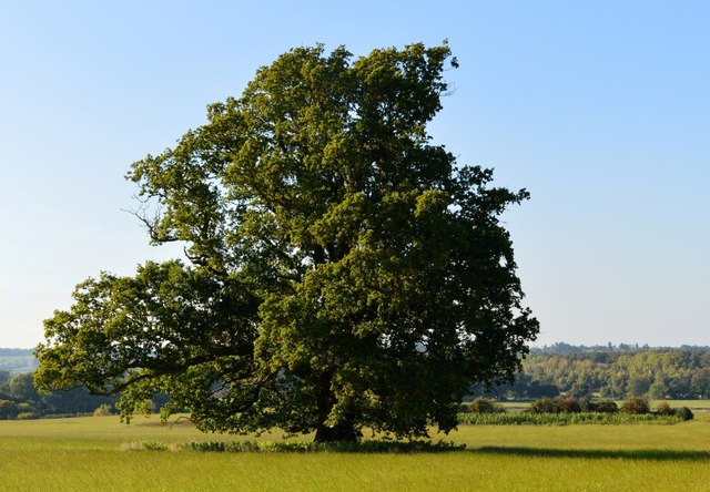
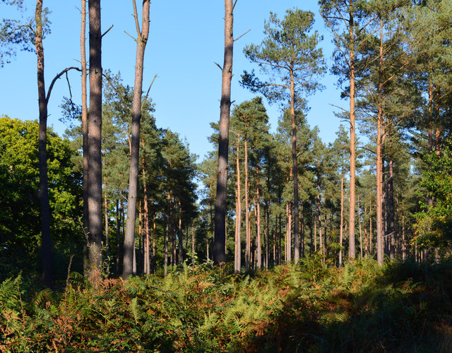
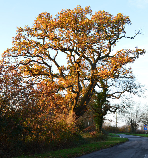
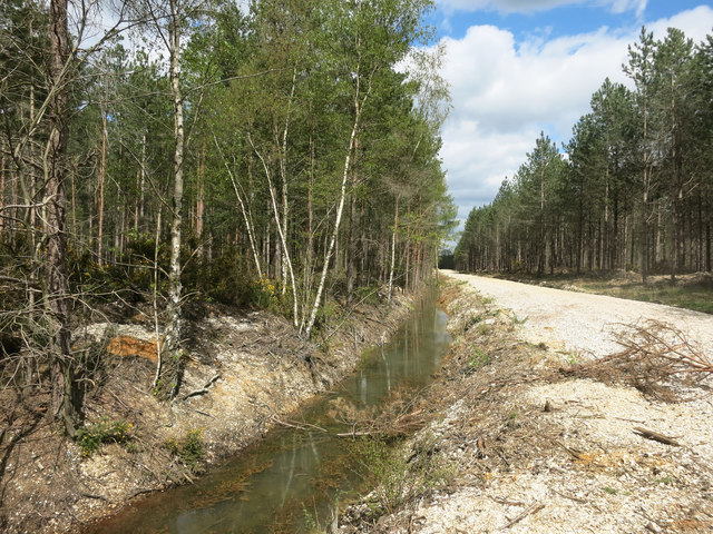
Covering an area of approximately 100 acres, Church Plantation is characterized by a diverse range of trees, including oak, beech, and birch. This variety of trees creates a vibrant and colorful canopy throughout the year, attracting numerous species of birds and other wildlife.

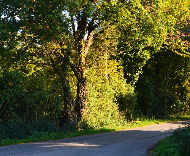
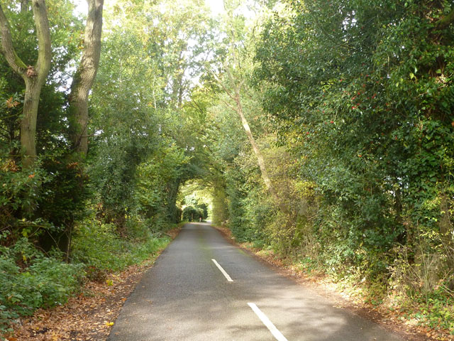
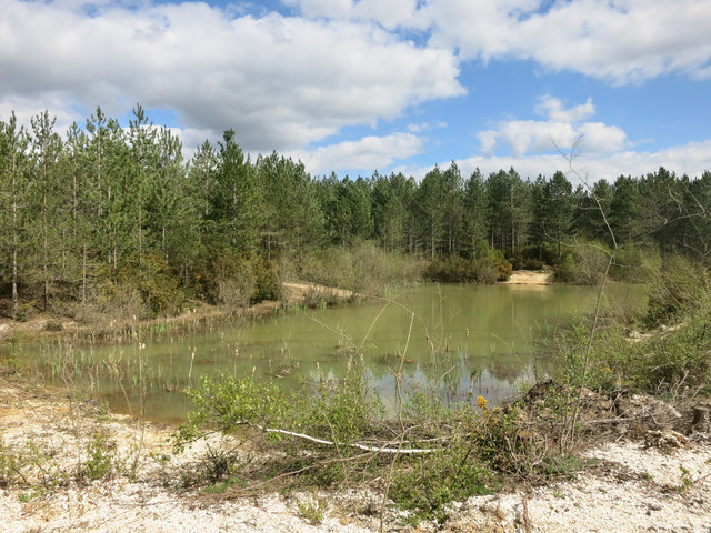
The woodland is crisscrossed by several well-maintained walking trails, allowing visitors to explore the area at their own pace. These paths lead to various points of interest, such as a small stream that meanders through the plantation, providing a soothing backdrop of running water.

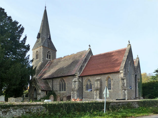
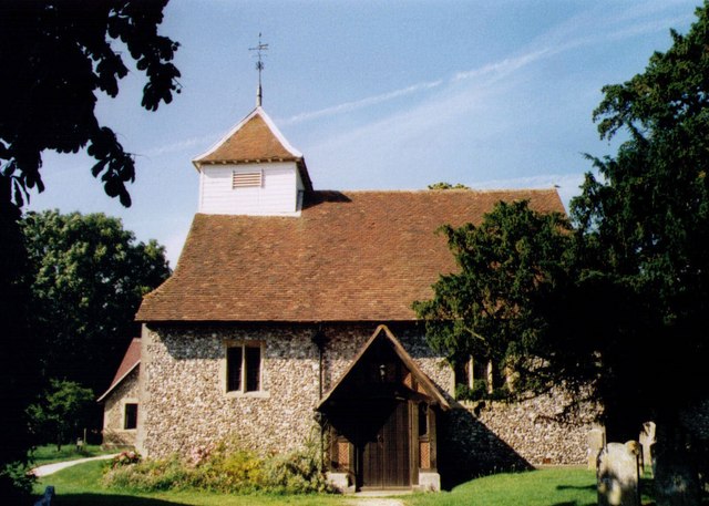
One of the standout features of Church Plantation is its historic church, which dates back several centuries. The church, nestled amidst the trees, adds a touch of charm and nostalgia to the woodland, making it an ideal spot for contemplation and quiet reflection.

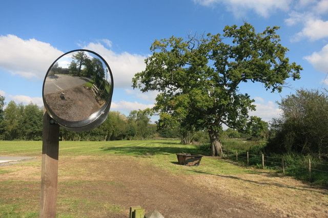
In addition to its natural beauty, Church Plantation also serves as a recreational area for locals and visitors alike. It offers picnic spots, benches, and designated areas for outdoor activities, making it a popular destination for families and groups.

Overall, Church Plantation in Berkshire is a hidden gem, offering a peaceful and serene escape from the hustle and bustle of everyday life. Its combination of scenic beauty, historical significance, and recreational amenities make it a must-visit destination for those seeking a connection with nature.

If you have any feedback on the listing, please let us know in the comments section below.

Church Plantation Images

Images are sourced within 2km of 51.396815/-1.0908191 or Grid Reference SU6366. Thanks to Geograph Open Source API. All images are credited.

Padworth Common, Berkshire
Tree & Mirror, Ufton Green There is an awkward exit opposite, hence the mirror.
Tree & Mirror, Ufton Green
There is an awkward exit opposite, hence the mirror.
Country lane, Ufton Nervet, Berkshire
Island Farm Road There is an Island Farm up the road, but the Island bit is far from apparent.
Island Farm Road
There is an Island Farm up the road, but the Island bit is far from apparent.
Bridleway to Burghfield Common Also access to Firlands Farm.
Bridleway to Burghfield Common
Also access to Firlands Farm.
Ufton Nervet church St. Peter's.
Ufton Nervet church
St. Peter's.
Road junction, Sulhamstead Kingston Lane turns right off Sulhamstead Hill.
Road junction, Sulhamstead
Kingston Lane turns right off Sulhamstead Hill.
Farmland, Ufton Nervet, Berkshire
Coniferous woodland, Ufton Nervet, Berkshire
Evening light, Sulhamstead, Berkshire
Late afternoon sunshine, Ufton Nervet, Berkshire
Forest Track through Holden's Firs Most of this square is forested. There are a lot of drainage ditches all around like the one here, suggesting the area would naturally be quite boggy.
Forest Track through Holden's Firs
Most of this square is forested. There are a lot of drainage ditches all around like the one here, suggesting the area would naturally be quite boggy.
Pond in Holden's Firs This square is almost all forest.
Pond in Holden's Firs
This square is almost all forest.
Ufton Court The setting for the annual Ufton Dole ceremony.
"The Ufton Dole is a distribution of bread and sheets, from a window in the Great Hall of Ufton Court, every Maundy Thursday to the villagers of Ufton Nervet and Padworth. Lady Marvyn left money in her will of 1581 for this annual dole. Tradition has it that this was to thank the villagers for having helped her return home after becoming lost in the local woods. Additionally, a curse is said to have been placed on any lord of the manor who breaks the tradition." (Wikipedia)
Full Wiki. history page on <span class="nowrap"><a title="https://en.wikipedia.org/wiki/Ufton_Court" rel="nofollow ugc noopener" href="https://en.wikipedia.org/wiki/Ufton_Court">Link</a><img style="margin-left:2px;" alt="External link" title="External link - shift click to open in new window" src="https://s1.geograph.org.uk/img/external.png" width="10" height="10"/></span>
Ufton Court
The setting for the annual Ufton Dole ceremony. "The Ufton Dole is a distribution of bread and sheets, from a window in the Great Hall of Ufton Court, every Maundy Thursday to the villagers of Ufton Nervet and Padworth. Lady Marvyn left money in her will of 1581 for this annual dole. Tradition has it that this was to thank the villagers for having helped her return home after becoming lost in the local woods. Additionally, a curse is said to have been placed on any lord of the manor who breaks the tradition." (Wikipedia) Full Wiki. history page on LinkExternal link
Fish Pond at Ufton Court One of a line of small medieval ponds to the north of the manor house.
Fish Pond at Ufton Court
One of a line of small medieval ponds to the north of the manor house.
Not much room for fish Ufton Court has a line of ancient fish ponds along a small valley near the house. The upper ones are still in water, but the lowest one looks to have been taken over by this very healthy spinachy looking stuff.
Update from Mick Crawley, BSBI botanical recorder for Berkshire, who says "Your plant is Skunk Cabbage Lysichiton americanus. Also in the pond are the massive leaves of Gunnera tinctoria."
Well, spinach, cabbage, I wasn't far off, but I'd never have guessed the Skunk bit, so Thanks Mick.
Not much room for fish
Ufton Court has a line of ancient fish ponds along a small valley near the house. The upper ones are still in water, but the lowest one looks to have been taken over by this very healthy spinachy looking stuff. Update from Mick Crawley, BSBI botanical recorder for Berkshire, who says "Your plant is Skunk Cabbage Lysichiton americanus. Also in the pond are the massive leaves of Gunnera tinctoria." Well, spinach, cabbage, I wasn't far off, but I'd never have guessed the Skunk bit, so Thanks Mick.
Grim's Bank in Church Plantation Grim's Dykes and Grim's Ditches are found all over the place, Grim's Banks less so. 
Generally thought to be ancient boundary markers, they vary in condition from impressive to scarcely visible.
This section is very well preserved.
Grim's Bank in Church Plantation
Grim's Dykes and Grim's Ditches are found all over the place, Grim's Banks less so. Generally thought to be ancient boundary markers, they vary in condition from impressive to scarcely visible. This section is very well preserved.
Middle Farm, Ufton Nervet
Show me another place!

Church Plantation is located at Grid Ref: SU6366 (Lat: 51.396815, Lng: -1.0908191)

Unitary Authority: West Berkshire

Police Authority: Thames Valley

What 3 Words

///herds.twinkled.caskets. Near Theale, Berkshire

Related Wikis

Ufton Nervet

Ufton Nervet is a village and civil parish in West Berkshire, England centred 6 miles (10 km) west southwest of the large town of Reading and 7 miles east...

The Willink School

The Willink School is a comprehensive community school in Burghfield Common, Berkshire, United Kingdom. Founded in 1957, the school is co-educational and...

Padworth

Padworth is a dispersed settlement and civil parish in the English county of Berkshire, with the nearest town being Tadley. Padworth is in the unitary...

Sulhamstead

Sulhamstead is a village and civil parish in West Berkshire, England. It occupies an approximate rectangle of land south of the (Old) Bath Road (A4) between...

Nearby Amenities

Located within 500m of 51.396815,-1.0908191
Barrier: kissing_gate
Foot: yes
Lat/Long: 51.4004272/-1.0936274
Barrier: kissing_gate
Foot: yes
Lat/Long: 51.3991416/-1.0956019
Board Type: history
Information: board
Tourism: information
Lat/Long: 51.4005428/-1.0935315
Give Way
Direction: forward
Source: Bing
Lat/Long: 51.3999304/-1.0886513
Give Way
Direction: backward
Source: Bing
Lat/Long: 51.3999694/-1.0885588
Ford: yes
Lat/Long: 51.3980553/-1.0911574
Ford: yes
Lat/Long: 51.3969594/-1.0889765
The data included in this document is from www.openstreetmap.org. The data is made available under ODbL.

Have you been to Church Plantation?

Leave your review of Church Plantation below (or comments, questions and feedback).