Dursley Cross

Settlement in Gloucestershire Forest of Dean

England

Dursley Cross

Mill Lane A dead-end lane off Velthouse Lane, Longhope.
Mill Lane Credit: Jonathan Billinger

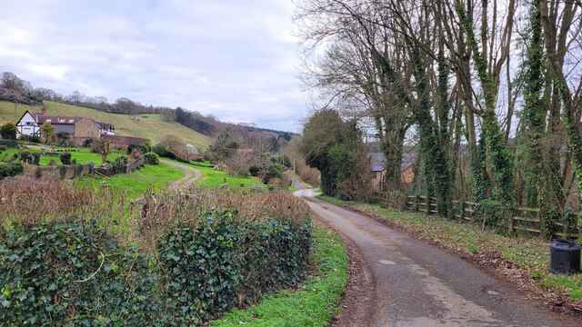
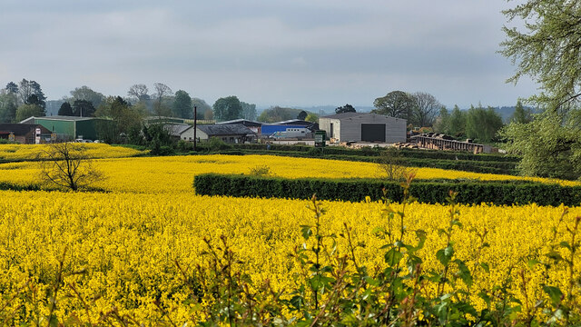
Dursley Cross is a small village located in the Cotswold district of Gloucestershire, England. Situated approximately 20 miles southwest of Gloucester, it lies on the eastern edge of the Cotswolds, a designated Area of Outstanding Natural Beauty. The village is nestled amidst rolling hills and picturesque countryside, offering stunning views and a tranquil ambiance.

With a population of around 3,000 residents, Dursley Cross has a tight-knit community and a strong sense of local pride. The village is known for its rich history, dating back to the medieval period. It was once an important market town, with industries such as weaving and quarrying flourishing in the area. Today, remnants of this history are still visible, including the charming old stone buildings that line the streets.

Dursley Cross offers a range of amenities to its residents and visitors alike. The village boasts a variety of shops, including independent boutiques, cafes, and traditional pubs. It also has a primary school, a library, and a community center, which host various events and activities throughout the year.

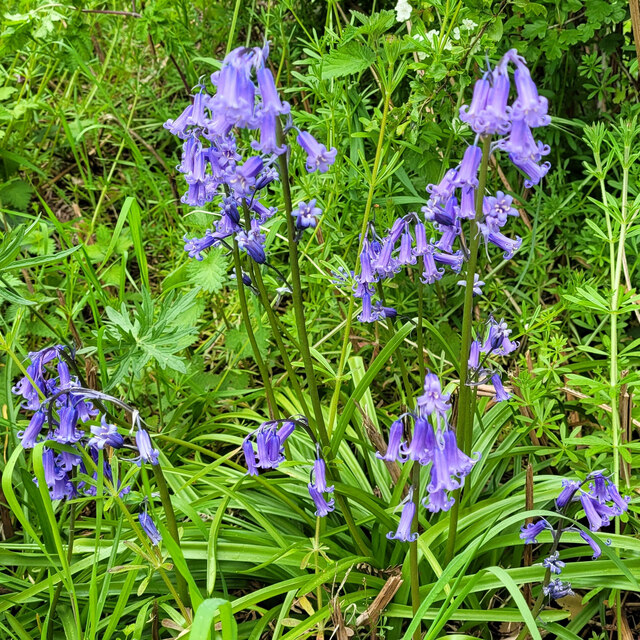
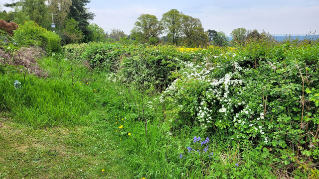
For nature enthusiasts, Dursley Cross is an ideal destination. The village is surrounded by beautiful countryside, providing ample opportunities for walking, hiking, and exploring the outdoors. Nearby attractions include the Cotswold Way, a long-distance footpath that offers breathtaking views of the area's rolling hills and charming villages.

Overall, Dursley Cross is a delightful village that combines a rich history, stunning natural beauty, and a strong sense of community, making it an idyllic place to live or visit in Gloucestershire.

If you have any feedback on the listing, please let us know in the comments section below.

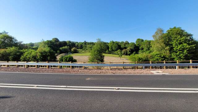
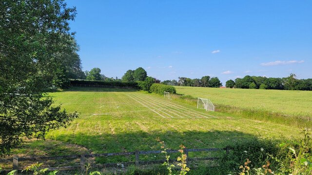
Dursley Cross Images

Images are sourced within 2km of 51.879058/-2.437967 or Grid Reference SO6920. Thanks to Geograph Open Source API. All images are credited.

Mill Lane A dead-end lane off Velthouse Lane, Longhope.
Mill Lane
A dead-end lane off Velthouse Lane, Longhope.
Longhope allotments The Longhope Brook forms the boundary over to the right.
Longhope allotments
The Longhope Brook forms the boundary over to the right.
Oilseed in full bloom The rape crop is next to the A40 at Huntley.
Oilseed in full bloom
The rape crop is next to the A40 at Huntley.
Wild bluebells These lovely plants are by a footpath near Huntley.
Wild bluebells
These lovely plants are by a footpath near Huntley.
Footpath with wild bluebells Showing the context for the plants in <a href="https://www.geograph.org.uk/photo/7688281">SO7119 : Wild bluebells</a>.
Footpath with wild bluebells
Showing the context for the plants in SO7119 : Wild bluebells.
Laurel in flower Prunus laurocerasus, Cherry Laurel is normally used as a hedging plant and clipped regularly will not flower. Here it has been allowed to grow freely.
Laurel in flower
Prunus laurocerasus, Cherry Laurel is normally used as a hedging plant and clipped regularly will not flower. Here it has been allowed to grow freely.
Spring cloudburst A heavy May shower has liberated some silt from the upper slopes to flow down in a red river.
Spring cloudburst
A heavy May shower has liberated some silt from the upper slopes to flow down in a red river.
Hanging basket Not hanging yet - it's just been planted.
Hanging basket
Not hanging yet - it's just been planted.
Common Spotted Orchid Dactylorhiza fuchsii, in early June 2023.
Common Spotted Orchid
Dactylorhiza fuchsii, in early June 2023.
A40, looking towards May Hill, 1 Looking across the newly-reconstructed carriageway.
A40, looking towards May Hill, 1
Looking across the newly-reconstructed carriageway.
A40, looking towards May Hill, 2 A slightly more elevated view showing the wooded dome of May Hill beyond
A40, looking towards May Hill, 2
A slightly more elevated view showing the wooded dome of May Hill beyond
School playing field The markings are for the Huntley Primary School sports day.
School playing field
The markings are for the Huntley Primary School sports day.
The Apse House, Leaf Creative After a long series covering the construction, here is the finished result.
The Apse House, Leaf Creative
After a long series covering the construction, here is the finished result.
A summer's evening event The Apse House at Leaf Creative is the venue for a summer supper event.
A summer's evening event
The Apse House at Leaf Creative is the venue for a summer supper event.
The Nags Head and the Gloucestershire Way The redundant pub by the A40 is now converted into residential.
The Nags Head and the Gloucestershire Way
The redundant pub by the A40 is now converted into residential.
The Gloucestershire Way Heading towards May Hill from the A40 at Nags Head.
The Gloucestershire Way
Heading towards May Hill from the A40 at Nags Head.
Field by the Longhope Brook, 1 A fine June evening with cow parsley and wild rose.
Field by the Longhope Brook, 1
A fine June evening with cow parsley and wild rose.
Field by the Longhope Brook, 2 The Gloucestershire Way heads east here towards May Hill.
Field by the Longhope Brook, 2
The Gloucestershire Way heads east here towards May Hill.
Show me another place!

Dursley Cross is located at Grid Ref: SO6920 (Lat: 51.879058, Lng: -2.437967)

Administrative County: Gloucestershire

District: Forest of Dean

Police Authority: Gloucestershire

What 3 Words

///eclipses.swordfish.uncouth. Near Longhope, Gloucestershire

Nearby Locations

Dursley Cross Beech Grove

Related Wikis

Hobbs Quarry SSSI, Longhope

Hobbs Quarry, Longhope (grid reference SO695195) is a 1-hectare (2.5-acre) geological and biological Site of Special Scientific Interest in Gloucestershire...

May Hill

May Hill is a prominent English hill between Gloucester and Ross-on-Wye. Its summit, on the western edge of Gloucestershire and its northern slopes in...

Longhope railway station

Longhope railway station is a disused stone-built railway station that served the village of Longhope in Gloucestershire, England. Opened in 1855 with...

Longhope

Longhope is a village in west Gloucestershire, situated within the Forest of Dean, England, United Kingdom. Arthur Bullock, who was born in Longhope in...

Longhope Hill

Longhope Hill (grid reference SO693185) is a 0.2-hectare (0.49-acre) geological Site of Special Scientific Interest in Gloucestershire, notified in 1989...

The Mount, Nottswood Hill

The Mount, Nottswood Hill, is a grade II listed house near Blaisdon in Gloucestershire. The house is thought to have been rebuilt in the later nineteenth...

Luxley

Luxley is a village in the southwest Midlands of England, on the border between Gloucestershire and Herefordshire near May Hill. Luxley is 12 km (7.5 mi...

Cliffords Mesne

Cliffords Mesne is an English village in Gloucestershire, two miles (3.2 km) south-west of the town of Newent. It became the home of the autobiographical...

Nearby Amenities

Located within 500m of 51.879058,-2.437967
Bus Stop
May Hill Turn
Bus: yes
Naptan AtcoCode: 1600GLF091
Naptan Bearing: W
Naptan BusStopType: CUS
Naptan CommonName: May Hill Turn
Naptan Indicator: Opp
Naptan NaptanCode: gloamgtg
Naptan Street: A40
Naptan Verified: no
Public Transport: platform
Source: naptan_import
Lat/Long: 51.8777613/-2.4377684
Bus Stop
May Hill Turn
Bus: yes
Naptan AtcoCode: 1600GLF092
Naptan Bearing: E
Naptan CommonName: May Hill Turn
Naptan NaptanCode: gloamgtd
Naptan Street: A40
Naptan Verified: no
Public Transport: platform
Source: naptan_import
Lat/Long: 51.8778686/-2.4378568
Barrier: stile
Lat/Long: 51.8817773/-2.4322207
Barrier: stile
Lat/Long: 51.8818993/-2.4323743
Turning Circle
Lat/Long: 51.8816248/-2.4417497
Dursley Cross
Is In: Gloucestershire, England, UK
Place: hamlet
Lat/Long: 51.8791933/-2.437955
The data included in this document is from www.openstreetmap.org. The data is made available under ODbL.

Have you been to Dursley Cross?

Leave your review of Dursley Cross below (or comments, questions and feedback).