Ash Holt
Wood, Forest in Nottinghamshire Bassetlaw
England
Ash Holt

Ash Holt is a small village located in the district of Ashfield, Nottinghamshire, England. Situated within the heart of Sherwood Forest, the village is renowned for its lush woodlands and serene surroundings. With a population of around 1,000 residents, Ash Holt offers a peaceful and close-knit community for its inhabitants.
The village is predominantly residential, with a mix of traditional brick houses and newer developments. The architecture reflects the charm of the surrounding countryside, blending seamlessly with the natural beauty of the area. Walking through the village, visitors can enjoy the picturesque views of the rolling hills and dense forests.
One of the main attractions in Ash Holt is its close proximity to Sherwood Forest, which is steeped in history and mythology. Visitors can explore the legendary Major Oak, said to be the hiding place of Robin Hood and his Merry Men. The forest also offers numerous walking and cycling trails, allowing nature enthusiasts to immerse themselves in the diverse flora and fauna of the area.
Despite its rural setting, Ash Holt is well-connected to nearby towns and cities. Nottingham city center is a short drive away, providing residents with access to a wide range of amenities, including shopping centers, restaurants, and cultural attractions.
Overall, Ash Holt is a tranquil village that offers residents and visitors an idyllic escape from the hustle and bustle of city life. With its natural beauty, rich history, and close-knit community, it is a truly enchanting place to live or visit.
If you have any feedback on the listing, please let us know in the comments section below.
Ash Holt Images
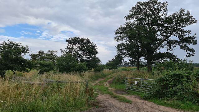
Images are sourced within 2km of 53.351306/-1.0575954 or Grid Reference SK6284. Thanks to Geograph Open Source API. All images are credited.


![Farm storage area Containing only a few bales of straw though there were hundreds more in the adjacent field <a href="https://www.geograph.org.uk/photo/6937183">SK6383 : Hundreds of bales of straw</a>]](https://s2.geograph.org.uk/geophotos/06/93/71/6937182_fea755f4.jpg)


Ash Holt is located at Grid Ref: SK6284 (Lat: 53.351306, Lng: -1.0575954)
Administrative County: Nottinghamshire
District: Bassetlaw
Police Authority: Nottinghamshire
What 3 Words
///daffodils.dwarf.vote. Near Ranskill, Nottinghamshire
Nearby Locations
Related Wikis

Bilby, Nottinghamshire
Bilby is a hamlet in Nottinghamshire, England. It is part of the civil parish of Barnby Moor. It is located 5 miles west of Retford, close to the A1 road...

Hodsock
Hodsock is a settlement and civil parish about 4 miles from Worksop, in the Bassetlaw district, in the county of Nottinghamshire, England. The parish includes...
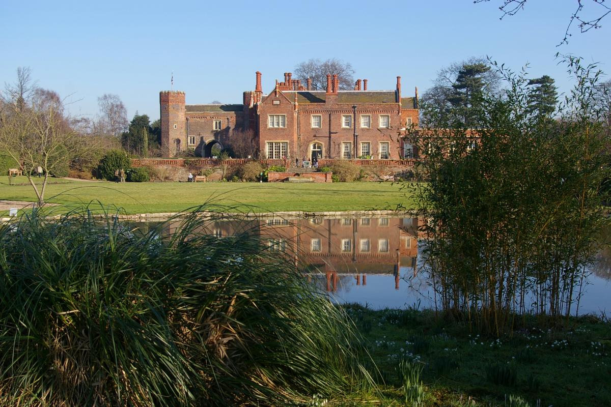
Hodsock Priory
Hodsock Priory is an English country house in Hodsock, Nottinghamshire, 4 miles (6.4 km) north of Worksop, England, and 1 mile (1.6 km) south of Blyth...

Blyth, Nottinghamshire
Blyth is a village and civil parish in the Bassetlaw district of the county of Nottinghamshire, in the East Midlands, north west of East Retford, on the...
RAF Worksop
Royal Air Force Worksop, or more simply RAF Worksop, is a former Royal Air Force satellite station located at Scofton, 2.8 miles (4.5 km) north east of...

Blyth Priory
Blyth Priory was a priory in Nottinghamshire, England, dedicated to St Mary the Virgin. == History == Blyth Priory was founded in 1088 by Roger de Busli...

Worksop Rural District
Worksop (previously Blyth and Cuckney) was a Rural District in Nottinghamshire, England. It originated as Worksop Rural Sanitary District in 1872. In...
St Mary and St Martin's Church, Blyth
St. Mary and St. Martin's Church, Blyth, is a Grade I listed parish church in Blyth, Nottinghamshire, England. == Priory == The priory of St. Mary and...
Nearby Amenities
Located within 500m of 53.351306,-1.0575954Have you been to Ash Holt?
Leave your review of Ash Holt below (or comments, questions and feedback).